Santa Catalina Island, California
May, 2006
» lone tree point
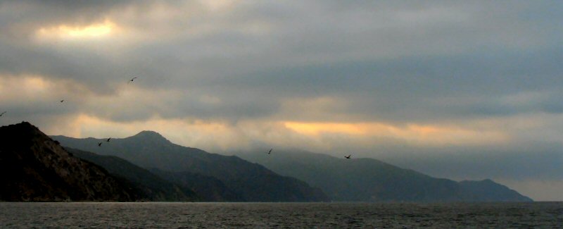
While there is no tree at Lone Tree Point, the amazing view will more than make up for that false promise. Unless, that is, your view is completey obscured by fog as it was when we first arrived. It was depressing to have come all that way only to see a view which would hardly rival a blank sheet of paper. We didn't give up and turn around though, we waited, hoping things would change, and while I'm not particularliy religious, I cannot think of any other way to explain what happened next on that day. In my mind I was hoping that the clouds would clear so that we could see the scenery around, and then, sure enough, 15 minutes later, they did. A hole in the clouds first revealed the brillant turquoise waters far below, and then the dramatic jagged cliffs stretching east and west.
We were probably at Lone Tree Point for a couple hours and we did not see another person the entire time. I was expecting Catalina to be more crowded and developed but once you walk a mile from Avalon, there is not much but wilderness. Given the steep mountains the island is made up of, you can understand why.
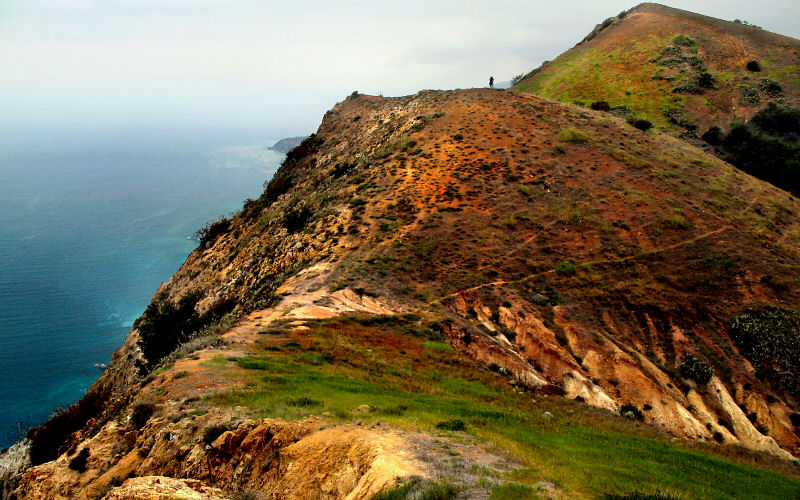
From Avalon, it is about 8.5 miles RT to Lone Tree Point with 1,634 feet of elevation gain. The views get more interesting once you cross the center line of the island and can see the jagged southwestern coast. Catalina is about 35 miles off the coast of Dana Point (south of LA) which is where we caught our 1.25 hour boat ride to the island.
While there is no tree at Lone Tree Point, the amazing view will more than make up for that false promise. Unless, that is, your view is completey obscured by fog as it was when we first arrived. It was depressing to have come all that way only to see a view which would hardly rival a blank sheet of paper. We didn't give up and turn around though, we waited, hoping things would change, and while I'm not particularliy religious, I cannot think of any other way to explain what happened next on that day. In my mind I was hoping that the clouds would clear so that we could see the scenery around, and then, sure enough, 15 minutes later, they did. A hole in the clouds first revealed the brillant turquoise waters far below, and then the dramatic jagged cliffs stretching east and west.
Read more about this miraculous event
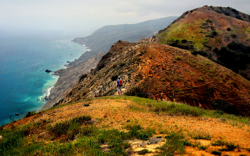
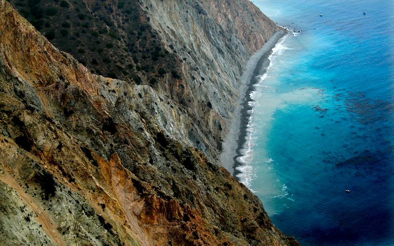
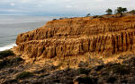
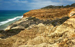
However the clouds cleared, they did, leaving us with one of the most beautiful views I have laid eyes on. From Lone Tree Point, the undulating topography of the island drops off jaggedly to the ocean, 1,634 feet below. Along the shore the waves cloud the water with sediment, resulting in a brilliant turquoise color. The trail officially ends at Lone Tree Point but if you follow the cliff edge in either direction you will be treated to many amazing and dramatic views from the various contours along the coast.
We were probably at Lone Tree Point for a couple hours and we did not see another person the entire time. I was expecting Catalina to be more crowded and developed but once you walk a mile from Avalon, there is not much but wilderness. Given the steep mountains the island is made up of, you can understand why.
From Avalon, it is about 8.5 miles RT to Lone Tree Point with 1,634 feet of elevation gain. The views get more interesting once you cross the center line of the island and can see the jagged southwestern coast. Catalina is about 35 miles off the coast of Dana Point (south of LA) which is where we caught our 1.25 hour boat ride to the island.
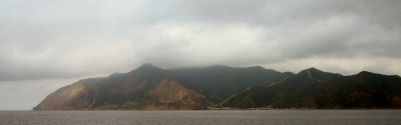
Approaching Catalina Island. Avalon is just visible in this picture to the right of the cliffs. The peak we hiked to is the one in the clouds.
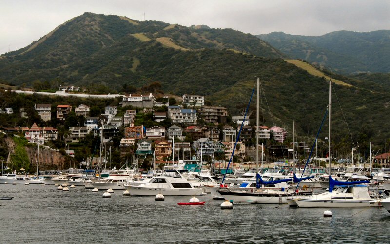
Avalon.
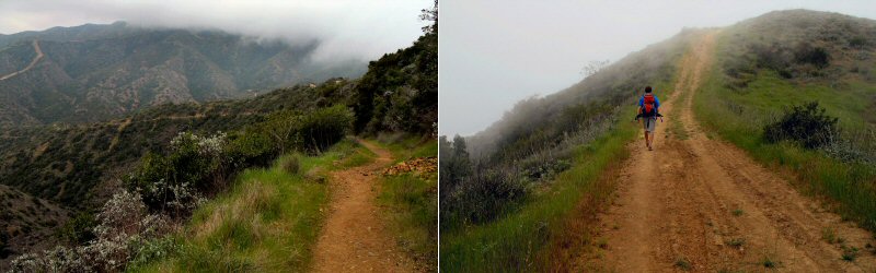
Looking back at the trail up Hermit Gulch as fog rolls in from the west, and me hiking (taken by Megan).
Avalon from above.
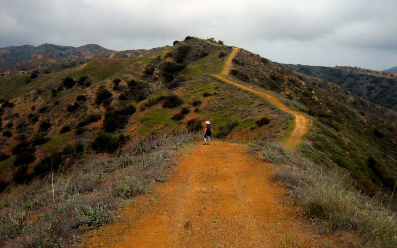
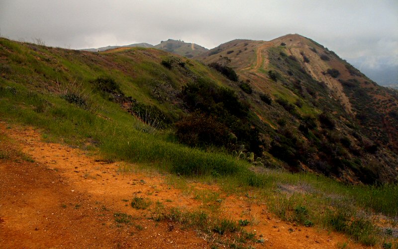
Megan pausing along the trail as it meandered along hilltops. There is no flat land on Catalina.
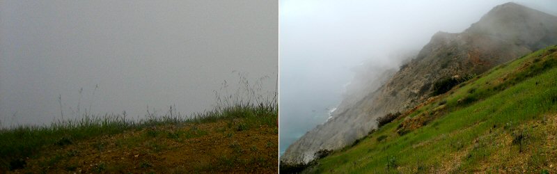
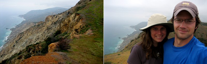
The blank white view we were greeted with initially at Lone Tree Point, and the view as things started to clear up.
Me enjoying the view from Lone Tree Point after the clouds cleared (taken by Megan).
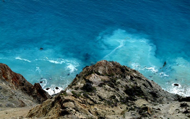
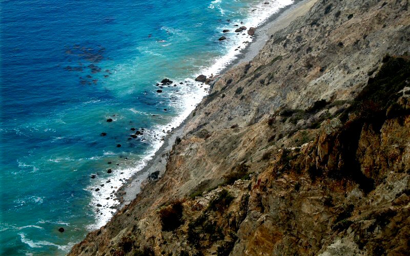
Looking down on a beautiful beach, well southeast of Lone Tree Point.
A closer look at the beach. Two boats can be seen in the upper right corner of this zoomed in view.
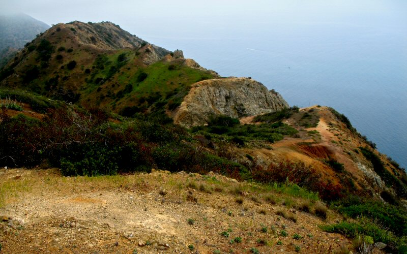
Megan on a peak just north of Lone Tree Point.
The turbulent turquoise water along the shore.
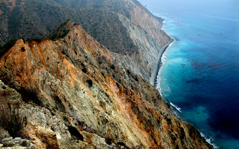
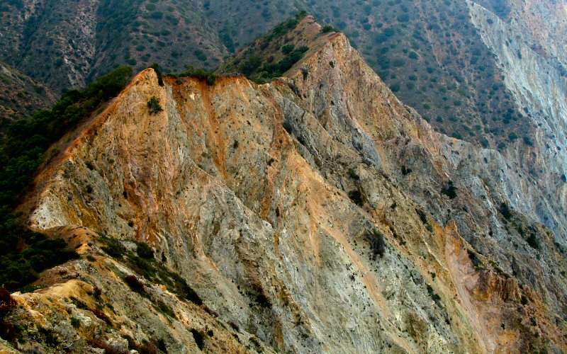
Jagged.
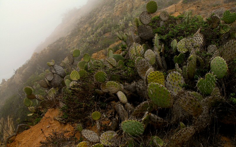
Prickly Pears along the cliffs. If not for the fog, the ocean would be visible in the upper left.
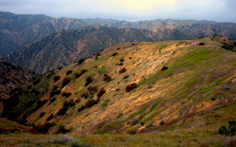
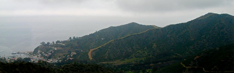
The lay of the land.
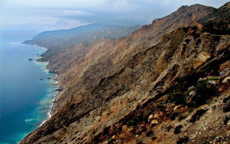
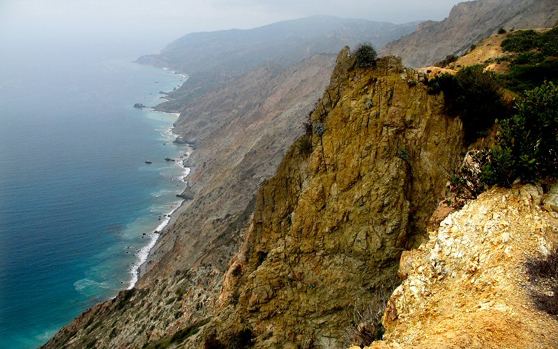
The view from just east of Lone Tree Point. Salta Verde Point is in the background.
Undulating topography.
This is where I turned around.
The shore.
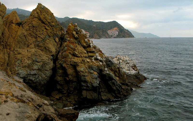
The edge of the island.
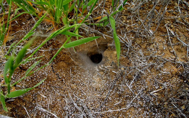
A dew covered spider web on the ground. It is not quite visible in this picture but there is a spider waiting in that hole.
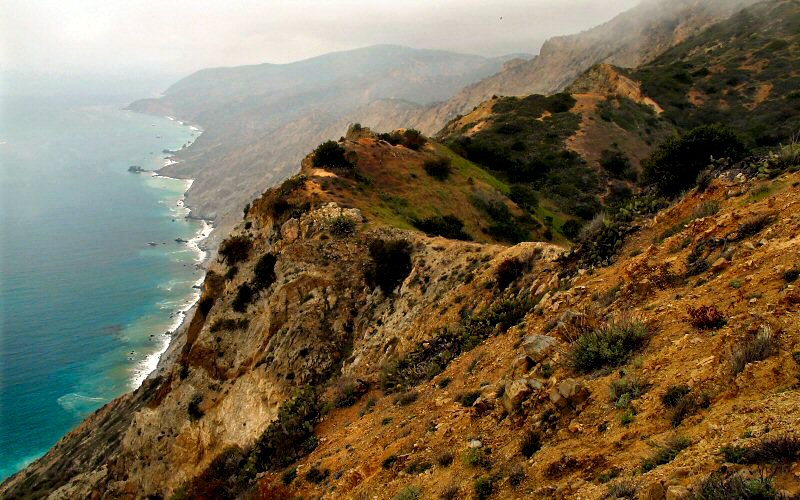
Looking towards Salta Verde Point (taken by Megan), and us.
Heading back.
The view from southeast of Avalon.
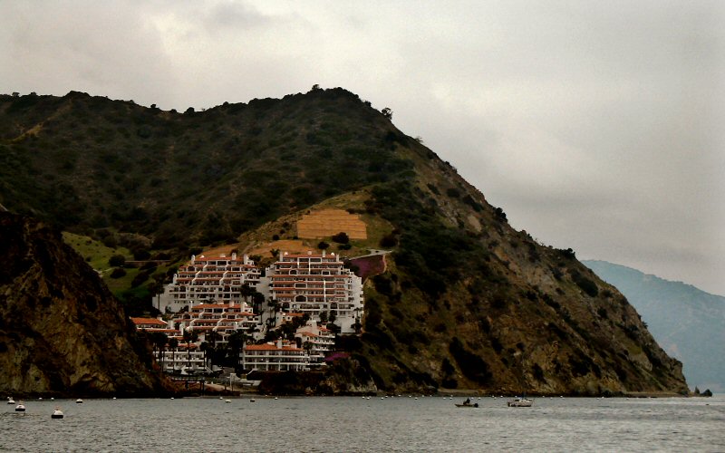
An impressive structure built into the cliffs.
As we left.
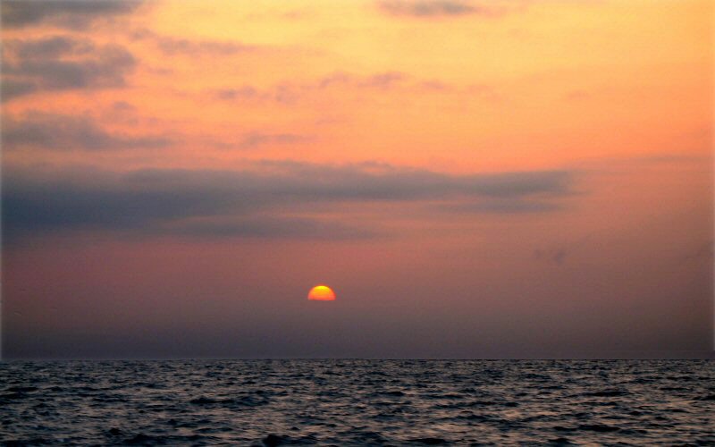
The setting sun as we cruised back to Dana Point.
» all photo reports from southern california


Cabrillo National Monument, California
May 28, 2009 Enjoying the great views from Point Loma. Not a lot of (good) photos though. 
La Jolla, California
December 23 - 30, 2007 Hiking around Torrey Pines, enjoying the views from Mount Soledad, and walking along La Jolla Cove. 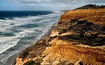
San Diego, California
December 25 - 29, 2006 Pictures from Torrey Pines, La Jolla beaches, and Iron Mountain. 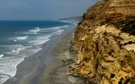
Santa Catalina Island & San Diego, California
July 20 - 26, 2006 Sailing around Santa Catalina Island and hiking around Torrey Pines State Park in San Diego. 
Santa Catalina Island, California
May 6, 2006 Hiking to Lone Tree Point on Santa Catalina Island, one of the Channel Islands off the coast of Los Angeles. 
Southern California
August 25 - 30, 2005 Hiking in the Laguna Mountains, and kayaking La Jolla Shores. 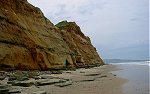
Southern California
February 10 - 15, 2005 Pictures from multiple trips, including Torrey Pines, Big Bear, Anza-Borrego Desert, and Santa Barbara. |

Joshua Tree, California
December 22 - 31, 2008 A quick trip through Joshua Tree National Park and a few other places near San Diego. 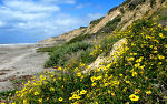
San Diego, California
March 27 - April 1, 2008 Wandering the beaches of La Jolla, checking out the Anza-Borrego Desert, and doing a quick hike near Iron Mountain. 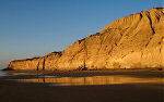
Torrey Pines, California
January 20, 2007 A few pictures from an evening walk along the beach in Torrey Pines State Park. 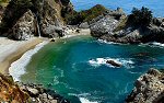
Big Sur, California
July 22, 2006 Driving up the California coast from San Diego to Monterey, checking out Morro Bay, San Simeon, McWay Falls, Big Sur, and Point Lobos. 
San Diego, California
May 4 - 8, 2006 Hiking around the San Diego area: Torrey Pines, La Jolla Cove, San Diego Gliderport, and some inland canyons. 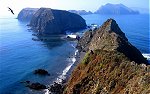
Southern California
November 10 - 14, 2005 Hiking in the Anza-Borrego Desert, exploring Anacapa Island in Channel Islands National Park, and climbing Iron Mountain. 
Southern California
May 2005 Hiking to Cedar Falls, up Woodson Mountain, and through La Jolla Valley. 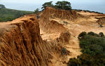
|
Copyright 1995- Lars Jensen | randomspace@umich.edu |