Southern California
May, 2005
» cedar falls
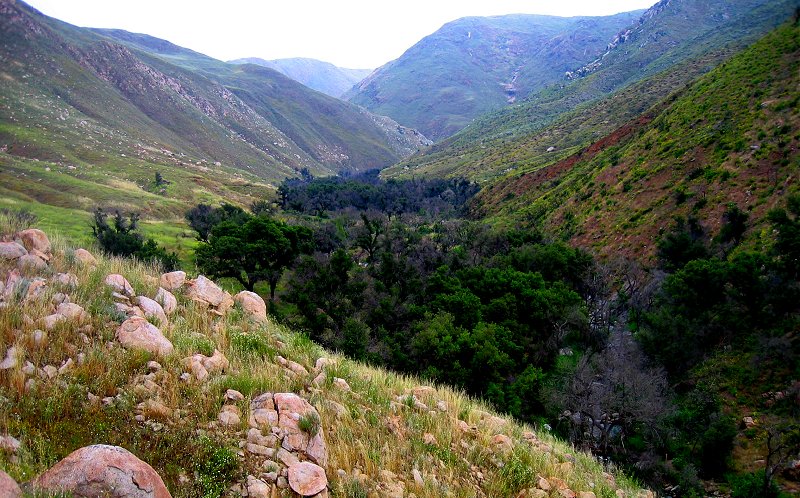
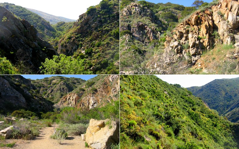
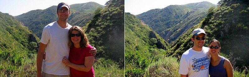
the drive to the cedar falls trailhead ended with a bumpy curvy dirt road that got progressively rougher and narrower during its long eight mile duration. there was dense fog most of the way so i was beginning to think that going on this hike was as foolish as megan thought it was...but you never know what you will experience when you explore the outdoors and as we descended into the the valley there was no doubt that the drive was worth it, because after all, it was megans car, not mine, that was getting ripped apart by the deep ruts. due to the excessive rain this spring, the waterfalls and creeks were rolling with water and the hillsides were covered with flowers. the trail headed down one side of the valley, wrapping around the curves of the hills with mildred falls cascading down the rocks in the background and with wildflower covered slopes ahead. we got a little lost and ended up hiking down to the san diego river, over to cedar creek, up to the falls, up the side of the falls, and back around.
the drive to the cedar falls trailhead ended with a bumpy curvy dirt road that got progressively rougher and narrower during its long eight mile duration. there was dense fog most of the way so i was beginning to think that going on this hike was as foolish as megan thought it was...but you never know what you will experience when you explore the outdoors and as we descended into the the valley there was no doubt that the drive was worth it, because after all, it was megans car, not mine, that was getting ripped apart by the deep ruts. due to the excessive rain this spring, the waterfalls and creeks were rolling with water and the hillsides were covered with flowers. the trail headed down one side of the valley, wrapping around the curves of the hills with mildred falls cascading down the rocks in the background and with wildflower covered slopes ahead. we got a little lost and ended up hiking down to the san diego river, over to cedar creek, up to the falls, up the side of the falls, and back around.
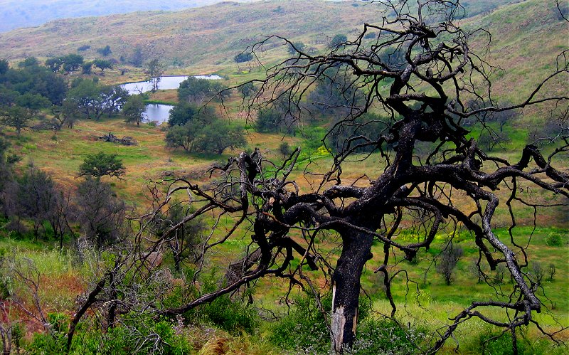
above the valley, pools of water collect and feed the creek below. this tree looks like a victim of the 2003 fire.
entering the valley.
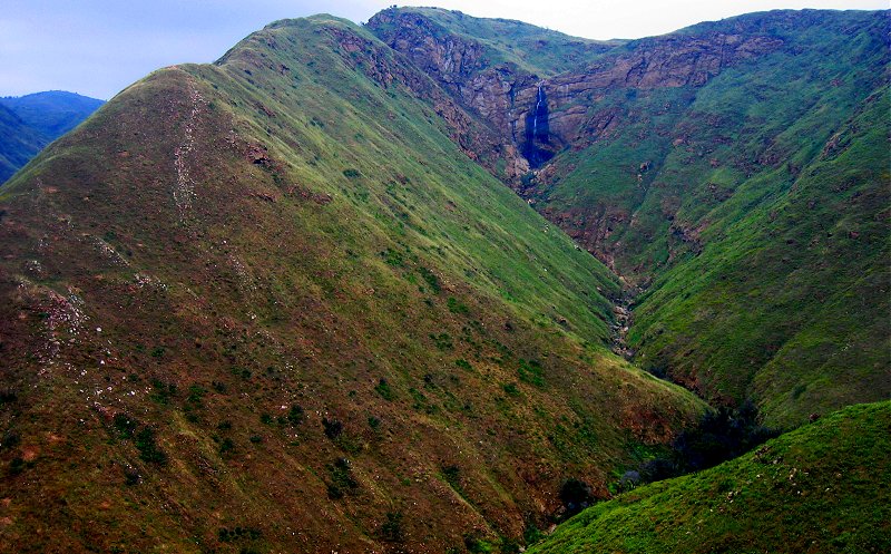
from the start of our hike, the 100 foot mildred falls could be seen in the distance behind us.
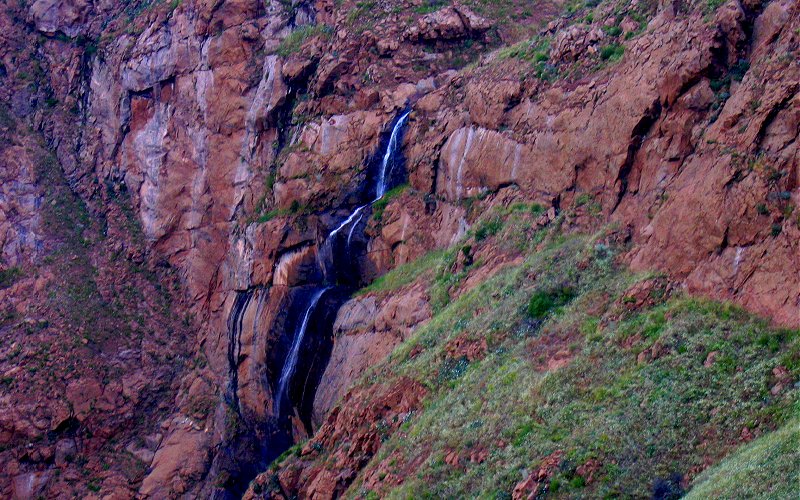
a closer look at mildred falls (there is an unofficial trail prior to the cedar falls trail which will lead you to this overlook).
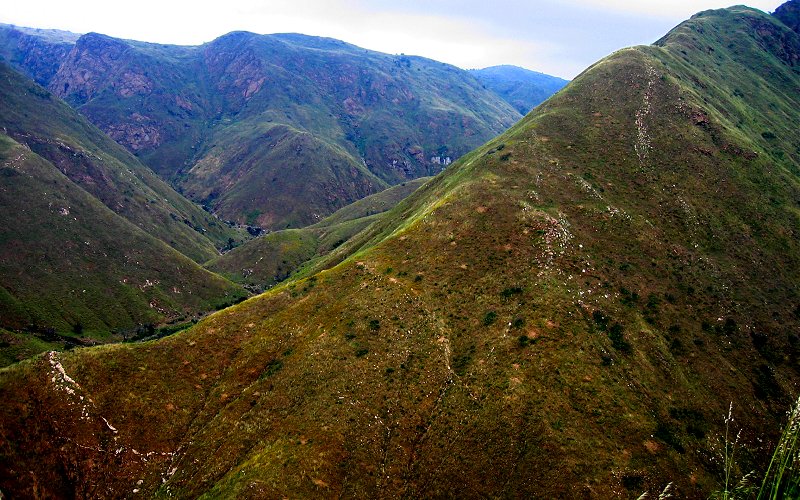
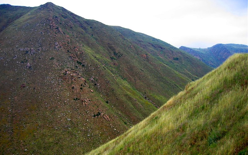
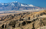
ridge.
mountain.
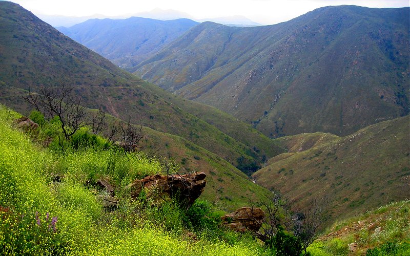
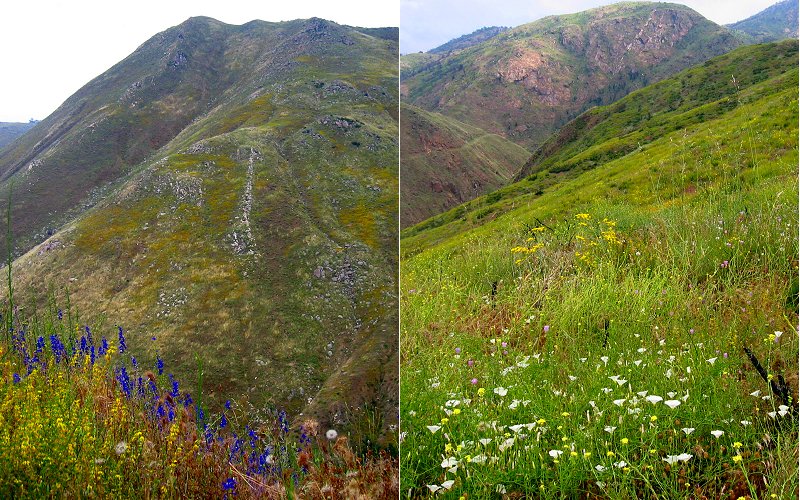
the overlapping slopes of the valley.
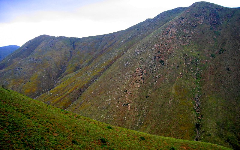
steep slopes.
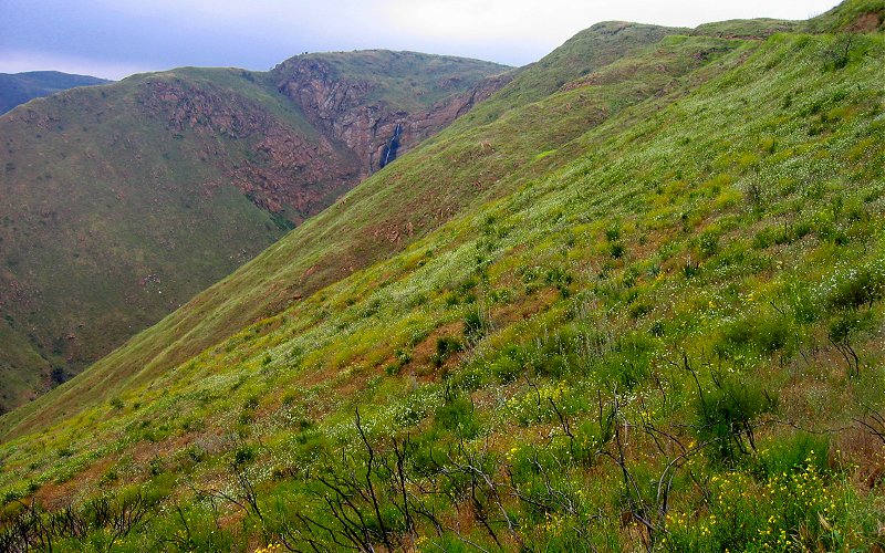
mildred falls is still visible in the distance.
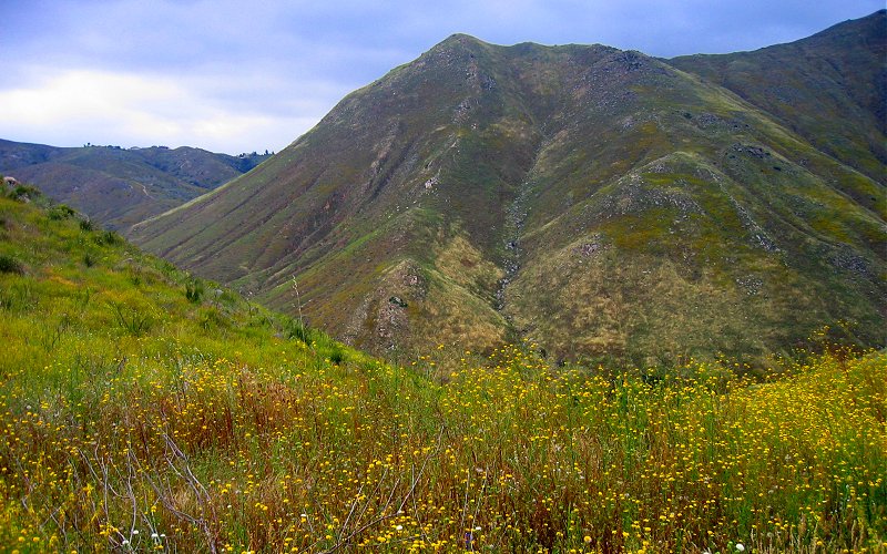
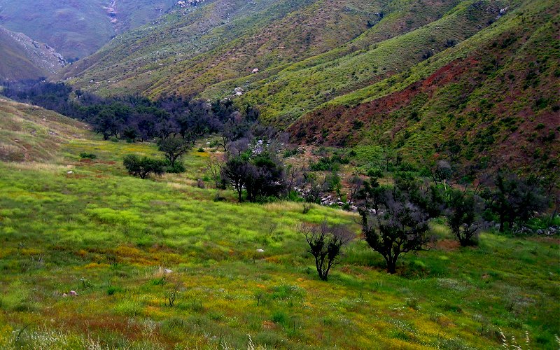
the valley and some flowers.
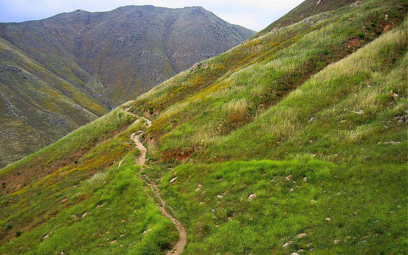
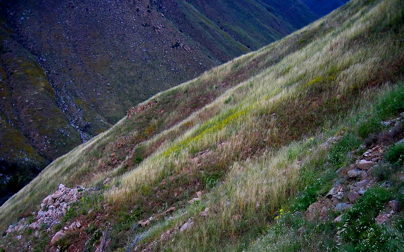
looking back at the trail.
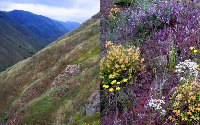
fields of flowers.
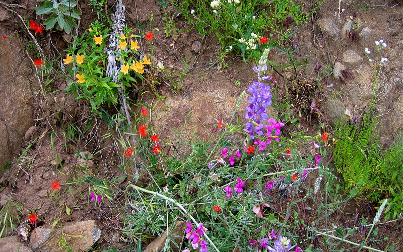
assorted wild flowers.
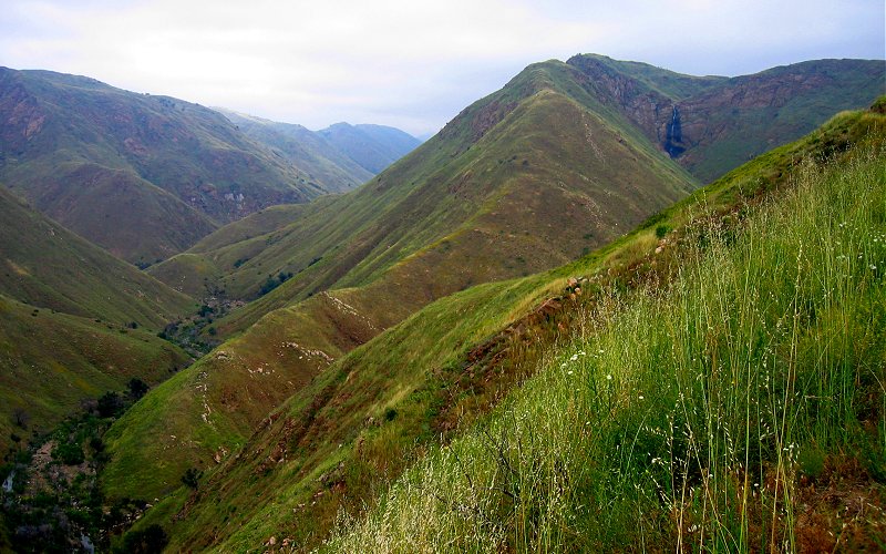
looking back at the valley.
across the valley.
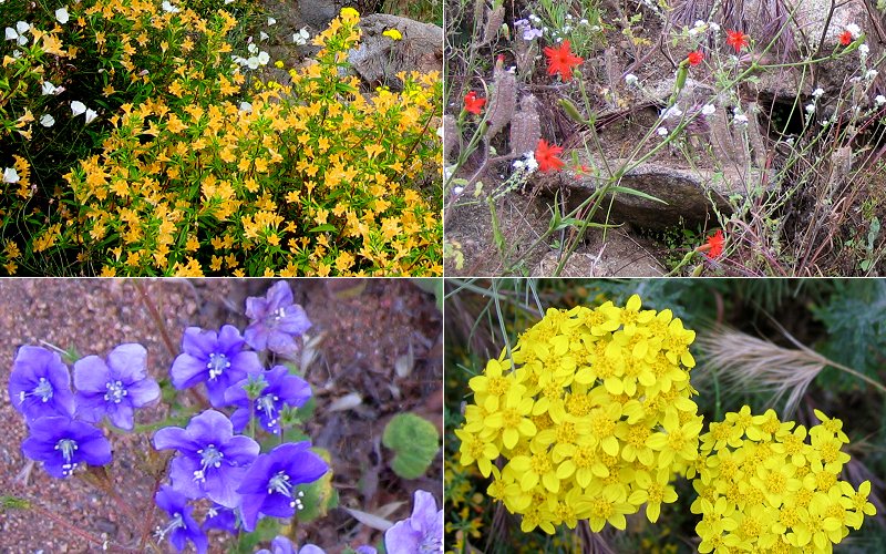
wildflowers.
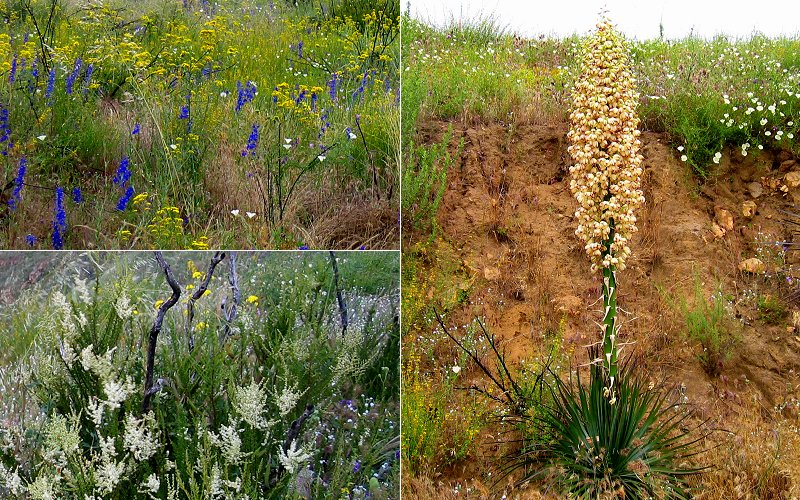
wildflowers.
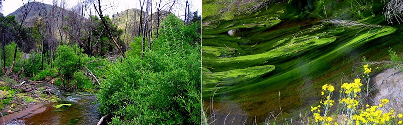
left: the san diego river, at the bottom of the valley. right: a green stringy moss that hung in the water, pulled by the current, and covered much of the surface in some areas.
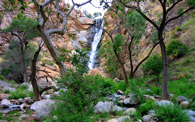
cedar falls (90 ft).
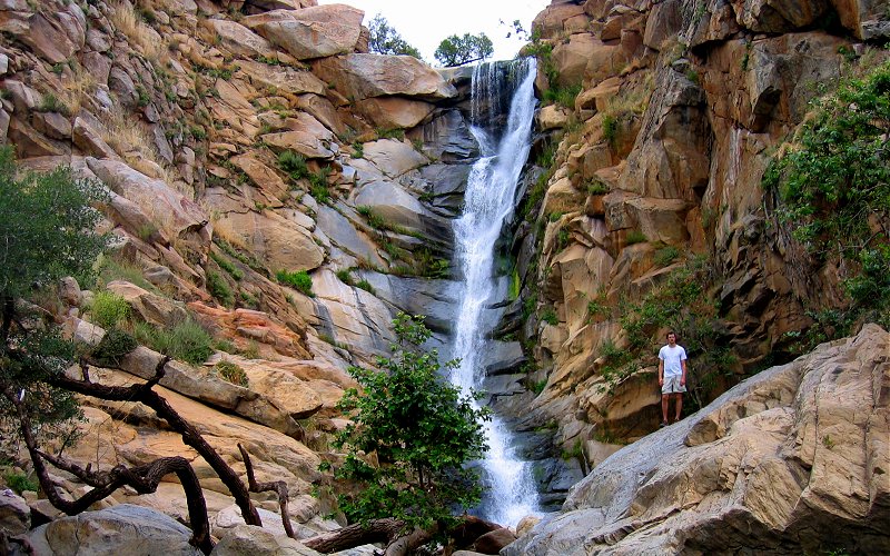
me on the rocks in front of cedar falls.
trees congregate in the valley floor, above cedar falls.
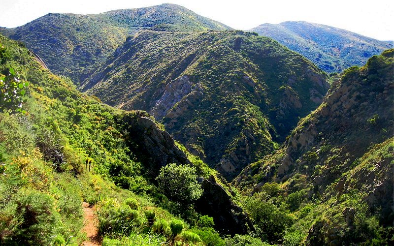
further up the valley.
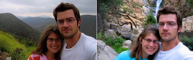
we were there.
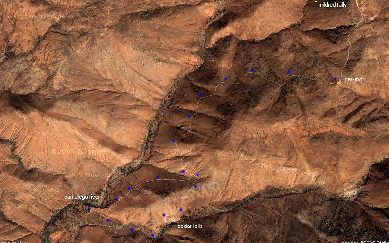
here is the path we took, courtesy of google maps.
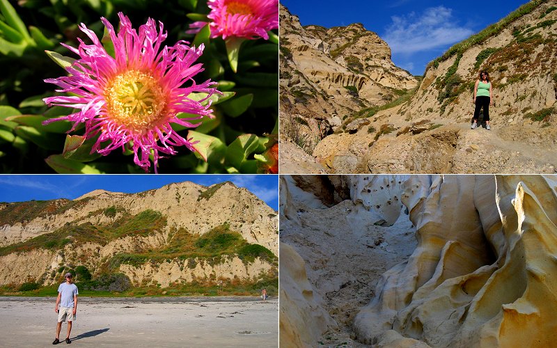
» la jolla valley
our venture into the la jolla valley was rudely interrupted by a rattlesnake.although i calmly informed everyone of the snake in my barry white-like voice (come on now my sugar babies, there's a snake on this here trail and he's just a lookin' for some lovin'), it still sent everyone running in the other direction once the rattle started going. okay it wasn't the snake that sent them running, my barry white impression was really bad.it was a bright sunny day and either i or my camera suck at taking pictures in the sun so the pictures don't really do the scenery justice.
our venture into the la jolla valley was rudely interrupted by a rattlesnake.although i calmly informed everyone of the snake in my barry white-like voice (come on now my sugar babies, there's a snake on this here trail and he's just a lookin' for some lovin'), it still sent everyone running in the other direction once the rattle started going. okay it wasn't the snake that sent them running, my barry white impression was really bad.it was a bright sunny day and either i or my camera suck at taking pictures in the sun so the pictures don't really do the scenery justice.
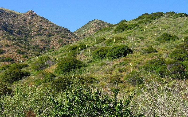
those things that look like large q-tips are actually plants that i forget the name of, but they are not yuccas as some would have you believe.
heading into the valley.
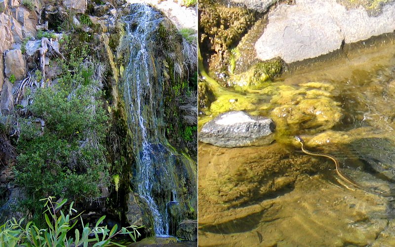
a waterfall and a snake in the pool below the falls.
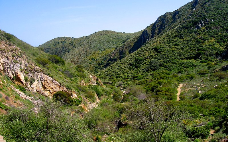
deeper into the valley.
various views of the valley.
me, megan, geoff, cheryl. there are no photographic tricks going on here, geoff and cheryl are actually dwarves. they may have little legs but they have big hearts, just don't piss them off or they will come right at your knees. just joking, there is no way they are dwarves, they are not angry enough.
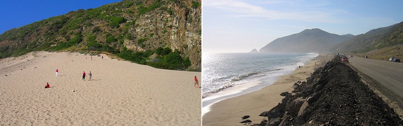
near la jolla valley, along the pacific coast highway, there is a big sand dune that we climbed.
» woodson mountain
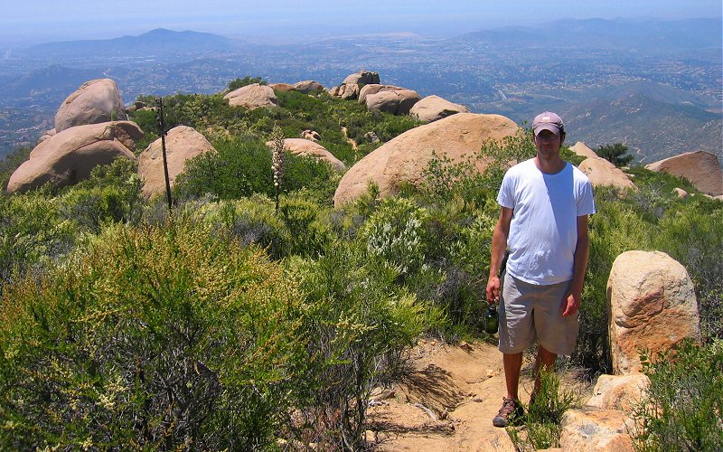
the most distinctive feature of the woodson mountain area is the rock strewn slopes. i have no idea how they got there (god maybe?), but the huge rounded boulders are everywhere and are often big enough to present a rock climbing challenge by themselves.
the most distinctive feature of the woodson mountain area is the rock strewn slopes. i have no idea how they got there (god maybe?), but the huge rounded boulders are everywhere and are often big enough to present a rock climbing challenge by themselves.
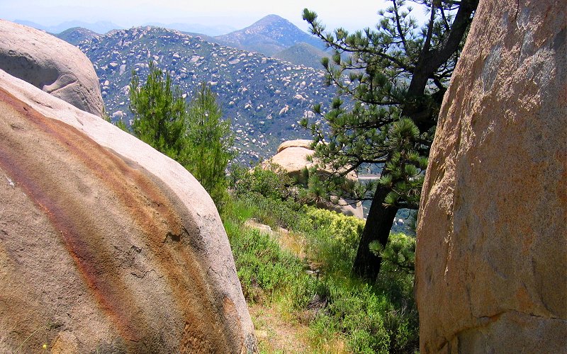
from the top of woodson mountain.
heading down.
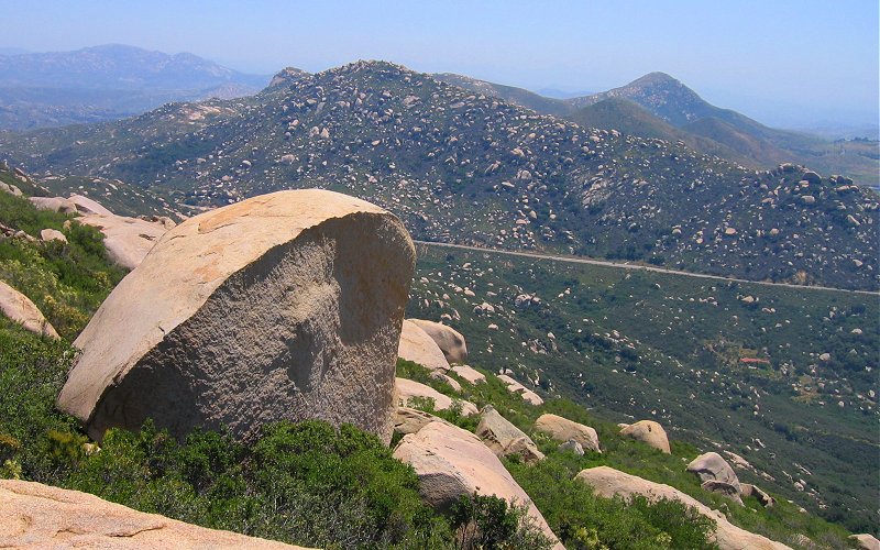
littered with rocks.
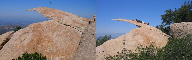
an interesting rock formation and dan using it to fullfill his childhoood dream of being superman.
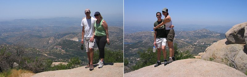
me, megan, dan, alex.
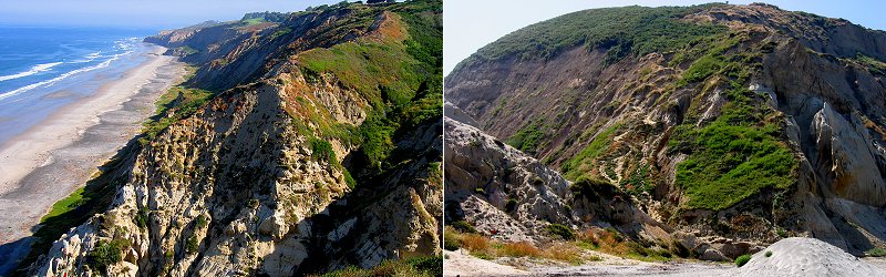
» glider port, la jolla
i had been to the glider port several times but never explored the north side so this time i decided i would. there is a nice canyon on the north side that i couldn't help but hike up and i eventually ran into a 3-tier waterfall about 30 feet high that was actually flowing with water due to all the rain (or, the water is runoff from the golf course above the cliffs).
i had been to the glider port several times but never explored the north side so this time i decided i would. there is a nice canyon on the north side that i couldn't help but hike up and i eventually ran into a 3-tier waterfall about 30 feet high that was actually flowing with water due to all the rain (or, the water is runoff from the golf course above the cliffs).
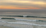
view from the top of the cliffs and the view from the beach looking back up at the trail down.
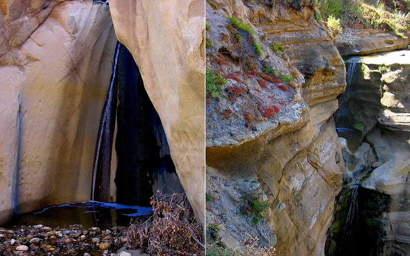
left: the bottom tier of the waterfall where the water glides across a near vertical cliff. right: the top two tiers of the waterfall.
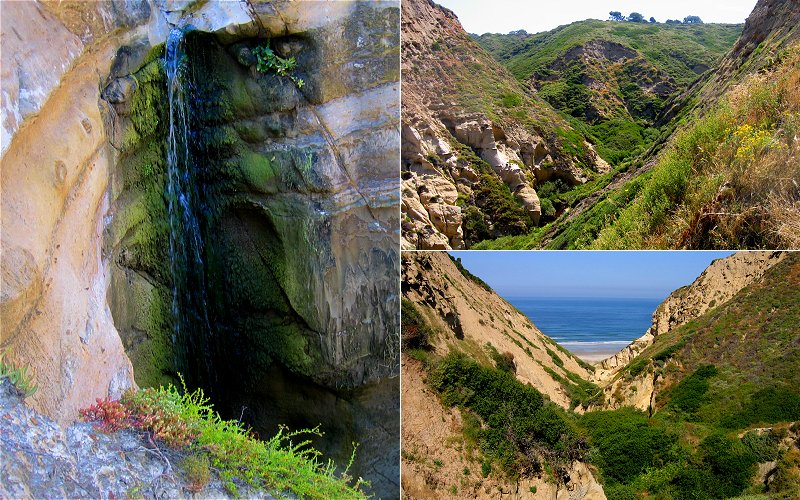
the middle teir and looking from the ocean into the valley and from the valley to the ocean.
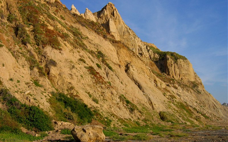
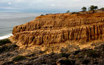
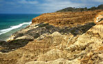
a peak in the ocean cliffs.
we were there.
» all photo reports from southern california

Cabrillo National Monument, California
May 28, 2009 Enjoying the great views from Point Loma. Not a lot of (good) photos though. 
La Jolla, California
December 23 - 30, 2007 Hiking around Torrey Pines, enjoying the views from Mount Soledad, and walking along La Jolla Cove. 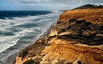
San Diego, California
December 25 - 29, 2006 Pictures from Torrey Pines, La Jolla beaches, and Iron Mountain. 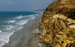
Santa Catalina Island & San Diego, California
July 20 - 26, 2006 Sailing around Santa Catalina Island and hiking around Torrey Pines State Park in San Diego. 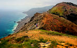
Santa Catalina Island, California
May 6, 2006 Hiking to Lone Tree Point on Santa Catalina Island, one of the Channel Islands off the coast of Los Angeles. 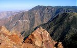
Southern California
August 25 - 30, 2005 Hiking in the Laguna Mountains, and kayaking La Jolla Shores. 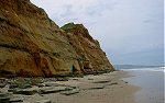
Southern California
February 10 - 15, 2005 Pictures from multiple trips, including Torrey Pines, Big Bear, Anza-Borrego Desert, and Santa Barbara. |
Joshua Tree, California
December 22 - 31, 2008 A quick trip through Joshua Tree National Park and a few other places near San Diego. 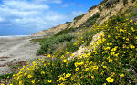
San Diego, California
March 27 - April 1, 2008 Wandering the beaches of La Jolla, checking out the Anza-Borrego Desert, and doing a quick hike near Iron Mountain. 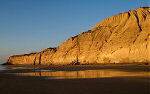
Torrey Pines, California
January 20, 2007 A few pictures from an evening walk along the beach in Torrey Pines State Park. 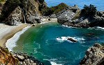
Big Sur, California
July 22, 2006 Driving up the California coast from San Diego to Monterey, checking out Morro Bay, San Simeon, McWay Falls, Big Sur, and Point Lobos. 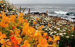
San Diego, California
May 4 - 8, 2006 Hiking around the San Diego area: Torrey Pines, La Jolla Cove, San Diego Gliderport, and some inland canyons. 
Southern California
November 10 - 14, 2005 Hiking in the Anza-Borrego Desert, exploring Anacapa Island in Channel Islands National Park, and climbing Iron Mountain. 
Southern California
May 2005 Hiking to Cedar Falls, up Woodson Mountain, and through La Jolla Valley. 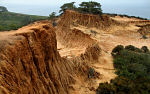
|
Copyright 1995- Lars Jensen | randomspace@umich.edu |