Pictured Rocks, Michigan
March 17, 2007
» hiking the ice shelf
First, a warning: The ice shelf can be dangerous. The National Park Service does not recommend walking on the ice shelf because it is unstable and unpredictable. Ice bridges can form on the surface and you will never know it until you step on one and fall through. Also, during warm weather or stormy seas, large chunks of the ice shelf may fall into the lake. You would not want to be on one then, and you would not want a section of ice to fall into the lake when it is your only way back to land. The ice can also be undercut by waves so while you may think you are standing on a solid piece, you may be on an overhang that is just waiting to break off. Normally, falling through ice wouldn't be fatal as long as you can climb back out within a few minutes. However, if you fall through or over the edge of the ice shelf your chances of climbing back out are very slim unless perhaps you are wearing crampons and have ice axes. You of course need to be extra careful around Spray Falls or any other spot where the ice may be weakened by flowing water. The lakeshore is very remote in the winter and the weather is highly variable, so be prepared for anything. Don't expect to be able to call for help should you get into trouble, cell phones don't work and there will likely not be anyone else within several miles of you. The trails through the woods can be very hard to follow if they are buried in snow so it's best if you are familiar with the area. You should of course bring a map and compass (or GPS). Once you are lost in the woods there are not many landmarks to tell you which way is which. Winter is a very unforgiving time of year and Pictured Rocks is a very remote place so plan well and stay safe.
Two weeks before our hike, another group, who did a multi-day trip in Pictured Rocks, reported 40-50 mph winds and 15 foot waves on Lake Superior. That storm dumped about 2 feet of new snow along the lakeshore and most of the ice that formed along the cliffs was broken up and washed away.
Ed Shively attempted the first winter ice crossing of Lake Superior shortly before our trip. He ran out of ice just after Spray Falls and his footprints were still visible in the snow along the ice shelf where we walked. He said that following animal tracks, which we also saw, is a good way to avoid bad ice. Apparently animals have a sixth sense, the "ice thickness sensing" sense. He hiked in a dry suit and had all the provisions for self-rescue in case he fell through.
Our friend Kai, who is too lazy to put his pictures online, hiked the ice shelf last year under much more dangerous conditions. In the spring thaw, rocks were falling from the cliffs and chunks of the ice shelf were falling into the lake or disintegrating behind him. His story could probably be made into a TV movie, but long story short, they intended to hike the entire Pictured Rocks lakeshore, ran out of ice, climbed up the cliffs, got lost in the woods, and were eventually rescued by a lumberjack. I think the logging industry is missing a great opportunity for some positive PR here: "We cut down trees, but we save people."
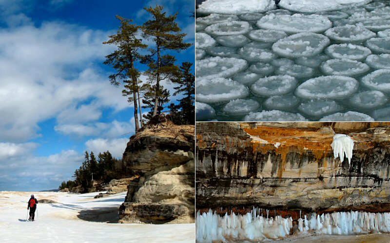
Lake Superior is a very unique place. It has sandy beaches, towering cliffs, cascading waterfalls, massive sand dunes, numerous islands, it's the largest freshwater lake by surface area, it generates more "lake effect" snow than anywhere else, and so on, but I think what is most enticing about it is it's many moods and seasons. Sometimes the water is as tranquil as a bathtub. Other times it looks as angry as a stormy ocean with crashing waves and viscous wind. In the summer, the air temperature may be in the 90's and the clear emerald green water may make you think of the Caribbean. In the winter it is more reminiscent of Antarctica: freezing cold, snowy, and bearing an ice shelf that would rival some glaciers in size. It's a very dynamic place. More subtle changes may also be going on due to global warming, some scientists expect there will be little to no ice on the Lake in 40-50 years.
Megan and I have made many trips to the Pictured Rocks backcountry in the winter. It's a remote and seldom visited place so it's hard to get information about the current conditions. I read ice & snow charts religiously and watch nearby webcams but we didn't really know what we would see once we exited the woods and stepped onto Twelvemile Beach after hiking 4.5 miles. With the recent warm weather I wasn't expecting much, we were prepared to have to turn around at the beach due to lack of ice and I consoled myself with the thought that we would at least be able to check out the cool ice cave we found in this area last year. Turns out the ice cave from last year was iceless this year, while the beach had the largest ice shelf I had seen. The ice towered above the beach in house-sized chunks and formed high points that could rightly be called hills. Walking to the edge of the ice shelf is pretty perilous so I did this infrequently and cautiously. I did not necessarily get close to the areas that may have been tallest, but I did see places where the shelf rose at least 20 feet above the lake. If you have trouble believing that the ice could ever get that tall, have a look at this picture of an ice ridge on Lake Superior taken by the National Weather Service.
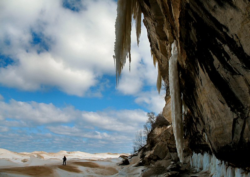
So, there was a solid ice shelf and sunny skies all the way to Spray Falls, allowing us to get a different view of the cliffs. This is of course possible in the summer via boat, but being able to walk below the cliffs, explore the various caves, and see Spray Falls from below is quite amazing.
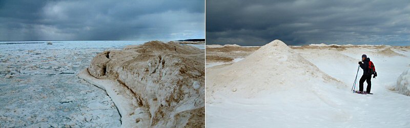
The snow on the hilly Beaver Lake Road was icy and inconsistent so we ditched our skis after about a mile and snowshoed from then on. On the way out we were happy to get back on skis, they are so much smoother than clunky snowshoes. Hiking to Spray Falls is 14 miles RT in winter and it took us about 9 hours.
First, a warning: The ice shelf can be dangerous. The National Park Service does not recommend walking on the ice shelf because it is unstable and unpredictable. Ice bridges can form on the surface and you will never know it until you step on one and fall through. Also, during warm weather or stormy seas, large chunks of the ice shelf may fall into the lake. You would not want to be on one then, and you would not want a section of ice to fall into the lake when it is your only way back to land. The ice can also be undercut by waves so while you may think you are standing on a solid piece, you may be on an overhang that is just waiting to break off. Normally, falling through ice wouldn't be fatal as long as you can climb back out within a few minutes. However, if you fall through or over the edge of the ice shelf your chances of climbing back out are very slim unless perhaps you are wearing crampons and have ice axes. You of course need to be extra careful around Spray Falls or any other spot where the ice may be weakened by flowing water. The lakeshore is very remote in the winter and the weather is highly variable, so be prepared for anything. Don't expect to be able to call for help should you get into trouble, cell phones don't work and there will likely not be anyone else within several miles of you. The trails through the woods can be very hard to follow if they are buried in snow so it's best if you are familiar with the area. You should of course bring a map and compass (or GPS). Once you are lost in the woods there are not many landmarks to tell you which way is which. Winter is a very unforgiving time of year and Pictured Rocks is a very remote place so plan well and stay safe.
Two weeks before our hike, another group, who did a multi-day trip in Pictured Rocks, reported 40-50 mph winds and 15 foot waves on Lake Superior. That storm dumped about 2 feet of new snow along the lakeshore and most of the ice that formed along the cliffs was broken up and washed away.
Ed Shively attempted the first winter ice crossing of Lake Superior shortly before our trip. He ran out of ice just after Spray Falls and his footprints were still visible in the snow along the ice shelf where we walked. He said that following animal tracks, which we also saw, is a good way to avoid bad ice. Apparently animals have a sixth sense, the "ice thickness sensing" sense. He hiked in a dry suit and had all the provisions for self-rescue in case he fell through.
Our friend Kai, who is too lazy to put his pictures online, hiked the ice shelf last year under much more dangerous conditions. In the spring thaw, rocks were falling from the cliffs and chunks of the ice shelf were falling into the lake or disintegrating behind him. His story could probably be made into a TV movie, but long story short, they intended to hike the entire Pictured Rocks lakeshore, ran out of ice, climbed up the cliffs, got lost in the woods, and were eventually rescued by a lumberjack. I think the logging industry is missing a great opportunity for some positive PR here: "We cut down trees, but we save people."
Lake Superior is a very unique place. It has sandy beaches, towering cliffs, cascading waterfalls, massive sand dunes, numerous islands, it's the largest freshwater lake by surface area, it generates more "lake effect" snow than anywhere else, and so on, but I think what is most enticing about it is it's many moods and seasons. Sometimes the water is as tranquil as a bathtub. Other times it looks as angry as a stormy ocean with crashing waves and viscous wind. In the summer, the air temperature may be in the 90's and the clear emerald green water may make you think of the Caribbean. In the winter it is more reminiscent of Antarctica: freezing cold, snowy, and bearing an ice shelf that would rival some glaciers in size. It's a very dynamic place. More subtle changes may also be going on due to global warming, some scientists expect there will be little to no ice on the Lake in 40-50 years.
Megan and I have made many trips to the Pictured Rocks backcountry in the winter. It's a remote and seldom visited place so it's hard to get information about the current conditions. I read ice & snow charts religiously and watch nearby webcams but we didn't really know what we would see once we exited the woods and stepped onto Twelvemile Beach after hiking 4.5 miles. With the recent warm weather I wasn't expecting much, we were prepared to have to turn around at the beach due to lack of ice and I consoled myself with the thought that we would at least be able to check out the cool ice cave we found in this area last year. Turns out the ice cave from last year was iceless this year, while the beach had the largest ice shelf I had seen. The ice towered above the beach in house-sized chunks and formed high points that could rightly be called hills. Walking to the edge of the ice shelf is pretty perilous so I did this infrequently and cautiously. I did not necessarily get close to the areas that may have been tallest, but I did see places where the shelf rose at least 20 feet above the lake. If you have trouble believing that the ice could ever get that tall, have a look at this picture of an ice ridge on Lake Superior taken by the National Weather Service.
So, there was a solid ice shelf and sunny skies all the way to Spray Falls, allowing us to get a different view of the cliffs. This is of course possible in the summer via boat, but being able to walk below the cliffs, explore the various caves, and see Spray Falls from below is quite amazing.
The snow on the hilly Beaver Lake Road was icy and inconsistent so we ditched our skis after about a mile and snowshoed from then on. On the way out we were happy to get back on skis, they are so much smoother than clunky snowshoes. Hiking to Spray Falls is 14 miles RT in winter and it took us about 9 hours.
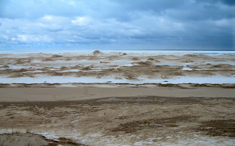
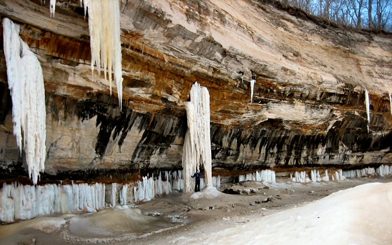
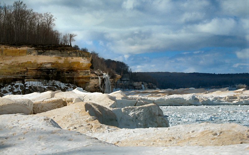
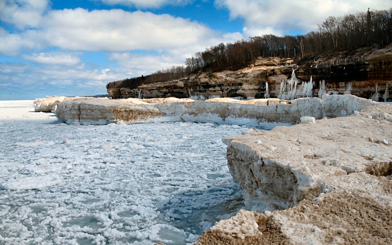
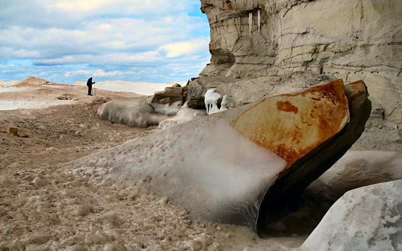
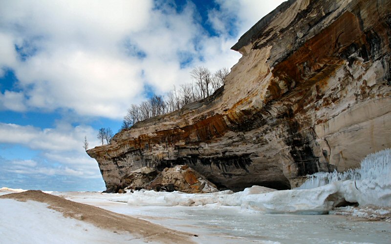
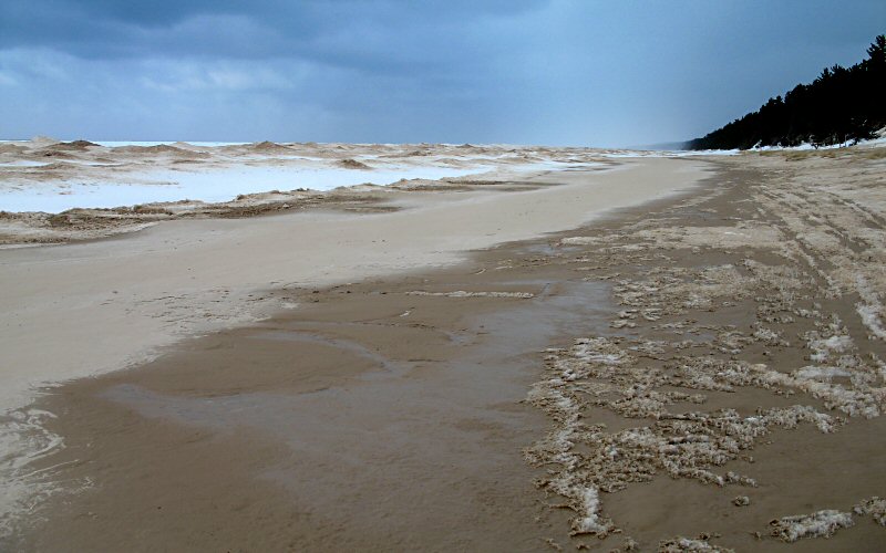
This is the view of Twelvemile beach near where the trail emerges from the woods. The snow/ice is brown because the wind and waves mix the sand and snow together. The beach itself was pretty snow free, but the ice shelf extended about 100 feet from the shore. Without this ice shelf, it would not be possible to hike to the base of Spray Falls because there is no land between the cliffs and the lake. Unfortunately, you cannot appreciate the scale of the ice shelf from this picture.
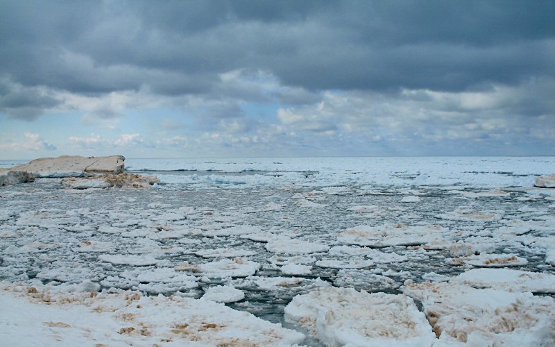
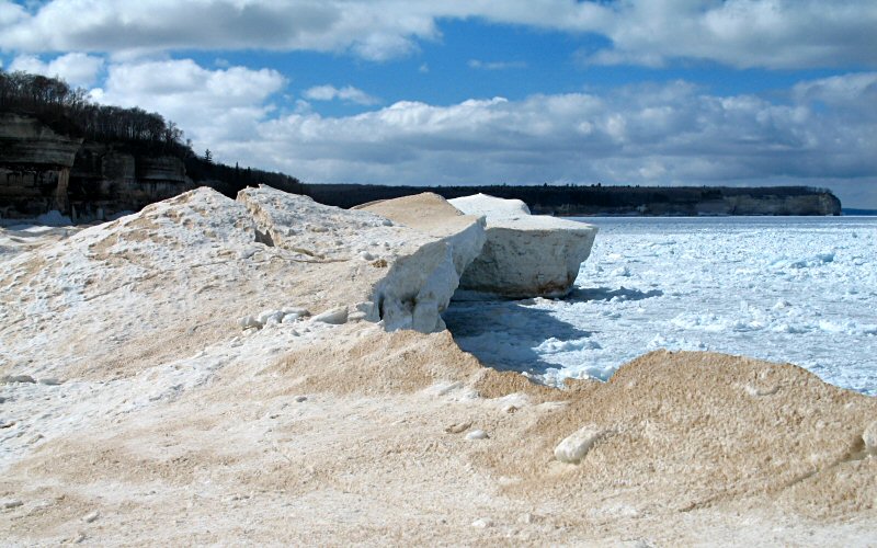
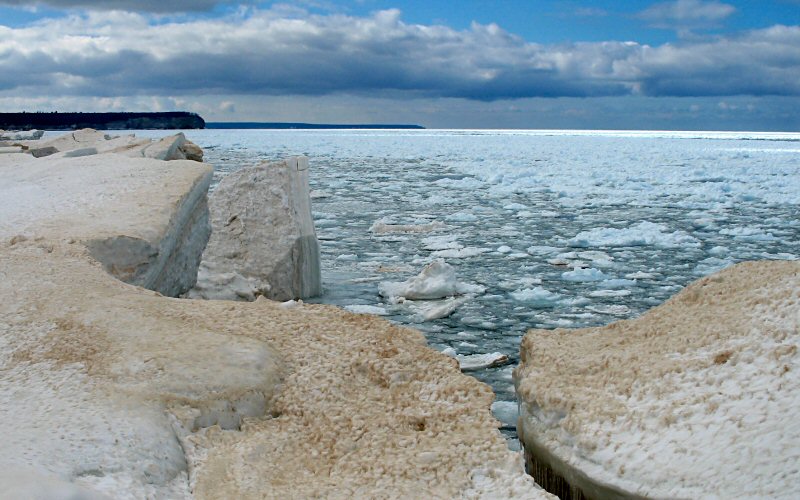
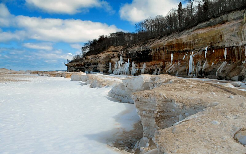
Lake ice from the edge of the ice shelf on Twelvemile Beach.
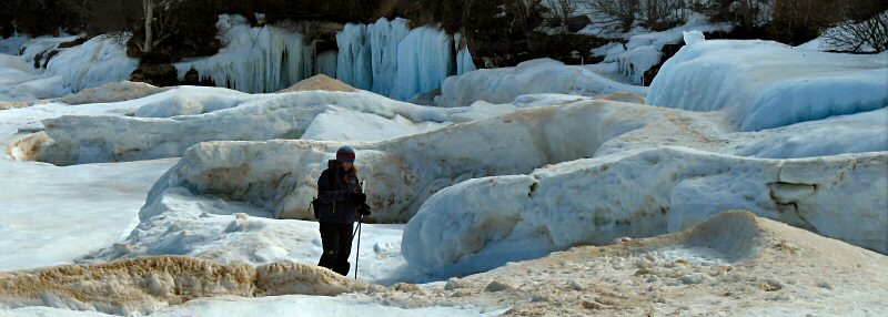
Megan in the contours of the ice.
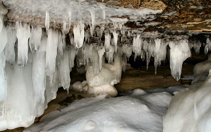
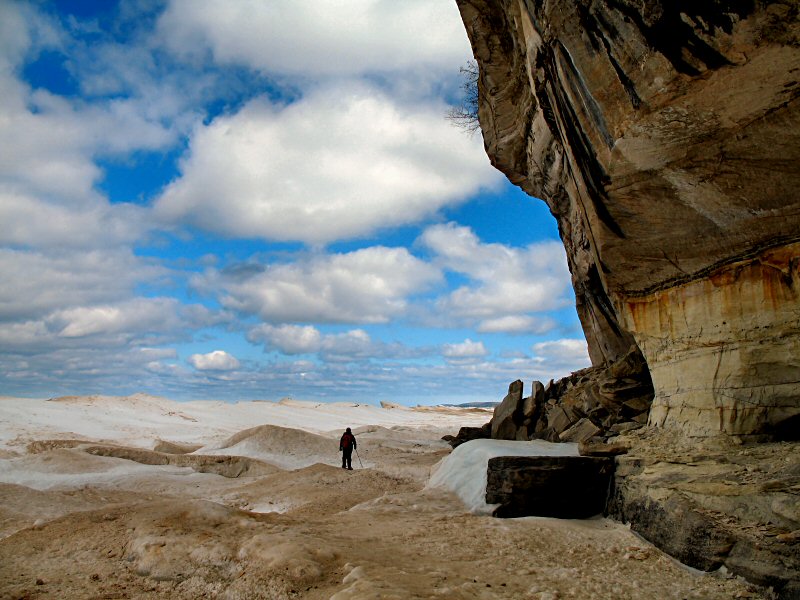
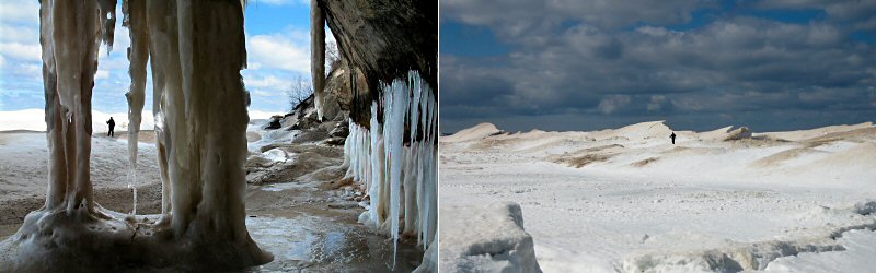
Ice cave.
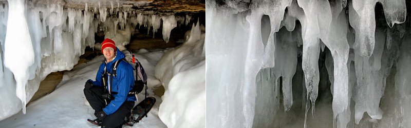
Left: Me in the ice cave (Photo by Megan). Right: Icicles.
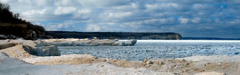
The edge of the ice shelf with Grand Portal Point in the background.
Me standing under an ice column (Photo by Megan).
Megan from a cave.
Our first view of Spray Falls.
Megan under a cliff. Without the ice, the lake would extend all the way to the cliff.
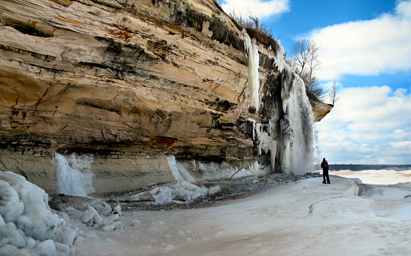
Me checking out Spray Falls (Photo by Megan).
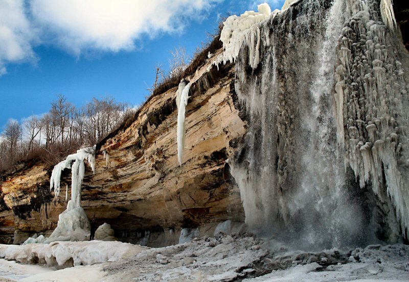
Spray Falls.
The ice shelf west of Spray Falls.
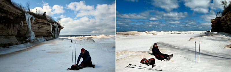
Taking a break on the ice.
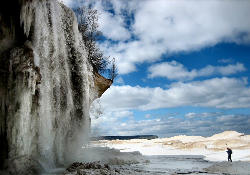
Me under Spray Falls (Photo by Megan).
In order to appreciate Spray Falls, I think you need to see it in motion.
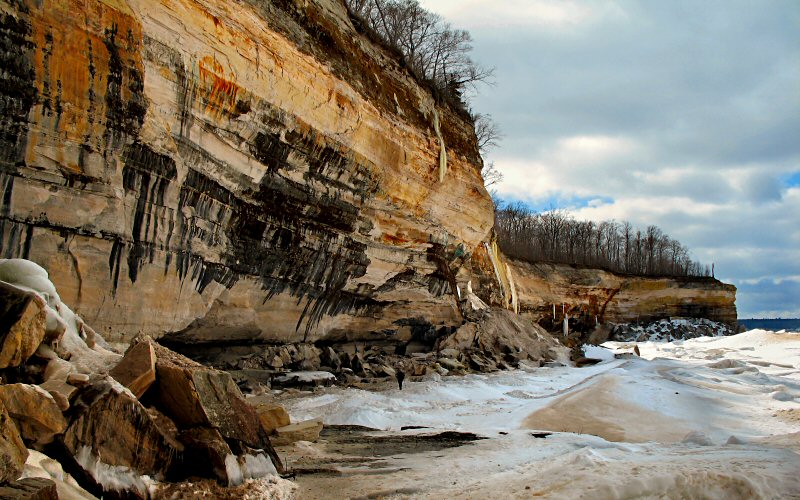
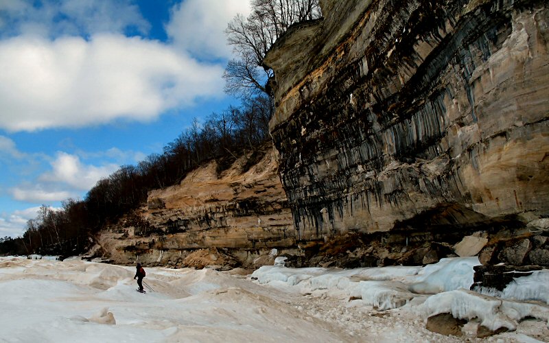
Cliffs.
Megan pausing.
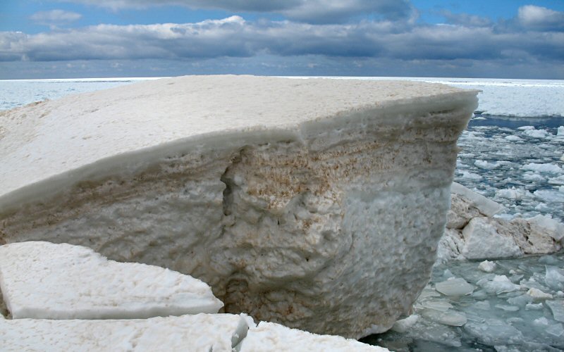
The edge of the ice shelf with Grand Portal Point in the background. I'm not sure how big the shelf was in this spot but it was 20 feet tall in many places.
Megan below the cliffs.
A large slice of pie, bigger than an SUV.
Icicles above.
A collapse.
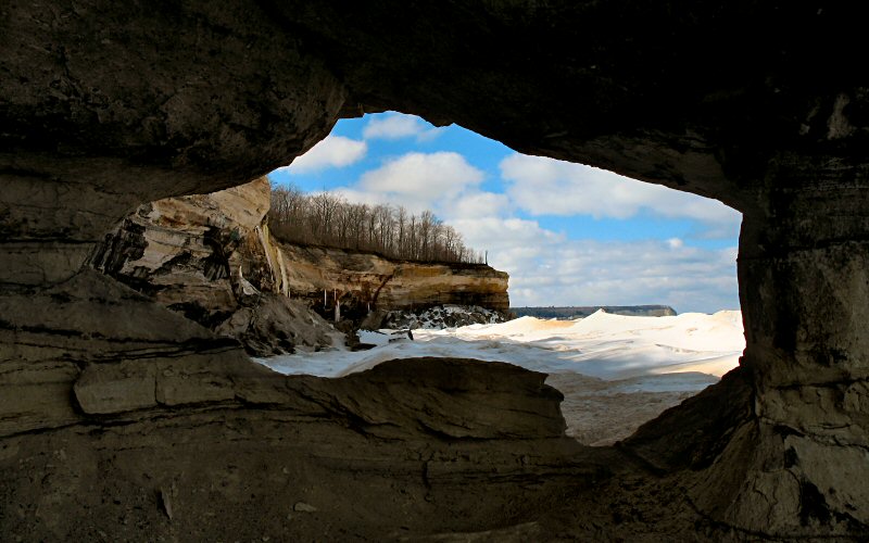
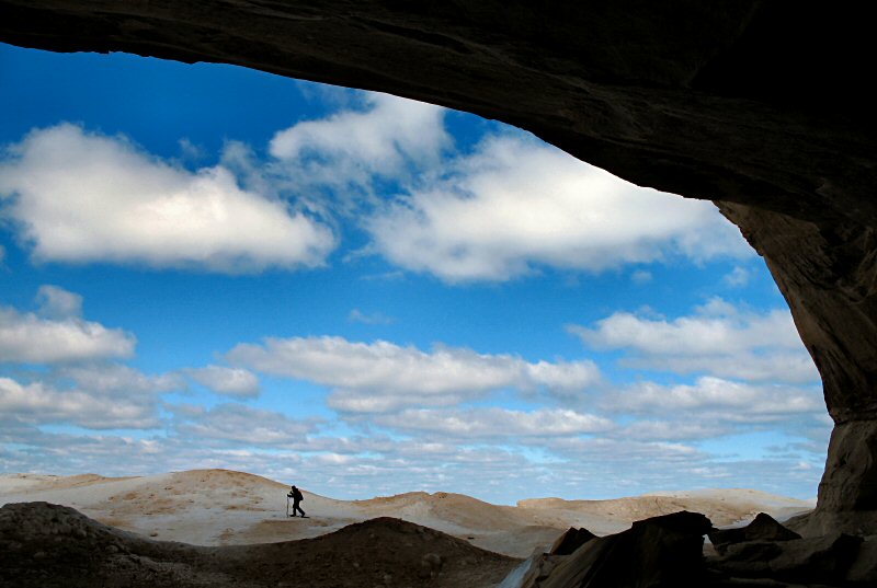
Looking through a portal.

The edge.
Cracks in the ice.
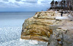
Leaning cliffs.
Left: Interesting ice formations. Right: Me closer to the edge (Photo by Megan).
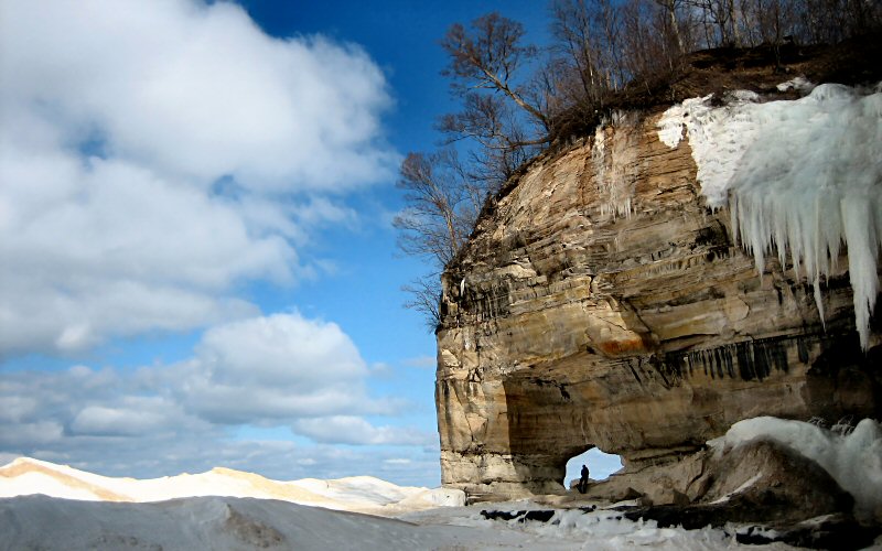
Me sitting in the portal (Photo by Megan).
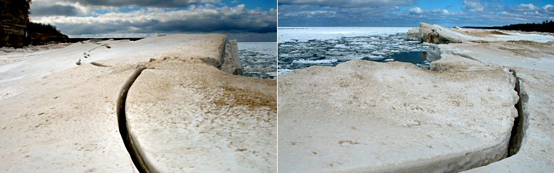
As time goes by, the edge of the ice shelf moves further out into the lake, leaving behind ridges like this.
Megan hiking along the shrinking cliffs, pancake ice, and ice on a cliff.
Left: The sand-coated edge. Right: Megan standing next to an old ice volcano.
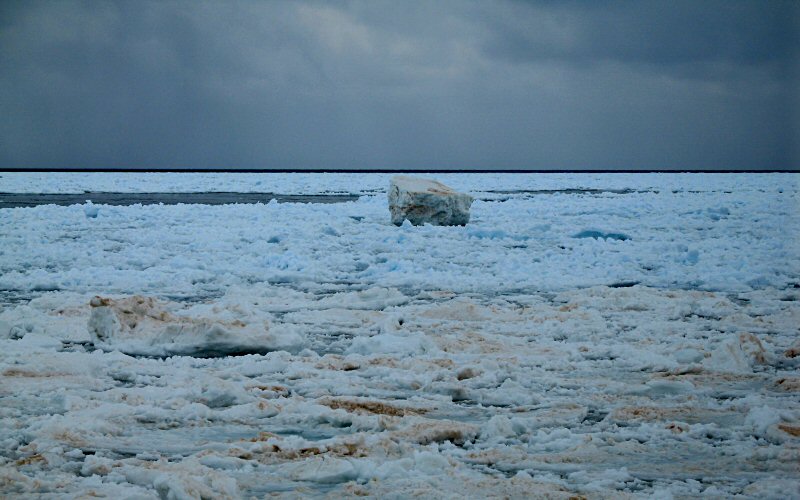
A lone iceberg as a storm comes in off the lake.
Ice.
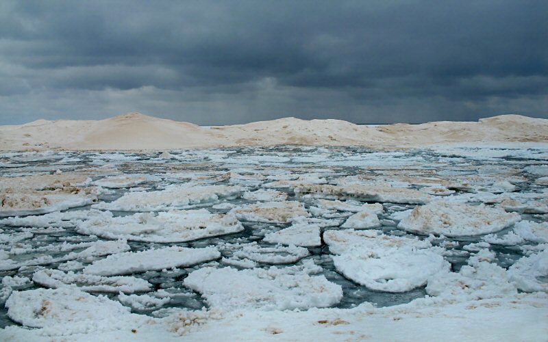
Twelvemile Beach.
» all photo reports from michigan's upper peninsula
Thinking about traveling to Pictured Rocks yourself? You might want to read my guide to Pictured Rocks.
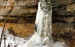
Ice Climbing, Michigan
March 4 - 5, 2011 Ice Climbing at Pictured Rocks with a side trip to Miners Castle. 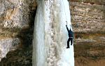
The Upper Peninsula, Michigan
October 2 - 11, 2009 Enjoying fall in the Upper Peninsula from Pictured Rocks to the Porcupine Mountains to the Keweenaw Peninsula. 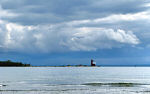
Mackinac Island, Michigan
October 3, 2009 Spending a short day on the island and enjoying the views, even without the influence of fudge. 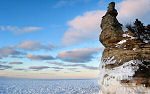
Pictured Rocks, Michigan
March 7 - 9, 2008 Skiing & snowshoeing in the Miners Castle & Grand Sable Dunes areas. We also checked out the ice in Grand Marais & Mackinac Straits. 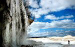
Pictured Rocks, Michigan
March 17, 2007 Hiking along the ice shelf from Twelvemile Beach to Spray Falls. 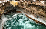
Pictured Rocks, Michigan
January 27, 2007 Skiing & hiking the Chapel Loop in Pictured Rocks National Lakeshore on a stormy day. 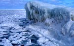
Pictured Rocks, Michigan
March 2 - 4, 2006 Ice climbing and skiing in Pictured Rocks National Lakeshore. 
Pictured Rocks, Michigan
January 7, 2006 A backcountry ski trip to the remote lakeshore cliffs of Pictured Rocks National Lakeshore. 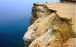
Pictured Rocks, Michigan
July 3 - 4, 2005 Hiking in Pictured Rocks National Lakeshore, and checking out some of the other sights in the area. |
Pictured Rocks, Michigan
February 25 - 26, 2011 Backpacking the Chapel Loop in winter, with a side trip to Spray Falls. 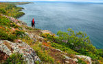
Bare Bluff, Michigan
October 8, 2009 A fall hike to Bare Bluff, one of the more scenic areas of the Keweenaw Peninsula. 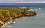
Pictured Rocks, Michigan
October 4 - 11, 2009 Some stormy fall weather along the Pictured Rocks lakeshore. 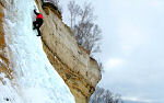
Pictured Rocks, Michigan
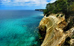
August 30 - September 2, 2007 Back to the Great Lakes with a rare summer visit to Pictured Rocks to see what it all looks like when it's green. 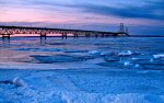
Mackinac Straits & Pictured Rocks, Michigan
March 16 - 18, 2007 Skiing to Miners Castle, lingering in the Straits of Mackinac, and some other stuff. 
Pictured Rocks in Fall, Michigan
October 7, 2006 Hiking the Chapel Loop & checking out other sights like Spray Falls, Miners Castle, Miners Beach, Munising Falls, Grand Sable Dunes, etc. 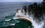
Pictured Rocks, Michigan
February 19 - 20, 2006 Skiing & snowshoeing the Pictured Rocks backcountry. Areas visited include: Miners Castle, Miners Beach, Twelvemile Beach, and Spray Falls. 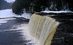
The Upper Peninsula, Michigan
December 26 - 28, 2005 Winter pictures from Tahquamenon Falls State Park and Pictured Rocks National Lakeshore. |
Copyright 1995- Lars Jensen | randomspace@umich.edu |