Pictured Rocks, Michigan
January 7, 2006
» the chapel loop, with ice
have you ever been sitting at work on friday and thought that you should drive 400 miles to the northern boundary of the united states that night, sleep for 4 hours, wake up, spend 11 hours skiing and hiking 20 miles in the cold snow the next day, and then drive home immediately afterward?...if not, then you don't know what fun is. you don't. i mean, unless you've been to disney world. but let me introduce you to a new kind of fun, a kind of fun that is painful and torturous. not really. read more...
have you ever been sitting at work on friday and thought that you should drive 400 miles to the northern boundary of the united states that night, sleep for 4 hours, wake up, spend 11 hours skiing and hiking 20 miles in the cold snow the next day, and then drive home immediately afterward?...if not, then you don't know what fun is. you don't. i mean, unless you've been to disney world. but let me introduce you to a new kind of fun, a kind of fun that is painful and torturous. not really. read more...
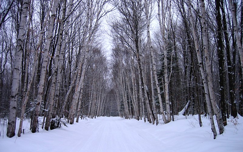
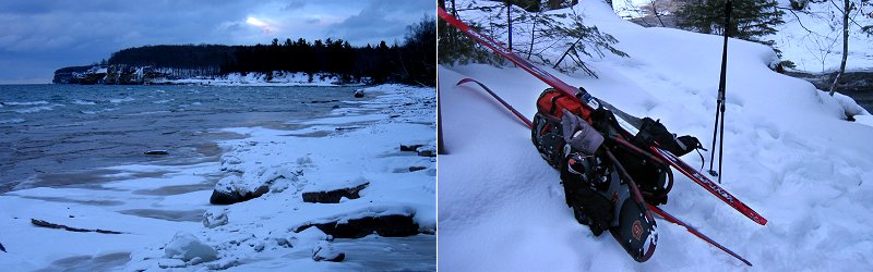
the unplowed road in that we skied to get to the trailhead (chapel road).
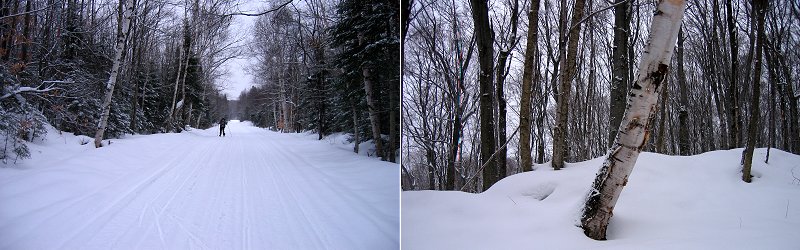
kai skiing, and some trees.
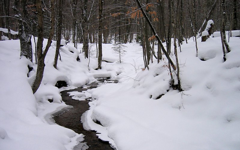
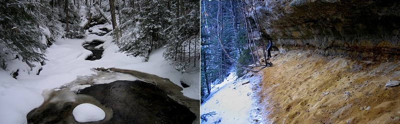
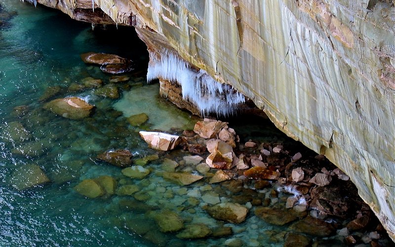
creeks like this are a very common sight in the woods above the cliffs.
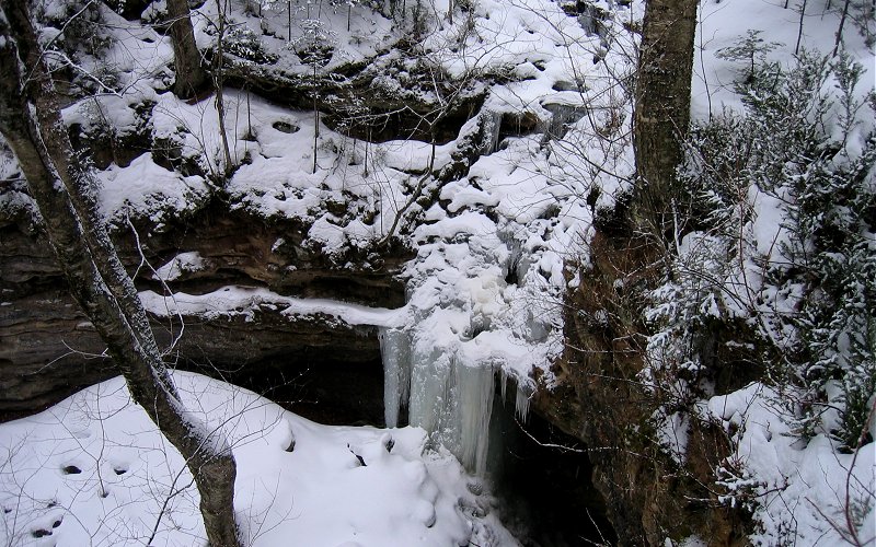
unnamed ice falls near the chapel lake overlook, probably at least 20 feet tall.

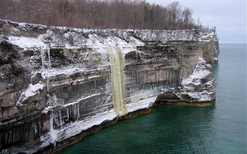
chapel falls as seen from the viewpoint, the top of the falls, and the view from (halfway) below.
chapel creek above the falls, and kai hiking below the cliff that leads to the base of the falls.
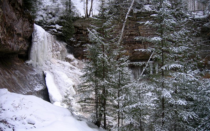
the top of chapel falls from the side.
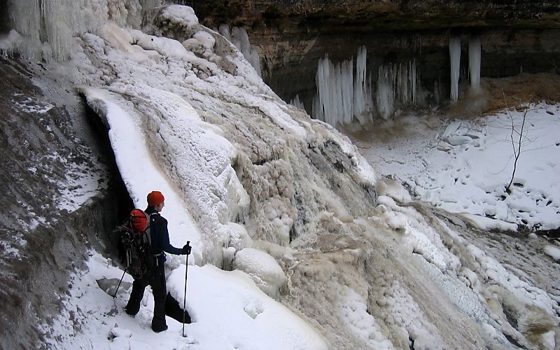
me next to the falls. it's hard to tell from the pictures, but there was lots of water running over the ice still.
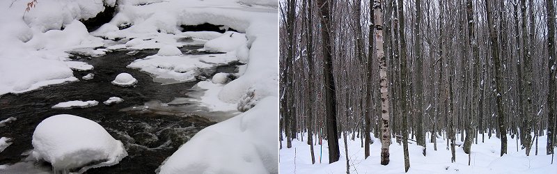
chapel creek, and trees on the way to chapel beach. the forest alternated between conifers and deciduous trees.
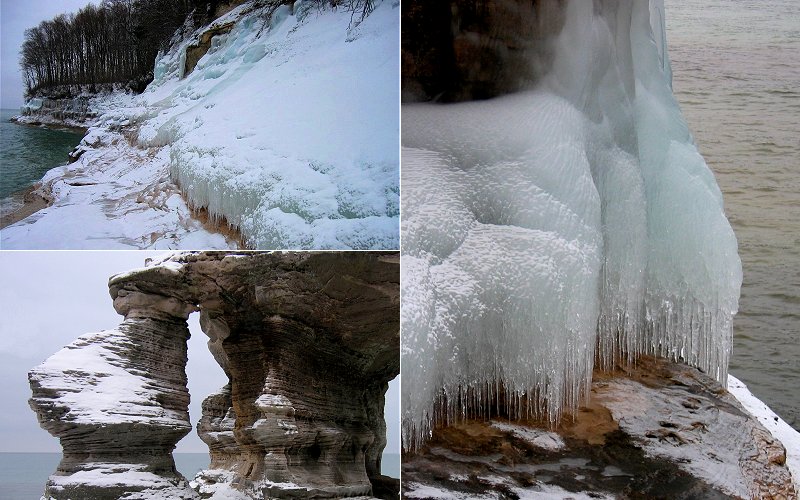
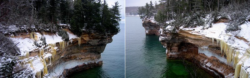
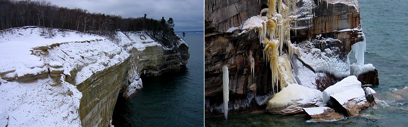
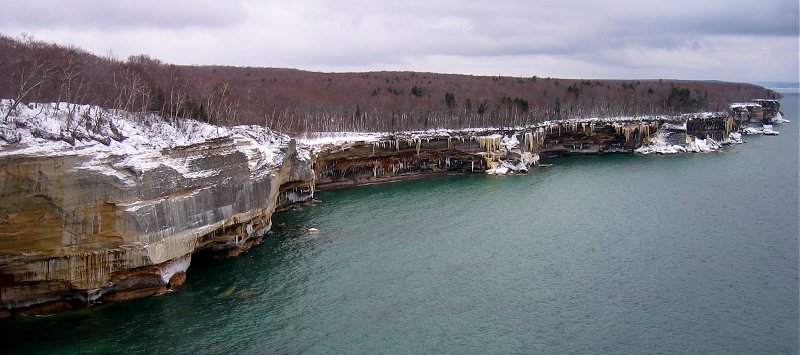
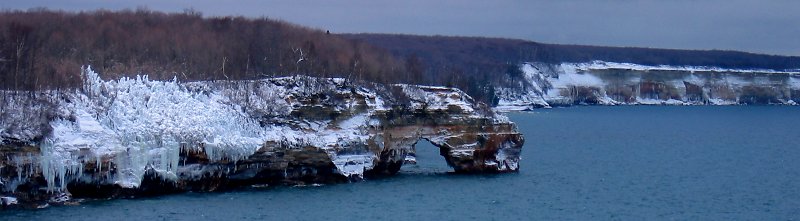
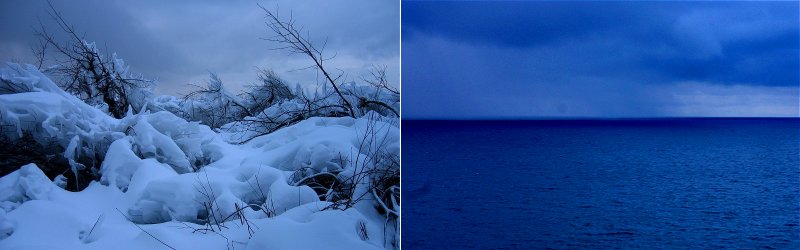
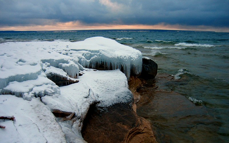
icy cliffs, ditto, and chapel rock.
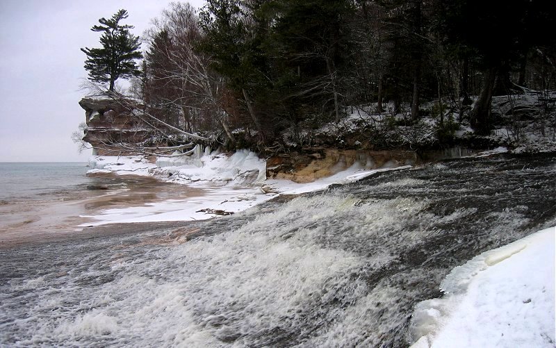
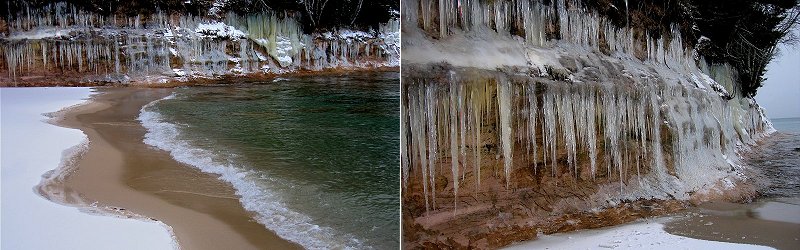
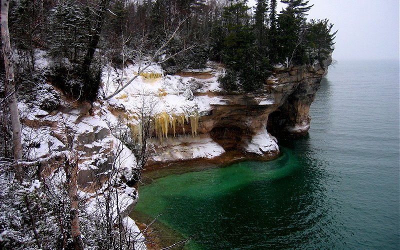
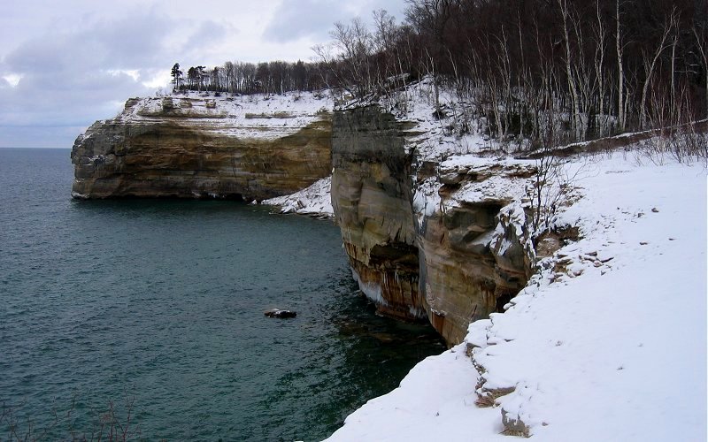
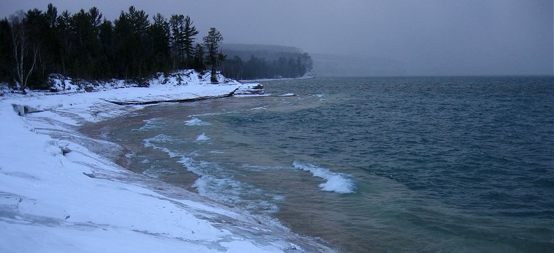
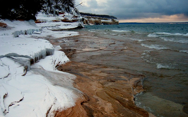
lower chapel falls flowing into lake superior and chapel rock as seen from chapel beach.
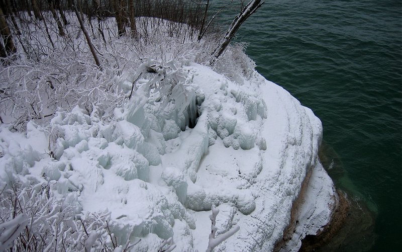
iced cliff and vegetation.
closer views.
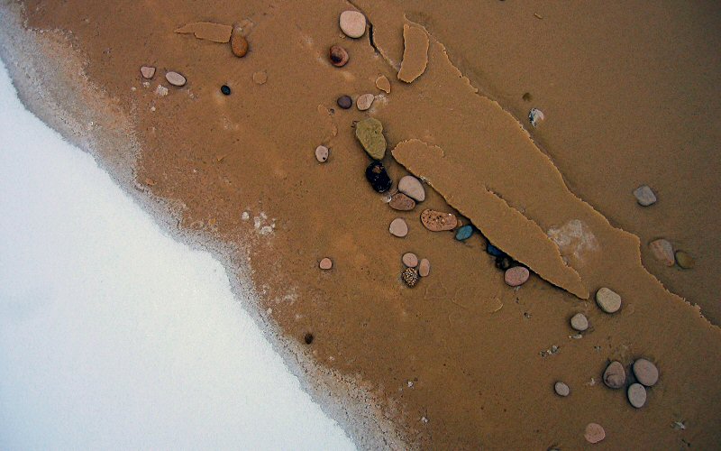
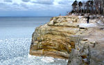
snow to sand on chapel beach.
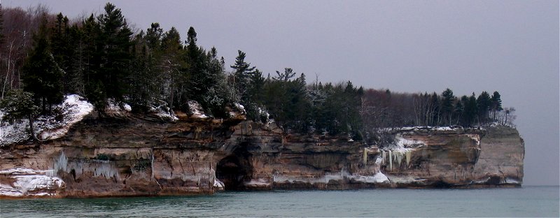
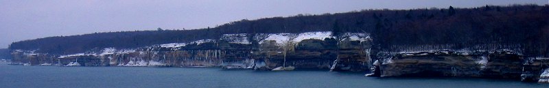
cliffs west of chapel beach.
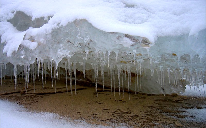
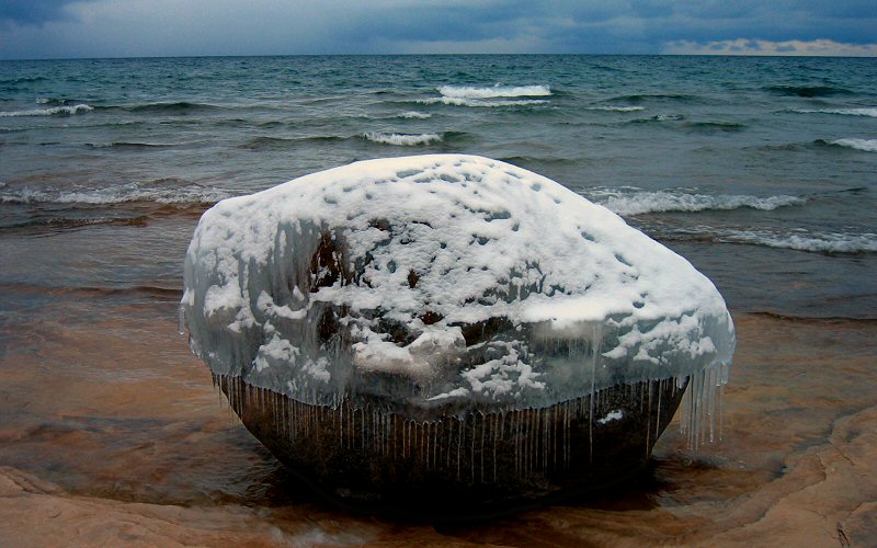
icicles under a chunk of ice laying on the beach.
icicles on a cliff.
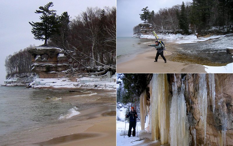
chapel rock, kai pointing out lake superior to me, and me standing next to some icicles at the west end of the beach.
just west of chapel beach.
closer.
looking back at the cliffs east of chapel beach. spray falls is in there somewhere (about 85 pixels from the left).
both of these pictures are from the "battleship row" area (a series of small coves). there is a better view of battleship row where you can see more "ships" but when hiking east to west you have to remember to look behind you to see it and i didn't.
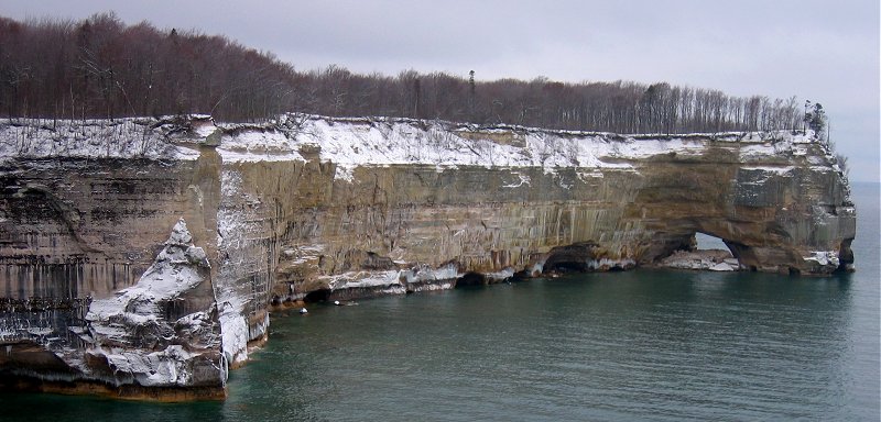
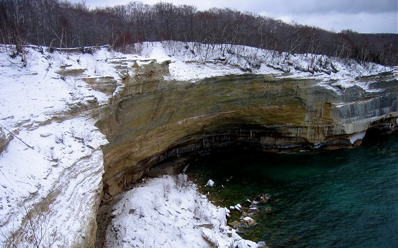
the back side of grand portal point.
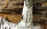
this ice formation is 100 feet high and ice climbers know it as "singing in the rain".
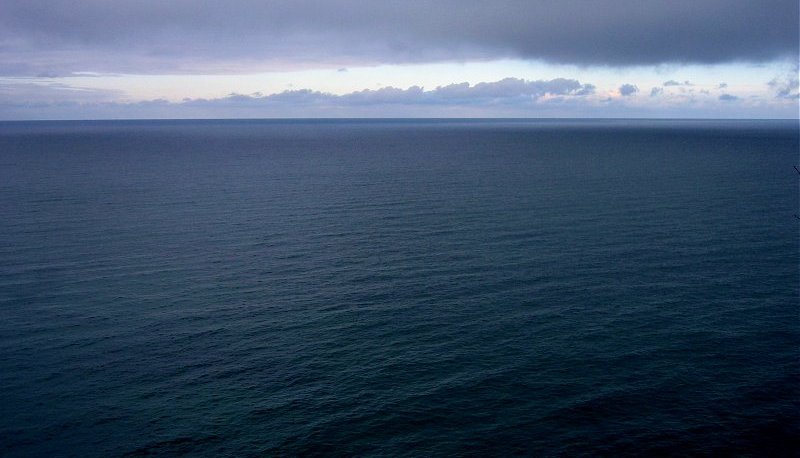
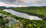
lake superior going on forever.
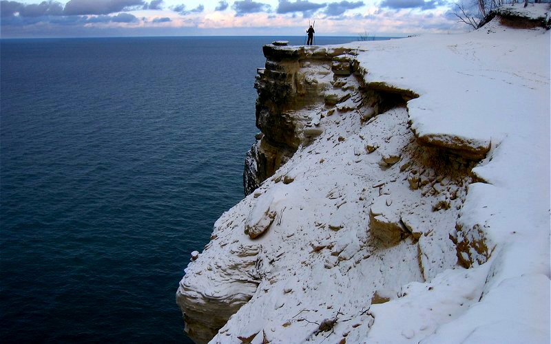
me standing on grand portal point.
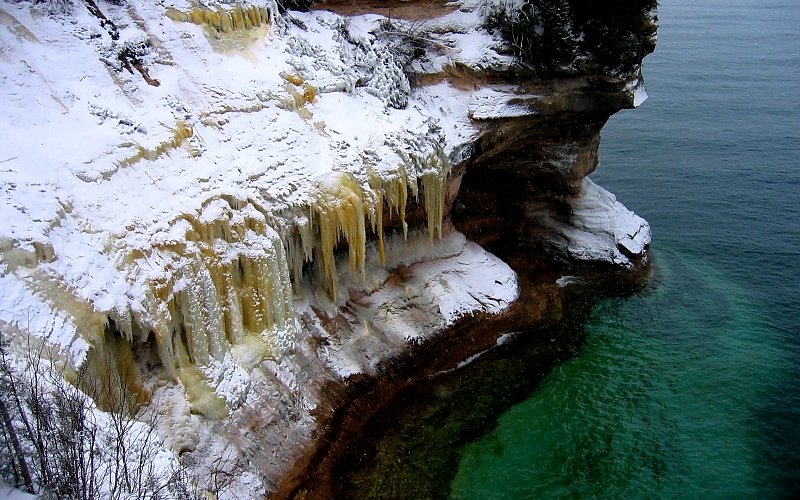
i think the brown colored ice is from water that seeps over the cliffs from the forest and the blue ice is generally formed from spray from lake superior waves.
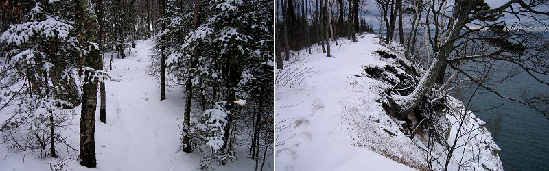
the trail going through some evergreens, and the trail going along the cliff edge.
the view west from indian head.
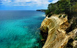
emerald shallows and mineral stained cliffs.
cliffs west of indian head.
indian head from the west.
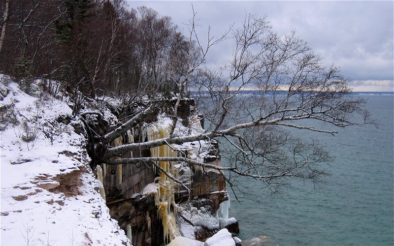
a tree clinging to the edge.
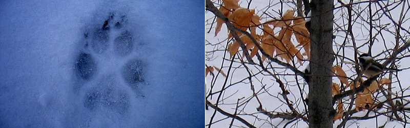
we've got company. a fresh red fox footprint, and a bird.
an iced cliff next to "lover's leap" arch.
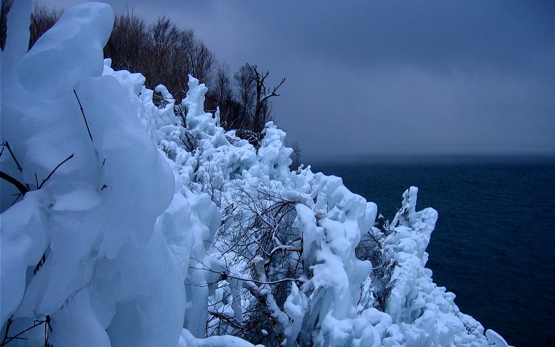
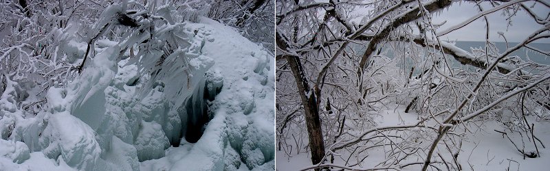
iced vegetation (which can be seen from a distance in the previous picture), at least 50 feet above the lake.
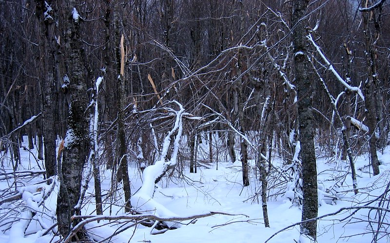
busted up trees (near the iced vegetation). the following is explanation of this specific phenomenon from a park ranger:
"That section of cliffs spawns some really big waves on Lake Superior. The waves actually crash into and up and over the cliffs, coating the trees with tons of ice on a repeated basis all winter. The trees there are stunted because of this phenomena. Since it happens repeatedly, we get trees snapping off - which you saw on your trip."
i guess they had 2 really big wind storms in november. the only thing that made the cause of this damage not obvious is that the damaged trees were in a very localized area, making wind an unlikely cause, and there was no ice on the trees in this area when we were there, making ice buildup an unobvious cause.
more iced vegetation, and a storm brewing over lake superior. we got hit by a few short-lived snow squalls but, in general, the weather was as perfect as we could have asked for.
east of mosquito beach. the cliffs in the background are not too visible because it is snowing over there.

ice on mosquito beach.
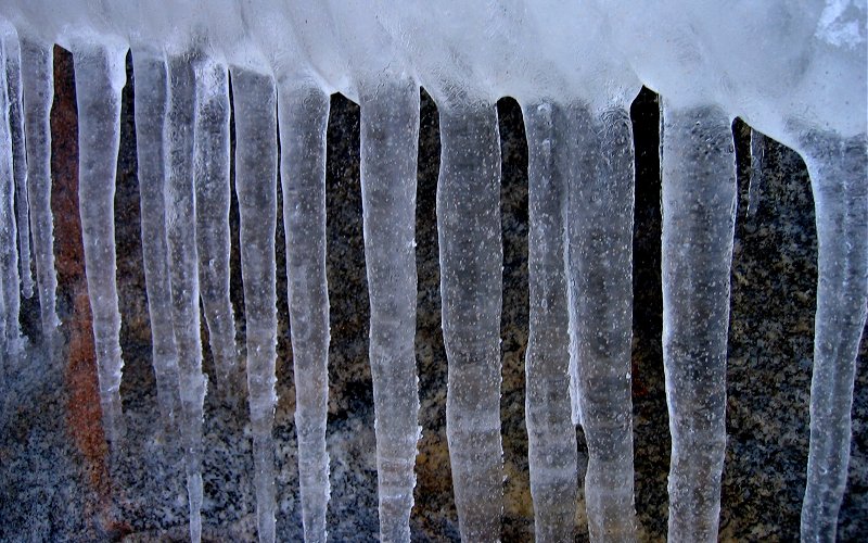
icicles on a rock.
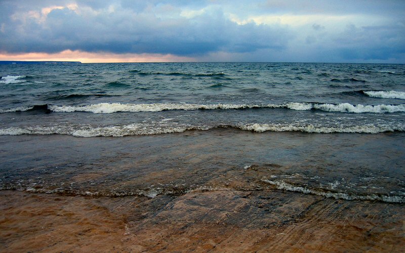
lake superior. grand island is on the horizon on the left.
looking back at mosquito beach, and my pack.
icy rocks at the west end of mosquito beach.
where mosquito beach ends.
icy rock.
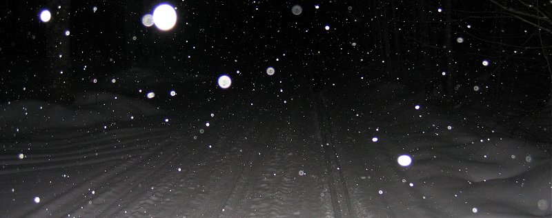
kai skiing the final stretch back to the car in the snowy dark.
» all photo reports from michigan's upper peninsula
Thinking about traveling to Pictured Rocks yourself? You might want to read my guide to Pictured Rocks.
Ice Climbing, Michigan
March 4 - 5, 2011 Ice Climbing at Pictured Rocks with a side trip to Miners Castle. 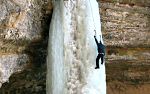
The Upper Peninsula, Michigan
October 2 - 11, 2009 Enjoying fall in the Upper Peninsula from Pictured Rocks to the Porcupine Mountains to the Keweenaw Peninsula. 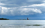
Mackinac Island, Michigan
October 3, 2009 Spending a short day on the island and enjoying the views, even without the influence of fudge. 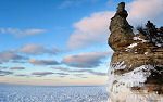
Pictured Rocks, Michigan
March 7 - 9, 2008 Skiing & snowshoeing in the Miners Castle & Grand Sable Dunes areas. We also checked out the ice in Grand Marais & Mackinac Straits. 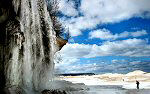
Pictured Rocks, Michigan
March 17, 2007 Hiking along the ice shelf from Twelvemile Beach to Spray Falls. 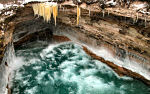
Pictured Rocks, Michigan
January 27, 2007 Skiing & hiking the Chapel Loop in Pictured Rocks National Lakeshore on a stormy day. 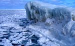
Pictured Rocks, Michigan
March 2 - 4, 2006 Ice climbing and skiing in Pictured Rocks National Lakeshore. 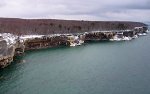
Pictured Rocks, Michigan
January 7, 2006 A backcountry ski trip to the remote lakeshore cliffs of Pictured Rocks National Lakeshore. 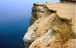
Pictured Rocks, Michigan
July 3 - 4, 2005 Hiking in Pictured Rocks National Lakeshore, and checking out some of the other sights in the area. |
Pictured Rocks, Michigan
February 25 - 26, 2011 Backpacking the Chapel Loop in winter, with a side trip to Spray Falls. 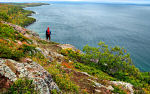
Bare Bluff, Michigan
October 8, 2009 A fall hike to Bare Bluff, one of the more scenic areas of the Keweenaw Peninsula. 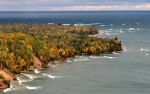
Pictured Rocks, Michigan
October 4 - 11, 2009 Some stormy fall weather along the Pictured Rocks lakeshore. 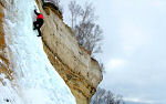
Pictured Rocks, Michigan
August 30 - September 2, 2007 Back to the Great Lakes with a rare summer visit to Pictured Rocks to see what it all looks like when it's green. 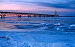
Mackinac Straits & Pictured Rocks, Michigan
March 16 - 18, 2007 Skiing to Miners Castle, lingering in the Straits of Mackinac, and some other stuff. 
Pictured Rocks in Fall, Michigan
October 7, 2006 Hiking the Chapel Loop & checking out other sights like Spray Falls, Miners Castle, Miners Beach, Munising Falls, Grand Sable Dunes, etc. 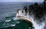
Pictured Rocks, Michigan
February 19 - 20, 2006 Skiing & snowshoeing the Pictured Rocks backcountry. Areas visited include: Miners Castle, Miners Beach, Twelvemile Beach, and Spray Falls. 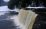
The Upper Peninsula, Michigan
December 26 - 28, 2005 Winter pictures from Tahquamenon Falls State Park and Pictured Rocks National Lakeshore. |
Copyright 1995- Lars Jensen | randomspace@umich.edu |