Upper Peninsula, Michigan
December, 2005
» whitefish point
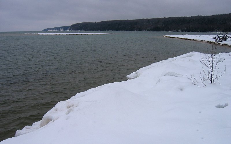
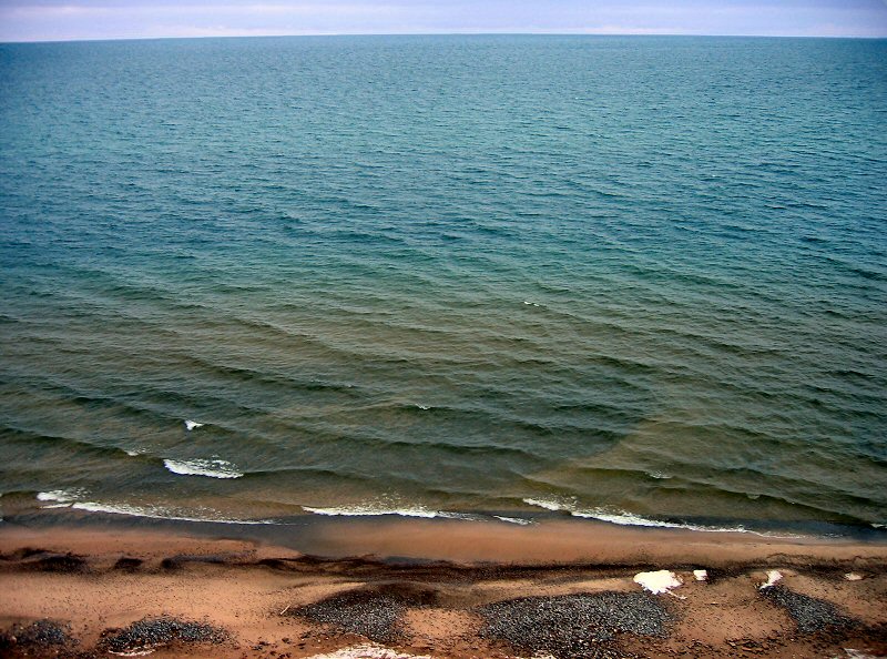
whitefish point is just north of the town of paradise on the southern shore of lake superior.
whitefish point is just north of the town of paradise on the southern shore of lake superior.
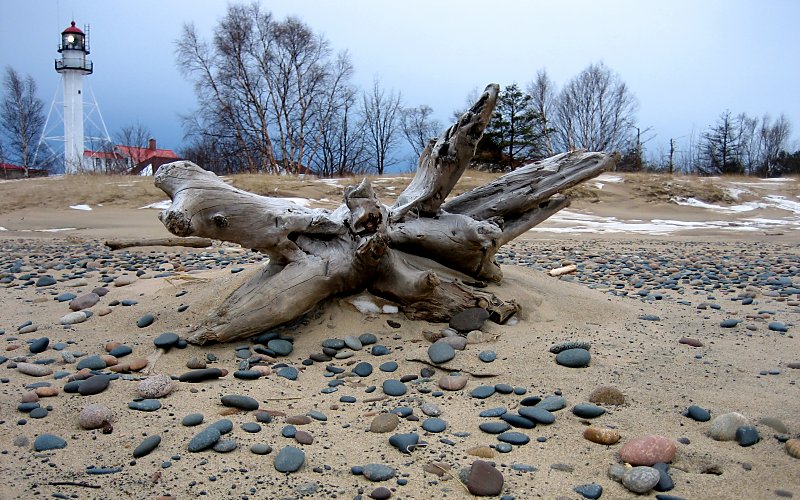
the whitefish point lighthouse as seen from the beach (taken by megan).
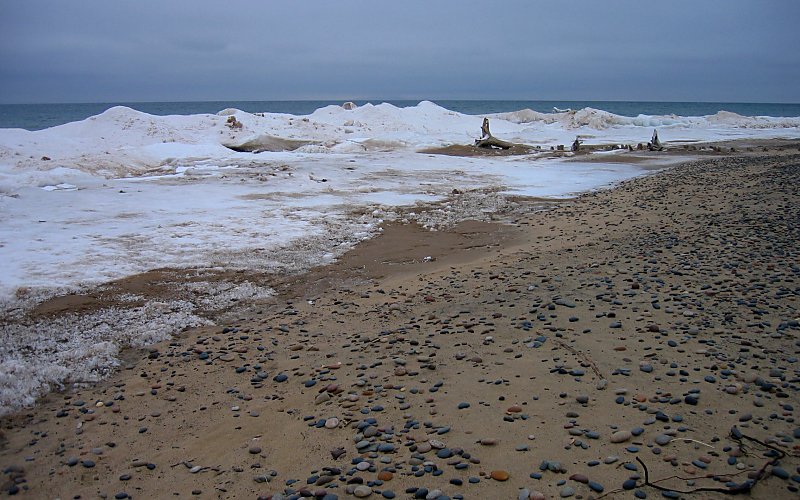
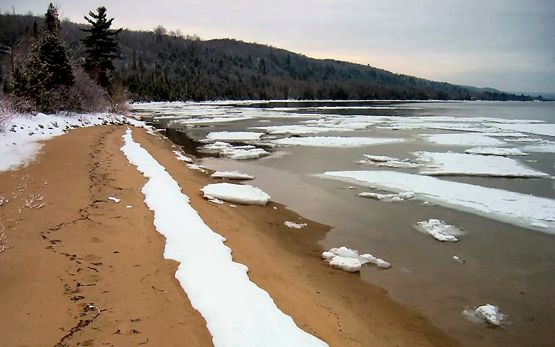
beach, ice, water, and sky.
shore ice. these are not ice covered rocks or anything, they are just big chunks of ice on a sandy beach.
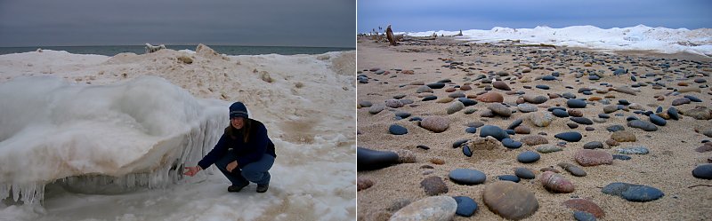
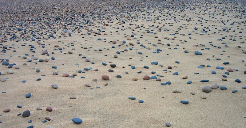
megan on the ice, and wave-polished rocks on the beach.
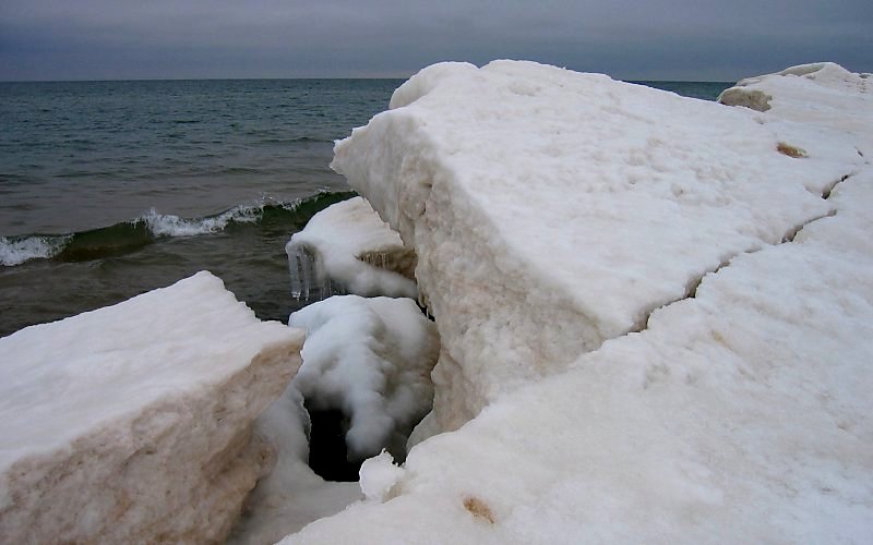
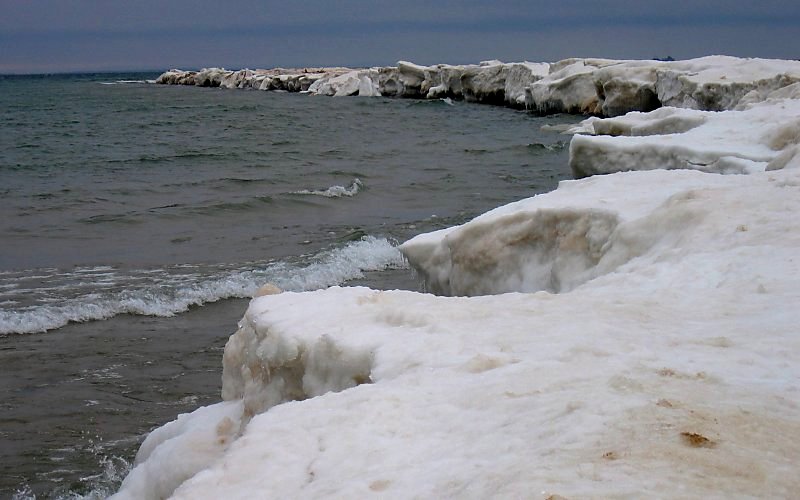
shore ice.
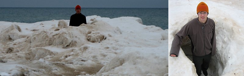
me standing in an "ice volcano" (taken by megan). ice volcanoes are formed as the waves slip underneath the shore ice and then get forced up through crevices, causing spray which then freezes.
rocks.
me standing on the ice at the point (taken by megan).
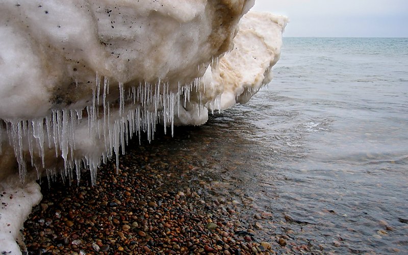
icicles hanging from the ice along the shore.
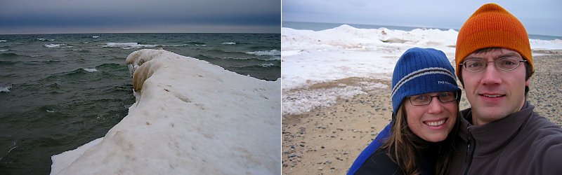
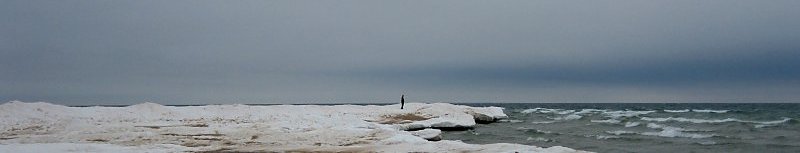
ice at the point, and us.
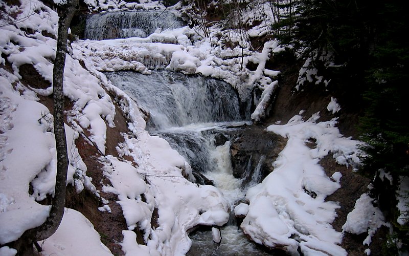
» tahquamenon falls
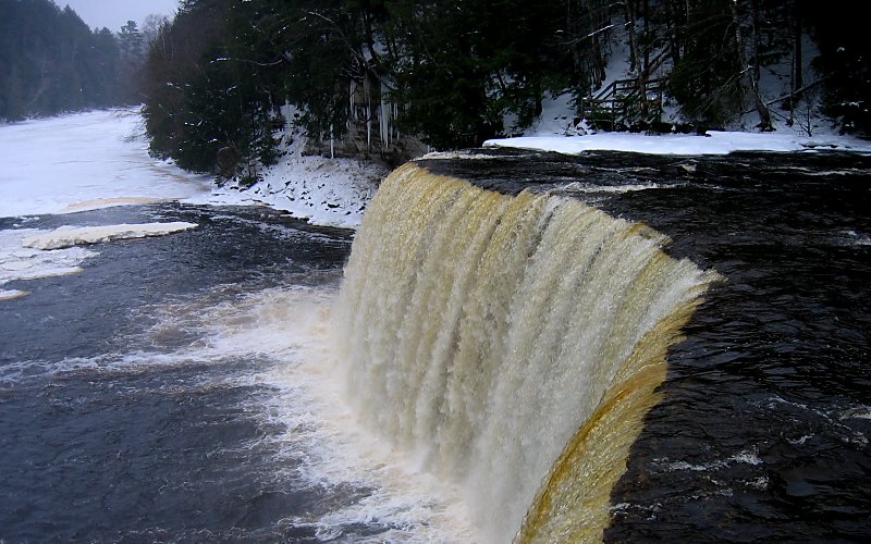
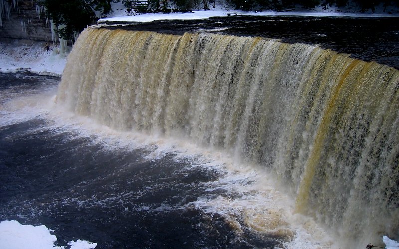
they say tahquamenon falls is the 2nd largest waterfall east of the mississippi (behind niagara) and they must be referring to the volume of water because at 50 feet, there are certainly taller waterfalls in the area. note that the color of the water is NOT due to pollution, it's from tanic acid from the cedar and hemlock swamps that feed the river.
they say tahquamenon falls is the 2nd largest waterfall east of the mississippi (behind niagara) and they must be referring to the volume of water because at 50 feet, there are certainly taller waterfalls in the area. note that the color of the water is NOT due to pollution, it's from tanic acid from the cedar and hemlock swamps that feed the river.
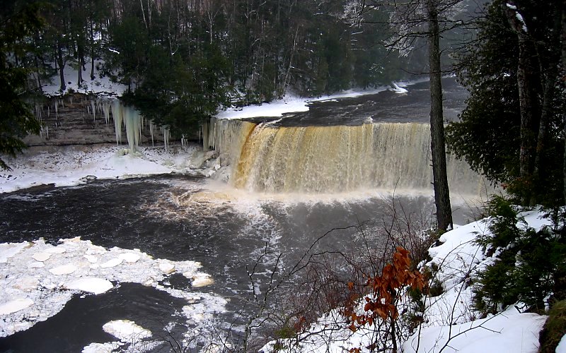
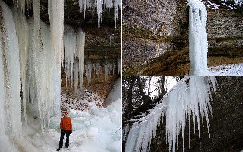
the upper falls.
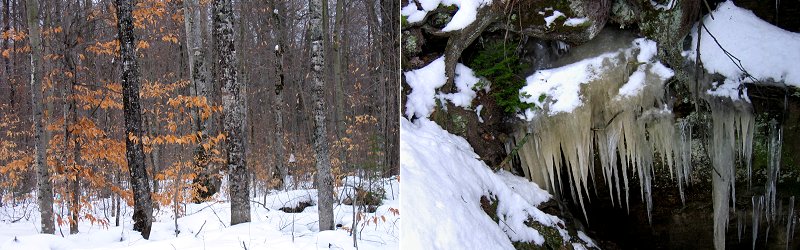
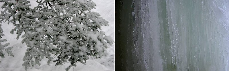
the forest, and icicles on a cliff.
from the side.
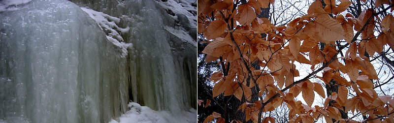
an iced cliff, and lingering leaves.
the falls from below.
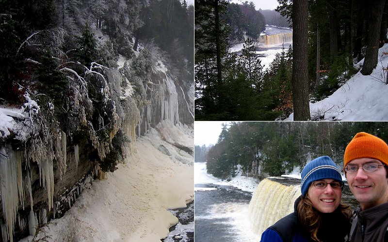
ice on the cliff next to the falls, the falls from afar, and us.
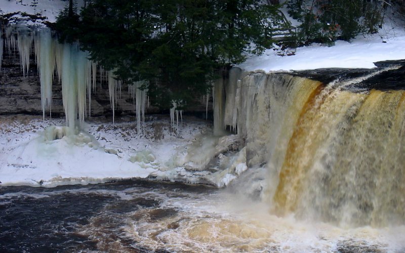
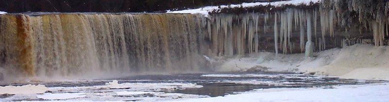
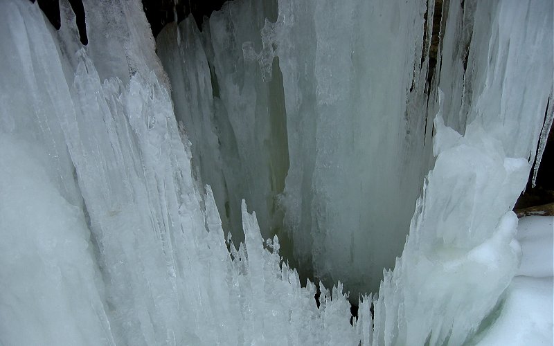
the falls and 50 foot icicles.
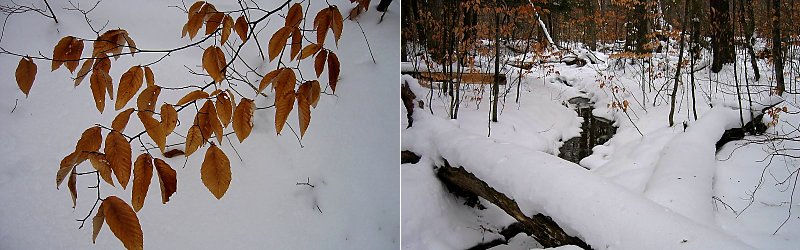
leaves, and a creek near the falls.
yet another angle.
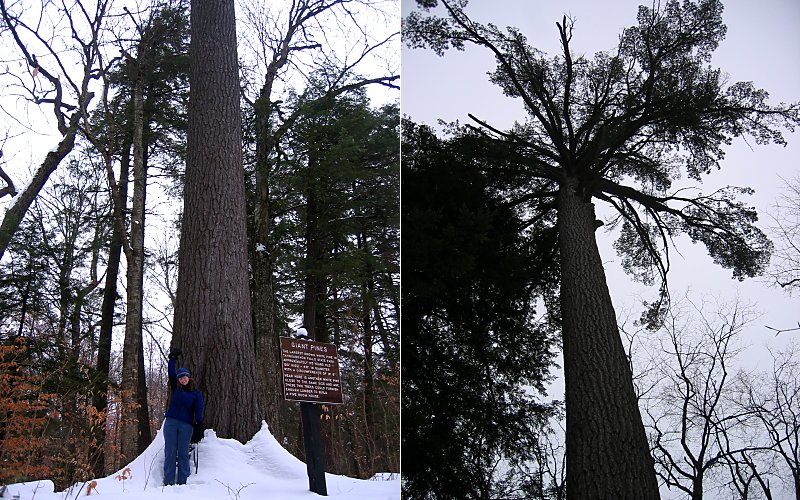
megan in front of one of the few trees the loggers did not cut down back in the day. now known as the "big pines", they dwarf the surrounding trees.
» munising falls, pictured rocks
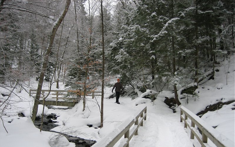
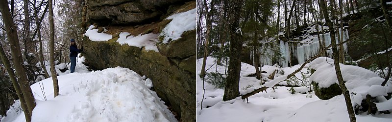
the hike to munising falls is a short one, up a beautiful little valley.
the hike to munising falls is a short one, up a beautiful little valley.
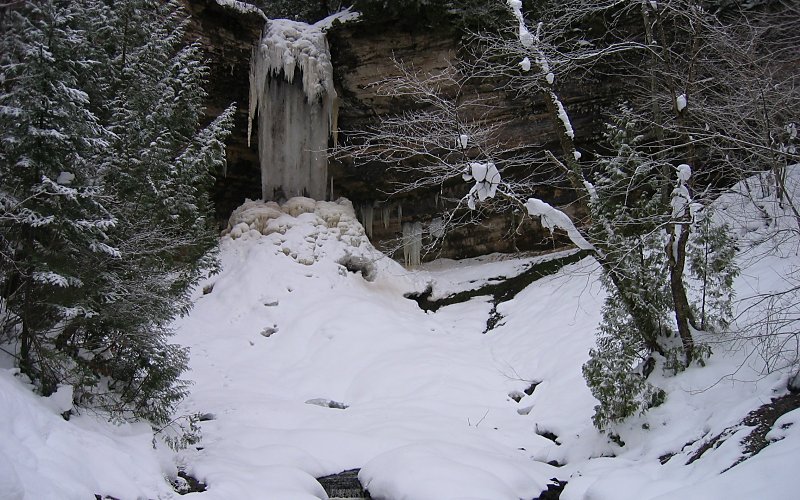
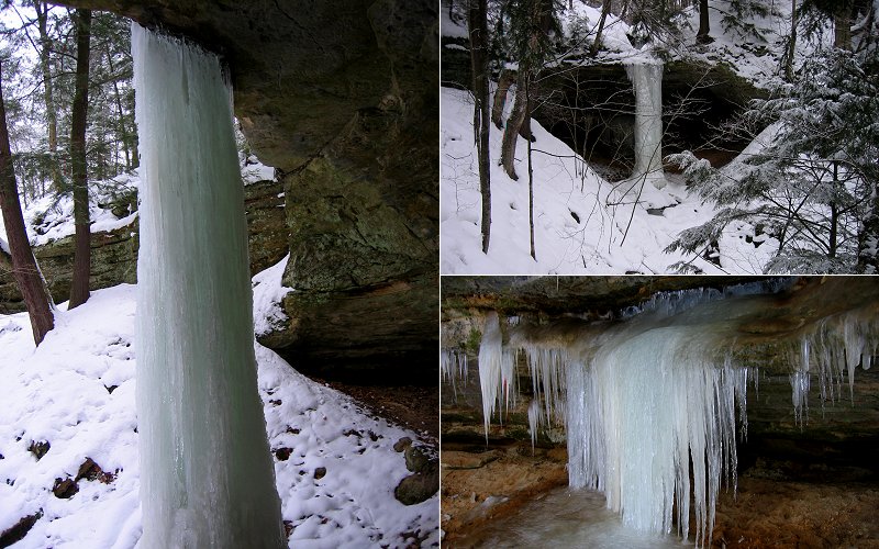
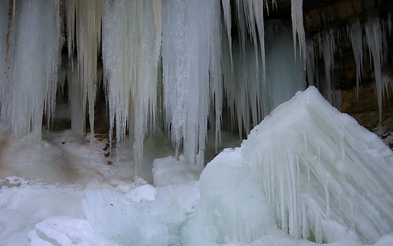
munising falls. there was a column of ice from top to bottom but it was also still flowing with water.
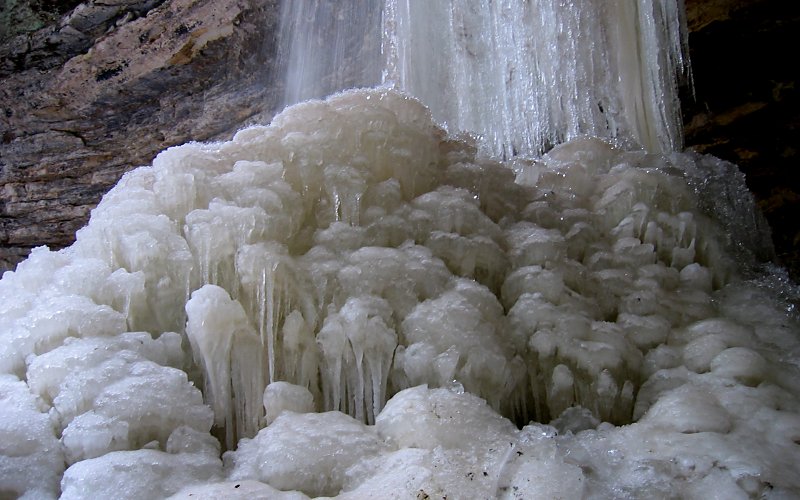
icicles in the ice at the base of the falls.
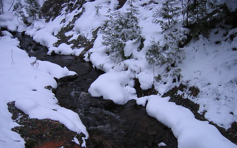
creek below the falls.
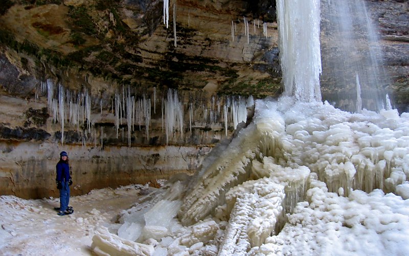
megan near the base of the falls.
me snowshoeing (taken by megan).
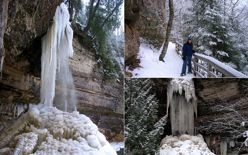
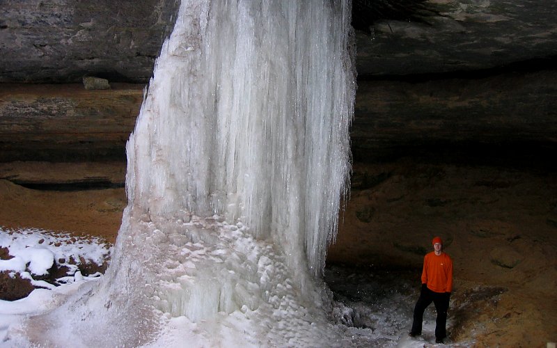
the falls from the side, megan on the trail, and me standing next to the falls (look for the orange hat) (taken by megan).
» mna memorial falls, munising
this was another short hike up a valley that leads to two waterfalls.
this was another short hike up a valley that leads to two waterfalls.
a huge column of ice.
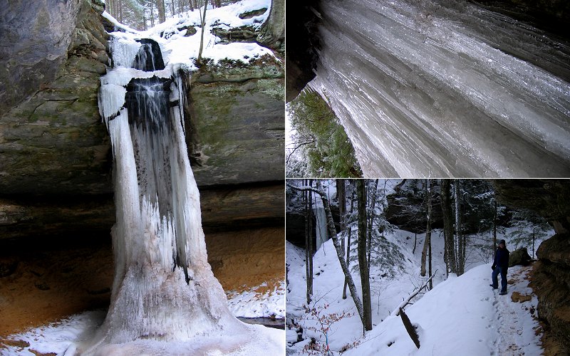
the waterfall from the front, looking up at the ice column, and megan hiking along the cliffs.
a snow covered pine tree (taken by megan), and the view from behind the ice.
the second waterfall, the view from afar, and icicles behind the falls.
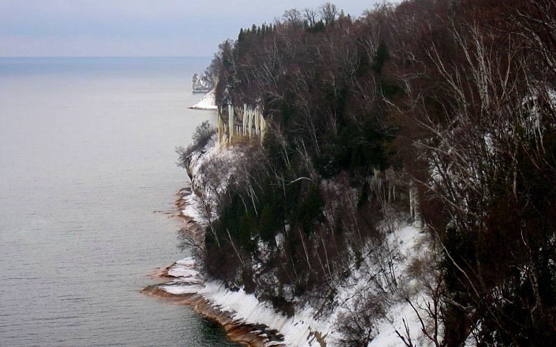
» sand point area, pictured rocks
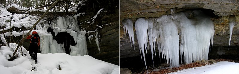
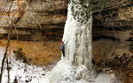
sand point is on the western side of the park and the road to it is one of the few park roads that are plowed in the winter. if you duck into the woods off sand point road and hike uphill for a bit you will come to some cliffs. if you hike along the bottom of those cliffs, you will come to an ice formation every few hundred feet. this is a popular area for ice climbing and we did run across two people climbing in our wanderings.
sand point is on the western side of the park and the road to it is one of the few park roads that are plowed in the winter. if you duck into the woods off sand point road and hike uphill for a bit you will come to some cliffs. if you hike along the bottom of those cliffs, you will come to an ice formation every few hundred feet. this is a popular area for ice climbing and we did run across two people climbing in our wanderings.
the beach, icebergs, and frosted trees at sand point.
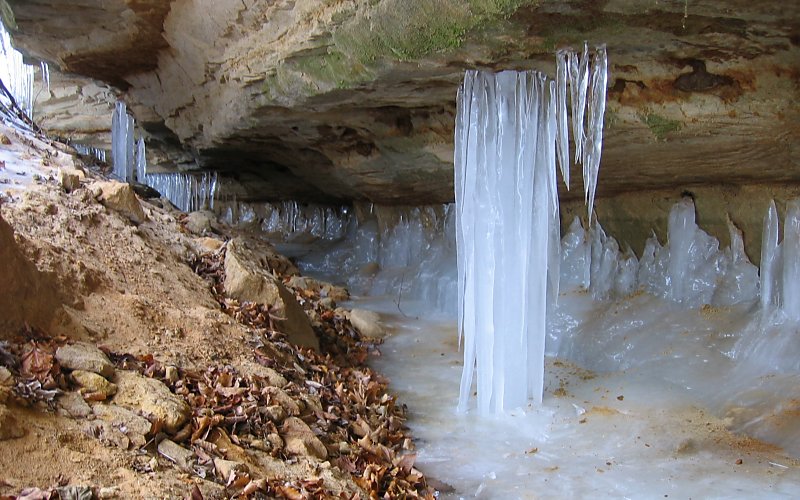
icicles formed by the water that seeps through the cliffs.
larger icicles.
me next to the icicles (we did see a huge chunk of ice break off and crash down so standing under the icicles is not necessarily that wise) (taken by megan), an ice column, and more icicles.
megan hiking along the cliffs, and some icicles from afar.
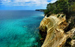
» sand point to miners castle, pictured rocks
we were hoping to make it to miners castle (a rock formation along the lakeshore cliffs), but it turned out to be a 10 mile RT hike and we wanted to have time to drive to the other side of the park to check out the dunes so we had to cut this hike short. unfortunately, you don't ever really get a good view of the cliffs until you get to miners castle due to all the trees and lack of indentations in the cliffs.
we were hoping to make it to miners castle (a rock formation along the lakeshore cliffs), but it turned out to be a 10 mile RT hike and we wanted to have time to drive to the other side of the park to check out the dunes so we had to cut this hike short. unfortunately, you don't ever really get a good view of the cliffs until you get to miners castle due to all the trees and lack of indentations in the cliffs.
looking towards miners castle (5 miles away) from sand point.
a hollow ice column formed by a waterfall.
me hiking (taken by megan), and icicles.
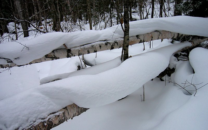
snow hanging on fallen birch trees.
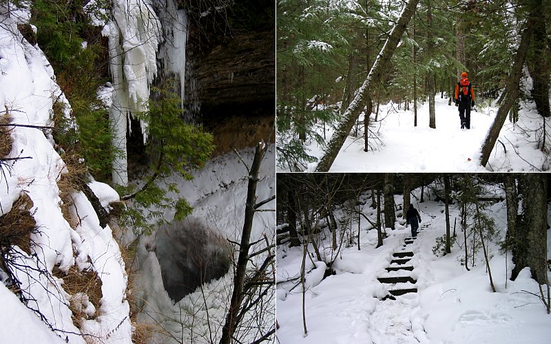
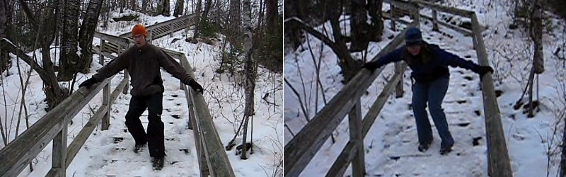
looking down on an ice hole, me hiking (taken by megan), and megan climbing some steps.
this is as close as i got to miners castle (i ran ahead of megan a bit to get this view and i still had to hang onto a tree and lean over the edge of the cliff to get a clear shot).
» wagner falls, munising
another waterfall that can be reached by a short hike.
another waterfall that can be reached by a short hike.
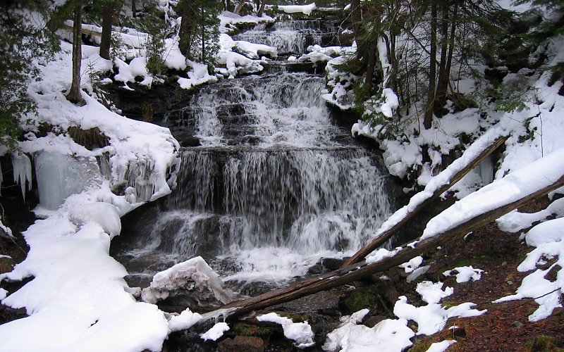
not so frozen.
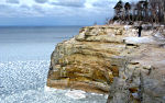
» grand sable dunes, pictured rocks
the grand sable dunes rise hundreds of feet above lake superior. unfortunately, we only had a small amount of time to explore this area.
the grand sable dunes rise hundreds of feet above lake superior. unfortunately, we only had a small amount of time to explore this area.
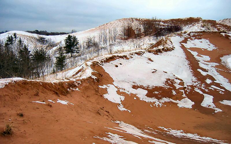
dunes. the wind creates an interesting mixture of sand and snow here, sometimes you would step on what appeared to be sand and break through it because there was snow underneath.
sable falls. scale is lost in this picture, but this is a large waterfall with a total drop of 75 feet.
there were tons of snow covered steps leading down the side of the falls which were fun to slide down.
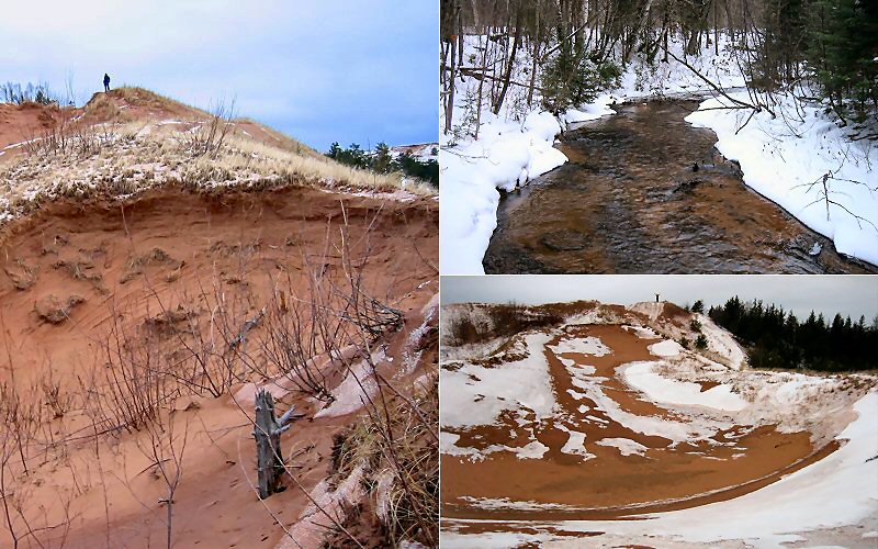
megan on a dune, sable creek, and me on a dune (taken by megan).
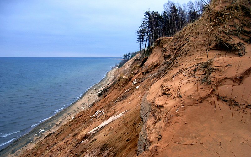
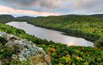
the dune bluffs and lake superior.
the dunes.
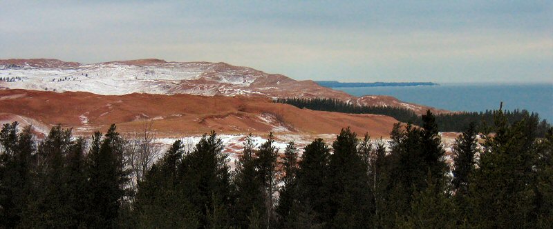
lake superior from the top of the dunes.
» all photo reports from michigan's upper peninsula
Thinking about traveling to Pictured Rocks yourself? You might want to read my guide to Pictured Rocks.
Ice Climbing, Michigan
March 4 - 5, 2011 Ice Climbing at Pictured Rocks with a side trip to Miners Castle. 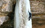
The Upper Peninsula, Michigan
October 2 - 11, 2009 Enjoying fall in the Upper Peninsula from Pictured Rocks to the Porcupine Mountains to the Keweenaw Peninsula. 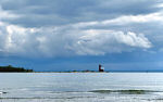
Mackinac Island, Michigan
October 3, 2009 Spending a short day on the island and enjoying the views, even without the influence of fudge. 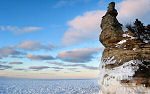
Pictured Rocks, Michigan
March 7 - 9, 2008 Skiing & snowshoeing in the Miners Castle & Grand Sable Dunes areas. We also checked out the ice in Grand Marais & Mackinac Straits. 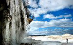
Pictured Rocks, Michigan
March 17, 2007 Hiking along the ice shelf from Twelvemile Beach to Spray Falls. 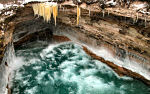
Pictured Rocks, Michigan
January 27, 2007 Skiing & hiking the Chapel Loop in Pictured Rocks National Lakeshore on a stormy day. 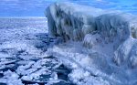
Pictured Rocks, Michigan
March 2 - 4, 2006 Ice climbing and skiing in Pictured Rocks National Lakeshore. 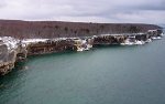
Pictured Rocks, Michigan
January 7, 2006 A backcountry ski trip to the remote lakeshore cliffs of Pictured Rocks National Lakeshore. 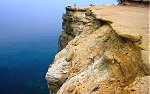
Pictured Rocks, Michigan
July 3 - 4, 2005 Hiking in Pictured Rocks National Lakeshore, and checking out some of the other sights in the area. |
Pictured Rocks, Michigan
February 25 - 26, 2011 Backpacking the Chapel Loop in winter, with a side trip to Spray Falls. 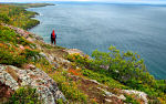
Bare Bluff, Michigan
October 8, 2009 A fall hike to Bare Bluff, one of the more scenic areas of the Keweenaw Peninsula. 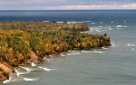
Pictured Rocks, Michigan
October 4 - 11, 2009 Some stormy fall weather along the Pictured Rocks lakeshore. 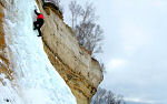
Pictured Rocks, Michigan
August 30 - September 2, 2007 Back to the Great Lakes with a rare summer visit to Pictured Rocks to see what it all looks like when it's green. 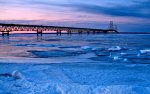
Mackinac Straits & Pictured Rocks, Michigan
March 16 - 18, 2007 Skiing to Miners Castle, lingering in the Straits of Mackinac, and some other stuff. 
Pictured Rocks in Fall, Michigan
October 7, 2006 Hiking the Chapel Loop & checking out other sights like Spray Falls, Miners Castle, Miners Beach, Munising Falls, Grand Sable Dunes, etc. 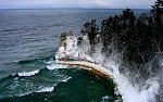
Pictured Rocks, Michigan
February 19 - 20, 2006 Skiing & snowshoeing the Pictured Rocks backcountry. Areas visited include: Miners Castle, Miners Beach, Twelvemile Beach, and Spray Falls. 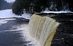
The Upper Peninsula, Michigan
December 26 - 28, 2005 Winter pictures from Tahquamenon Falls State Park and Pictured Rocks National Lakeshore. |
Copyright 1995- Lars Jensen | randomspace@umich.edu |