Yosemite, California
March 18 - 20, 2006
» the road to yosemite
We started out from San Diego at 5:30am, later than expected due to an alarm malfunction. Apparently with these new fang dangled alarm clocks, not only can you screw yourself by mixing up AM and PM or leaving the volume turned down, but you can also accidentally setup the alarm to only go off on weekdays.
Anyway, the drive from San Diego is mostly scenic, especially the hills outside of LA and the area between Fresno and Yosemite. It took us about 6 hours to get to the park entrance. From that point on it was a winding hilly drive past several waterfalls and rumbling creeks to Yosemite Valley.
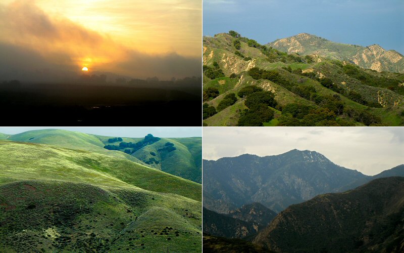
Views on the drive from San Diego to Yosemite.
Near Fresno. This area had some of the prettiest farmland I have ever seen. Rolling rocky green hills with scraggily oak trees and meandering cows. The above picture does not capture this.
» yosemite valley
When we arrived in Yosemite it was raining hard and showed no signs of letting up. The valley was getting saturated not only by rain, but by melting snow. We started to wonder if we were going to be camping in a puddle, or worse, if we were going to have to get a hotel for that night. Not only was it wet, but it was cold, dropping down into the 20's at night. We went on a short hike to the base of Bridalveil Falls and got totally soaked. Then we decided we may as well find some place to eat lunch and hope that the weather would get better because things couldn't get any worse. And then they did get worse: the food court at Yosemite Lodge was not serving hot food until later in the day. Okay, this is okay, adversity just brings out the best in people right? Yeah so we picked up some of the cafeteria chairs and chucked them through the windows. That will teach them to close down the food court during normal lunch hours, or at least not to have chairs that aren't bolted down.
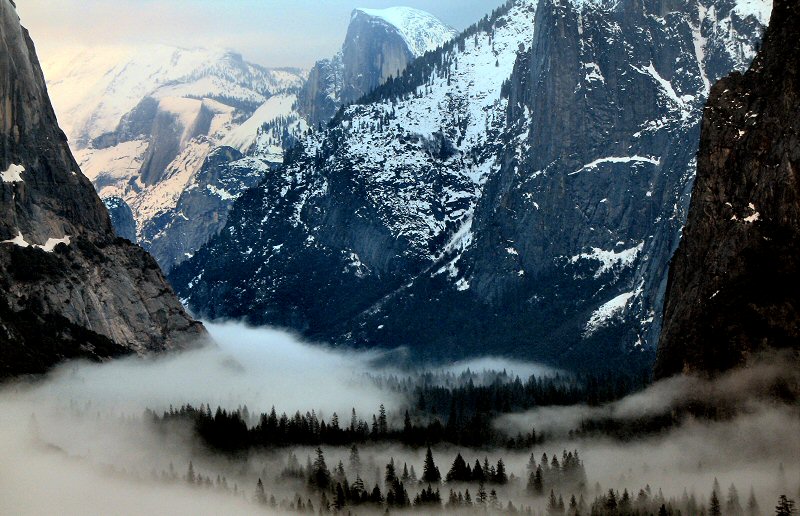
So we dropped the whole food issue and started worrying about where we were going to sleep. There weren't really any rooms available in the Valley, just some heated tents, and we figured we should check out our campsites before we gave up on them. Seeing temporary creeks flowing through some of the campgrounds just didn't give us a good feeling about it. But when we got to our campground, most of the ground was covered by snow, not water, and the rain had stopped. Kate & Steve swapped sites for one that was less wet and we were good to go. We setup camp and then toured around the Valley. Waterfalls were pouring down the cliffs all over the place due to snowmelt or rain, and the wet weather had caused fog to settle in the valley, creating a beautiful scene. At dusk we headed back to camp, made some dinner and s'mores, and then wrapped ourselves tightly in our sleeping bags as the temperature dropped.
When we arrived in Yosemite it was raining hard and showed no signs of letting up. The valley was getting saturated not only by rain, but by melting snow. We started to wonder if we were going to be camping in a puddle, or worse, if we were going to have to get a hotel for that night. Not only was it wet, but it was cold, dropping down into the 20's at night. We went on a short hike to the base of Bridalveil Falls and got totally soaked. Then we decided we may as well find some place to eat lunch and hope that the weather would get better because things couldn't get any worse. And then they did get worse: the food court at Yosemite Lodge was not serving hot food until later in the day. Okay, this is okay, adversity just brings out the best in people right? Yeah so we picked up some of the cafeteria chairs and chucked them through the windows. That will teach them to close down the food court during normal lunch hours, or at least not to have chairs that aren't bolted down.
So we dropped the whole food issue and started worrying about where we were going to sleep. There weren't really any rooms available in the Valley, just some heated tents, and we figured we should check out our campsites before we gave up on them. Seeing temporary creeks flowing through some of the campgrounds just didn't give us a good feeling about it. But when we got to our campground, most of the ground was covered by snow, not water, and the rain had stopped. Kate & Steve swapped sites for one that was less wet and we were good to go. We setup camp and then toured around the Valley. Waterfalls were pouring down the cliffs all over the place due to snowmelt or rain, and the wet weather had caused fog to settle in the valley, creating a beautiful scene. At dusk we headed back to camp, made some dinner and s'mores, and then wrapped ourselves tightly in our sleeping bags as the temperature dropped.
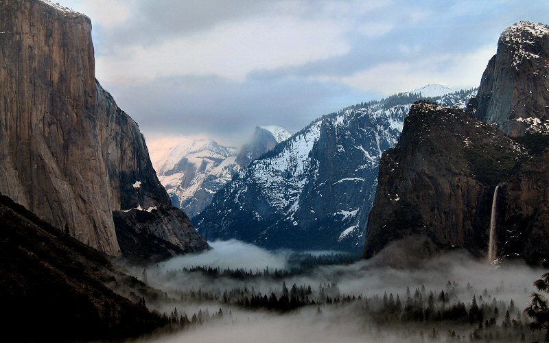
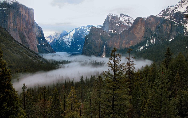
Yosemite Valley from Discovery View. The 620 foot Bridalveil Falls is on the right.
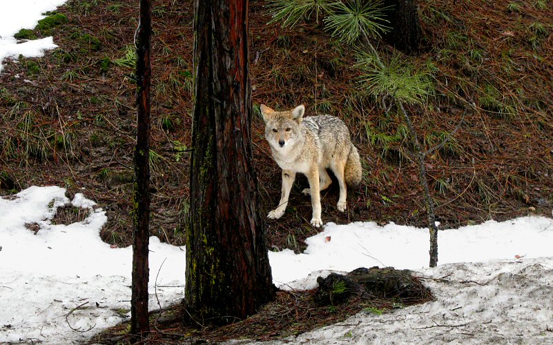
We saw two coyotes on the drive in and that was about all the wildlife we saw during our entire time there.
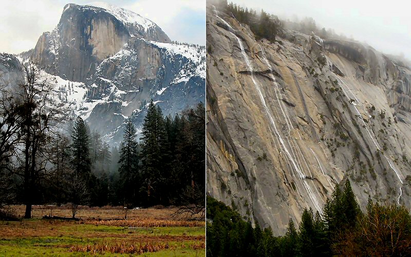
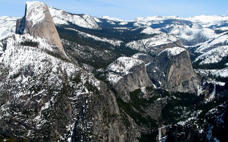
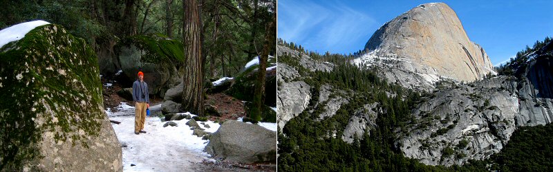
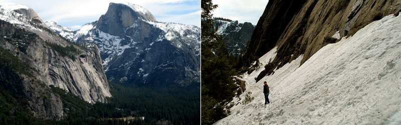
Half Dome from the valley floor, and water cascading down the cliffs on a rainy day.
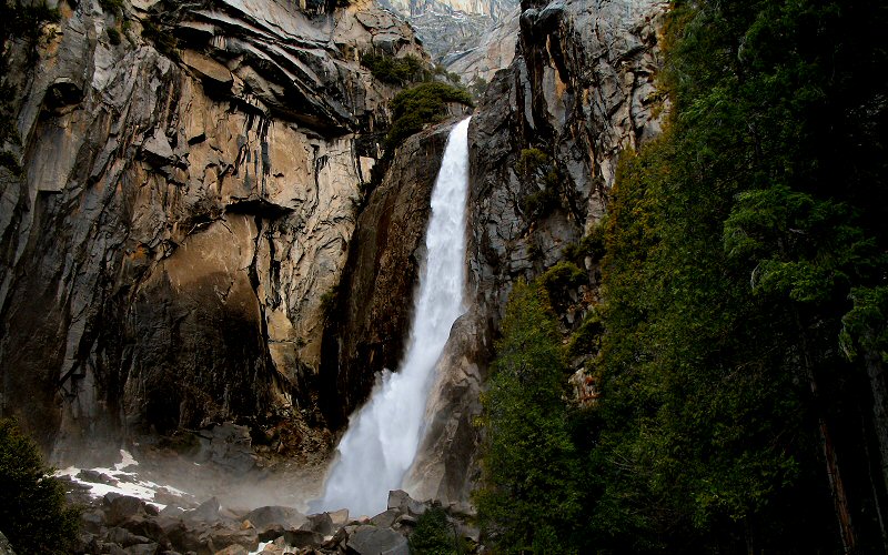
Lower Yosemite Falls.
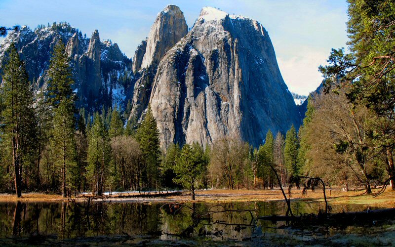
Cathedral Rocks.
Discovery View.
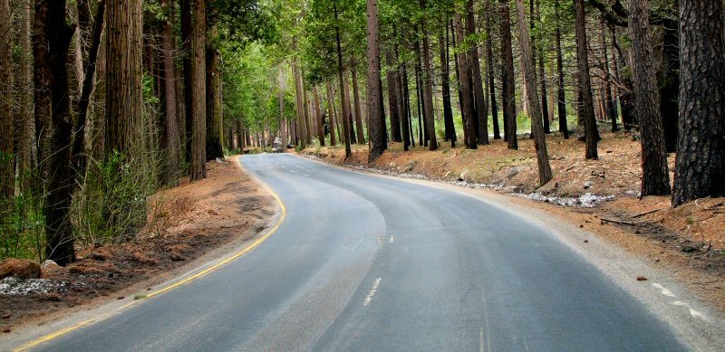
The road through Yosemite Valley.
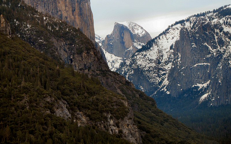
Half Dome from Discovery View.
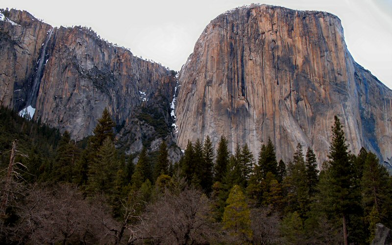
El Capitan. Pictures of El Capitan have never impressed me much, but in person, this is one of the most impressive things in Yosemite Valley, it is huge and very sheer. Ribbon Falls can be seen on the left.
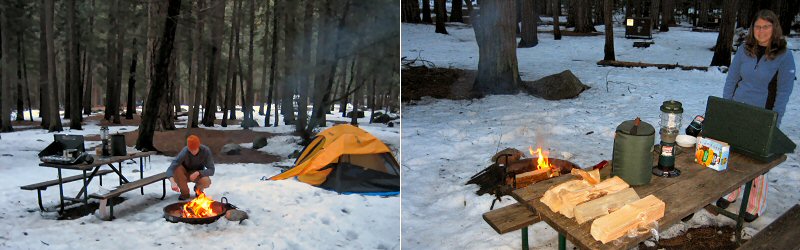
Camping in the snow.
Half Dome from Highway 41 on a clearer day.
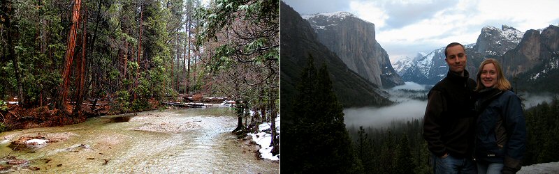
The Merced River, and Kate & Steve (taken by Megan).
» glacier point ski
The trail (an unplowed road) to Glacier Point is a hilly 21 mile round trip. If you're like me then you have a little trouble comprehending how far 21 miles is. Let me share a trick with you: Imagine how far away the moon is. Now imagine 0.008786% of that. That is 21 miles. Yes, only 99.9922% farther and we could have made it to the moon. Unlike the moon landings, which were just an elaborate government hoax done to show our supposed dominance over communist Australia (our enemy in the Cold War if I recall correctly), we actually made it to Glacier Point.
We got a bit of a late start because I took a little walk around the campground in the morning that turned into a hike/jog to Vernal Falls. Let me tell you, the Mist Trail is closed in winter for a good reason, climbing over steep icy rocks on the edge of a cliff eventually caused me to turn around.
When I returned, we made some oatmeal for breakfast and then Megan and I headed up to Badger Pass where our ski trip would start. Kate & Steve appeared to still be sleeping in their tents like they were on vacation in the Caribbean. I now see why Americans get stereotyped as being lazy. Chains were required on the road up to Badger Pass but since we had a 4WD vehicle, they did not make us put them on. The road was a little slick and snow was piled high on both sides (they had a 9 foot base) but it was a warm sunny day so the drive was no big deal.
When we started skiing, the skis glided incredibly well, one push would send you coasting effortlessly and I thought we would be at Glacier Point in no time. You can take an overnight guided trip to Glacier Point for a couple hundred dollars but skiing there and back in a day is not a common thing to do so we weren't sure how realistic our (my) goal was. When the trail became an uphill struggle for many miles and had no markers to indicate our progress we began to wonder if we were going to make it. Then we came upon a sign for Taft Point and knew that we were only a mile or so from our final destination. That would be close enough for most people but we said hey, lets go all the way and show that Americans, like our president, are not afraid of hard work.
We arrived at Washburn Point to a spectacular view of Half Dome towering above the Valley with Nevada and Vernal falls flowing far below. It was another 0.5 miles or so to Glacier Point, all downhill. I decided to ski there while Megan headed back. The view at Glacier Point is slightly different, you see the front side of Half Dome a bit, and Yosemite Falls. After taking many pictures, I started back to see if I could catch up with Megan. It would be a long time before I would see her again as she had decided to race me back.
I was delighted to realize that we had climbed uphill for many miles on the way in as I coasted downhill for several minutes straight on the return trip. The sun had ruined the snow, however. Areas that were in the sun were sticky and would bring you to a sudden stop when you glided over them and areas in the shade were icy, causing you to slide backwards when you pushed off. After awhile of not catching Megan, I started to wonder if she had skied off the trail somewhere or gotten into some other trouble, but eventually I decided it didn't really matter because there was no way I was skiing back to try and find her, 21 miles was enough skiing for one day. I did eventually catch her in the last mile.
We then headed back to the Valley to get a well deserved meal. The whole trip took us about 7 hours.
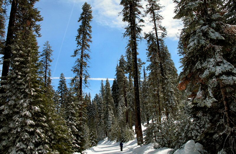
Megan skiing below tall trees.
One of the views along the way (to the south).
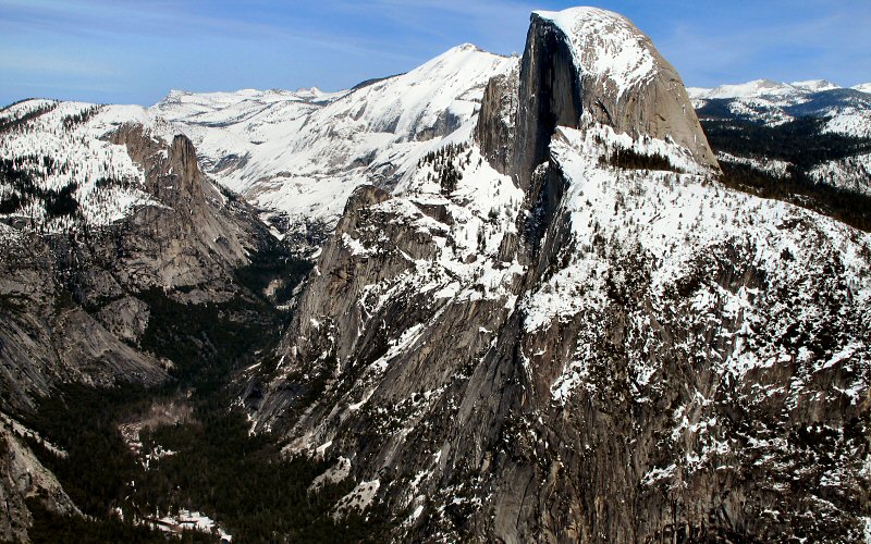
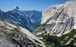
Half Dome, Nevada Falls, and Vernal Falls from Washburn Point.
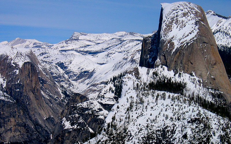
Half Dome.
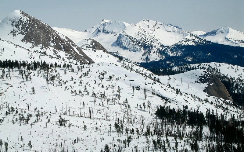
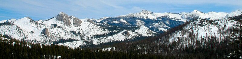
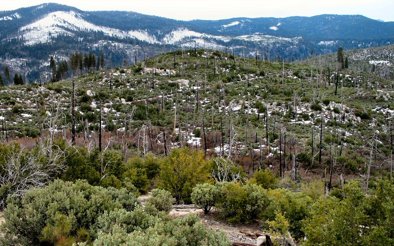
Mountains above Yosemite Valley.
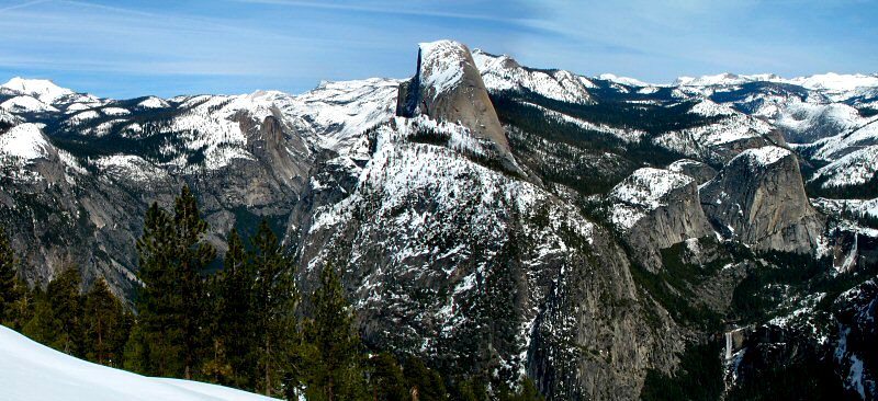
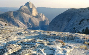
Half Dome towering above Yosemite and Little Yosemite Valleys.

Mossy Trees.
Me enjoying the view (taken by Megan).
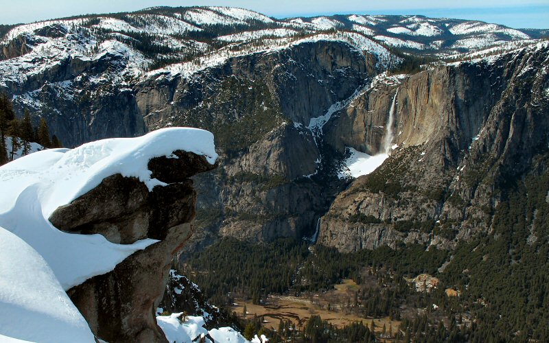
Yosemite Falls from Glacier Point.
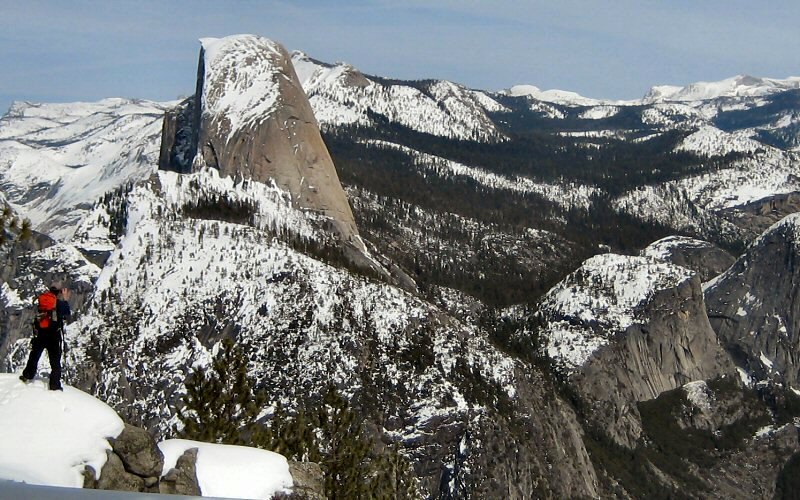
Half Dome from Glacier Point.
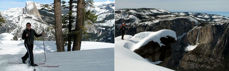
Megan skiing, and me at Glacier Point.
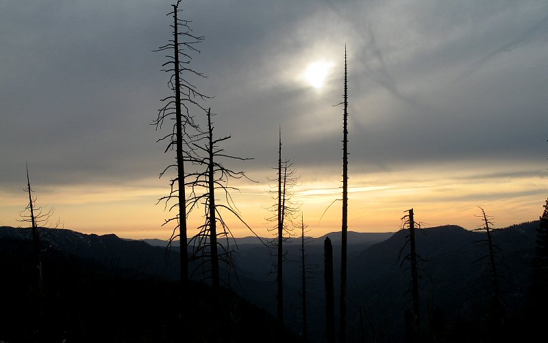
Sunset.
» nevada falls
We ran into lots of snow on this hike and Megan decided to turn around shortly after Vernal Falls while I hiked on to try and get a view of Nevada Falls. It was quite a hike before Nevada Falls was visible and the abundant snow made the trail unclear. I dropped off my (Megan's) water bottle and hat along the trail to pickup on my return but on my way back down I didn't see them so I hiked back up the snow and once again I did not see my stuff so I figured they must have been lower than I had hiked initially so I headed back down. But I never found them. I am now considering the hat and water bottle to be a donation to the National Parks and deducting them from my taxes. I was basically jogging the entire time, sliding on snowfields and almost falling at least once, because I told Megan I would only hike on for 15 minutes.
We ran into lots of snow on this hike and Megan decided to turn around shortly after Vernal Falls while I hiked on to try and get a view of Nevada Falls. It was quite a hike before Nevada Falls was visible and the abundant snow made the trail unclear. I dropped off my (Megan's) water bottle and hat along the trail to pickup on my return but on my way back down I didn't see them so I hiked back up the snow and once again I did not see my stuff so I figured they must have been lower than I had hiked initially so I headed back down. But I never found them. I am now considering the hat and water bottle to be a donation to the National Parks and deducting them from my taxes. I was basically jogging the entire time, sliding on snowfields and almost falling at least once, because I told Megan I would only hike on for 15 minutes.
Me on the trail (taken by Megan), and the south side of Half Dome.
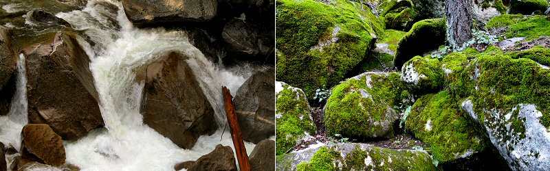
The roaring Merced River below Vernal Falls, and moss covered rocks.
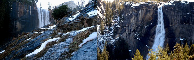
The top of Vernal Falls, and Nevada Falls.
» yosemite falls
The trail to the base of Yosemite Falls is about 1.5 miles one way, mostly going steeply uphill. We ran into a lot of snow once we got above Lower Yosemite Falls but that was okay because we didn't intend to hike much higher.
The trail to the base of Yosemite Falls is about 1.5 miles one way, mostly going steeply uphill. We ran into a lot of snow once we got above Lower Yosemite Falls but that was okay because we didn't intend to hike much higher.
A view of Half Dome from the trail, and Megan crossing a snowfield.
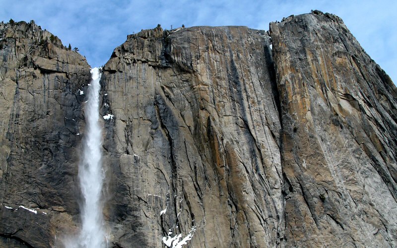
Upper Yosemite Falls.
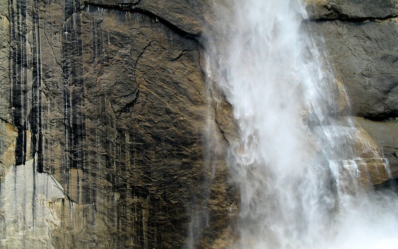
The bottom of Upper Yosemite Falls, where the water finishes its ~1500 foot fall.
» yosemite to mammoth lakes
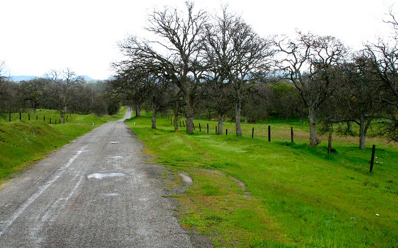
We drove to Mammoth via Highways 120, 49, 88, and 395, a seven hour drive. In the summer, when mountain passes are not closed due to snow, it is only about a half hour drive to Mammoth. That was okay though because the enitre drive ended up being really scenic. First there was 120 which followed Yosemite Valley to the west. Then there was 49 which passed historic gold rush towns nestled into rolling green hills, horses grazing, rumbling creeks, occasional waterfalls, lakes, scraggily oak trees, and winding roads. Then there was 88 that headed up into the mountains, with deep snow all around and jagged peaks above. Then there was 395, which we traveled at night, but Kate & Steve said it was very scenic as well, especially the Mono Lake area.
We drove to Mammoth via Highways 120, 49, 88, and 395, a seven hour drive. In the summer, when mountain passes are not closed due to snow, it is only about a half hour drive to Mammoth. That was okay though because the enitre drive ended up being really scenic. First there was 120 which followed Yosemite Valley to the west. Then there was 49 which passed historic gold rush towns nestled into rolling green hills, horses grazing, rumbling creeks, occasional waterfalls, lakes, scraggily oak trees, and winding roads. Then there was 88 that headed up into the mountains, with deep snow all around and jagged peaks above. Then there was 395, which we traveled at night, but Kate & Steve said it was very scenic as well, especially the Mono Lake area.
West of Yosemite Valley, along 120.
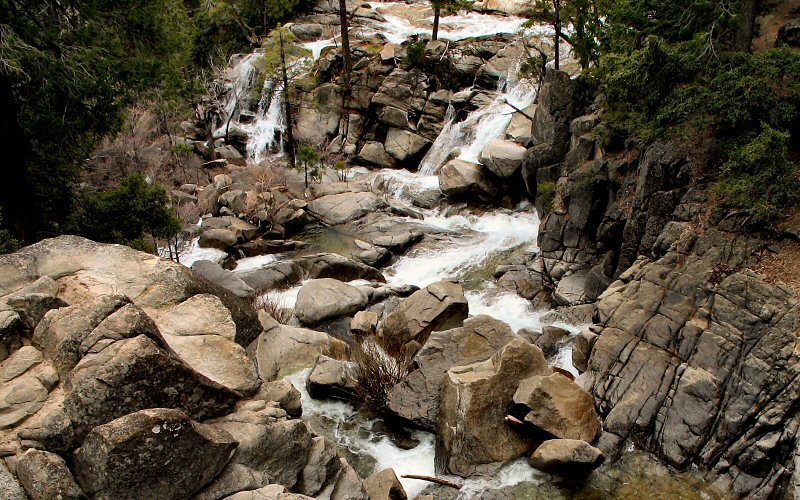
Cascade Falls. This was a very impressive waterfall to see in person, water was rushing in from all directions.
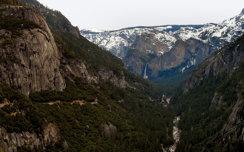
Bridalveil Falls and the west end of Yosemite Valley.
Some viewpoint along Highway 120.
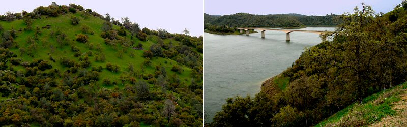
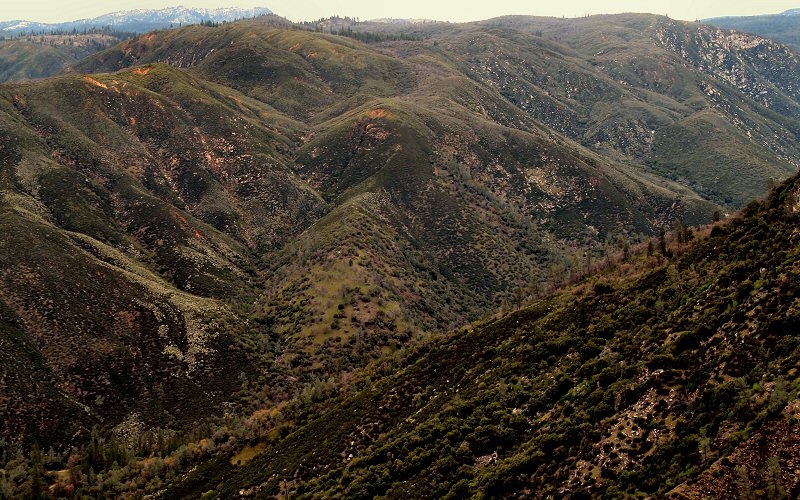
Some views along Highway 49.

» all photo reports from the eastern sierra
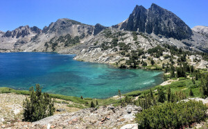
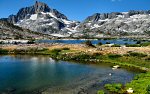
Thousand Island Lake, California
September 3, 2006 Hiking to Thousand Island and Garnet Lakes in the Ansel Adams Wilderness, starting from Agnew Meadows. 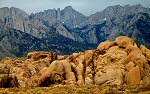
Eastern Sierra, California
July 24, 2006 Hiking to Treasure Lakes in the Little Lakes Valley near Bishop/Mammoth Lakes, and driving south along the Eastern Sierra. 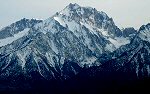
Mammoth Mountain, California
March 21 - 23, 2006 Skiing Mammoth Mountain and driving Highway 395 back to San Diego. 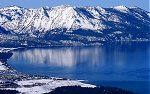
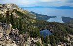
Lake Tahoe, Nevada/California
January 24 - 29, 2006 Skiing some of the resorts around Lake Tahoe (Heavenly, Squaw Valley, Diamond Peak). |
Tenaya Canyon, California
August 16, 2012 Hiking from Tenaya Lake to the top of Pywiack Cascade in Yosemite National Park. 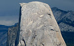
Yosemite, California
August 5, 2010 Passing through Yosemite and enjoying some sights along the way. 
Little Lakes Valley, California
August 4, 2010 Hiking through Little Lakes Valley in the Eastern Sierra. 
Mount Agassiz, California
September 2, 2006 Hiking to the summit of Mount Agassiz in the Bishop Creek area, starting from the South Lake trailhead. 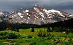
Yosemite, California
July 23, 2006 Checking out Yosemite Valley, Glacier Point, Tuolumne Meadows, and driving over Tioga Pass. 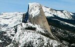
Yosemite, California
March 18 - 20, 2006 Camping in Yosemite, skiing to Glacier Point, and exploring the valley. |
Copyright 1995- Lars Jensen | randomspace@umich.edu |