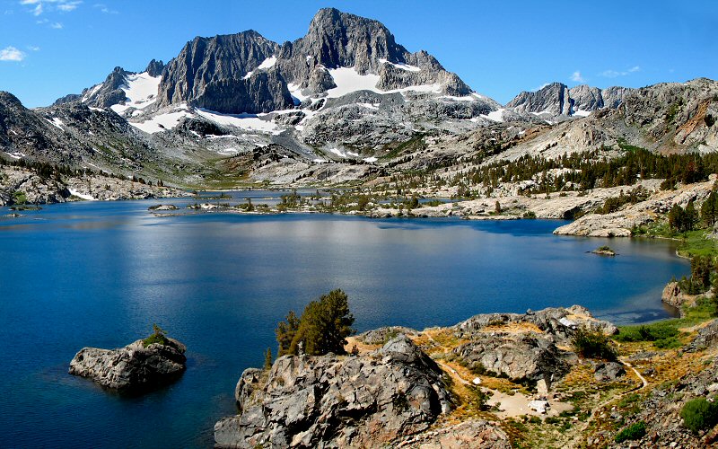
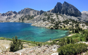
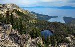
Thousand Island Lake, California
September, 2006
» ansel adams wilderness
Yeah, basically a monkey with a camera could take beautiful pictures in this place. But enough about my photography techniques. I first saw the Ritter mountain range from afar while skiing at Mammoth Mountain. It's composed of 3 very impressive peaks which dramatically rise over 3,000 feet above their immediate surroundings. From the internets, I decided the mountains looked most impressive from Thousand Island Lake but the shortest route to it was 15 miles, a bit long for a day hike. Or so I thought.
I set my sights a little lower and planned for us to hike to Garnet Lake which still has great views of the peaks but is a couple miles closer. Lucky for me, the trail to Garnet Lake is not marked so we hiked right on by it and then decided we may as well hike on to Thousand Island Lake. Then after that, we decided we may as well hike to Garnet Lake too since it wasn't too far out of the way. I'm not sure if it was due to the fact that we had just done a very painful hike the day before, but this one didn't seem so bad, until the ending.
» times
Started at 7am, got to Thousand Island Lake around 10am, Garnet Lake around 12pm, and finished at 3pm (8 hours total).
» distances/elevations
15.5 miles round trip with 2,000' of elevation gain. 7.3 miles from Agnew Meadows to Thousand Island Lake, 2.6 miles to Garnet Lake, and 5.6 miles back. The trail starts at 8,305', drops down to about 8,000', and reaches a high of about 10,000'. We took the shortest route but if you have more time you could take a more scenic route by following the John Muir Trail or the Pacific Crest Trail. Since there are a lot of different trails you can take to Thousand Island or Garnet Lake, if you intend to hike in this area, I highly recommend this map: Mammoth High Country Trail Map » other details
Temperature was probably in the high 60's to low 70's. The River Trail is dusty, and the scenery is a bit tedious, but it gets you to Thousand Island Lake fast. We hiked on the Sunday of Labor Day weekend and often felt like we had the place to ourselves.
Yeah, basically a monkey with a camera could take beautiful pictures in this place. But enough about my photography techniques. I first saw the Ritter mountain range from afar while skiing at Mammoth Mountain. It's composed of 3 very impressive peaks which dramatically rise over 3,000 feet above their immediate surroundings. From the internets, I decided the mountains looked most impressive from Thousand Island Lake but the shortest route to it was 15 miles, a bit long for a day hike. Or so I thought.
I set my sights a little lower and planned for us to hike to Garnet Lake which still has great views of the peaks but is a couple miles closer. Lucky for me, the trail to Garnet Lake is not marked so we hiked right on by it and then decided we may as well hike on to Thousand Island Lake. Then after that, we decided we may as well hike to Garnet Lake too since it wasn't too far out of the way. I'm not sure if it was due to the fact that we had just done a very painful hike the day before, but this one didn't seem so bad, until the ending.
» times
Started at 7am, got to Thousand Island Lake around 10am, Garnet Lake around 12pm, and finished at 3pm (8 hours total).
» distances/elevations
15.5 miles round trip with 2,000' of elevation gain. 7.3 miles from Agnew Meadows to Thousand Island Lake, 2.6 miles to Garnet Lake, and 5.6 miles back. The trail starts at 8,305', drops down to about 8,000', and reaches a high of about 10,000'. We took the shortest route but if you have more time you could take a more scenic route by following the John Muir Trail or the Pacific Crest Trail. Since there are a lot of different trails you can take to Thousand Island or Garnet Lake, if you intend to hike in this area, I highly recommend this map: Mammoth High Country Trail Map
Temperature was probably in the high 60's to low 70's. The River Trail is dusty, and the scenery is a bit tedious, but it gets you to Thousand Island Lake fast. We hiked on the Sunday of Labor Day weekend and often felt like we had the place to ourselves.

Morning sun catching the Minarets on our way to the trailhead.
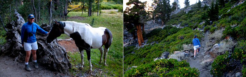
Left: A friendly (food seeking) horse near the trailhead. Right: The trail.
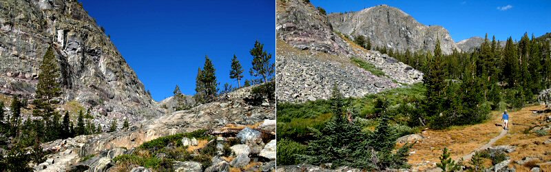
Views from further on the trail, once you climb out of the forest. The trail follows the San Joaquin River but you only get periodic views if it.
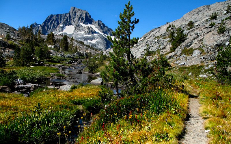
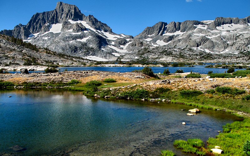
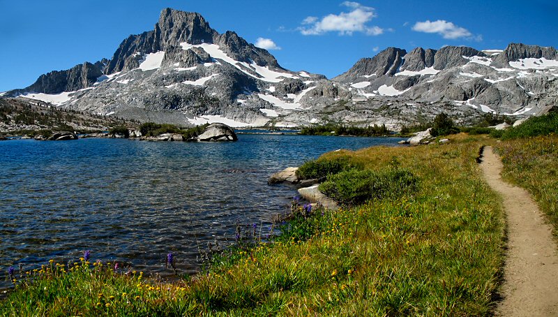
Things start to get beautiful. Banner Peak is visible in the distance as we approach Thousand Island Lake.
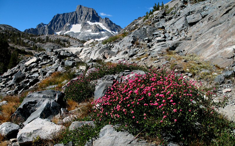
Some of the many wildflowers around.
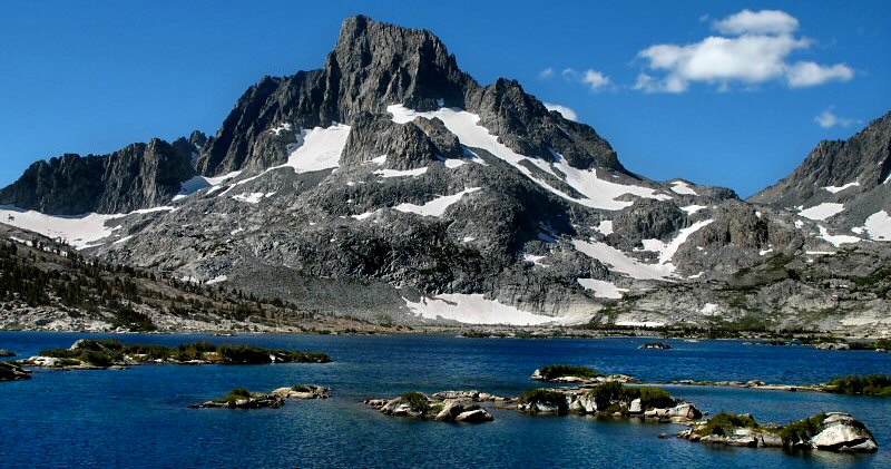
Banner Peak towering over 3,000 feet above Thousand Island Lake.
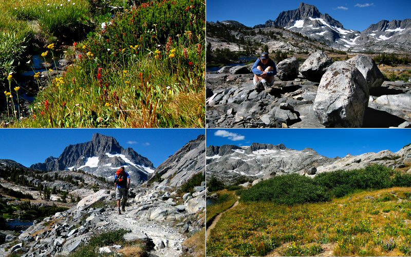
Top Left: Wildflowers. Top Right: Megan doing her world famous impression of a rock. Bottom Left: Me hiking. (Taken by Megan). Bottom Right: The ridge north of Banner Peak.
Banner Peak.
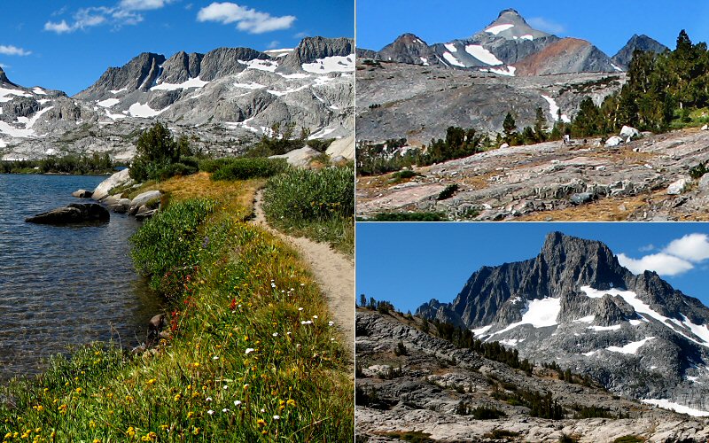
Left: Wildflowers along the lake. Top Right: Rodgers Peak in the distance. Bottom Right: Banner Peak.
The trail along the lake.
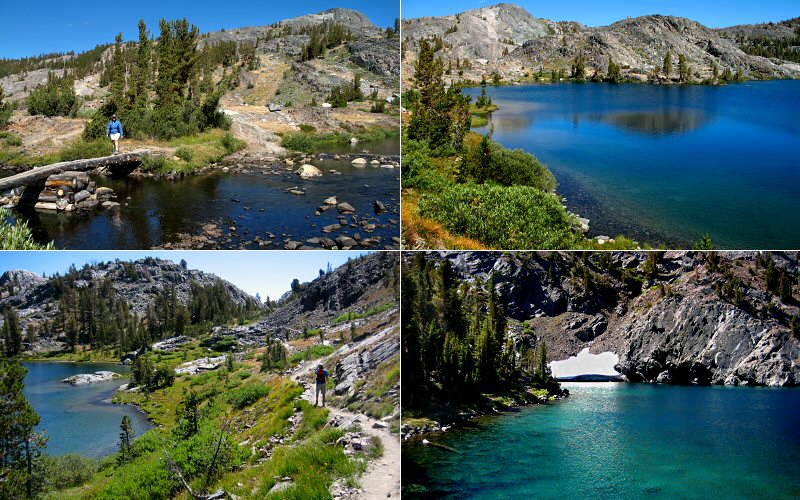
Views of Emerald and Ruby Lakes on the way to Garnet Lake from Thousand Island Lake.

Me enjoying the view at Garnet Lake (Taken by Megan).
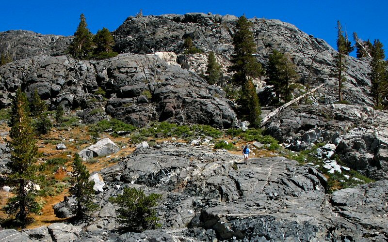
Megan hiking down the rocks that surround Garnet Lake.
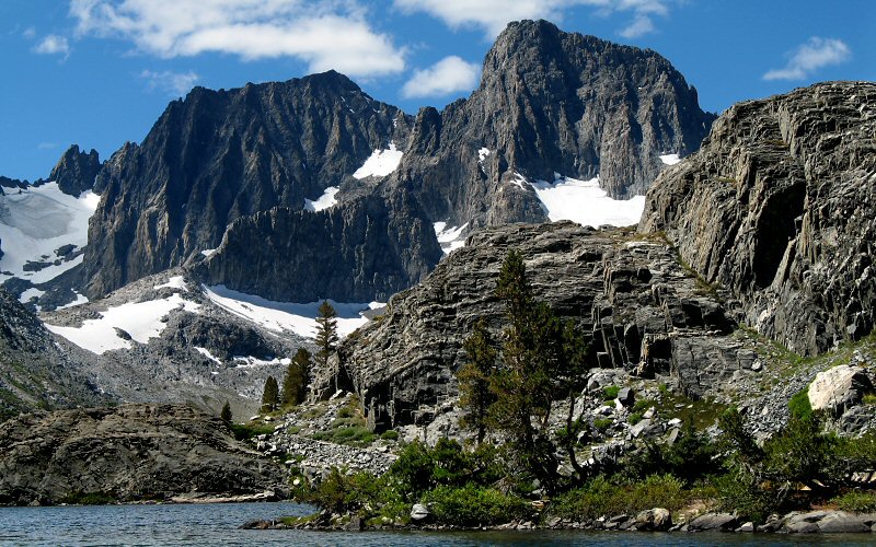
Mount Ritter and Banner Peak.
Garnet Lake.
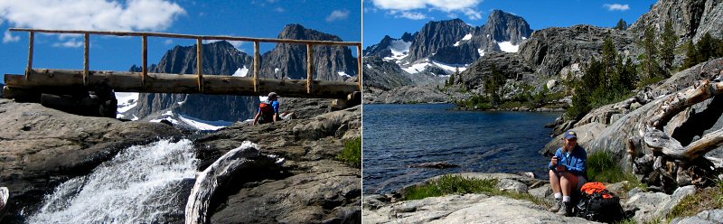
Hanging out near the Garnet Lake outlet falls and the John Muir Trail.
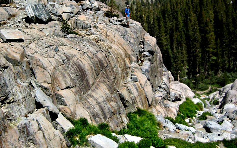
Me climbing down some rocks on our way back down to the River Trail. (Taken by Megan)
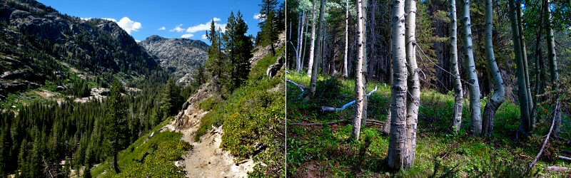
Left: The valley the River Trail follows. Right: Aspen trees.
» devils postpile
Devils Postpile is an interesting geologic formation that can be reached by a short walk, just outside Mammoth Lakes. It was formed by evenly cooled lava and polished by glaciers. If lava and glaciers can learn to work together, maybe there is hope for humanity.
Devils Postpile is an interesting geologic formation that can be reached by a short walk, just outside Mammoth Lakes. It was formed by evenly cooled lava and polished by glaciers. If lava and glaciers can learn to work together, maybe there is hope for humanity.
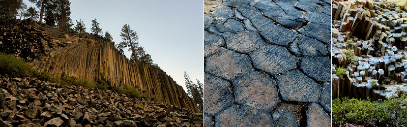
The view from below, the view up top (the hexagons have about the same diameter as a basketball), and another view.
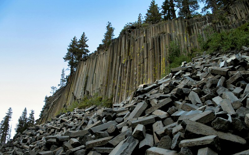
The view from below.
» manzanar
Right at the foot of the Sierra-Nevada mountain range off highway 395, lay the remains of one of the ten World War II Japanese internment camps, an unfortunate chapter in American history.
Right at the foot of the Sierra-Nevada mountain range off highway 395, lay the remains of one of the ten World War II Japanese internment camps, an unfortunate chapter in American history.
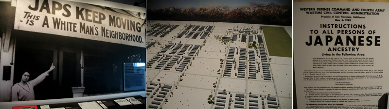
There is not much remaining from the camp, most things were disassembled and sold for scrap, but there is a nice museum that details life at the camp and the political climate at the time. The center picture is a model of the former camp, where 10,000 Japanese Americans were imprisoned. More information: Manzanar National Historic Site.
» all photo reports from the eastern sierra

Thousand Island Lake, California
September 3, 2006 Hiking to Thousand Island and Garnet Lakes in the Ansel Adams Wilderness, starting from Agnew Meadows. 
Eastern Sierra, California
July 24, 2006 Hiking to Treasure Lakes in the Little Lakes Valley near Bishop/Mammoth Lakes, and driving south along the Eastern Sierra. 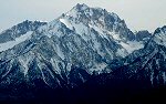
Mammoth Mountain, California
March 21 - 23, 2006 Skiing Mammoth Mountain and driving Highway 395 back to San Diego. 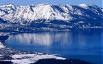
Lake Tahoe, Nevada/California
January 24 - 29, 2006 Skiing some of the resorts around Lake Tahoe (Heavenly, Squaw Valley, Diamond Peak). |
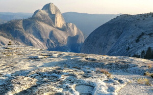
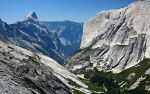
Tenaya Canyon, California
August 16, 2012 Hiking from Tenaya Lake to the top of Pywiack Cascade in Yosemite National Park. 
Yosemite, California
August 5, 2010 Passing through Yosemite and enjoying some sights along the way. 
Little Lakes Valley, California
August 4, 2010 Hiking through Little Lakes Valley in the Eastern Sierra. 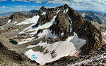
Mount Agassiz, California
September 2, 2006 Hiking to the summit of Mount Agassiz in the Bishop Creek area, starting from the South Lake trailhead. 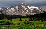
Yosemite, California
July 23, 2006 Checking out Yosemite Valley, Glacier Point, Tuolumne Meadows, and driving over Tioga Pass. 
Yosemite, California
March 18 - 20, 2006 Camping in Yosemite, skiing to Glacier Point, and exploring the valley. |
Copyright 1995- Lars Jensen | randomspace@umich.edu |