Colorado Fall
September 2005
» cottonwood pass
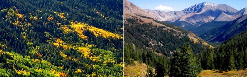
We set out for Crested Butte from Denver at about 5am via Cottonwood Pass (the shortest route when it is not closed by snow). The east side of Cottonwood Pass is paved and the west side is a winding dirt road that follows the Taylor River through a scenic little canyon.
We set out for Crested Butte from Denver at about 5am via Cottonwood Pass (the shortest route when it is not closed by snow). The east side of Cottonwood Pass is paved and the west side is a winding dirt road that follows the Taylor River through a scenic little canyon.
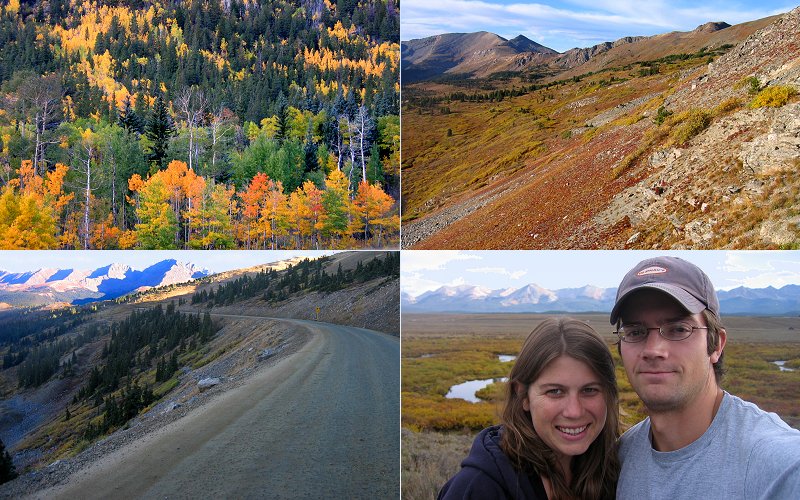
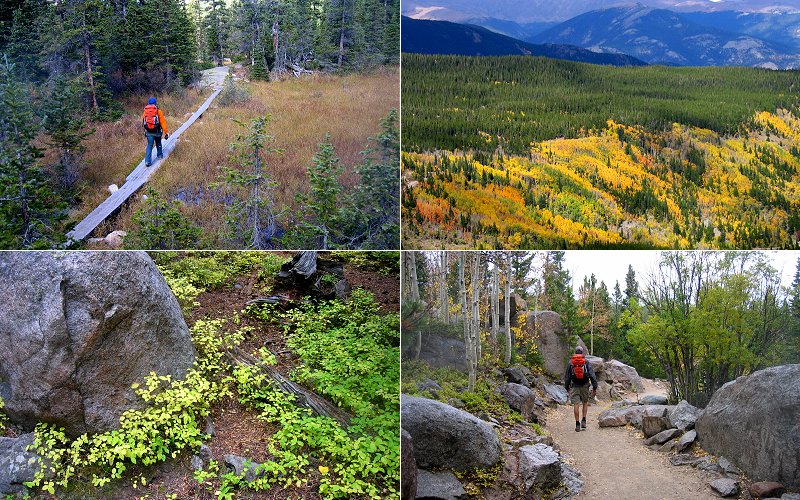
Aspens & evergreens, a view from Cottonwood Pass, the dirt road down the west side, and us looking kind of tired.
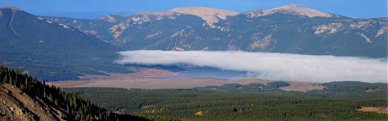
A low cloud hanging over Taylor Reservoir.
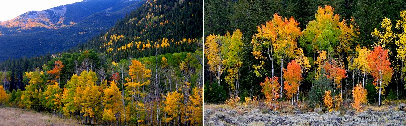
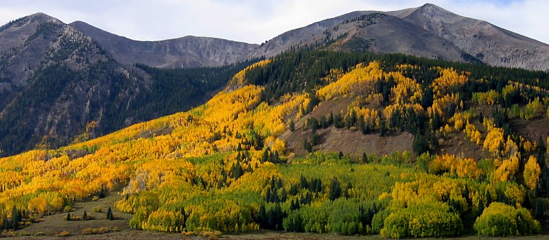
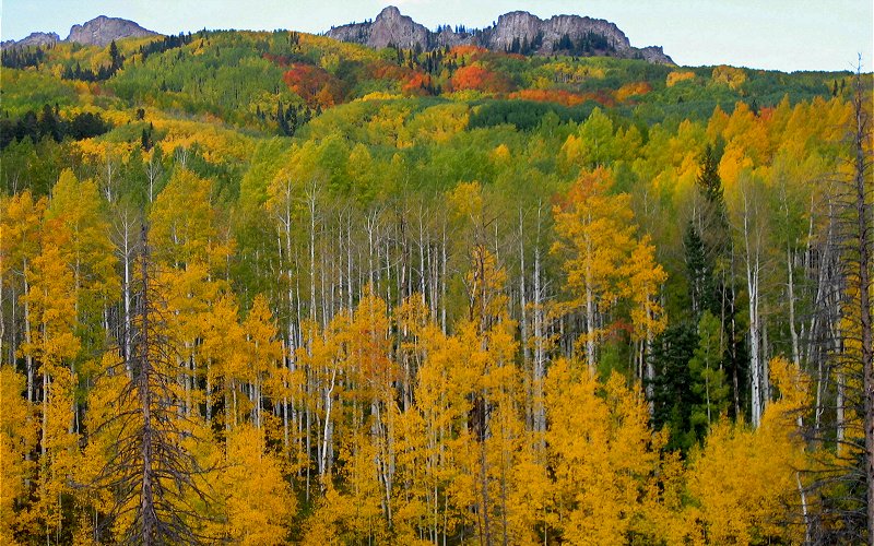
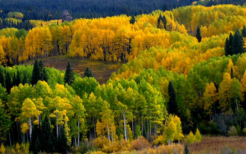
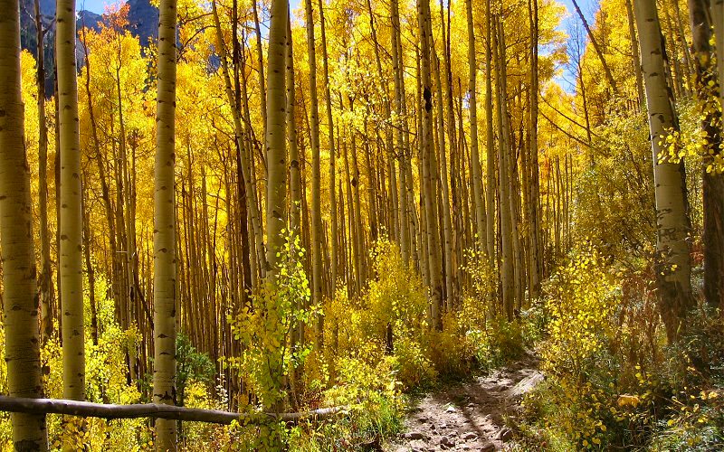
Aspens on the eastern slopes of Cottonwood Pass, and colorful aspens on the Crested Butte side of Cottonwood Pass.
» crested butte
I hadn't anticipated anything so much since i was seven years old and it was Christmas Eve. It bordered on obsession. I mean it was within the boundary of insanity, bordering on obsession. I mean it was very far north into insanity, there's just this little spot where the obsession border juts up into insanity and that is where it was. This is a heavily disputed boundary where violence often erupts. But I'm not here to give you a history lesson, I am sure that you remember all of this from your high school teachings. I mean, everyone spends one year of high school in a psychiatric ward, right? I know that most of my imaginary friends did. Anyway, Crested Butte did not disappoint, with the aspens changing, or even without, it was one of the most scenic places I've been.
I hadn't anticipated anything so much since i was seven years old and it was Christmas Eve. It bordered on obsession. I mean it was within the boundary of insanity, bordering on obsession. I mean it was very far north into insanity, there's just this little spot where the obsession border juts up into insanity and that is where it was. This is a heavily disputed boundary where violence often erupts. But I'm not here to give you a history lesson, I am sure that you remember all of this from your high school teachings. I mean, everyone spends one year of high school in a psychiatric ward, right? I know that most of my imaginary friends did. Anyway, Crested Butte did not disappoint, with the aspens changing, or even without, it was one of the most scenic places I've been.

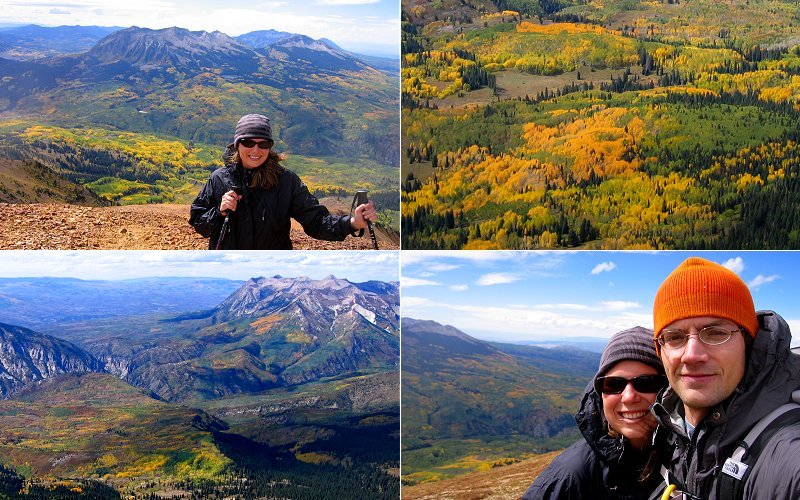
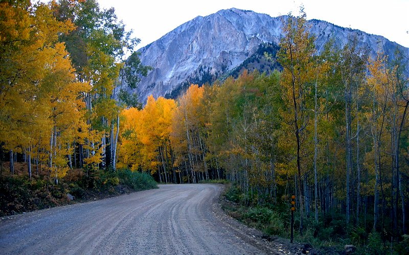
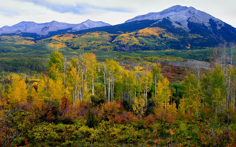
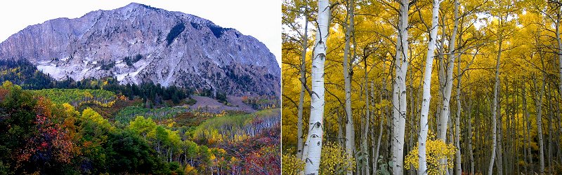
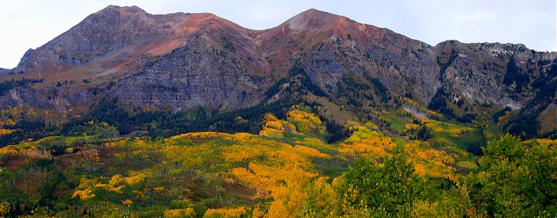
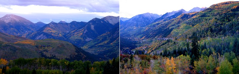
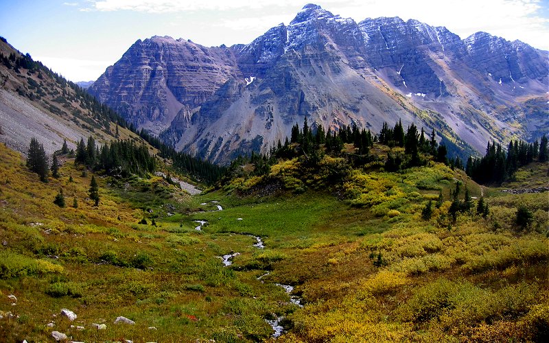
Whetstone Mountain, just south of town.
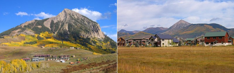
Mount Crested Butte and another shot near town.
Whetstone Mountain again.
» mount owen, crested butte
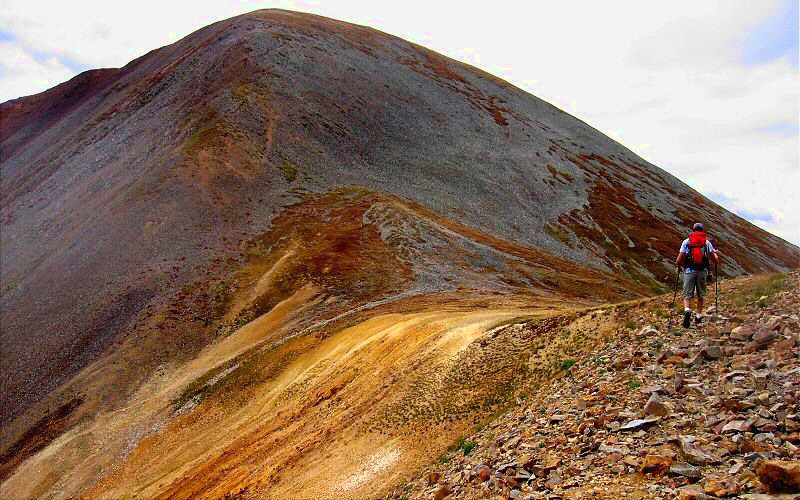
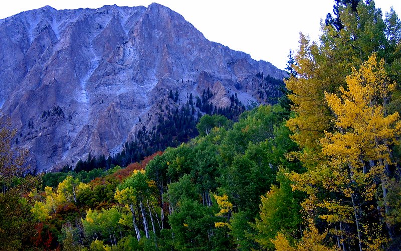
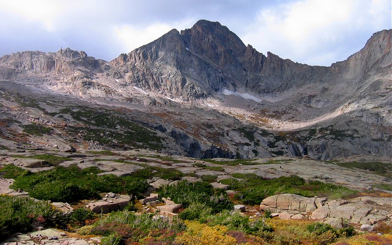
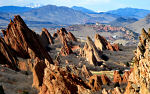
Mount Owen is the tallest mountain in the Ruby Range at 13,058 feet. It lies just west of Crested Butte and towers above the Kebler Pass area, home to the largest aspen grove outside of Utah. We started from the east side, from which you do not see many aspens, but once we made it over the ridge we were greeted with aspens for as far as the eye could see, many bursting with fall colors. It was a long hike, at least 8 miles and 2,500' vertical, over a lot of loose rock. I was hoping to shorten it up by driving up a 4wd road but it was far too rough.
Mount Owen is the tallest mountain in the Ruby Range at 13,058 feet. It lies just west of Crested Butte and towers above the Kebler Pass area, home to the largest aspen grove outside of Utah. We started from the east side, from which you do not see many aspens, but once we made it over the ridge we were greeted with aspens for as far as the eye could see, many bursting with fall colors. It was a long hike, at least 8 miles and 2,500' vertical, over a lot of loose rock. I was hoping to shorten it up by driving up a 4wd road but it was far too rough.
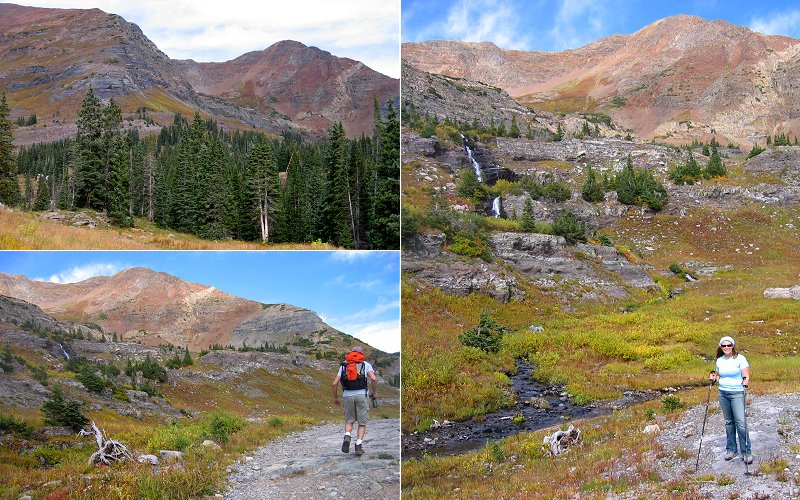
Ruby Peak & Mount Owen from where we started, megan standing below a waterfall we later ascended, and me hiking below mount owen.
Megan halfway up the waterfall, Green Lake, the view north, and Megan hiking below Mount Owen. There was actually another, bigger, waterfall beyond the one we climbed up but it didn't look too climbable and by this time it had started to set in how tiny we were in comparison with the mountain and that we didn't need to make this hike any harder than it was by going off-trail.
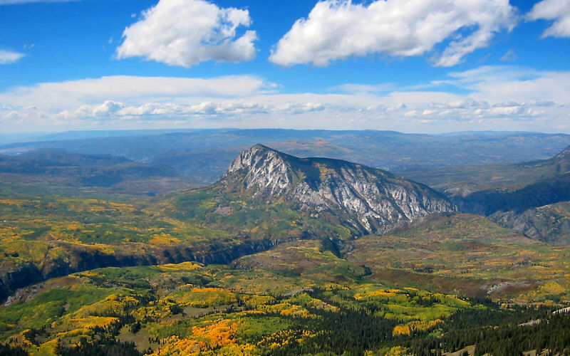
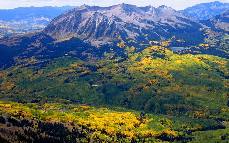
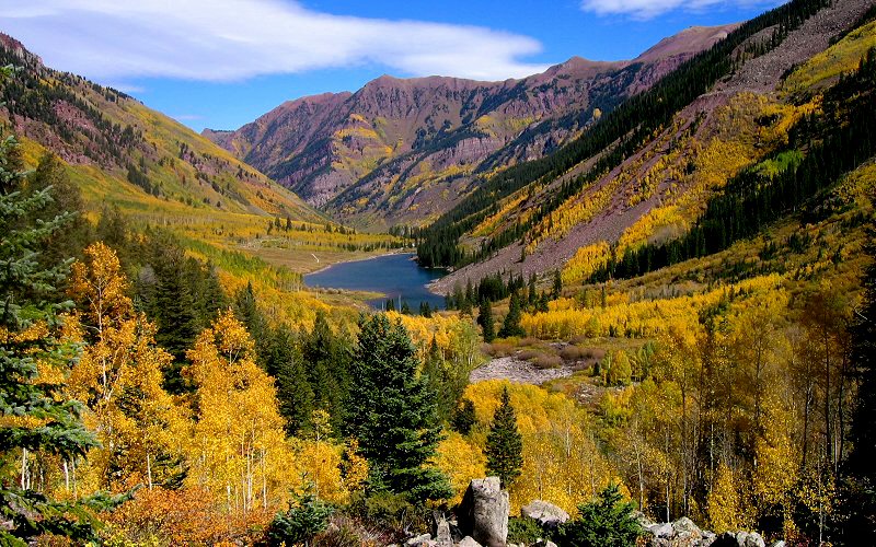
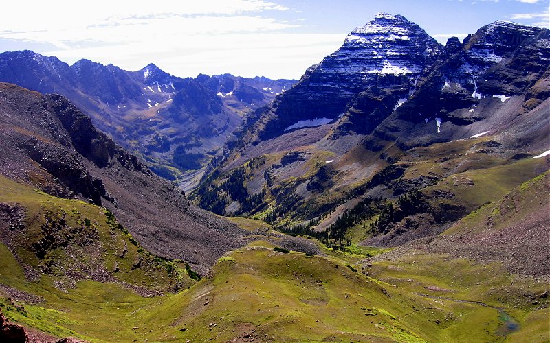
Once we made it over the ridge, we were greeted with an amazing view of Marcellina Mountain jutting out from the aspens of Kebler Pass.
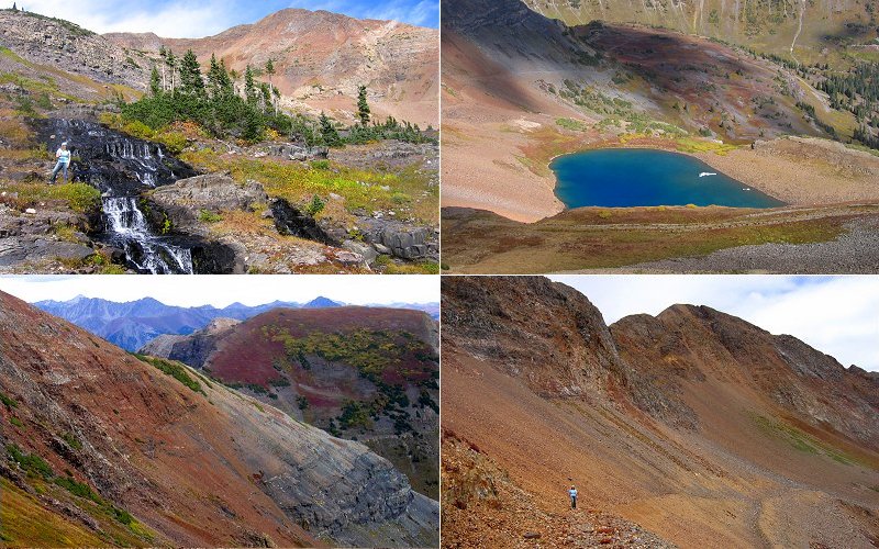
Megan in front of the Beckwiths, trees below us, the south end of the Raggeds, and us.
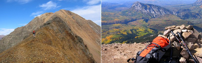
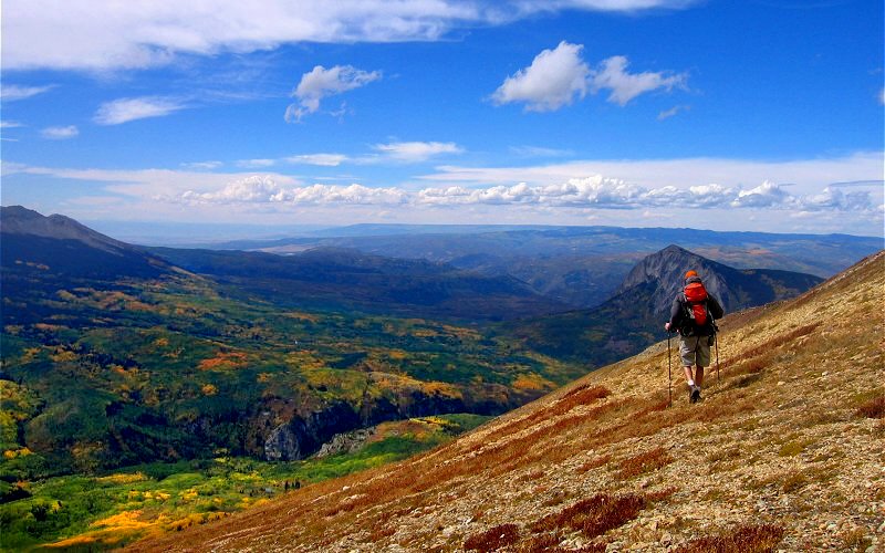
Me heading up the south ridge of Mount Owen and my stuff at the final summit. Pictures do not convey the size of these mountains. By the time I made it up to the summit (about 0.5 miles in the distance) I would be smaller than a dot in the left picture.
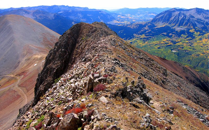
Looking back at the ridge that leads up to the summit of Mount Owen.
Dark Canyon and Marcellina Mountain from the top of Mount Owen. (Taken by Megan)
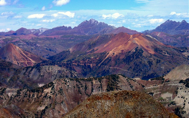
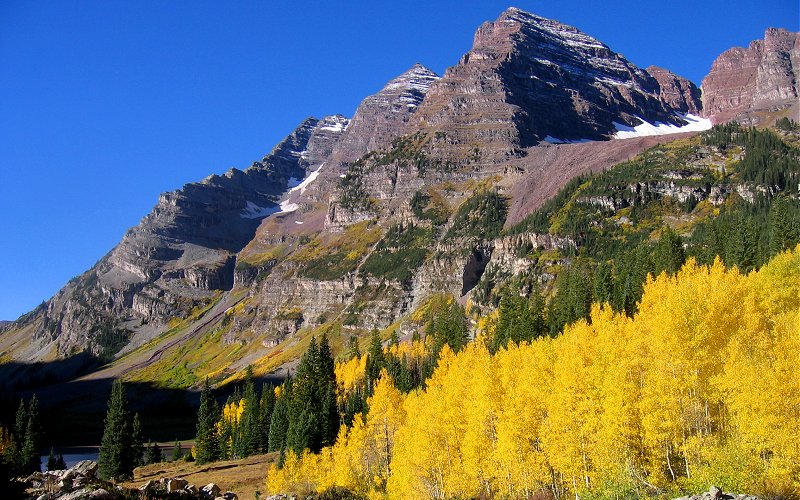
To the east, the back side of South Maroon Peak is the high point on the horizon. The redish cone shaped mountain on the left is Cinnamon Mountain and the redish mountain on the right is Mount Baldy, two other mountains I'd like to climb some day.
Aspens glow in the sunshine below East Beckwith Mountain.
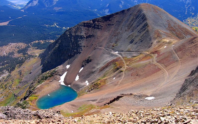
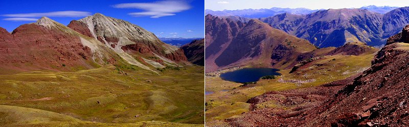
Looking down on Green Lake, below Ruby Peak. The trail up to the saddle can be seen here.
The Raggeds, to the north.
Ruby Peak rising above the saddle.
» kebler pass, near crested butte
After getting a birds eye view of Kebler Pass from Mount Owen, we drove through the area on our way to Aspen.
After getting a birds eye view of Kebler Pass from Mount Owen, we drove through the area on our way to Aspen.
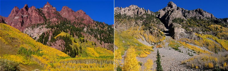
Marcellina Mountain towering 3,000 feet above Kebler Pass road.
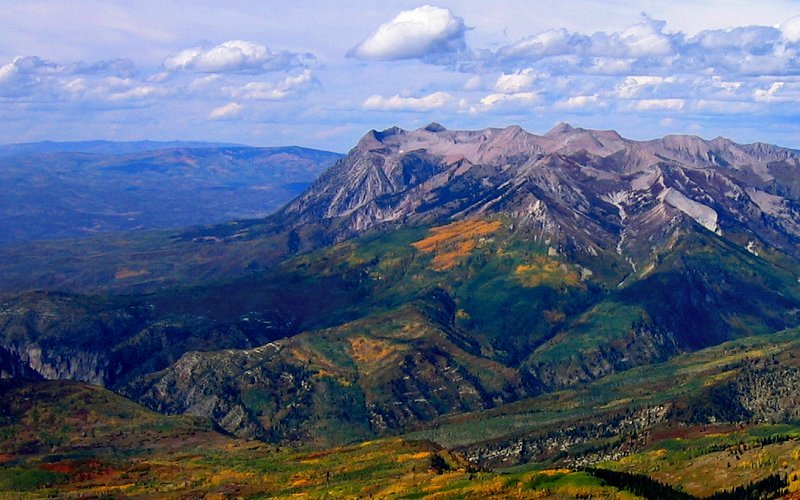
East and West Beckwith Mountains.
Marcellina Mountain and some aspens.
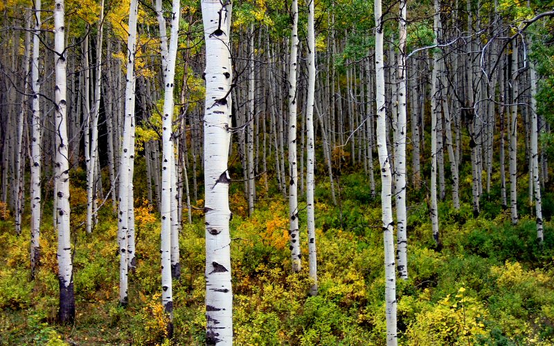
Tall aspens.
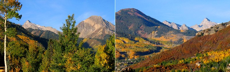
Mount Owen and Ruby Peak from Kebler Pass.
The forest.
Marcellina Mountain, again.
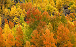
Changing aspens.
» mcclure pass, near marble
Light was fading as we headed over McClure Pass on our way to Aspen.
Light was fading as we headed over McClure Pass on our way to Aspen.
Aspens light up the slopes as the sun sets.
» snowmass
By now it was dark and we were tired and dirty so we didn't really feel like setting up camp. Instead, we got a hotel room in Snowmass and ate a good meal in Aspen (The Steak Pit).
By now it was dark and we were tired and dirty so we didn't really feel like setting up camp. Instead, we got a hotel room in Snowmass and ate a good meal in Aspen (The Steak Pit).
Mount Daly and Capitol Peak as seen from Snowmass as we left for Aspen in the morning.
» maroon bells, aspen
We hiked up past the photographers at Maroon Lake to Crater Lake and then up Minnehaha Gulch to Willow Pass.
We hiked up past the photographers at Maroon Lake to Crater Lake and then up Minnehaha Gulch to Willow Pass.
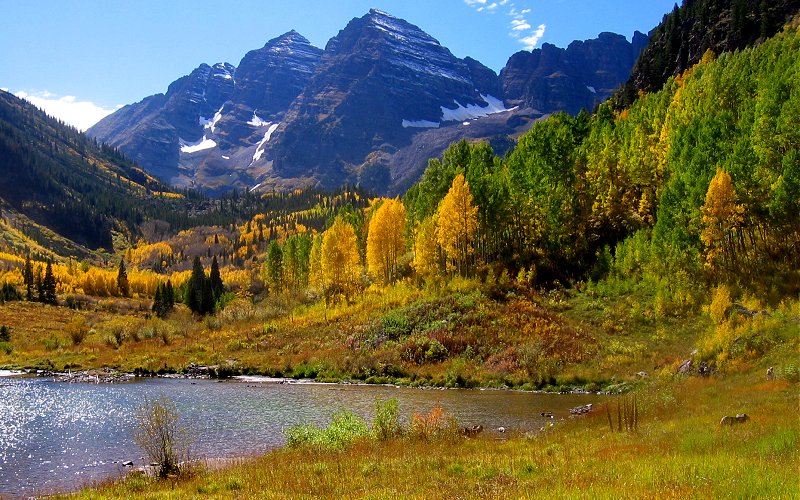
The Maroon Bells.
Aspen grove. I can't think of a better way to experience fall than walking through these trees on a sunny day with a crisp cool wind swirling around the fallen leaves.
Aspens around Maroon Lake.
North and South maroon peak. Despite apearrances in this picture, South Maroon Peak (on the left at 14,156') is actually 142' taller than North Maroon Peak (center).
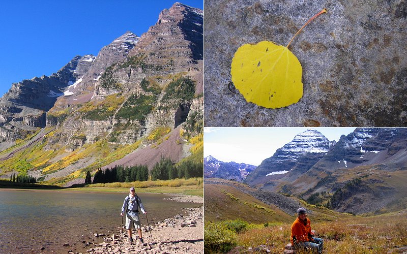
Me standing beside crater Lake, an aspen leaf, and Megan sitting in Minnehaha Gulch, beside the Maroon Bells.
Pyramid Peak.
The view north from Willow Pass, and the view east, showing Willow Lake.
North Maroon Peak from Willow Pass.
Gold aspens below Sievers Mountain near Maroon Lake and some other rock formations.
» independence pass, near aspen
Independence Pass goes from Aspen, through the Roaring Fork Valley, over the mountains beside Mount Elbert, the tallest mountain in Colorado, and down the other side, passing the ghost town of Independence along the way.
Independence Pass goes from Aspen, through the Roaring Fork Valley, over the mountains beside Mount Elbert, the tallest mountain in Colorado, and down the other side, passing the ghost town of Independence along the way.
Aspens on the west side of the pass, and the view on the east side.
» trail ridge road, rocky mountain national park
After doing two strenuous hikes on two consecutive days we decided to take a break and spend most of the day driving through Rocky Mountain National Park. we started by driving up Old Fall River Road, a winding dirt road that climbs into the mountains, and then we took Trail Ridge Road back down.
After doing two strenuous hikes on two consecutive days we decided to take a break and spend most of the day driving through Rocky Mountain National Park. we started by driving up Old Fall River Road, a winding dirt road that climbs into the mountains, and then we took Trail Ridge Road back down.
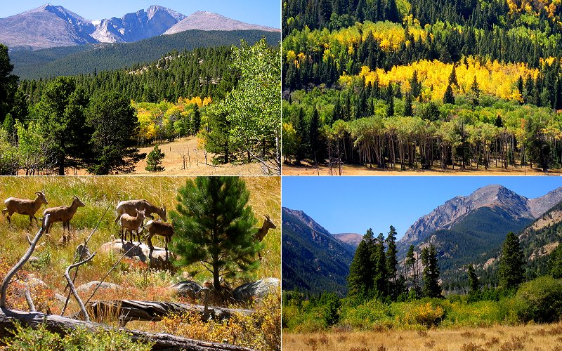
Longs Peak, aspens, bighorn sheep in Horseshoe Park, and mountains above Horseshoe Park.
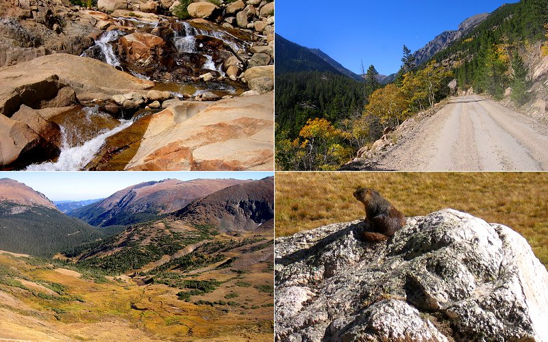
Horseshoe Falls at the Alluvial Fan, Old Fall River Road, the valley below the top of Trail Ridge Road (where a herd of elk were grazing), and a marmot.
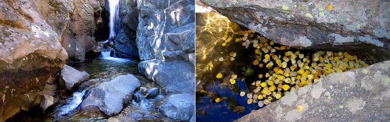
Chasm Falls and aspen leaves collecting in a pool below the falls.
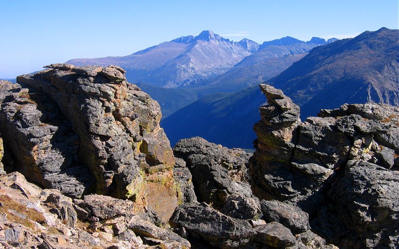
Longs Peak from Trail Ridge Road.
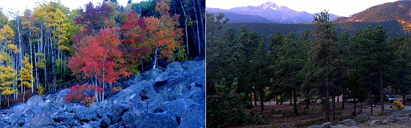
Red aspens near Glacier Gorge, and our campsite below Longs Peak. The campsites at RMNP are very nice, and since it was off-peak, we had no trouble finding an empty one.
» alberta falls, rocky mountain national park
We still had some daylight left after driving through the park so we decided to do the 1.8 mile hike to alberta falls.
We still had some daylight left after driving through the park so we decided to do the 1.8 mile hike to alberta falls.
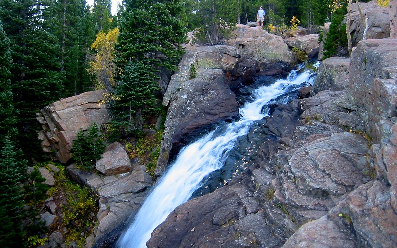
Me standing above Alberta Falls. (Taken by Megan)
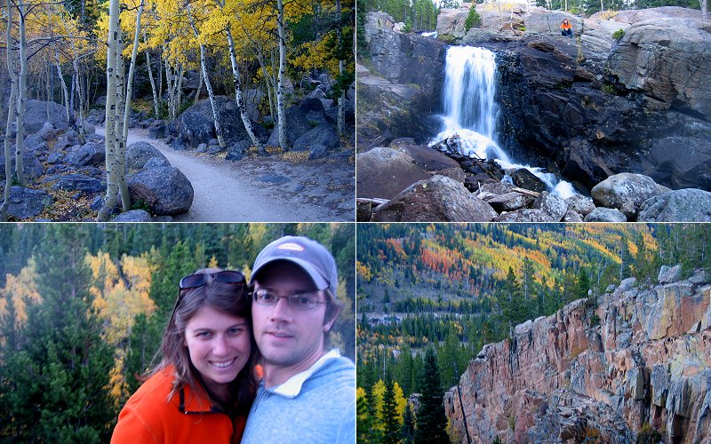
The trail, Megan above the falls, us, and colorful aspens on the opposing slope.
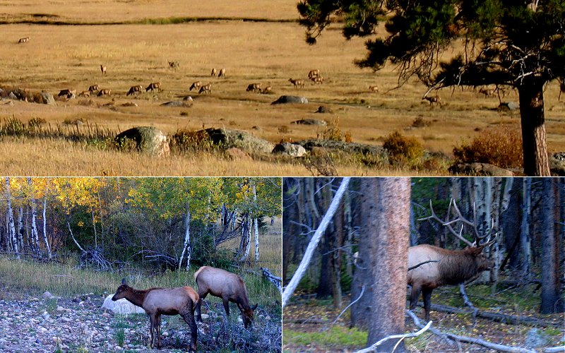
On the way to Alberta Falls, we saw elk all over the place. I don't really understand how the bull in the bottom right picture makes it through the woods with that rack on his head.
» black lake, rocky mountain national park
Black Lake is a 10 mile hike through the Glacier Gorge area that passes by many mountain lakes and waterfalls. Fall is a nice time to visit RMNP to avoid the crowds but things that are normally green tend to be a less appealing brown. However, the imposing cliffs, gorges and mountains of the glacier gorge area are always scenic and impressive.
Black Lake is a 10 mile hike through the Glacier Gorge area that passes by many mountain lakes and waterfalls. Fall is a nice time to visit RMNP to avoid the crowds but things that are normally green tend to be a less appealing brown. However, the imposing cliffs, gorges and mountains of the glacier gorge area are always scenic and impressive.
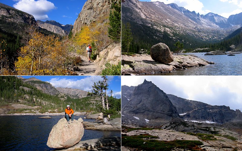
Glacier Gorge, Mills Lake, Megan at Mills Lake, and The Spearhead.
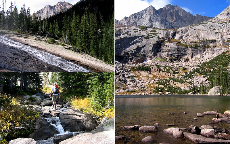
Ribbon Falls, Black Lake, and me rock hopping from the falls to Black Lake.
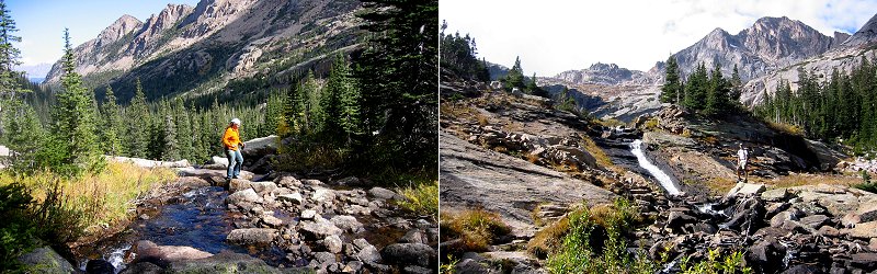
Megan rock hopping, and me below an unnamed waterfall.
McHenry's Peak, above Black Lake.
Megan walking the planks, aspens, the ground, and me hiking the final stretch where we got rained on a little bit.
» bear lake, rocky mountain national park
We were pretty wiped out after our hike to Black Lake so we just checked out Bear Lake, took the short hike up to Nymph Lake, and headed out.
We were pretty wiped out after our hike to Black Lake so we just checked out Bear Lake, took the short hike up to Nymph Lake, and headed out.
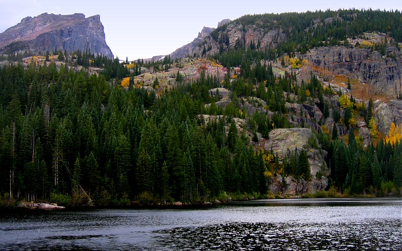
Halletts Peak above Bear Lake.
» all photo reports from colorado
Roxborough State Park, Colorado
March 15, 2009 A few photos from a quick stop at Roxborough State Park near Denver. 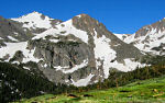
Denver, Colorado
July 1 - 5, 2008 Staying in Denver and checking out the Indian Peaks, Mt. Evans, and Rocky Mountain NP. 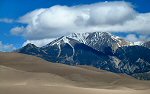
Great Sand Dunes, Etc, Colorado
October 19 - 22, 2006 Checking out the Great Sand Dunes National Park, Fraser, and hiking up Green Mountain outside Boulder. 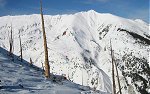
|
Crested Butte, Colorado
September 13 - 18, 2007 Hiking up Marcellina Mountain, to Frigid Air Pass, and a few other places, mostly in the Crested Butte area. 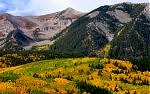
Colorado Fall
September 23 - 28, 2005 Hiking in Crested Butte, Aspen, and Rocky Mountain National Park. 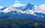
|
Copyright 1995- Lars Jensen | randomspace@umich.edu |