Southwestern Utah
June 2005
» in general
Utah is a geologists dreamland...because from what I understand, geologists spend a lot of time dreaming about Mormons. But beyond that, Utah also has lots of different rocks that the geologists can give fancy names to and use as pickup lines at bars (Say did you see all that igneous rock outside? I bet it still wasn't as hot as you when it formed). But lets forget about geologists for a minute, Utah is near Nevada and in Nevada you can gamble and that is something special because in most states, if you want to throw away your money you have to place it in a trash can and the trash can does not light up or make noise. It is very anti-climatic. But this is not the place for me to justify why I blew through $2000 on our first night in Vegas, I think you have seen the beauty of slot machines, heard their song, like a thousand cell phones going off at once, and you understand that no one can resist them.
Okay, minute is up, back to geologists...what kind of music do you think they like?...I'd say "rock"...you know?...(feel free to pause here while you laugh). Rock is the best kind of music, though, am I right? I'm rocking out to Britney Spears right now. But seriously, Megan and I headed out to southwestern Utah by way of Las Vegas to hike, camp, and eat at the finest establishments the area had to offer. We met up with our friends Kate & Steve who were in the middle of traveling across the country and we spent most of our time in Bryce and Zion Canyon National Parks, the latter being the highlight I think, although eating at Chilis in St. George after a long day of hiking is up there too.
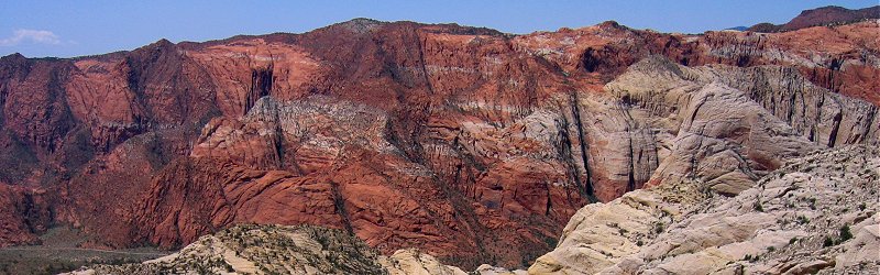
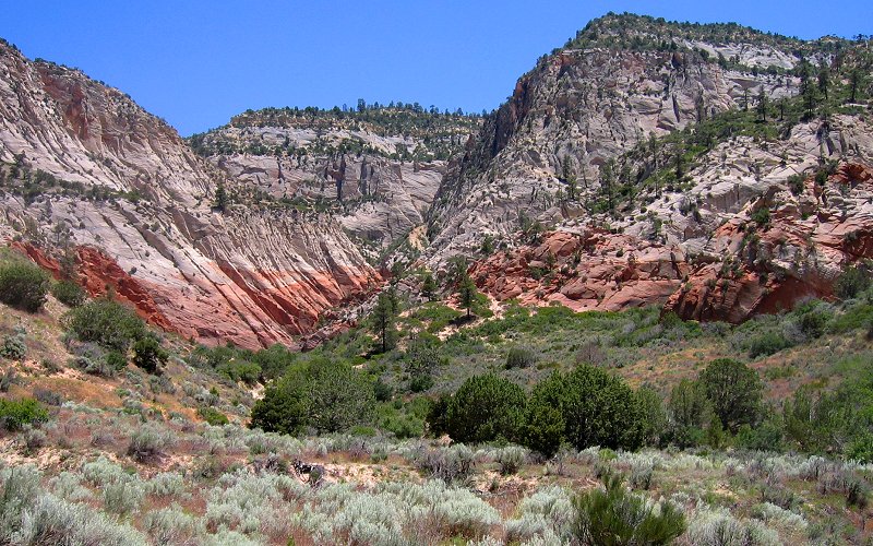
» snow canyon, utah
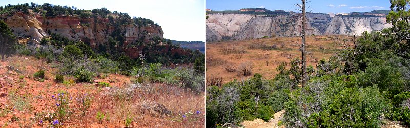
Snow Canyon State Park is a small park just outside of St. George, Utah. It has sand dunes, lava caves, and interesting red and white rock formations.
Snow Canyon State Park is a small park just outside of St. George, Utah. It has sand dunes, lava caves, and interesting red and white rock formations.
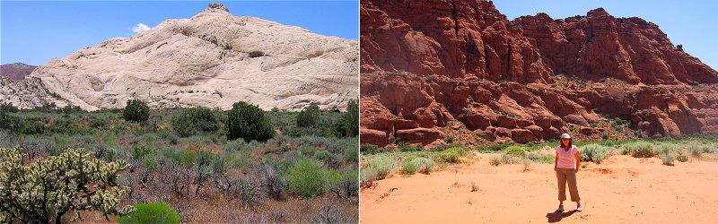
Left: The mountain we climbed. Right: Megan on the sand dunes.
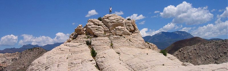
Me on the peak.
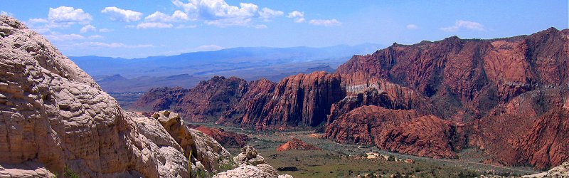
View from the mountain.
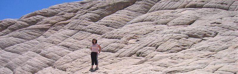
Quilted slopes.
Red and white.
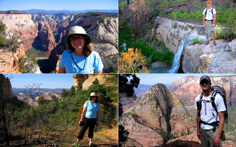
» deertrap mountain, zion
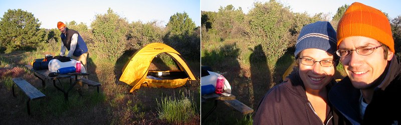
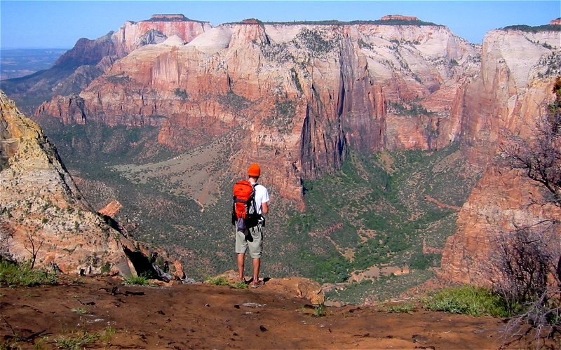
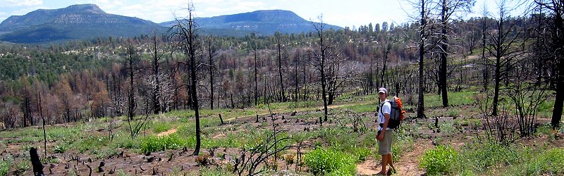
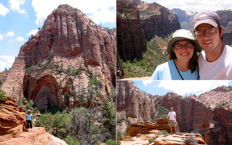
Like many national parks, Zion has gotten pretty crowded. Unlike a sporting event, where a big crowd can enhance the experience, when you're hiking out in the wilderness trying to listen to the birds chirp over people chattering about the latest episode of Gilmore Girls it can kind of kill it. So Megan and I aimed to achieve some solitude by heading over to the less crowded, off the beaten path, east plateau of Zion...and it was uncrowded, we had Deertrap Mountain to ourselves, but it turns out that Megan was the one who was chattering about the Gilmore Girls so...I found that stuffing dried grass in my ears until they bled kind of drowned out the sound. But seriously, to hike Deertrap from the canyon floor means at least 18 miles and we had a lot of other hiking we wanted to do so I figured we could shorten it up a bit by starting from an unoffical entrance on the east side of the park and by camping overnight on the trail.
So we got our backcountry permit, rental SUV, and directions and headed off to find the trailhead. Once we got up in the mountains and off on the dirt roads, it was apparent that we were in an area that didn't see much travel. The narrow winding road had a lot of big ruts and rocks in it but it was dry until we came to a hill where a creek was running through the road. There were some big muddy ruts here showing where others had had some difficulty getting through so I got out of the car to evaluate how stupid it would be to continue on. I decided the first part was an acceptable level of stupid and got through it okay although it was rough enough for me to really question whether I should continue on because the road only seemed to be getting worse...and that's when Megan said "just go!" and I did, and the car sunk down in the mud and we were stuck. We tried digging our way out for about an hour along with trying to put rocks and sticks under the wheels that were spinning out but there was no hope, the car was essentially bottomed out on the hard dry center of the road while the wheels were sunk down in watery mud.
So, we gave up, thinking that our vacation had been significantly derailed, packed up some stuff and started hiking the few miles back to the recreational ranch that we had passed on the way in. We asked them for advice or help and luckily, there was a young kid, Kurt, there who had the keys to his friends 4WD and a tow line so he drove us back to our car and, to our joy, pulled us out. We thanked him profusely and I gave him all the money in my wallet which he politely refused, I guess he didn't think 2 dollars was worth his while...kids these days! I swear! they think they deserve a handful of gold coins and a docile pet monkey just for breathing. For the record, he did accept it eventually and it was more than 2 dollars, thanks to the penny I found in my pocket. By then it was getting late so we just decided to get a shower at the ranch, camp there overnight, and then hike Deertrap bright and early in the morning.
It was quite cold when we woke up the next morning to pack up all our gear into the truck again for our second approach. This time we drove out the same road but stopped short of where we got stuck. It turns out that we were only about 1000 feet from the trailhead. The hike was nice, no one else was around except 3 wild turkeys that startled us as we walked by. We figure the hike to Deertrap was about 5.5 miles, over 4 rocky ridges mixed in with some flat hiking. Some areas were really wet and you could hear water trickling all around while other areas were dry and sandy. Deertrap had a prescribed burn a couple of years ago so a lot of the trees were either missing or charred. The wildflowers, however, were quite abundant. After we hit the offical end of the trail, we hiked along the edge of Deertrap for at least another half mile to get a view from the north side which overlooks Angels Landing, making for a round trip of about 12 miles.
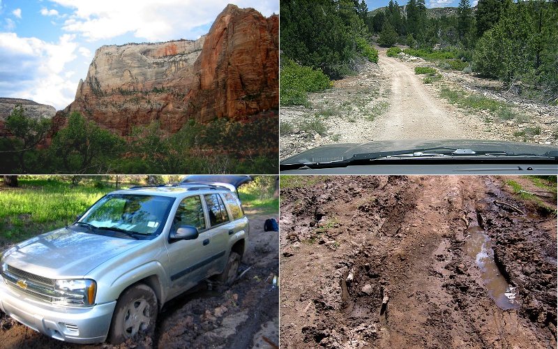
Whoops!...stuck in the mud...Top Left: The edge of deertrap mountain that we hiked along once we got up there. Top Right: A dry part of the road in.
Rising bright and early to hike Deertrap.
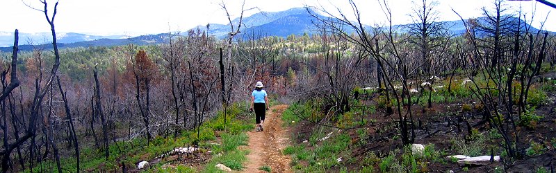
The charred forests of Deertrap.
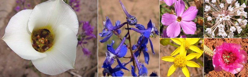
Wildflowers.
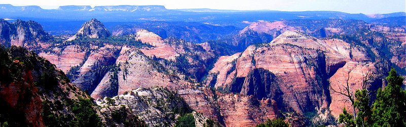
One of the ridges on Deertrap that we had to cross and the final canyon edge of Deertrap.
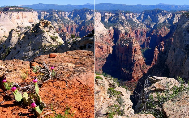
Me at the edge of Deertrap.
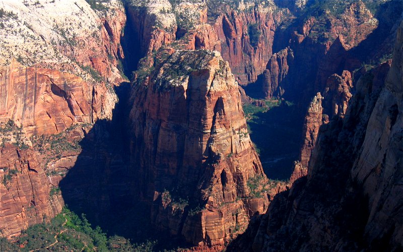
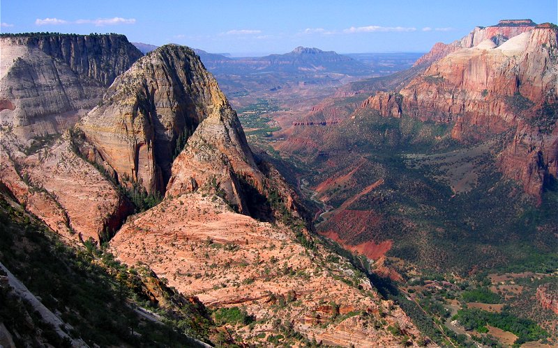
Angels Landing from above.
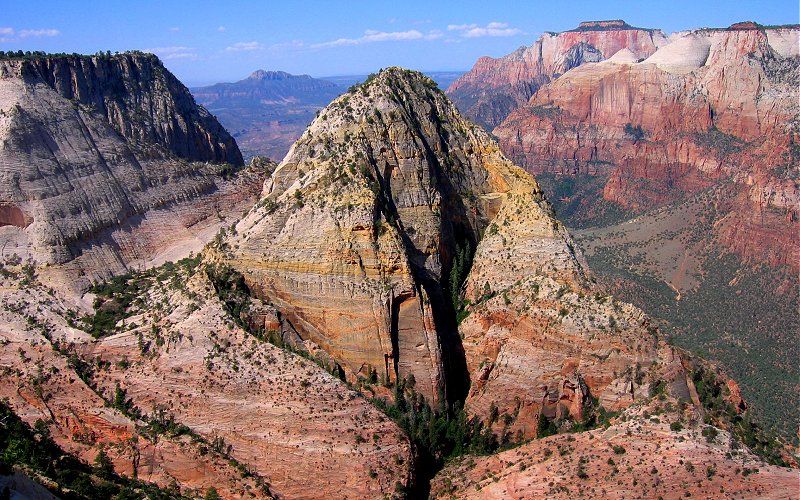
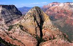
Mountain of the Sun.
Looking south from Deertrap.
Looking north from Deertrap and down on Angels Landing.
One last view down canyon.
We were there.
Heading back.
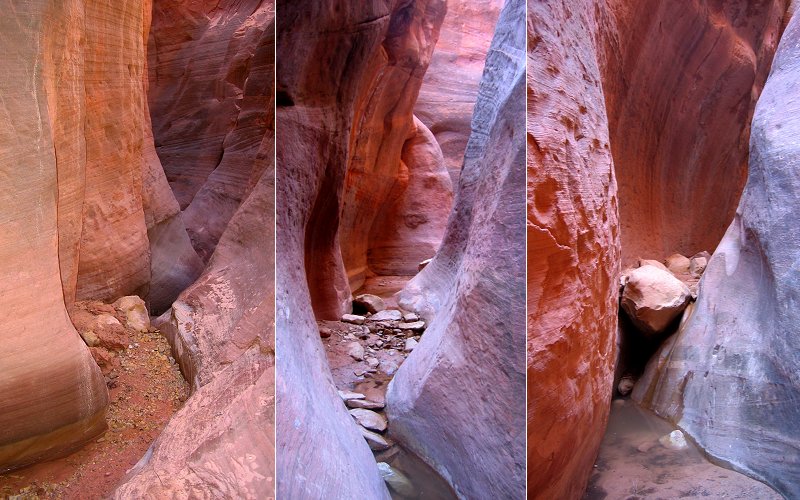
» red hollow slot canyon, utah
There are a lot of slot canyons in Utah but often they are hard to reach or require technical climbing. We had hoped to do the Kanarra Creek slot canyon which has a little creek flowing through it and some challenging bouldering spots around waterfalls, but due to the huge snowfall this year, the creek had turned into raging whitewater. So, we did Red Hollow instead which also has a creek running through it in the early spring but it was reduced to just a trickle by the time we were there. Climbing around in the slot canyon was very fun, much more interesting than just walking along a path because you actually have to think about how you are going to get around obstacles and even more so for us since Megan brought only one pair of shoes and didn't want to get them wet in the pools of water that dotted the canyon floor. The canyon got very narrow at points, making it easy to scamper up the walls by pushing off the opposing sides.
There are a lot of slot canyons in Utah but often they are hard to reach or require technical climbing. We had hoped to do the Kanarra Creek slot canyon which has a little creek flowing through it and some challenging bouldering spots around waterfalls, but due to the huge snowfall this year, the creek had turned into raging whitewater. So, we did Red Hollow instead which also has a creek running through it in the early spring but it was reduced to just a trickle by the time we were there. Climbing around in the slot canyon was very fun, much more interesting than just walking along a path because you actually have to think about how you are going to get around obstacles and even more so for us since Megan brought only one pair of shoes and didn't want to get them wet in the pools of water that dotted the canyon floor. The canyon got very narrow at points, making it easy to scamper up the walls by pushing off the opposing sides.
Red Hollow from a distance.
Inside the narrows of Red Hollow.
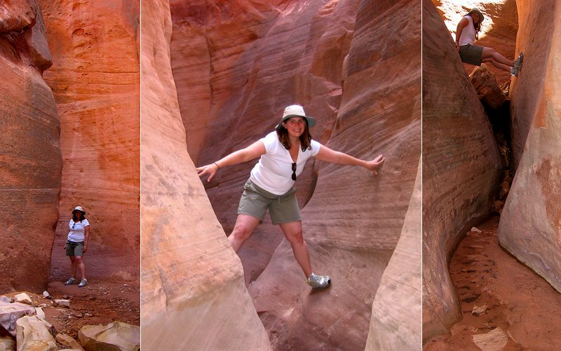
Bouldering around the chokestones and other obstacles.
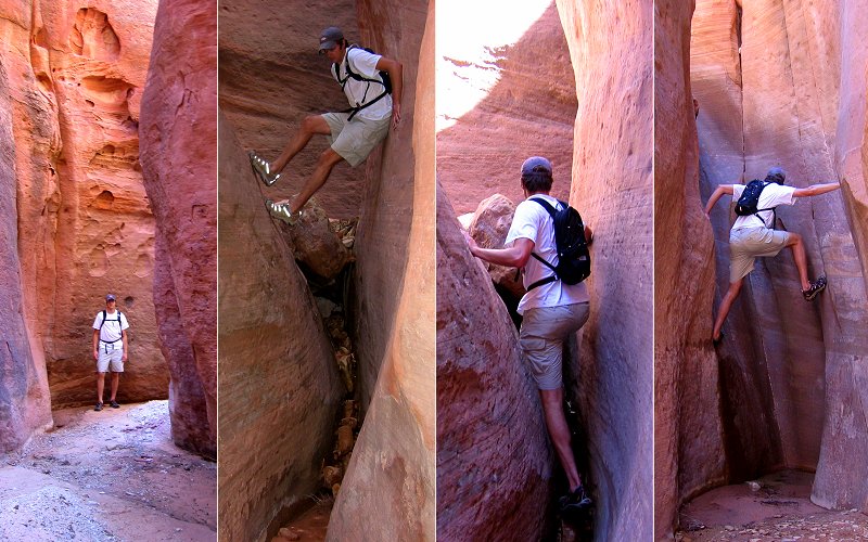
Climbing around.
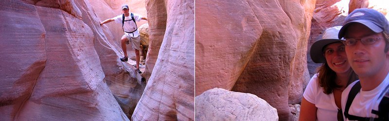
Hanging out.
» bryce canyon
We met up with Kate & Steve here and camped overnight. Megan & Kate were feeling pretty ill so we didn't hike a whole lot. We drove the whole park and checked out all the viewpoints and I took a quick hike down into the canyon in the Queens Garden area. The day before, Megan and I hiked around the Mossy Cave area which was real nice, it had a little creek that we hiked up and a couple of small waterfalls.
We met up with Kate & Steve here and camped overnight. Megan & Kate were feeling pretty ill so we didn't hike a whole lot. We drove the whole park and checked out all the viewpoints and I took a quick hike down into the canyon in the Queens Garden area. The day before, Megan and I hiked around the Mossy Cave area which was real nice, it had a little creek that we hiked up and a couple of small waterfalls.
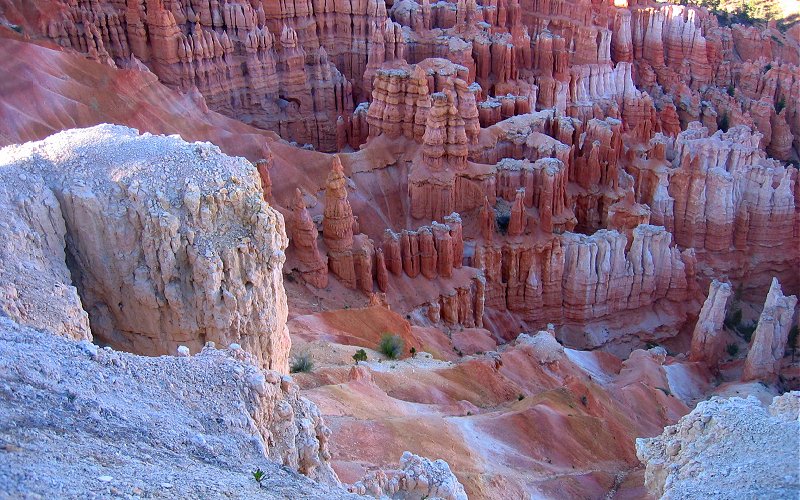
The hoodoos of Bryce Canyon.
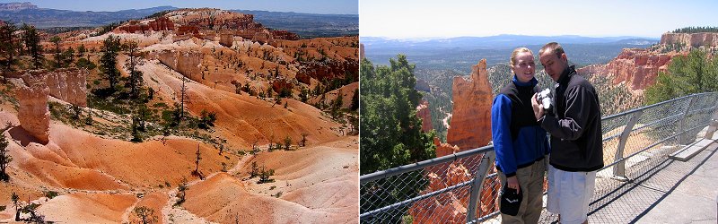
Queens Garden and Kate & Steve reviewing photos.
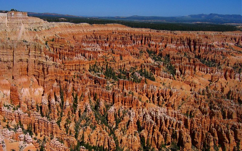
The main amphitheater.
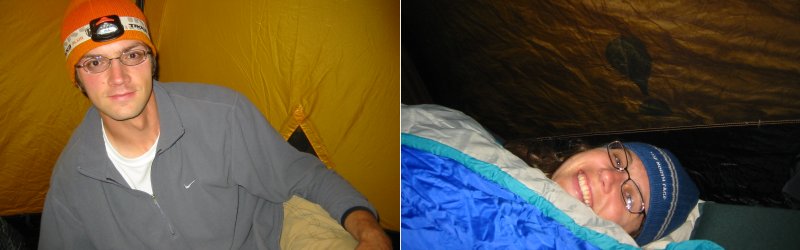
Campin'.
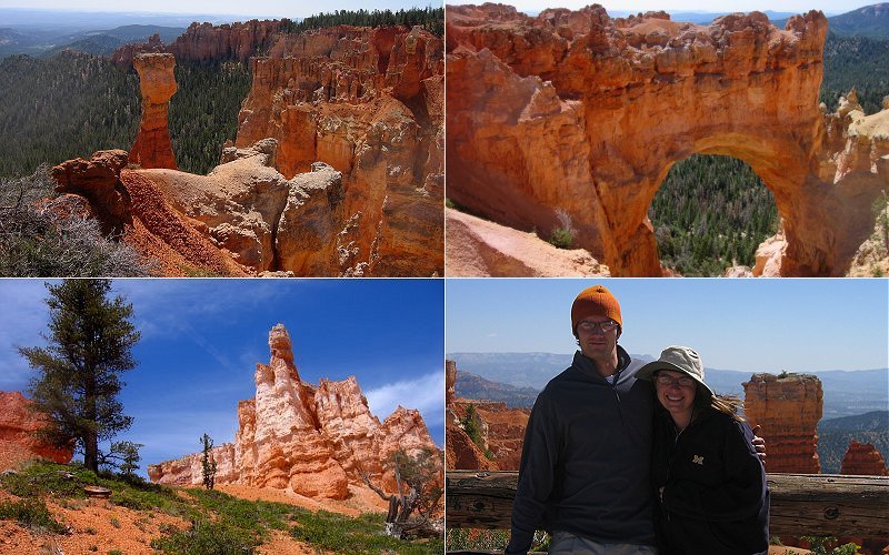
Formations elsewhere in the park.
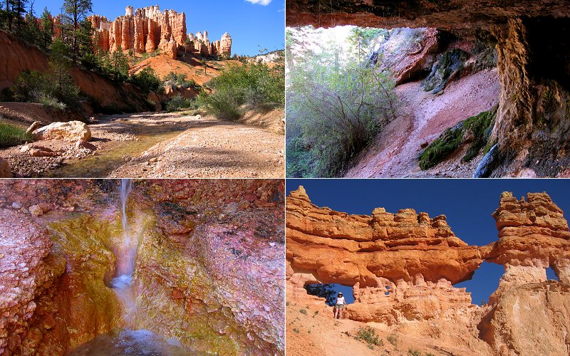
Mossy Cave area.
» angels landing, zion
While not as terrifying as the hype would suggest (unless you have a fear of heights), Angels Landing is still a unique and fun hike. Angels Landing is a relatively narrow rock formation that juts out into the main canyon and stands at about 1500 feet. For a half mile, the trail goes up the spine of this rock formation with 1000 foot drop-offs on each side of the steep, rocky trail. Megan and Kate opted out of the last part of the climb and they hung out at the base while Steve and I hustled up to the top.
While not as terrifying as the hype would suggest (unless you have a fear of heights), Angels Landing is still a unique and fun hike. Angels Landing is a relatively narrow rock formation that juts out into the main canyon and stands at about 1500 feet. For a half mile, the trail goes up the spine of this rock formation with 1000 foot drop-offs on each side of the steep, rocky trail. Megan and Kate opted out of the last part of the climb and they hung out at the base while Steve and I hustled up to the top.
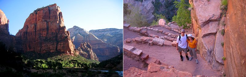
Left: Looking up at our final destination. Right: A series of steep switchbacks going up the back known as "Walters Wiggles".
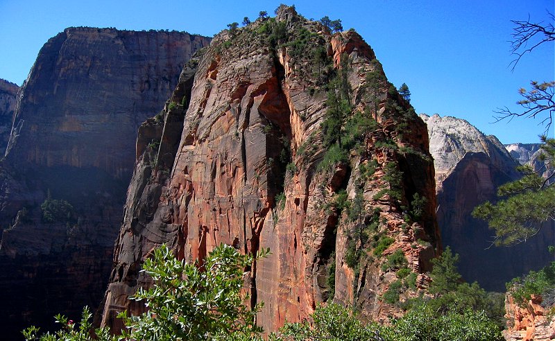
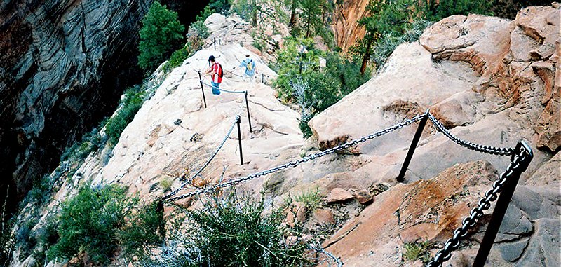
A good look at the trail that goes up the spine of Angels Landing.
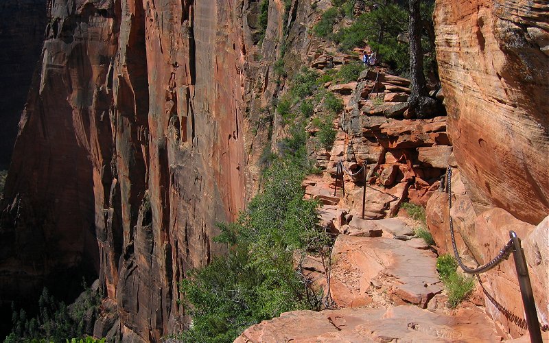
The trail with a big drop off on the left side (and a chain on the right to hold as you walk).
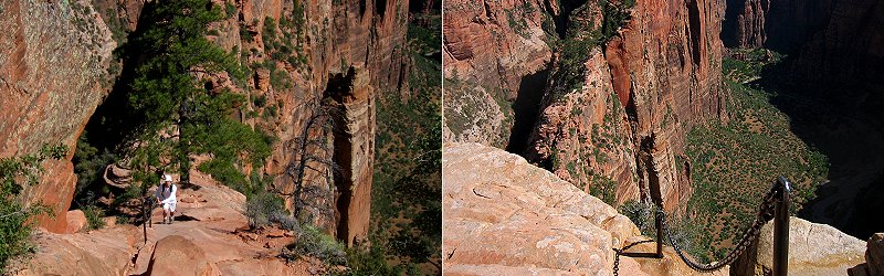
Left: Steve climbing up the spine. Right: A chain leading you over the edge (back to the trail).
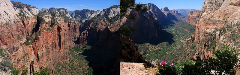
Looking north and south from the top of Angels Landing.
I didn't take this picture but it shows the chains going up the middle of the spine.
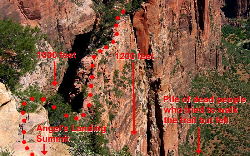
Just because I think the pictures of the Angels Landing trail are so hard to understand and because I want you to realize how much of a badass I am for hiking it, the above picture highlights the trail with red dots and shows how easily one could fall to their death on either the left or the right side. So the next time I am trying to one-up someone who is like "yeah man, I killed a baby with my bare hands just because it looked at me funny" I can be like "oh yeah?...well I walked on a trail that had, like, big drop offs near both sides. I could have totally fallen off if I had tried to walk with my eyes closed" and when they look at me confused I could point them to this diagram. So, the next time you see something and you're like "man, no one could walk on that", remember that I am one badass walking mother f**ker, I will walk on any sh*t, there ain't no mother f**king walking I can't do. However, I still refuse to "walk for cancer", etc. because that's silly. If you want to make a donation, make one, don't pay someone to waste their day walking. Besides, walking should be left to the pros or someone is likely to get hurt, I mean, do you see that picture above where I walked? It's crazy. Not a place for women or children. I mean, there were plenty of women and children on the trail, but I pushed them off whenever I passed them just to teach them a lesson about the dangers of hiking. Okay, I didn't pass any women or children, they passed me, but come on, it was scary!
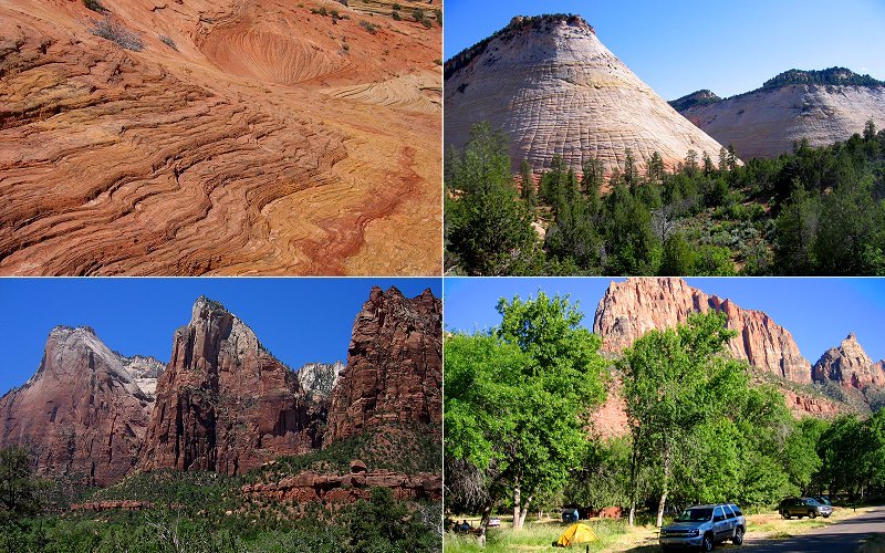
Water carved rocks, the Checkerboard Mesa, the Court of the Patriarchs, and our campsite under the Watchman.
Canyon overlook trail.
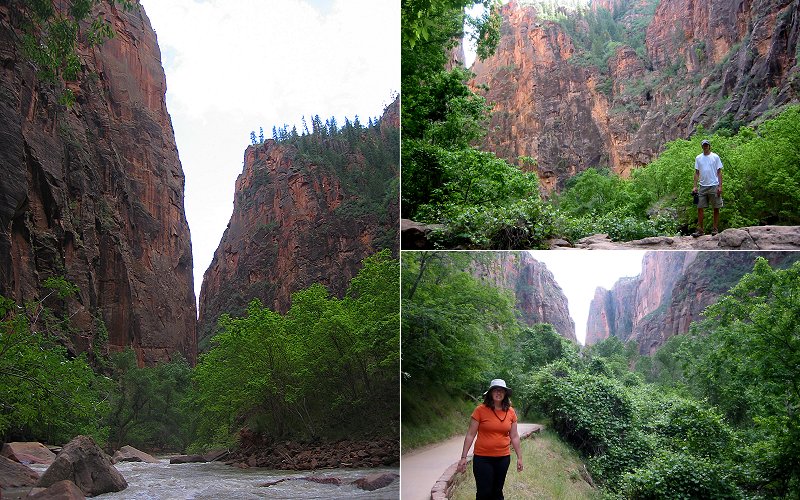
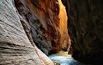
Riverside Walk, where the canyon gets tighter. Normally you can hike past the end of Riverside Walk to get a look at the Zion Narrows but the river water level was too high while we were there.
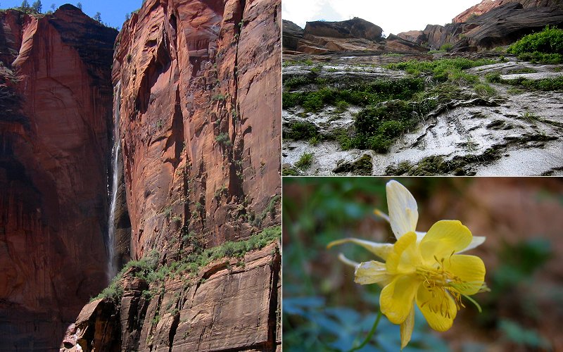
A tall waterfall and the hanging gardens of Riverside Walk. In the hanging gardens, flowers cling to vertical cliffs which constantly drip water down like rain.
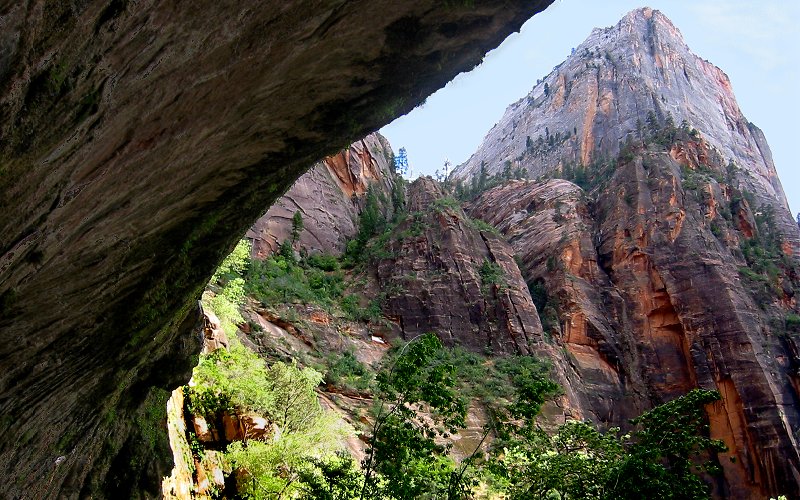
Weeping rock is on the left. It constantly drips water like rain which you can not see in this picture.
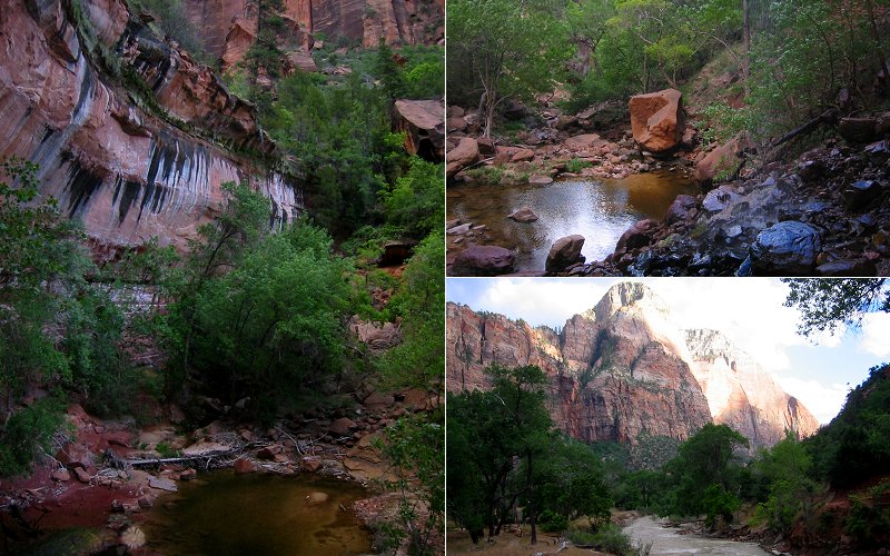
Lower Emerald Pool. There were a couple of waterfalls falling off that cliff on the left but they were too weak to show up well in pictures.
� valley of fire, nevada
We had a bit of extra time before our flight home so we decided to drive through the Valley of Fire State Park.
We had a bit of extra time before our flight home so we decided to drive through the Valley of Fire State Park.
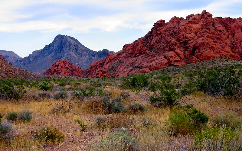
Valley of Fire.
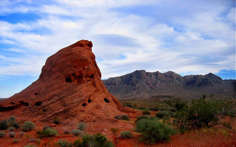
Valley of Fire.
» all photo reports from the southwest
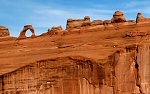
Arches National Park, Utah
October 19, 2006 Checking out Arches National Park and Dead Horse Point State Park. 
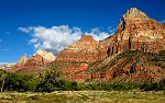
Zion National Park, Utah
October 17 - 18, 2006 Checking out the amazing sights of Zion Canyon and Utah 9. 
|
Zion Narrows, Utah
October 18, 2006 Taking a quick venture into "The Narrows" and Orderville Canyon in Zion National Park. 
Southwest Utah
June 3 - 8, 2005 Hiking in Zion National Park, Bryce Canyon National Park, Snow Canyon State Park, Valley of Fire State Park, and some other places. |
Copyright 1995- Lars Jensen | randomspace@umich.edu |