GIS
is used in the analysis of motorcycle and bus use in Bangkok in three main
parts, which are:
1)
Residence to Job Distance Calculation
2)
Display of Spatial Pattern of Bus Accessibility in Bangkok
3)
Clickable/Interactive Map
Data
on distances between residential and job locations of motorcycle and bus
users are required in performing a statistical analysis to see whether
distance traveled between residence and work place or school is a significant
factor influencing people's preference towards bus or motorcycle use. Since
the data on locations were collected at a polygon level (i.e. respondents
were asked what district they reside and work or go to school), a reference
point for each polygon or each district needs to be created in order to
calculate distance from one district to another. Centroids of the polygons
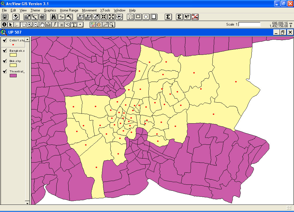
are used as reference points. The following screen shows a centroid for
each of the 50 districts of Bangkok.
After
the 50 centroids are created, data on XY coordinates are added for each
centroid, using Animal Movements Extension of ArcView. Then survey data
of residential and job locations are added and estimated distance between
residences and job or school locations can be calculated using the XY coordinates.