V. Conclusion
The GIS map based on data from SEMCOG and DAS enables to examine relations among geographic patterns, transportation facilities, and people who live there. Bus stops in Detroit need to be improved, especially the area where the bus stop is not accessible or not recognizable.
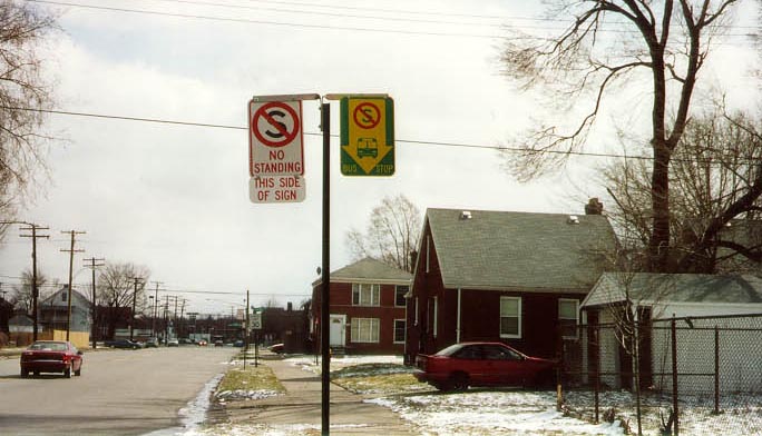
Bus stop sign at St. Patrick and Gunston, and parked cars in front of a bus stop at Hays and Majerledge
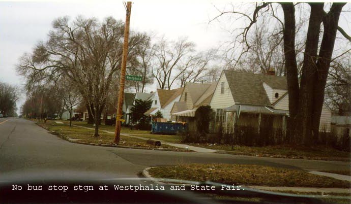
However, GIS data have limitations because each bus stop is situated in different quality in spite of same score or existence of a certain facility. Also, some locations were incorrectly marked in GIS data, such as a bus stop sign at Westphalia Ave. and State Fair Ave. There are no bus stop sign where is supposed to be, instead Hickory St., where is four blocks away from Westphalia, has a bus stop sign although GIS map indicates no stop sign exists.
<--- Previous page