|
Base Maps and Charts
|
|
 |
|
|
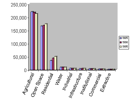
Change in area of 9 major categories from 1985 -1990 |
|
|
Total area of county ~463,000 acres |
|
|
Base Maps and Charts
|
|
|
|
|
|
Change in area of 9 major categories from 1985 -1990 |
|
|
Total area of county ~463,000 acres |
|