The Quest for Peace in the Middle East
Resource Page of
Sandra L. Arlinghaus, Ph.D.
Link to the 2007 student site.
Link to Sandy's 2007 project: http://www-personal.umich.edu/~sarhaus/MapsAndTimelines/Fall2007/Arlinghaus/
Link to Sandy's 2005 project: http://www-personal.umich.edu/~sarhaus/larimore02/index.htm
Syllabus, pdf format, Fall
2008.
Special Event: Tour of the 3D Lab, Wednesday, October 1, 1p.m. Meet outside the 3D Lab in the Central Collaboration Area on the first floor of the Duderstadt Center. See map below for floorplan.
Office Hours:
Special Event: Tour of the 3D Lab, Wednesday, October 1, 1p.m. Meet outside the 3D Lab in the Central Collaboration Area on the first floor of the Duderstadt Center. See map below for floorplan.
Office Hours:
- Wednesday,
Duderstadt Center, before class (or in the Map Library when class meets
in the Map Library), 10a.m. to 12:30p.m.
- Fridays,
10a.m. to 2p.m., Map Library
- Available on e-mail.
- I
will be out of town at a conference from Nov. 14 to December 1.
Locations
(beyond the usual meeting place on the third floor of the Duderstadt
Center--Windows I Training Room):
- UM3D Lab, 1st floor Duderstadt Center: Click here to find a floor plan; click on appropriate link to see where the room is
- Floor Plan
of the Duderstadt Center
Click on a link next to the plan to locate the room.
- Map Library: 8th floor Hatcher (Graduate) Library.
Helpful (hopefully!) comments
| One
way to transfer file from a local computer to the UM is to use
"M-file," http://mfile.umich.edu/ Follow the simple instructions online. This method is easy and works well over the internet. It is not the best for transferring a large number of files.
|
| Link
to catalogues: |
Windows
Universal Commands:
|
| Timelines: When inserting the graphic for a timeline, put it in a table. Go to Insert | Table in Seamonkey. Choose 2 columns and 1 row. Then you can put the graphic for the timeline in the left column and type text in the right column. There are ways to adjust the column size within the software window that comes up in association with the table. A simple workaround is simply to fill a row with text in the right side of the table and then color the text the same color as the background of the table. |
| Opening
.kml files in Google Earth: Download the .kml file to where you want to save it. Open it in Google Earth: in GE, go to File | Open and navigate to where you saved the .kml file and open it. |
GEOMAT components Checklist:
For the full power of a
GEOMAT case study to be realized, two sets of intersecting components
need to be included. First is a set of broad categories of
substantive data that form an ecological whole:
- climatic and weather systems including the water cycle
- terrain and topographic formation
- changing natural resources distribution and utilization such as movements of plants and animals both domesticated and wild
- population settlements and movements such as urbanization and migration
- family establishment and reproduction
- political institutions' operation
- social institutions' operation
- economic instutions' operation including land use systems' operation.
These
eight systems interact simulatneously at any place on the earth's
surface. Human individuals and groups are embedded in these
systems and act through them. Analyzing how these systems
interact to produce a particular event enables us to identify the
essential actors, human or otherwise, which have produced the event.
Second is a set of format categories:
Second is a set of format categories:
- Maps which show the features of the areas where significant events took place.
- Calendrical timelines showing the sequence of different kinds of events at appropriate scales.
- Identification of specific events, especially landmark events which irrevocably changed the situation being chronicled by the case study.
- Biographies, accounts, and images of human actors--corporate group agents contributing to the sequence of events.
- Reports about and images of other actors such as plants, animals, landscape features, terrain, mineral deposits, productive land use, weather and climate.
- Arrays of archival documents, records of messages exchanged, oral history accounts and contemporary images.
- Accounts of, documents and images from contemporary settlements such as cities, towns, villages, resorts.
- Documents and images from archeological sites and records of past
settlements.
Links to some related
materials:
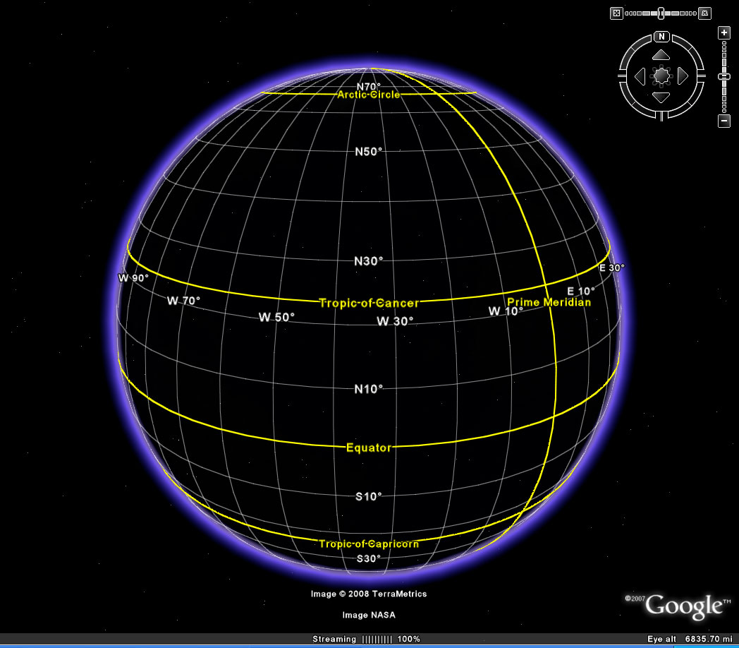
- Latitude and Longitude: general structure
- Scale: A Fundamental Geographical Problem
- Maps.
- Digital Chart of the World--selections
- Animated maps: integrating space and time.
- Four-color example
- Syrian example
- CSF link
- IMaGe link--numerous published animated maps
- Five Themes of Geography: Location, Place, Human/Environment Interaction, Movement, Regions (as characterized in 1984 by the Joint Committee on Geographic Education of the National Council for Geographic Education (NCGE) and the Association of American Geographers (AAG). They are outlined in greater detail in the NCGE/AAG publication Guidelines for Geographic Education, Elementary and Secondary Schools.)
Software:
Adobe PhotoShop--use for making animated maps, as well.
[Adobe ImageReady]--no longer supported, but you may have it.
ESRI GIS
Dreamweaver: to insert a picture on your webpage, go to Insert|Image; to insert a link, type in the full url in the link box after highlighting text.
Download a free editor to create your own webpage and to create Java Applets: SeaMonkey Composer.
http://earth.google.com/outreach/tutorial_youtube.html -- interesting possibilities...
Exercises:
Create
an animated map: open a
layered psd file in Photoshop CS3 Extended; go to
Window|Animation--then add new frames and click layers off and on
as desired; set timing between successive frames. File|Save for
Web and Devices, choose .gif.
Create
an interactive map in Google
Earth
- Use placemarks
- Overlay
a map
Create
a webpage: use SeaMonkey or
other wysiwyg software, or Dreamweaver (supported by UM)
Link
to timelines (use these or create your own).
Samples:
Wars of the Roses
Suleyman: Military Campaigns
Link to general shell containing the above.
Material from 3 co-authors:
Association of American Geographers Presentation
Lewis and Clark: The Gates of the Rocky Mountains.
Published in Solstice
Wars of the Roses
Suleyman: Military Campaigns
Link to general shell containing the above.
Material from 3 co-authors:
Association of American Geographers Presentation
Lewis and Clark: The Gates of the Rocky Mountains.
Published in Solstice
Technical
Material:
Mounting afs Drive (H:)
Location of DreamWeaver in the Duderstadt Center Classroom: Start | Multimedia Applications | Adobe Web Standard CS3 | Adobe DreamWeaver CS3
Mounting afs Drive (H:)
Location of DreamWeaver in the Duderstadt Center Classroom: Start | Multimedia Applications | Adobe Web Standard CS3 | Adobe DreamWeaver CS3
Links from Longstreth:
from Director of the Map Library, Karl Lonstreth
Selective Bibliography on Maps and Visual Representations.
from Director of the Map Library, Karl Lonstreth
Selective Bibliography on Maps and Visual Representations.
- Carlucci, April and Peter Barber. Lie of the Land: the secret life of maps. London: British Library, 2001. Hatcher Graduate, Map Library Book Shelves, Sahpiro Undergraduate. GA 195.L66 L54 2001
- Kaiser, Ward L. and Denis Wood. Seeing through maps: the power of images to shape our world views. Amherst, MA: ODT Inc., 2001. Hatcher Graduate, Map Library Book Shelves, GA 105.3.K34 2001
- Krygier, John and Denis Wood. Making maps: A visual guide to map design for GIS. New York: Guilford Press, 2005. Map Library Book Shelves, Shapiro Undergraduate. GA 105.3.K791 2005
- Monmonmier, Mark S. Mapping it out: Expository cartography for the humanities and social sciences. Chicago: University of Chicago Press, 1993. AAEL, Hatcher Graduate, Map Library Book Shelves GA 108.7.M663 1993
- Tufte, Edward R. Envisioning information. Cheshire, Conn.: Graphics Press, 2003. Map Library copy on reserve in AAEL P93.T841 2003
- Tufte, Edward R. Visual explanations: Images and quantities, evidence and narrative. Cheshire, Conn.: Graphics Press, 2003. Map Library Book Shelves, P93.5.T83 2003
- Wood, Denis and John Fels. The power of maps. New York: Guildord Press, 1992. Map Library Book Shelves, Hatcher Graduate: GA 105.3.W661 1992.
- Abu-Sirra, Salman H. Atlas of Population, 1948. London: Palestine Land Society, 2004. Map Library Atlas Shelves: Rm. 825 S. G 2235.A28 2004
- Blake, Gerald Henry, John C. Dewdney, and Jonathan Mitchell. The Cambridge atals of the Middle East & North Africa. Cambridge: Cambridge University Press, 1987. Map Library Atlas Shelves--Rm. 825 S. G 1780.C361 1987
- Freeman-Greenville, G. & P. and Lorraine Dessel. Historical atlas of the Middle East. new York: Simon & Schuster, 1993. Map Library Book Shelves G 2206.81 F71 1993
- Gilbert, Martin. The Routledge atlas of Jewish history. London: New york: Routledge, 2006. Shapiro Undergraduate, G 1030 G31 2006
- Gilbert, Martin. Atlas of the Arab Israeli Conflict. New York: Oxford University Press, 1993. Hatcher Graduate, Map Library Book Shelves, Shapiro Undergraduate Reference Shelves. G 2236.81 G521 1993
- Gilbert, Martin. The Arab Israeli conflict: Its history in maps. London: Weidenfeld and Nicolson, 1984. Hatcher Graduate Map Library Book Shelves, GA 1081.G47 1984.
- Karta (Firm), and Moshe Brawer. Atlas of the Middle East. New York: London: Macmillan Publishing Co., 1988. Map Library Book Shelves G2205.K331 1988
- Tubinger atlas des vorderen orients. Wiesbaden Reschert, 1977. Hatcher Graduate Map Library Atlas Shelves, Fine Arts Flat Folio Collection. G2205.T81
- United States, Atlas of the Middle East. [Washington DE: Central INtelligence Agency], 1993, Map Library Atlas Shelves G 2205.M5311 1993
- United States, Israel and Neighboring States. {Washington, D. C.: Central Intelligence Agency], 1990. Map Library, G 7420 1990.U5
Contributed links:
From Andrew Turner, student Fall 2007.
Here are some additional links you may
find useful:
MetaCarta Labs Online Map Rectifier: http://labs.metacarta.com/rectifier/rectify/313
Simile: http://simile.mit.edu/
Especially Exhibit: http://simile.mit.edu/exhibit/
Interesting use of time history:http://hindsight.trulia.com/
Particularly the outflux of residents from Detroit:
http://hindsight.trulia.com/map/#lat=42.381&lon=-83.094&zoom=15&metric=built&mix=0.500
Darfur Layers in GoogleEarth - part of the BrightEarth Project:
http://www.ogleearth.com/2007/04/google_turns_on.html