.
| Below is a map with the number of depopulated palestinian villages in red, remaining Palestinian villages in green, in baby blue is the existing Jewish colonies before 1948, the grey shaded area is Jewish owned land, and finally the important feature on the is map is the Purple region. It is the Jewish-Controlled Land upto the date of March 30, 1948. A number of military operational plans were prepared by the Haganah. Plan A was prepared in 1945 and Plan B was prepared in May 1947. Plan C was prepared in November 1947. Plan D (Plan Dalet) replacing all previous plans, was prepared in March 1948 (2), which Plan C is featured on the map |
Please click on the Map to move to the next Map that shows a continuation of this map at a later date!
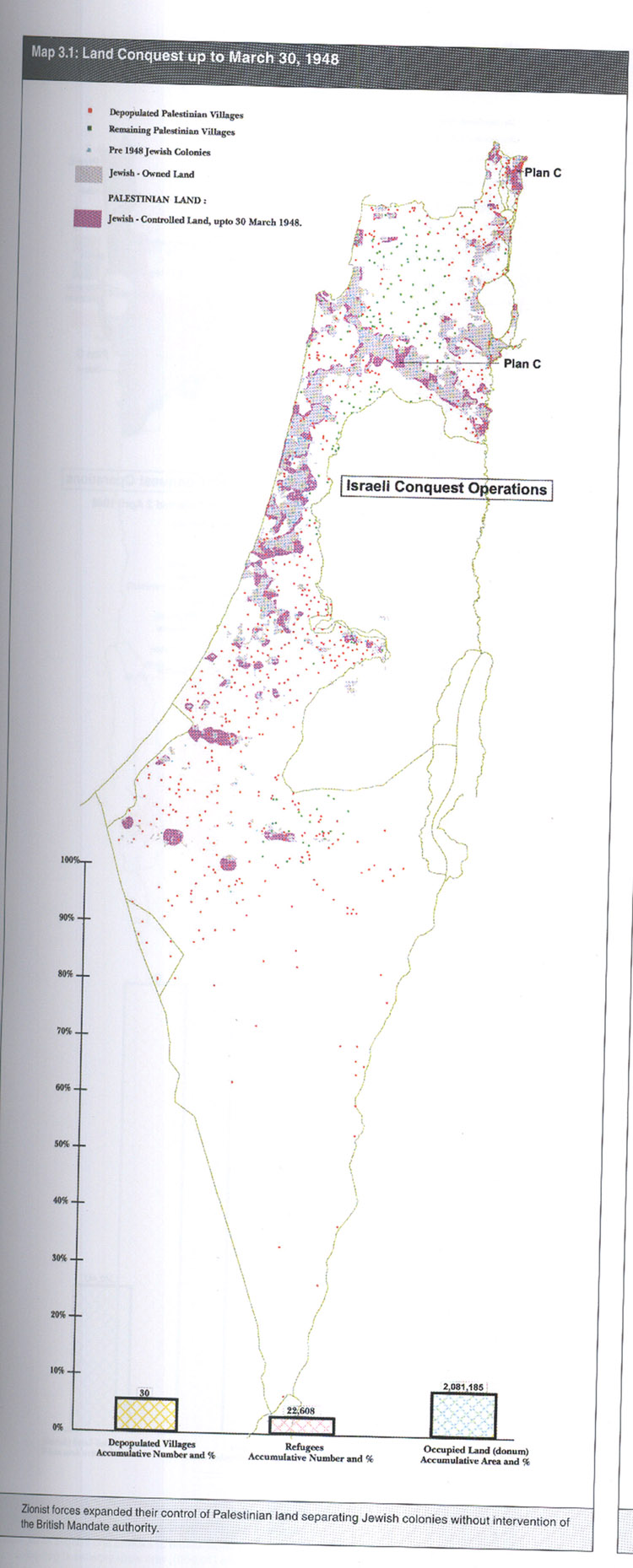
| This is an Map showing populated Palestinian villages, Israeli Colonies, and depopulated villages Palestinian villages up to March 30, 1948. Plan C is a military operation and on the map it shows where they were first implamented. On the bottom of the map shows a bar graph and gives a number and percentage of the depopulated villages, refugees and occupied land. |
Source: Salman H. Abu-sitta. Atlas of Palestine 1948. Palestine Land Society London, 2004