Please click on the Map to move to the next Map that shows a continuation of this map at a later date!
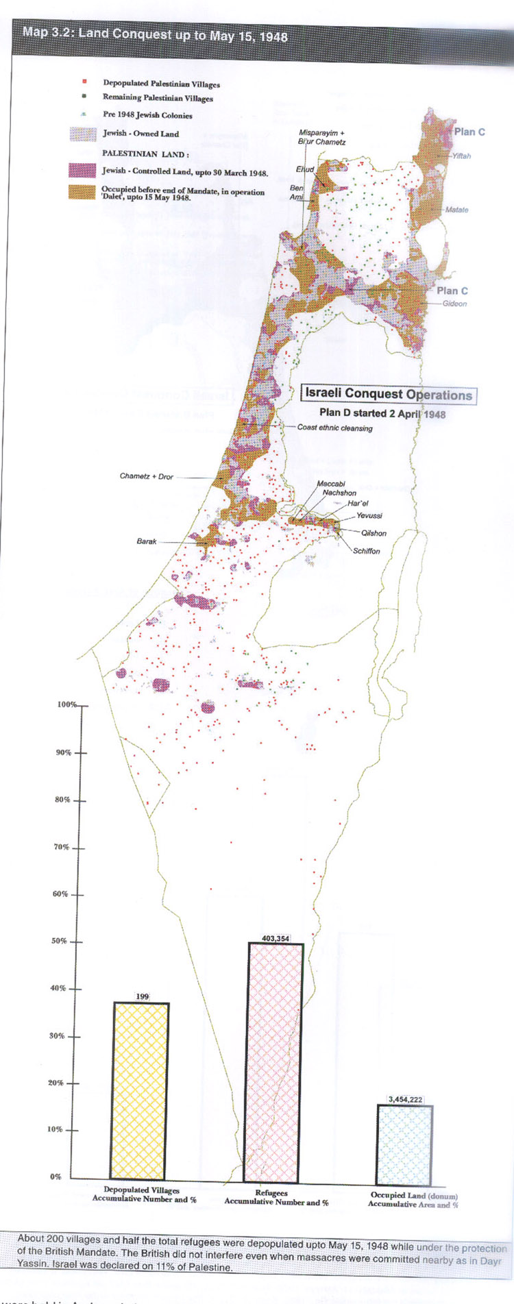
| This is a Map similar to the first one but two months later with the date of May 15, 1948. An increase in refugees and depopulated villages. This time period also includes the Massacre of Deir Yassin. If you noticed, there is an increase in Occupied land of Israeli Military gains. The new detail added to the map is the brown shaded region over the land if Israel/Palestine which represents Land that was occupied by the Jewish military before the end of the mandate through Plan D. |