South Manitou Island, Michigan
June 2, 2006
» lake, beach, forest, dunes, shipwrecks, and a journey through history
South Manitou Island sits in Lake Michigan and is part of Sleeping Bear Dunes National Lakeshore in northwestern Michigan. Besides the natural beauty of perched dunes, steep bluffs, forests, and prestine beaches, the Island has some other interesting aspects: numerous shipwrecks, a historically important lighthouse, and remnants of past inhabitants who farmed on the island.
North and South Manitou Islands form the Manitou Passage, a route many ships followed to shave 50 miles off their trip through the area and to escape storms over Lake Michigan. The bay on the east shore of South Manitou is the first natural harbor when sailing north out of Chicago and, historically, this bay was so popular in bad weather it was often referred to as the Forest of Masts. All of them did not escape the storms, however, there are over 150 known shipwrecks around the Manitou Passage.
Steamships also stopped at the island to refuel their boilers by chopping down trees from the forests. Only a few trees escaped the lumberjacks saws because they were either too hard to get to or too hard to chop down. These trees are now the largest Cedar trees in North America, and at over 500 years old, they pre-date when Columbus "discovered" America.
In the 1800s, farmers inhabited the island, taking advantage of the island's isolation from mainland pollens to grow specialized and prize-winning breeds of crops such as rye, beans, and peas. The old farm buildings, equipment, schoolhouse, and cemetary still remain today but the only inhabitants now are the park rangers.
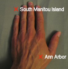
It's a very slow ride over to the island, the boat only travels at about 11 mph, making the 17 mile trip take 1.5 hours in good weather. However, the long journey will probably just make you appreciate your time on the island more.
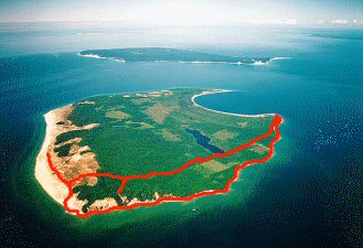
Once on the island, you only have 4.5 hours before the only ride off the island heads back to the mainland, assuming you aren't spending the night. So, we thought doing a 10 mile hike might be pushing it but we actually had an hour to spare at the end, giving us a chance to tour the lighthouse. The dunes were the highlight for me so I am glad we hiked all the way out there. Click here to view an aerial photo of the island showing where we hiked.
South Manitou Island sits in Lake Michigan and is part of Sleeping Bear Dunes National Lakeshore in northwestern Michigan. Besides the natural beauty of perched dunes, steep bluffs, forests, and prestine beaches, the Island has some other interesting aspects: numerous shipwrecks, a historically important lighthouse, and remnants of past inhabitants who farmed on the island.
North and South Manitou Islands form the Manitou Passage, a route many ships followed to shave 50 miles off their trip through the area and to escape storms over Lake Michigan. The bay on the east shore of South Manitou is the first natural harbor when sailing north out of Chicago and, historically, this bay was so popular in bad weather it was often referred to as the Forest of Masts. All of them did not escape the storms, however, there are over 150 known shipwrecks around the Manitou Passage.
Steamships also stopped at the island to refuel their boilers by chopping down trees from the forests. Only a few trees escaped the lumberjacks saws because they were either too hard to get to or too hard to chop down. These trees are now the largest Cedar trees in North America, and at over 500 years old, they pre-date when Columbus "discovered" America.
In the 1800s, farmers inhabited the island, taking advantage of the island's isolation from mainland pollens to grow specialized and prize-winning breeds of crops such as rye, beans, and peas. The old farm buildings, equipment, schoolhouse, and cemetary still remain today but the only inhabitants now are the park rangers.
It's a very slow ride over to the island, the boat only travels at about 11 mph, making the 17 mile trip take 1.5 hours in good weather. However, the long journey will probably just make you appreciate your time on the island more.
Once on the island, you only have 4.5 hours before the only ride off the island heads back to the mainland, assuming you aren't spending the night. So, we thought doing a 10 mile hike might be pushing it but we actually had an hour to spare at the end, giving us a chance to tour the lighthouse. The dunes were the highlight for me so I am glad we hiked all the way out there. Click here to view an aerial photo of the island showing where we hiked.
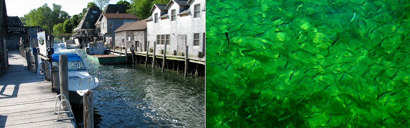
Left: Leland, where the ferry leaves from. Right: Tons of small fish swimming in the Leland canal. Every so often one of the fish would appear to go crazy, dancing erratically along the surface of the water, showing it's shiny silver sides (some sort of mating ritual?).
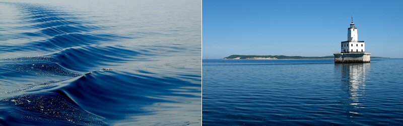
Left: Wake from the boat. Right: The North Manitou Shoal Lighthouse, marking the Manitou Passage.
Approaching Sandy Point on South Manitou Island where we would land and begin our hike through the forest, and over the dunes, to the other side of the island.
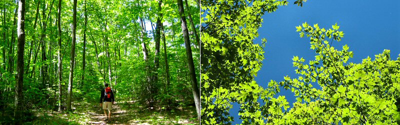
Left: Me hiking through the forest. Right: Looking up, the translucent green leaves were glowing in the sun, against a perfect blue sky (not really captured here). We came across 3 snakes in the forest but I did not manage to get a picture of them.

Some of the wildflowers along the trail. There were many more but they were hard to photograph because it was too bright in the sun and too dark in the shade. The flowers tended to be small but intricate.
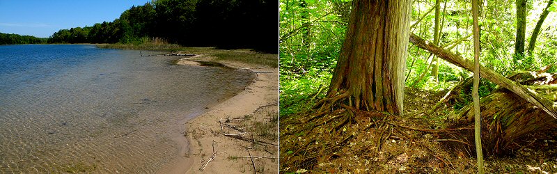
Left: Florence Lake, the only lake on the island. Right: One of the Giant Cedars. These trees are among the tallest Cedars in the world but if you have been out west and seen forests of Sequoias, then these trees may not be that impressive (the largest has a diameter over 6 feet and is about 100 feet tall). We actually turned around after seeing a couple because we were paranoid about missing the boat home and the first ones didn't look too impressive but maybe there were bigger ones around the next corner (note: some people love these trees so don't let me discourage you from visiting them).
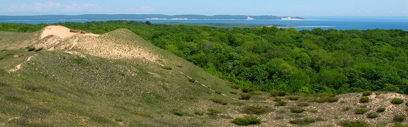
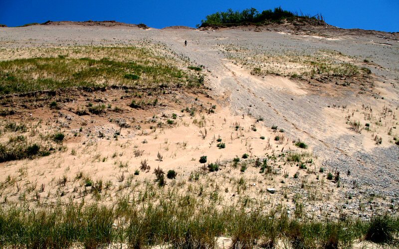
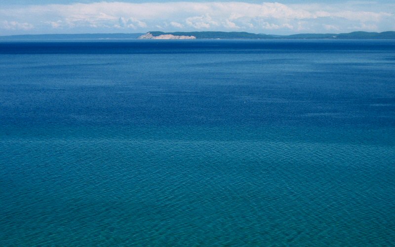
After hiking about 4 miles through forest, we climbed a hill and emerged on top of the perched dunes. This picture is looking back at the forest from the perched dunes with North Manitou Island in the background.
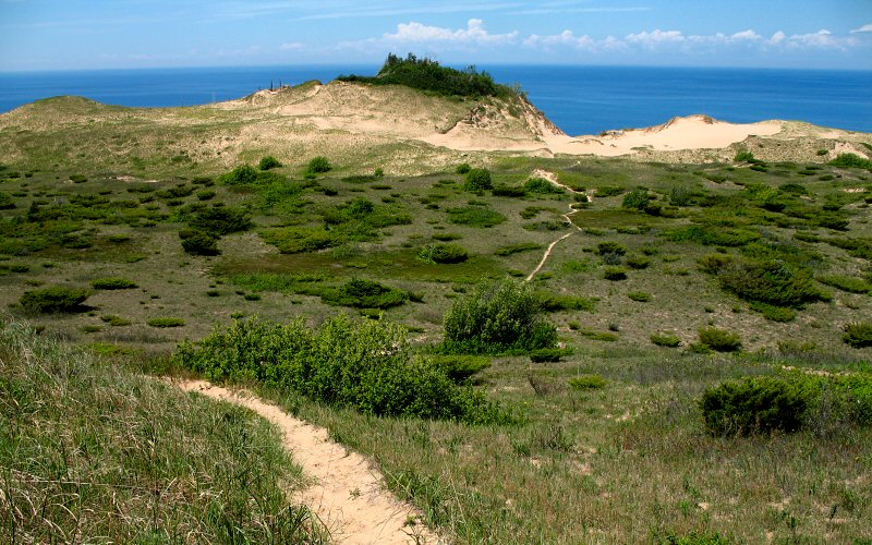
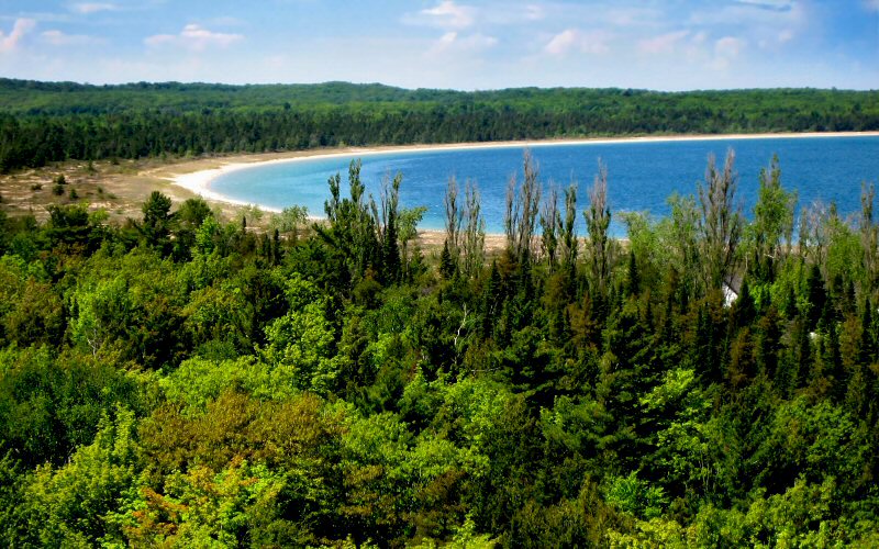
A glimpse of the brilliant blue waters of Lake Michigan could be seen over the dunes as we headed towards the western edge of the island. The high point of the island, known as the Island of Trees, is shown here. It reaches an elevation of 1,014 feet, about 434 feet above Lake Michigan.
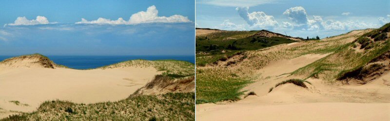
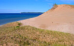
Left: A large sand bowl above Lake Michigan. Right: Looking back at the dunes we crossed.
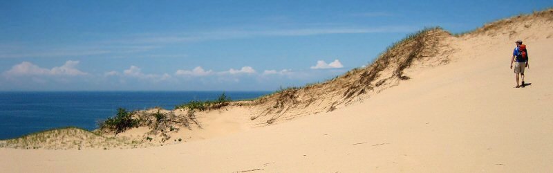
Hiking in the dunes. (Photo by Megan)
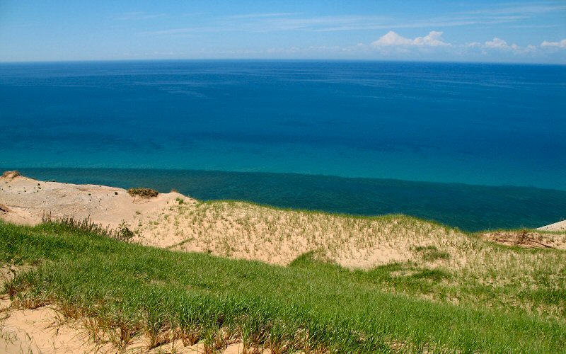
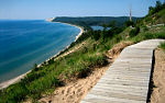
Finally, the top edge of the bluffs is visible below.
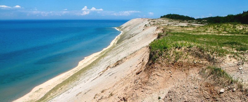
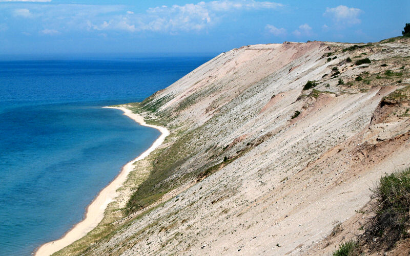
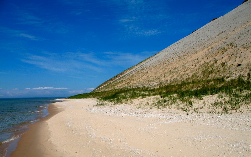
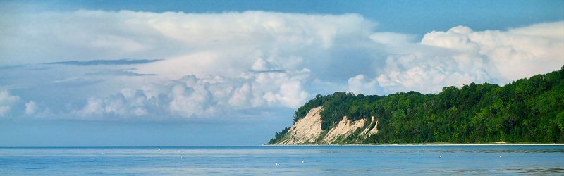
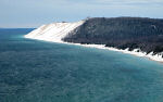
The bluffs, looking north. These bluffs rise over 300 feet above the waters of Lake Michigan.
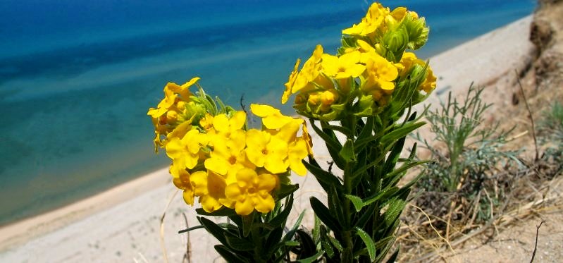
Flowers on the edge of the bluffs.
This point is the northern end of the bluffs.
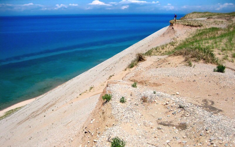
Me enjoying the view from the edge of the bluffs. (Photo by Megan)
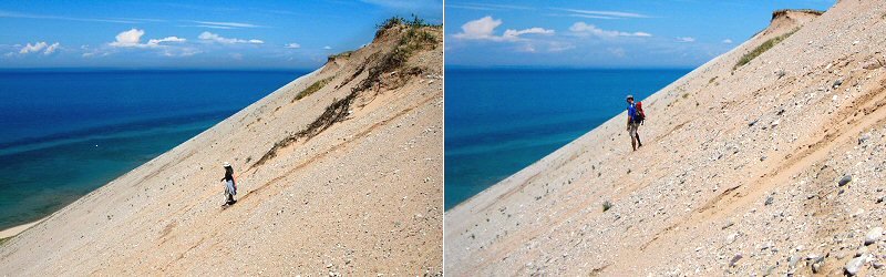
Hiking down the bluffs.
Me down on the beach. (Photo by Megan)
Megan hiking down the bluffs.
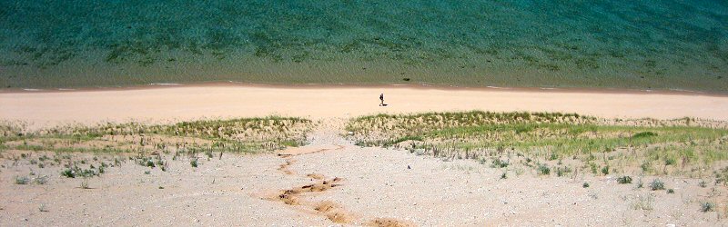
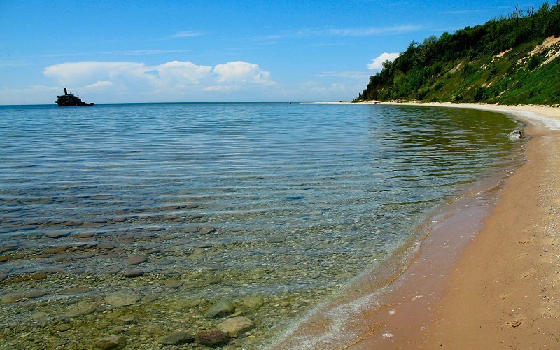
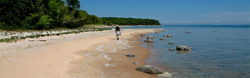
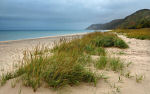
The beach below the bluffs. We followed the beach along the southern shore of the island to get back to Sandy Point.
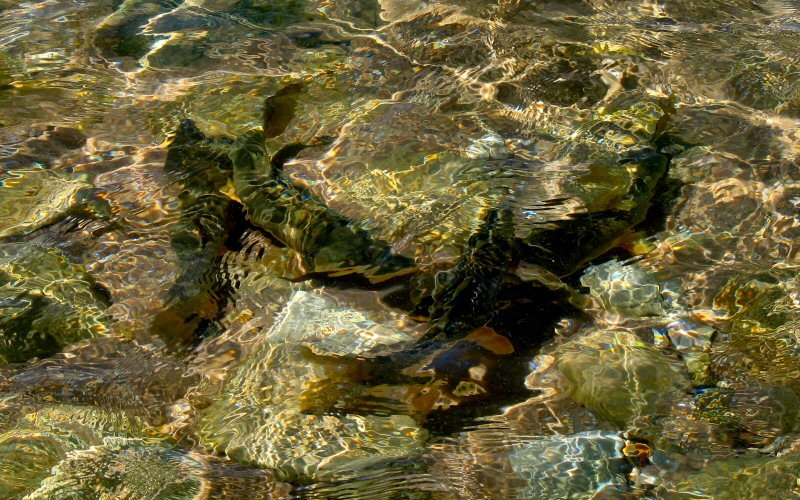
All along the shore below the bluffs there were big fish huddled in groups, seen above, through the ripples.
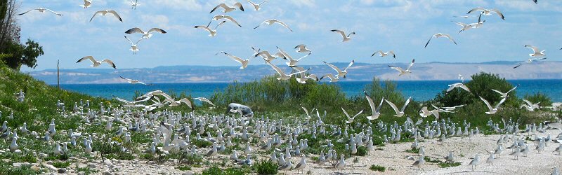
At the southwest point of the island we came across a Gull rookery, hundreds of Gulls sitting between the bluffs and Lake Michigan, leaving us no choice but to walk through them. This of course stirred them up, creating quite a sight.
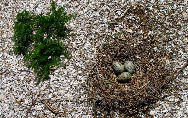
A gull nest with eggs, built on a bed of shells.
The Francisco Morazan freighter is the most visible of the over 50 known shipwrecks around the island. It ran aground during a fierce snow storm in 1960. The captain, his pregnant wife, and the crew were all rescued by the Coast Guard. In 1903, the Walter L. Frost, a wooden steamer, ran aground in the exact same spot.
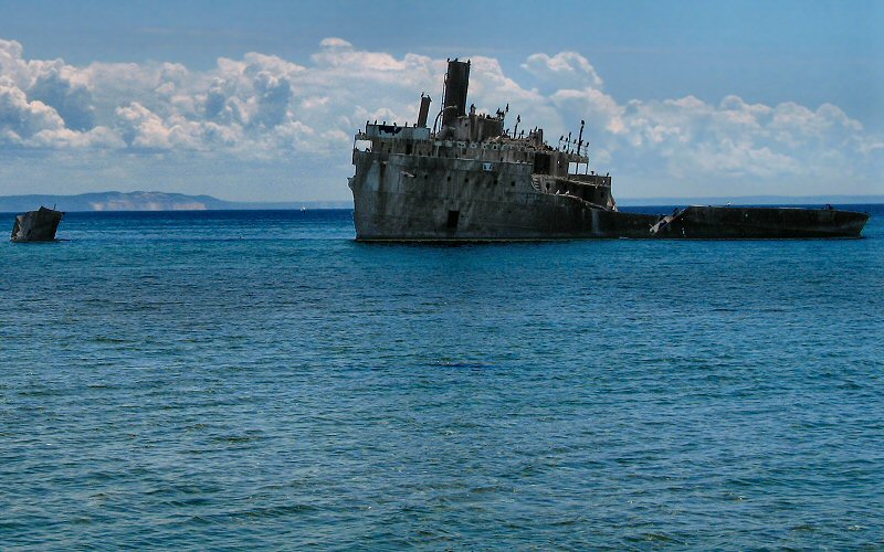
A closer look.
Megan hiking along the beach.
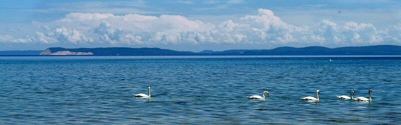
Swans.
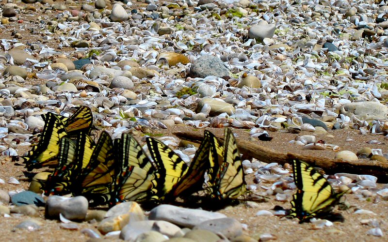
Eastern Tiger Swallowtail Butterflies were congregating along the shore.
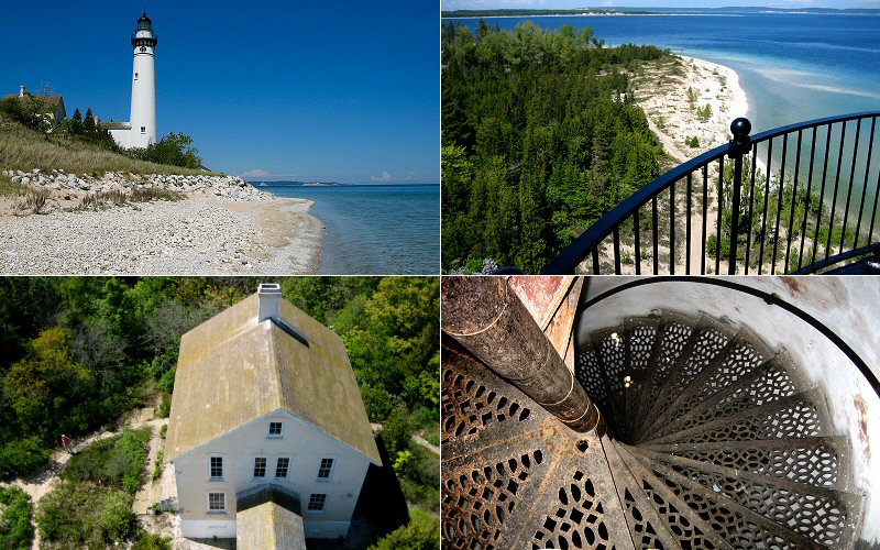
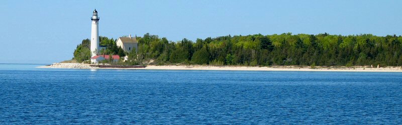
Views of and from the top of the lighthouse.
Looking towards the mainland (Pyramid Point), about 8 miles in the distance, from the lighthouse.
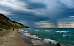
The bay on the east side of the island, where many ships sought refuge from storms.
Back in Leland, these bluffs are just north of the city.
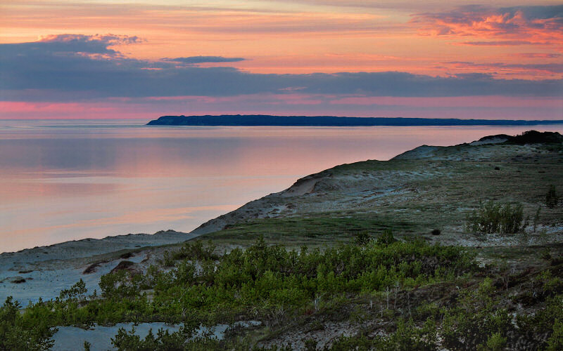
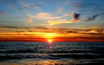
South Manitou Island at sunset, as seen from the Sleeping Bear Dunes bluffs viewpoint.
» all photo reports from lower michigan


Fall in Ann Arbor, Michigan
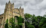
October 2011 Fall photos, mostly from around the University of Michigan campus. 

Nordhouse Dunes, Michigan
February 27 - 28, 2010 Winter camping in the Nordhouse Dunes Wilderness along Lake Michigan. 
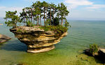
The Thumb, Michigan
September 6, 2009 Kayaking along the rocky shores of Lake Huron near Port Austin. 
Spring in Ann Arbor, Michigan
April - May 2009 Photos of bright colors returning to campus and town. 

Fall in Ann Arbor, Michigan
October - November 2008 A few attempts at capturing the beautiful fall colors. 
Frozen Coast, Michigan
February 16, 2008 Exploring the frozen shores of Lake Michigan, from Warren Dunes to South Haven. 
West Coast, Michigan
July 21, 2007 Checking out a couple of the beaches and towns of Michigan's west coast. 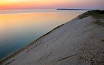
Northern Michigan
June 21 - 22, 2007 Canoeing the Pere Marquette River and checking out the Sleeping Bear Dunes area. 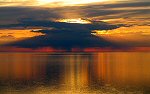
Northern Michigan
July 1 - 4, 2006 Checking out Grand Haven, Silver Lake, Sleeping Bear Dunes, and Traverse City. 


Northern Michigan
July 2 - 3, 2005 Hiking the Manistee River Trail, canoeing the Jordan River, and making a brief stop at Wilderness State Park. 
The Arb, Ann Arbor
January 2005 Pictures from the first big snowfall in Ann Arbor in 2005 when I skied from home to the Arb and fell into the river. 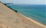

|
Sleeping Bear Dunes, Michigan
October 12 - 14, 2012 Unrelenting rain drenches our fall weekend trip. 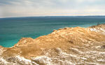
Sleeping Bear Dunes, Michigan
February 24 - 27, 2012 Winter photos from the Leelanau area, including Pyramid Point, Empire Bluffs, and Crystal Lake. 

Frozen Coast, Michigan
February 20, 2010 Checking out the frozen lakeshore of Lake Michigan at Warren Dunes, St. Joseph, and Holland. 
Fall in Ann Arbor, Michigan
October 2009 Fall color viewed mostly from a few tall buildings around town. 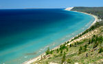
Sleeping Bear Dunes, Michigan
May 16 - 17, 2009 Enjoying springtime in Sleeping Bear Dunes National Lakeshore. 
Detroit, Michigan
March 7, 2009 Making a quick and rare trip to Detroit, checking out the haunting Michigan Central Station and a few other places. 
The Thumb, Michigan
January 31, 2009 Hiking along Lake Huron to see the rock formations and lighthouse near Port Austin. 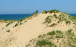
Nordhouse Dunes, Michigan
July 26 - 27, 2008 A quick overnight backpacking trip into the Nordhouse Dunes Wilderness Area. 
North Manitou Island, Michigan
August 11 - 12, 2007 Backpacking on North Manitou Island, enjoying the sunset, and watching storms roll off from Lake Michigan. 
Botanical Gardens, Ann Arbor
July 14, 2007 Checking out the flowers and interesting plants of the Univeristy of Michigan Botanical Gardens. 
Ice Storm, Ann Arbor
January 17, 2007 Pictures from around town after an ice storm coated all the trees in ice. 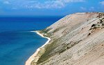
South Manitou Island, Michigan
July 2, 2006 Hiking to the sand dune bluffs on the west side of South Manitou Island. 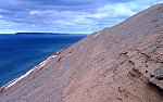
Sleeping Bear Dunes, Michigan
February 27, 2006 Hiking and skiing around the Sleeping Bear Dunes National Lakeshore. 
Sleeping Bear Dunes Area, Michigan
May 27 - 29, 2005 Kayaking on Lake Michigan near Sleeping Bear Dunes. 

Ross School of Business
Favorites My favorite photos of the Ross School of Business at the University of Michigan. |
Copyright 1995- Lars Jensen | randomspace@umich.edu |