| The
Map Realm The Fictional Road Maps of Adrian Leskiw |
 |
| The
Map Realm The Fictional Road Maps of Adrian Leskiw |
|
|
WELCOME! I have been an avid map collector and roadgeek ever since I can remember. From the age of 3 or 4 I have designed my own cities and nations and have since drawn a few hundred maps. A few years ago I began scanning some of my favorite maps and at first began updating them using a simple paint program, eventually upgrading my software and completely redrawing several of them digitally. Below you will find several of these digital maps as well as their hand drawn counterparts and a few extras. In the future I hope to add a few of my earlier maps and, based on the response to this webpage, perhaps add more recent ones as well. I hope you enjoy browsing! Please send me your comments or questions at aleskiw@umich.edu. |
 |
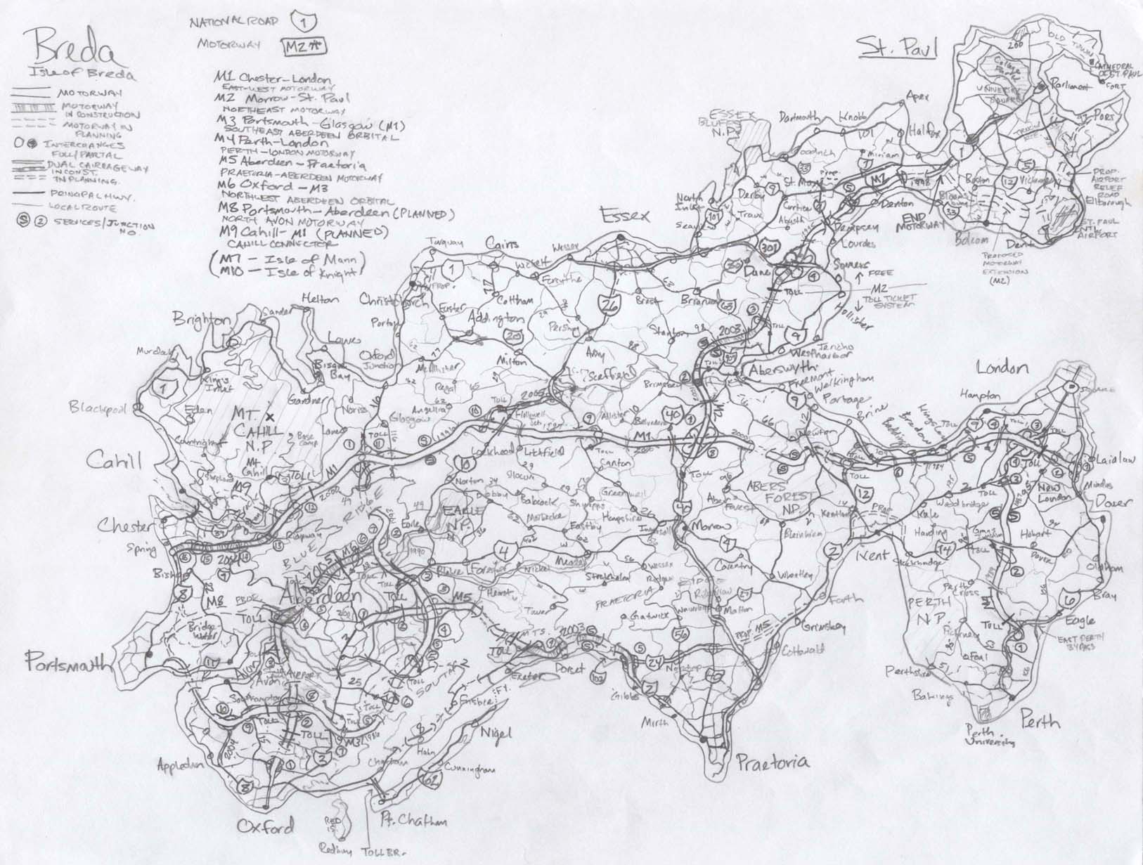
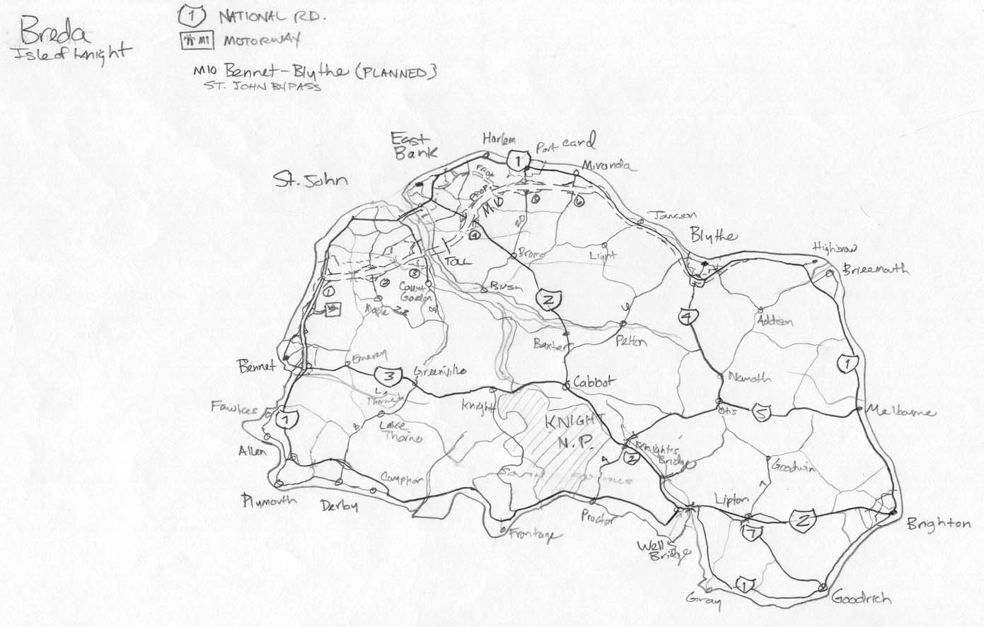
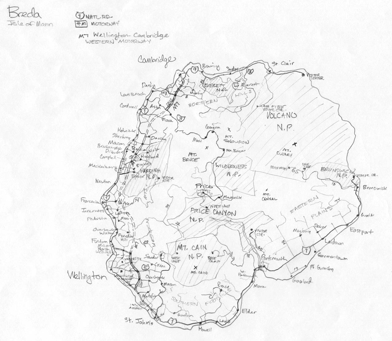
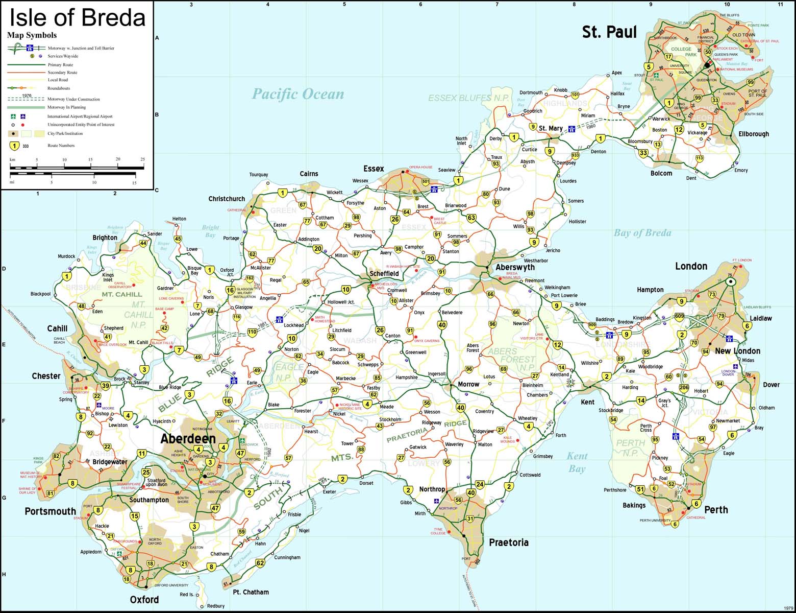
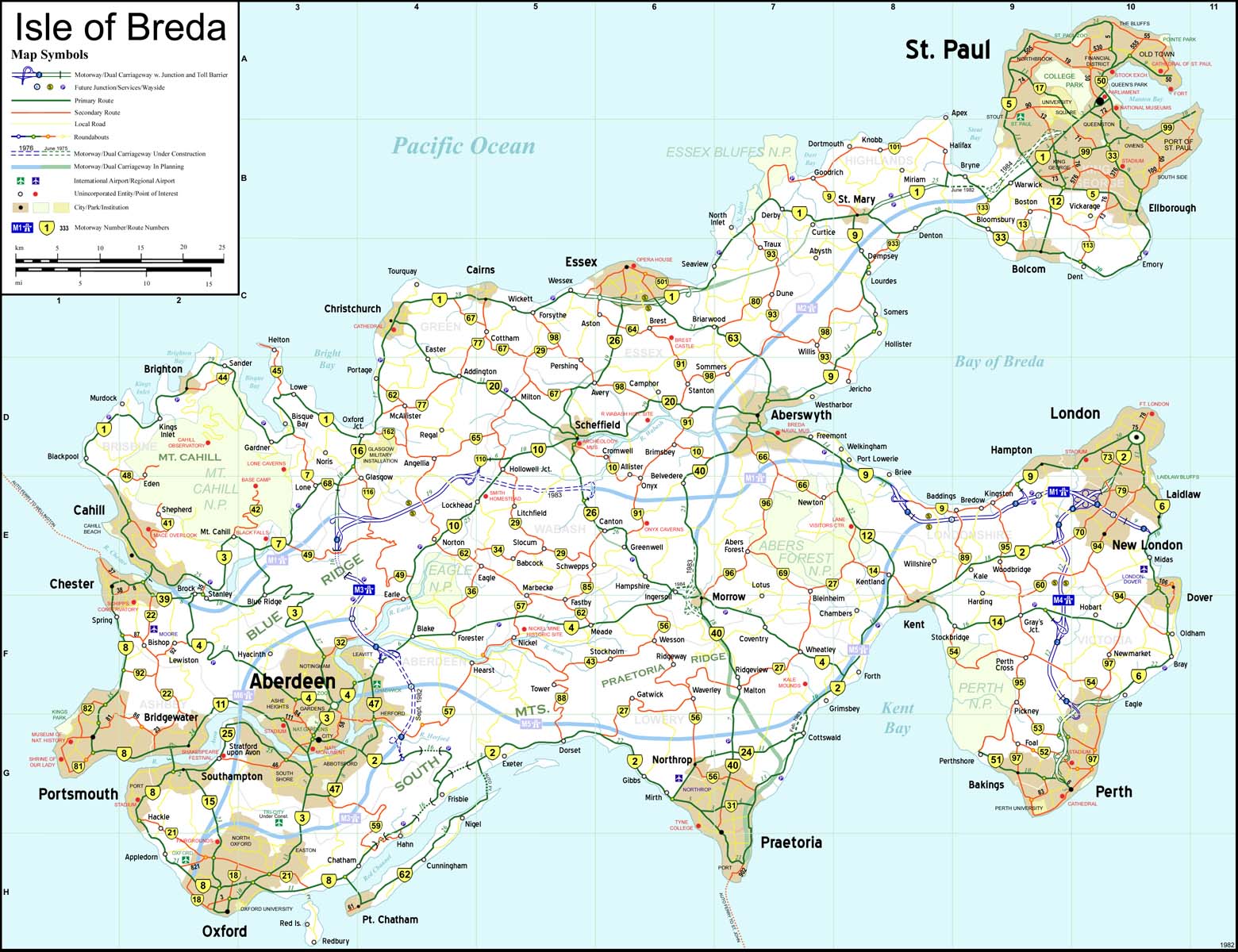
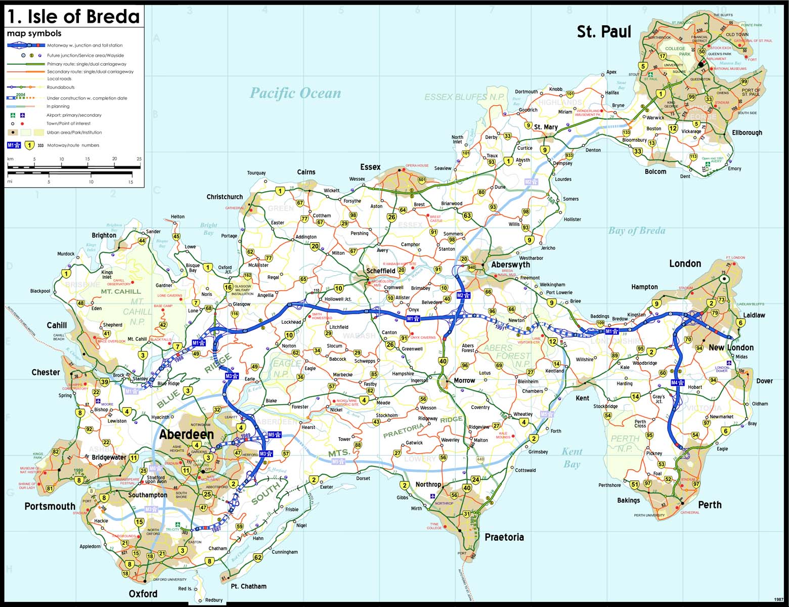
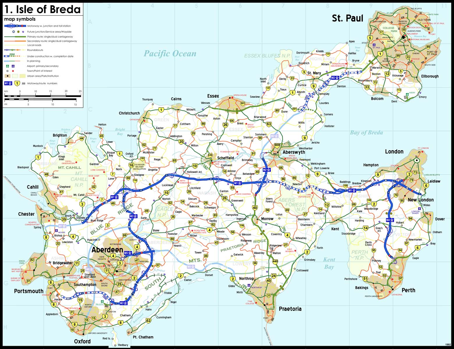
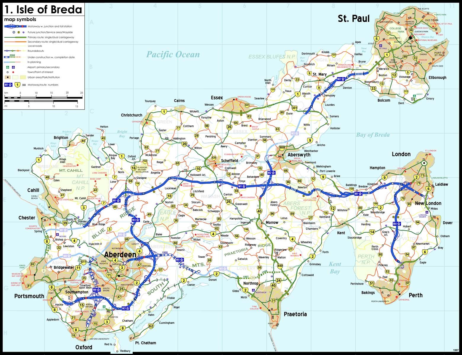
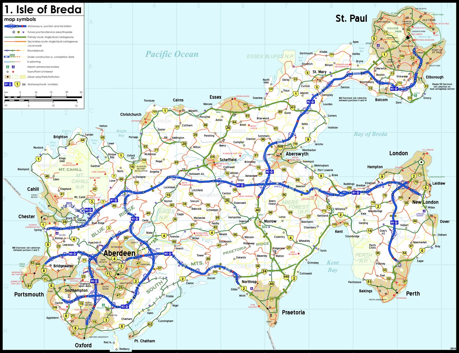
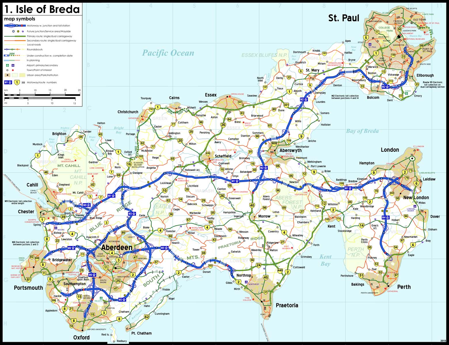
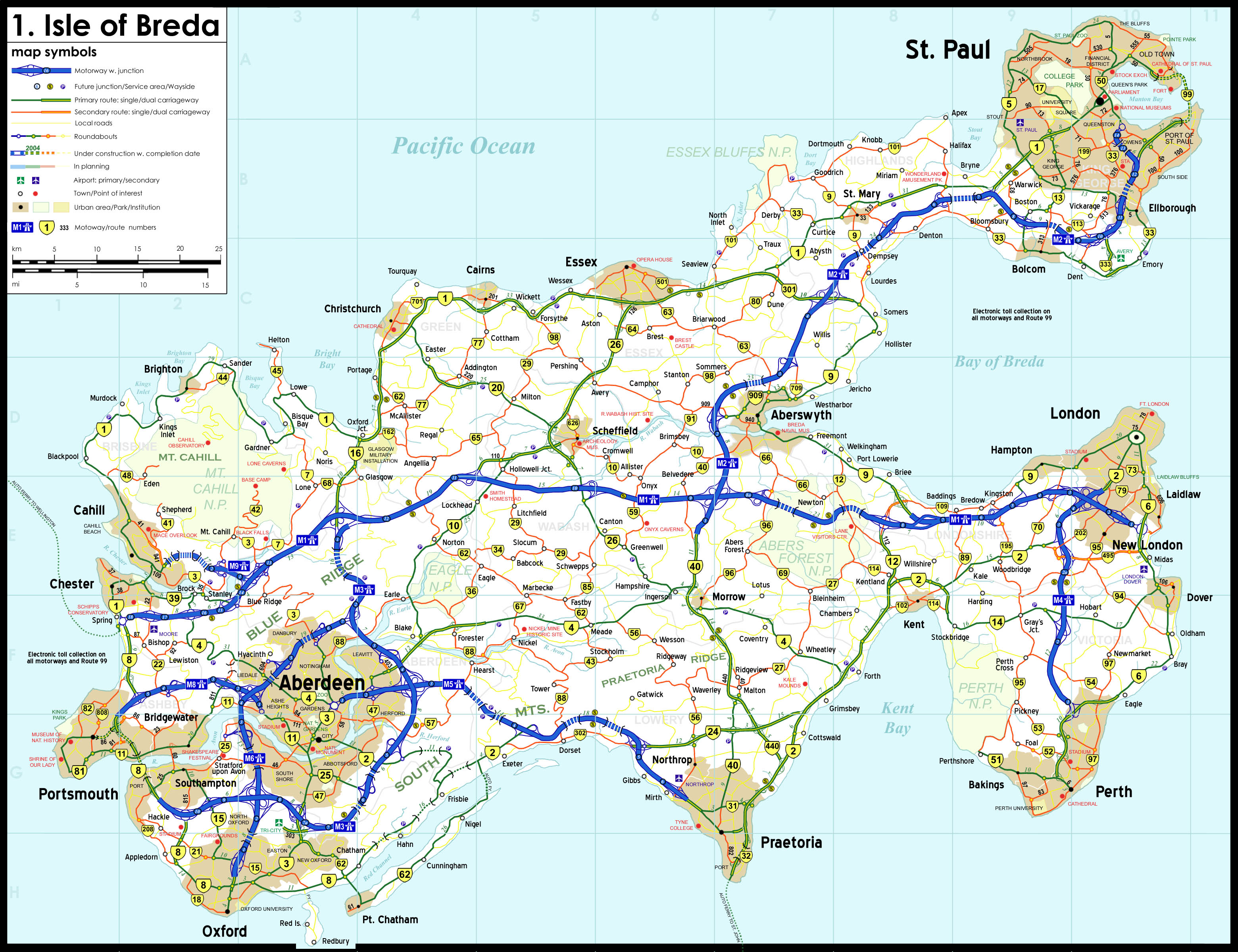
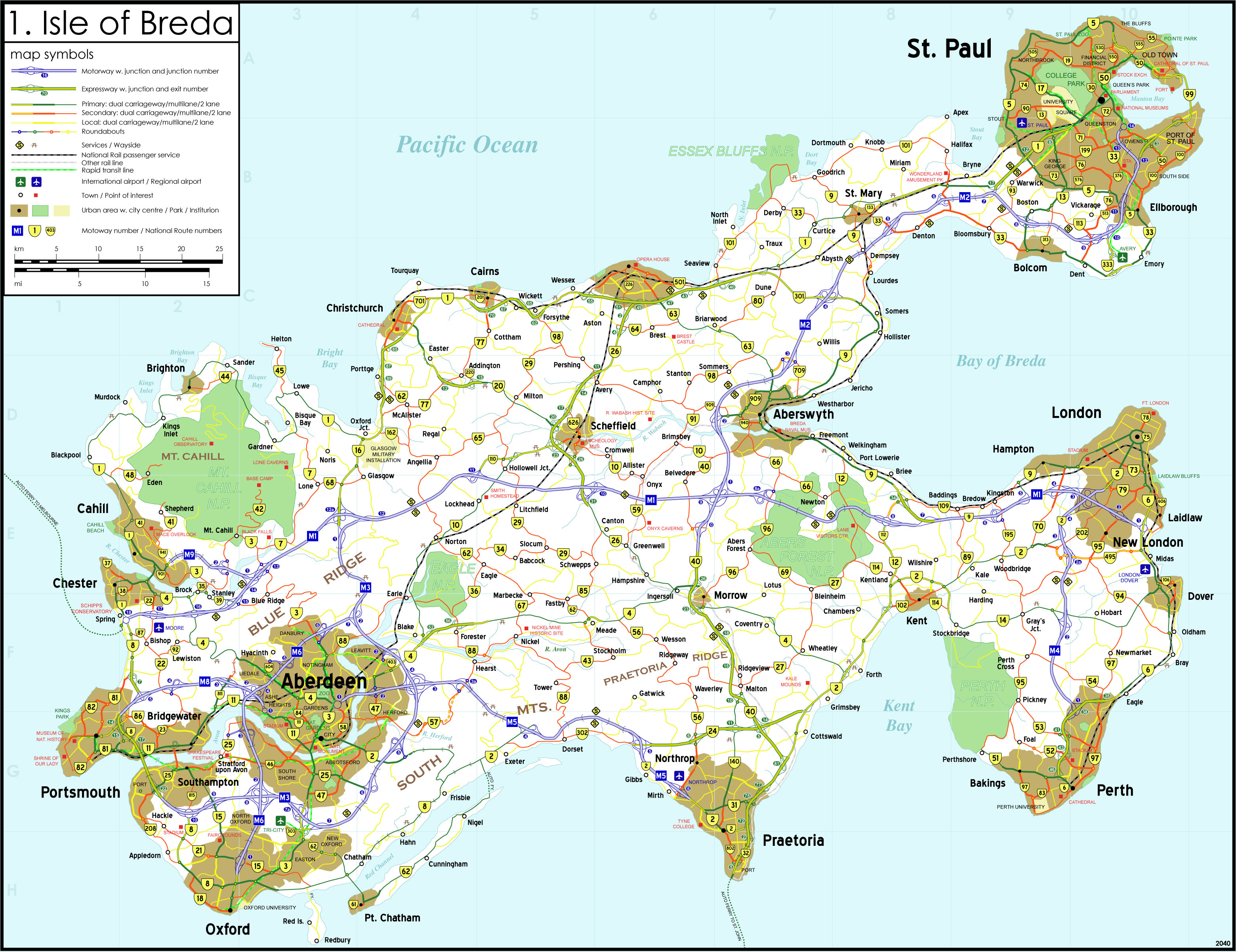
Nation of Breda My most recent project, this nation consists of three principal islands: Breda: the most populous island and home to the nation's capital city, St. Paul and largest metropolitan area, Aberdeen-Portsmouth-Oxford; Wright: the smallest and least populous island; and Mann: the largest island in area, but dominated by mountains and an active volcano and thus largely wilderness, although the western coast is densely populated and home to Wellington, the nation's third-largest city. The nation is located somewhere in the south Pacific and was most likely a British colony at one time and consequently roundabouts and European interchange designs are prevalent. The nation's roads are divided into five classes and each one is identified by it's own unique color-coded signage. Motorways are blue, primary highways are green, secondary highways are red, regional roads are yellow, and local roads are white. Motorways are identified by the label Mx beside the international symbol for limited-access highways, primary and secondary highways are identified by a black on yellow Australian-style shield affixed on the appropriate background color, and regional and local roads are referred to by name or primary destinations. All motorways and the Route 99/Manton Bay Tunnel are tolled. Prior to 2007 all motorways on the Isle of Breda operated on a system-wide toll ticket system, however the M2 extension. M8, and M9 were opened using electronic toll collection via overhead gantries and in 2025 the entire system on the Isle of Breda switched over to this system eliminating the need for toll booths. The M7 and M10 motorways employ mainline toll booths. Driving is on the left; distances are in kilometers; national speed limits are 120km/h: motorways, 90km/h: rural, and 40km/h: urban, however dual carriageways are usually posted at 100km/h and urban arterials at 60-70km/h. I began this map series in 2003
with three pencil drawings and then proceeded to scan these. After digitizing the 2003 map of the Isle of Breda I created a unique map for each year before, until 1979, and after, until 2024, by editing the base map and each subsequent new map, ending up with 46 unique maps (and possibly more in the future)! In the interest of saving space I have selected an assortment of 10 maps from this 46-year span in order to illustrate the development of the island's highway network. After finishing the 2024 map I began making multiple updates without going to the trouble creating a new map for each subsequent year and have tentatively labeled this iteration as the 2035 map. 3: Mann 2003 Digital (incomplete)
|
 |
Pellie Island, TSA My biggest project by far, these files represent only a fraction of my work on this island province of larger nation, the Treaty States of Aultica. 1995 Hand Drawn 2nd Edition 1997|Cover Hand Drawn 4th Edition 1998 Hand Drawn 5th Edition 2005 Digital 2005 Exit Lists PDF 2005 Motor Vehicle Permit PDF Central Pellie Island Hand Drawn PI Large Scale Digital (incomplete) Highway 2 Improvements Hand Drawn Highway 14/100 Interchange Hand Drawn Highway 6/100 Interchange Hand Drawn
|
 |
Dalton,
TSA/DNR Half of the coverage of this map includes the Province of Aultica, TSA which is the neighboring province to Pellie Island. 1997 Hand Drawn 2nd Edition 1998 Hand Drawn 3rd Edition 2001 Digital
|
 |
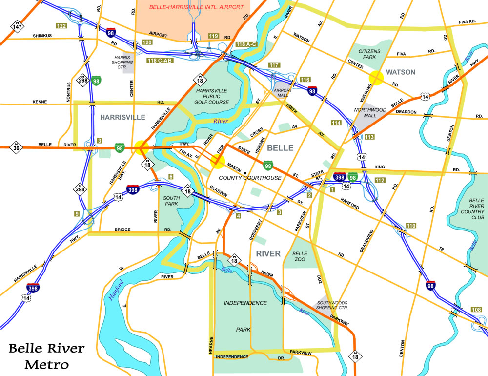
"Michigan" Cities Well, not quite. But these cities are set in a "fictional" Michigan complete with the familiar shields. Originally two of a dozen cities, these are the only two I have digitized as of yet. Belle River Digital Sanford Digital
|
 |
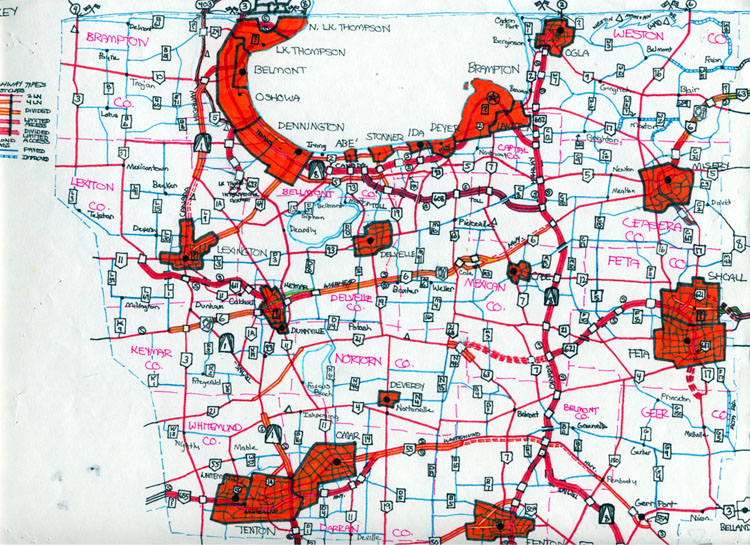
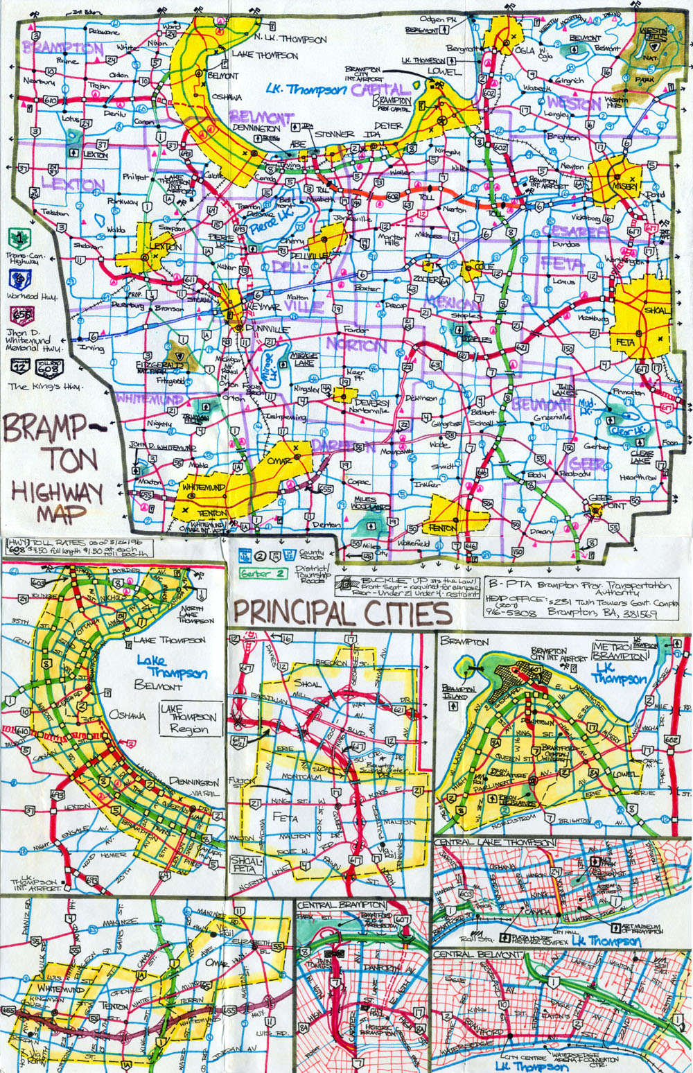
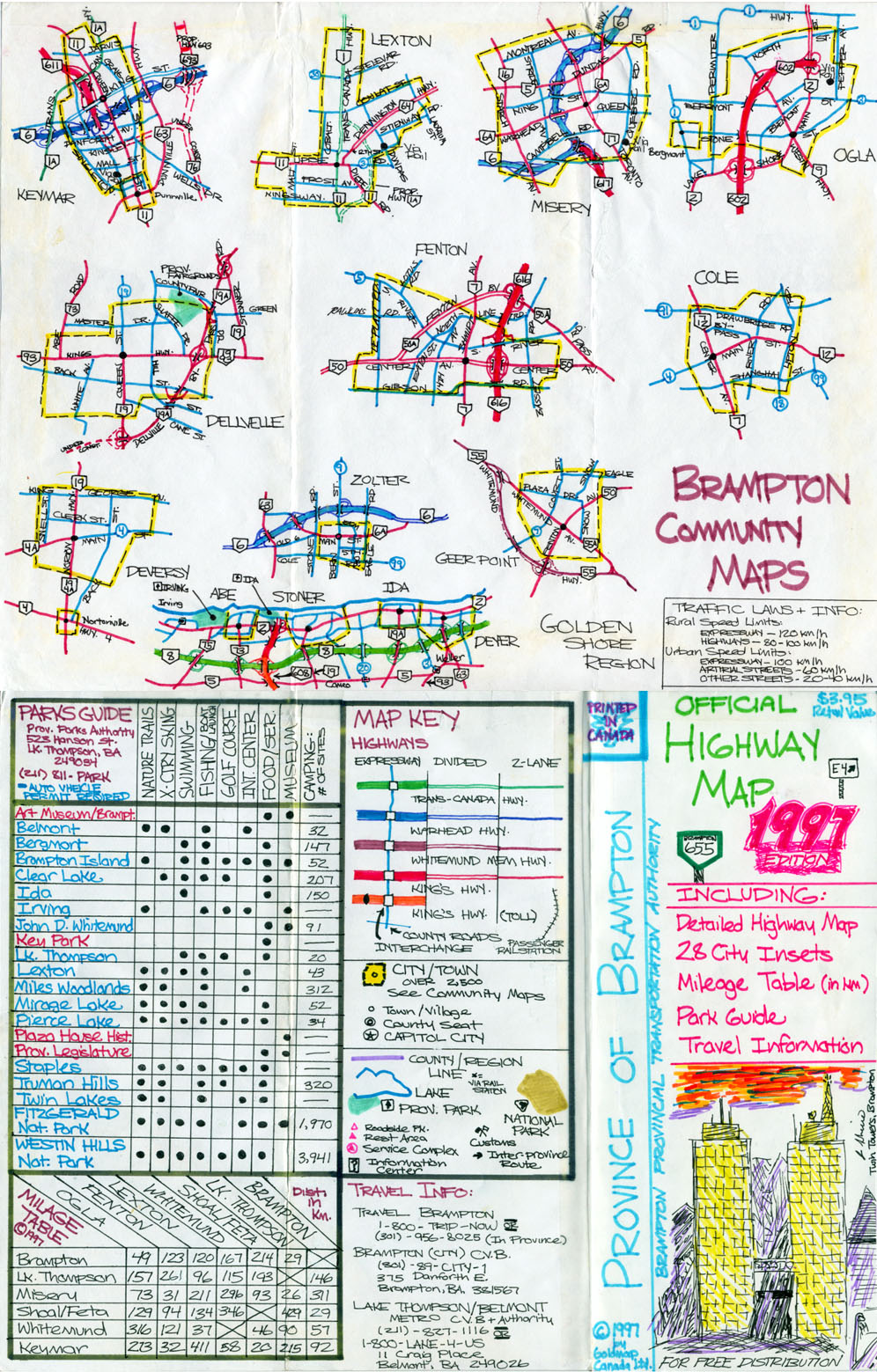
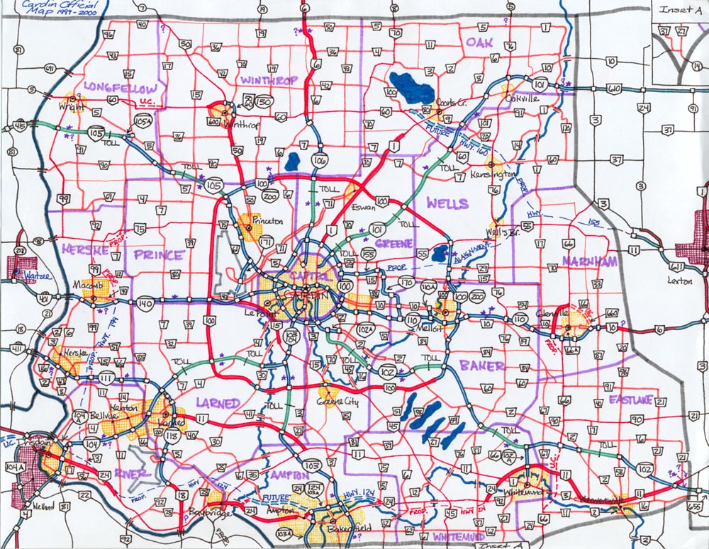
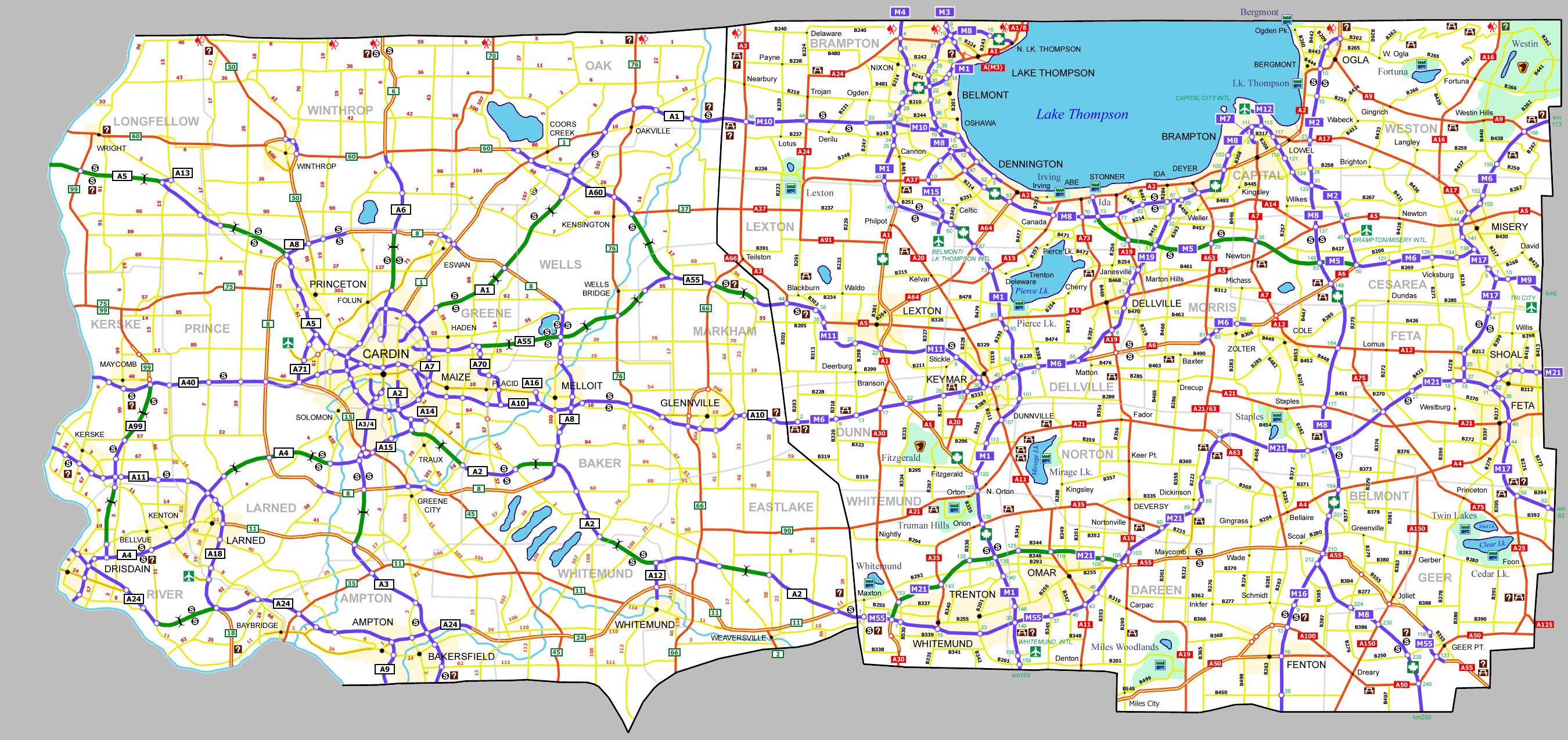
Brampton/Cardin
Provinces
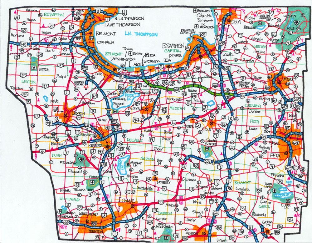
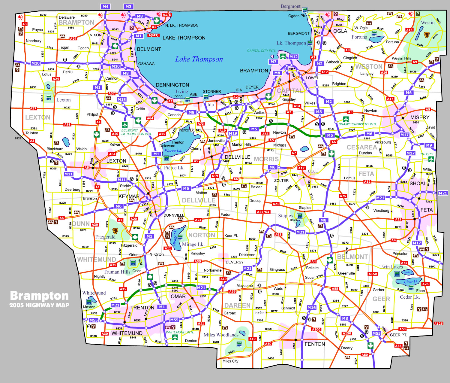
This road map is of the neighboring fictional Canadian provinces of Brampton and Cardin. You may notice that a few symbols used in the digital edition have been "borrowed" from the Ontario Official Highway Map.
Brampton 2nd
Edition Hand Drawn
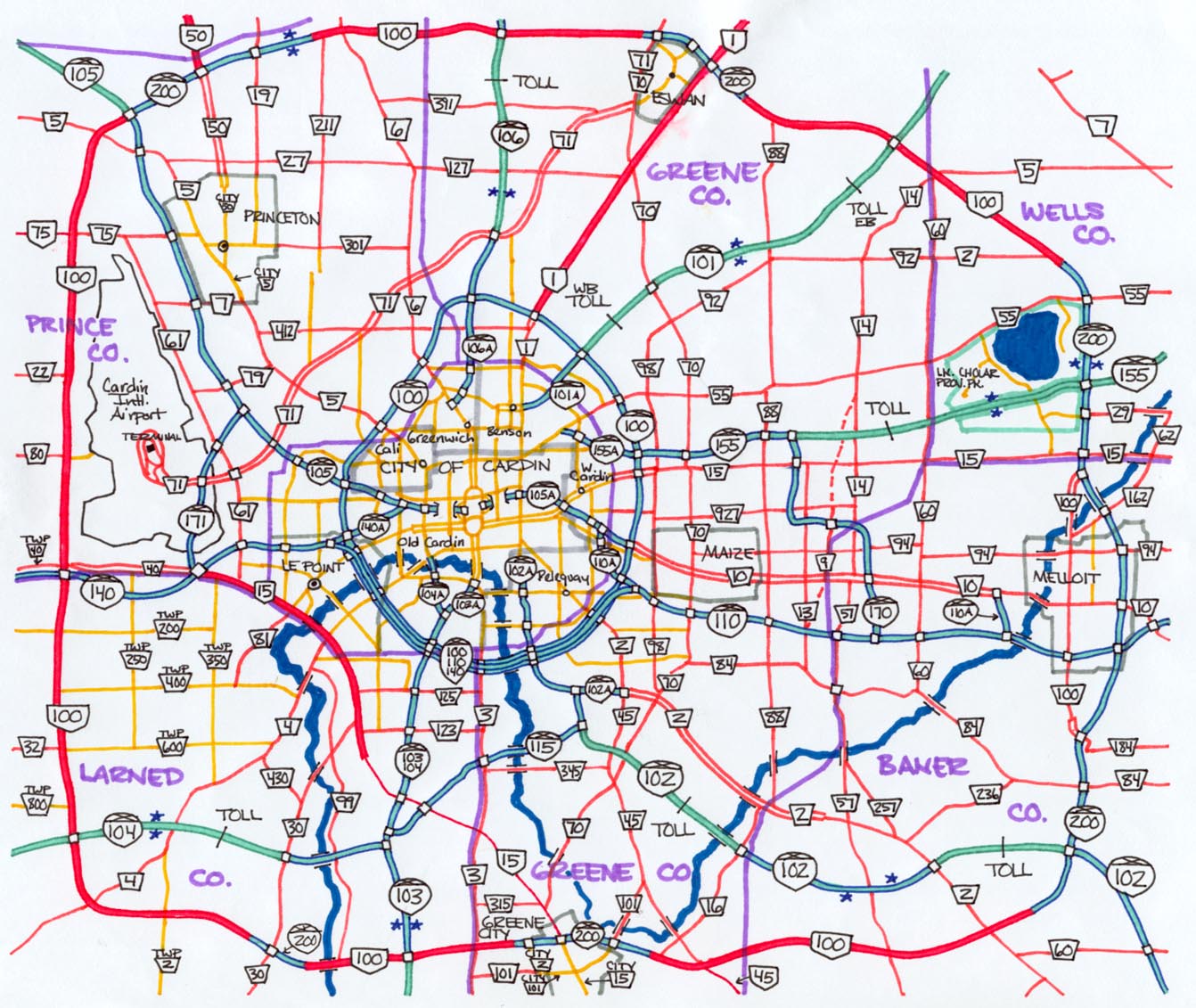
Cardin
City Region Hand Drawn
Cardin/Brampton Combined Digital
|
 |
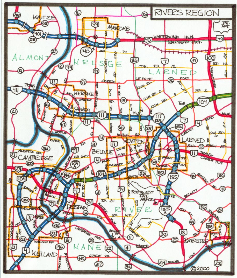
Highway E-11 Corridor The following are strip maps along the E-11 Expressway corridor, including two city maps and an exit list. Map
0 Hand Drawn Original
|
 |
Glenwood This city is located in the same country as above and is also along the E-11 corridor, but farther east than the strip maps above cover. Original Hand Drawn 4th Edition Digital
|
|
|
(c) 2002-2007 by Adrian
Leskiw |
|
Homepage | Official Road Map Site | Highway Photo Galleries | Links |