− Transportation Routes
Home | Timeline | Maps | People | Groups | Countries | Non-human actors | Bibliography
Map
1987 Map of Cyprus including British military bases, topographic features and buffer-zone between the TRNC and the Republic of Cyprus
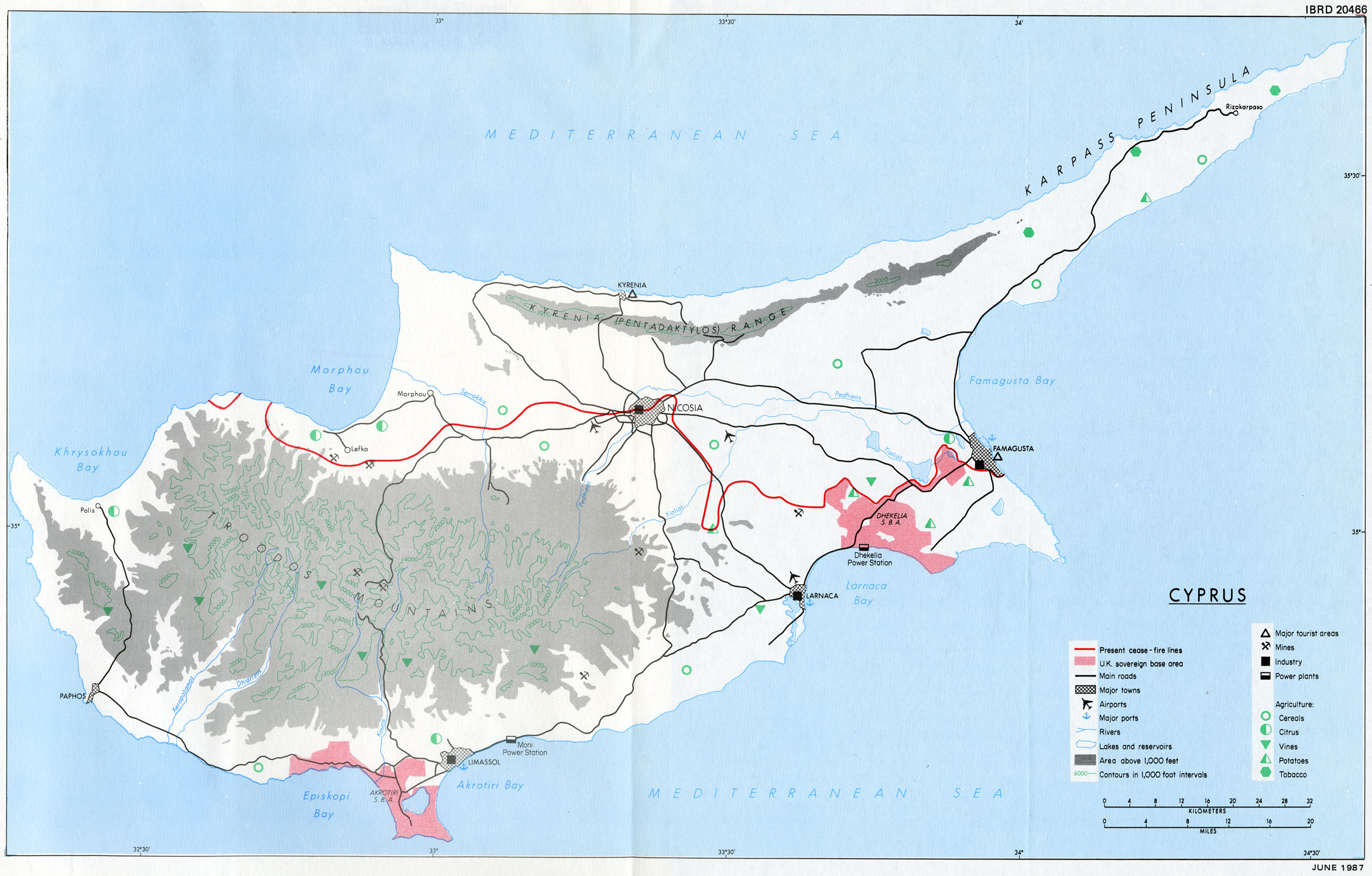
The variety of crops and areas of arable land are displayed along with the locations of major cities and the British sovereign bases.
Source: World Bank. Cyprus, a long-term development perspective. Washington, D.C., U.S.A.: World Bank, 1987.