− Maps
Home | Timeline | Maps | People | Groups | Countries | Non-human actors | Bibliography
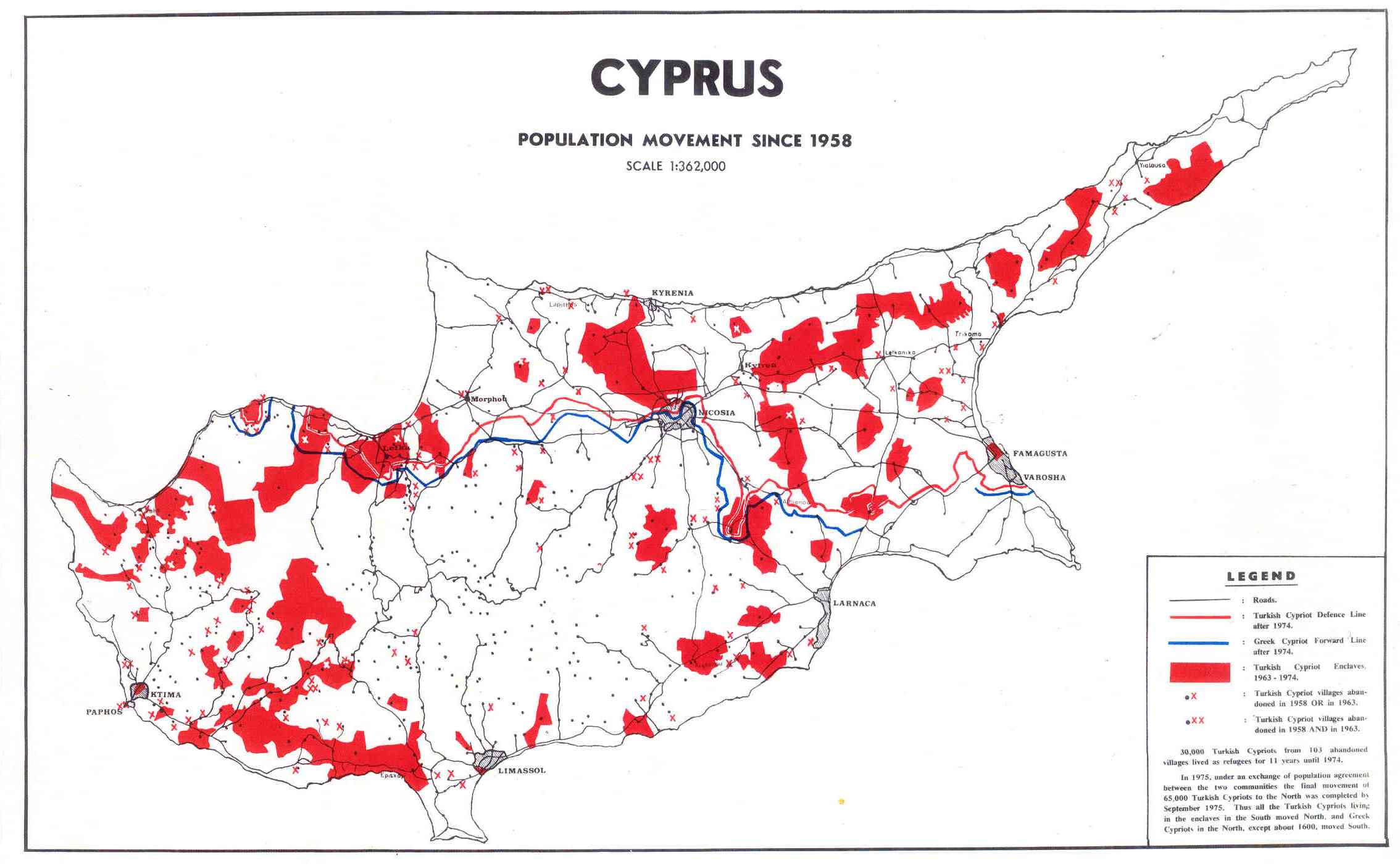
Turkish Population Movements after 1958

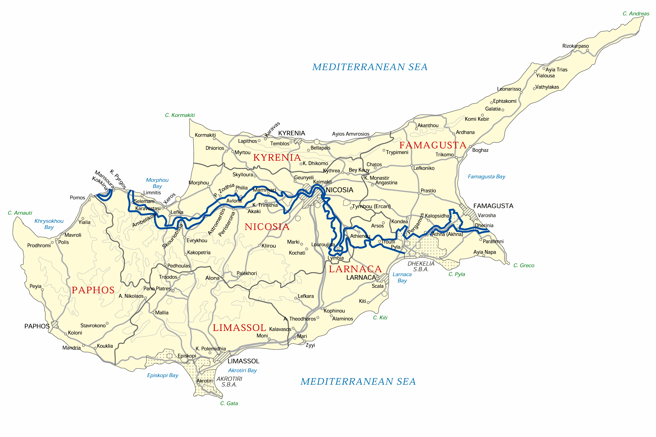
Map of Modern Cyprus

Source: Cyprus Maps from
CyprusNet Web Portal
View
Original link
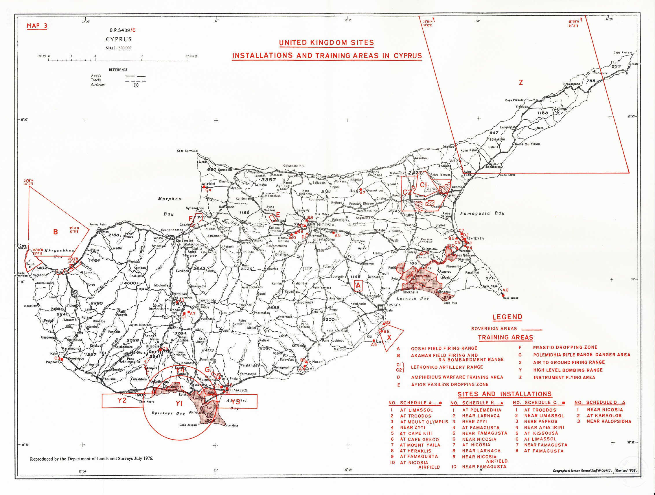
Population Movements of Turkish-Cypriots with British Military Base Overlay

From Google Map File. Download file.
United Kingdom Sites, Installations and Training Areas in Cyprus c. 1976

Source: Macris, Nicolas D., ed. The 1960 Treaties on Cyprus and Selected Subsequent Acts. Mannheim : Bibliopolis, 2003. Map no. 3.
View Enlarged Image with legible key
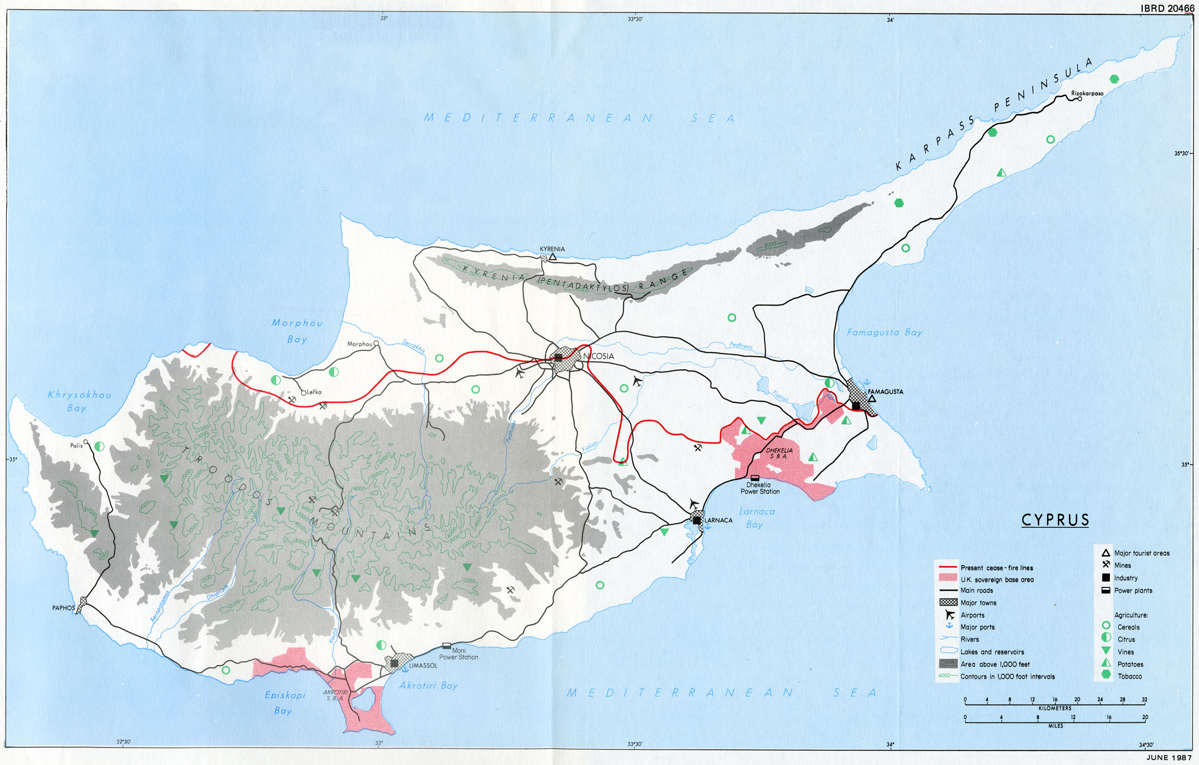
World Bank Map of Cyprus, 1987, including British military bases, topographic features and buffer-zone between TRNC and Republic of Cyprus
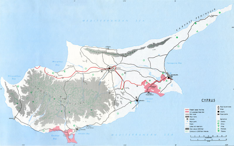
Source: World Bank. Cyprus, a long-term development perspective. Washington, D.C., U.S.A.: World Bank, 1987.
Baku-Tbilisi-Ceyhan Pipeline

Source: Wikipedia
UNHCR Map of Cyprus highlighting arterial raods leading to the British military bases
Cyprus_Atlas_A3LC.wor
Sources: UNHCR, Global Insight digital mapping - © 1998 Europa Technologies Ltd. The boundaries and names shown and the designations used on this map do not imply official endorsement or acceptance by the United Nations.
Geographic Information and Mapping Unit
Population and Geographic Data Section as of June 2003
GIMU / PGDS Cyprus
Printed: 01 June 2003
Email : mapping@unhcr.org