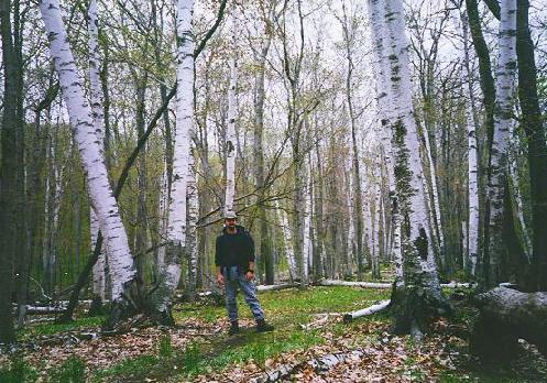
BACKPACKING ON NORTH MANITOU ISLAND, MICHIGAN
June 2, 1997
After spending last weekend on South Manitou island leading a troop of Boy Scouts, I decided to return alone to the more remote, North Manitou isle this weekend on my first solo backpacking trip. I have camped alone before, but it was always car camping, with day hikes, etc. I have never before walked into the woods alone with only my pack and my wits (well, most of them).
I arrived at the docks in Leland, MI on friday, May 30th around 11:45 am after driving 4 hours from Southfield to Traverse City, having lunch at my parents', and then driving another 40 minutes to Leland.
The local weather had called for rain all weekend, which I figured meant the weather would be nice. As it turned out, it rained all weekend downstate, but was clear and sunny all weekend on northern Lake Michigan.
When I arrived in Leland, I checked in with the Manitou ferry, paid $21 for the roundtrip and parking, and went out by the docks to wait in the fog.
I couldn't even see the end of the dock.
About a dozen others showed up to wait over the next hour. Most were couples, and there was one larger group of mixed 5th-ish graders and their chaperones. I figured they would be staying at the N. Manitou Village campground, which they did.
The boat finally arrived and boarded. We left around 1:00 pm. I slept most of the way there. I woke up to a rather loud 5th grader yelling "Land-Ho!!!!" from the bow. I checked my watch. 2:10. "Yep, this is it," I thought.
The couple sitting next to me were holding their packs on their laps, unlike the rest of us, who had stowed our backpacks in the stern in "fireman's brigade" style.
I heard them mention South Manitou, and asked if they were the reason the boat was heading directly to the smaller, more visited island to the south after dropping us at North. They had visited N. Manitou a few weeks ago, and wanted to try the south.
We each traded advice about where to travel on our respected islands, and they offered me a nicely laminated trail map of North. Thanking them, I bid them farewell, and headed for the ranger station for registration and "orientation."
No boat motors. (Lake Manitou is located in the center of the island)
No pets.
No wheeled vehicles (bikes, carts, etc.)
No ground fires ('cept in the Village Campground fire ring.)
No potable water ('cept at the pump by the ranger station)
Don't enter any buildings or structures.
Hang your food up to avoid loosing anything to the micro-bears (chipmunks)
and mini-bears (raccoons).
Be careful -- there are no ambulances to call!
Etc…
Same thing I heard last week at South.
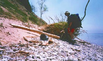
As soon as I got my permit signed and returned to me, I was off. I watched as the people all headed their own separate ways. Many headed west, towards the center of the island, where the lake was located (and the beautiful sunsets over Lk. Michigan.) Others headed south, towards the historic, abandoned homesteads (about 10 on the whole isle). A few headed north, towards the village campground. I decided to follow the smallest pack that way. 2:25 pm.
After passing the campground, everyone filtered off, except for a couple guys who were trudging slowly behind me about 400 yards. I picked up my pace and headed straight up the eastern shoreline path.
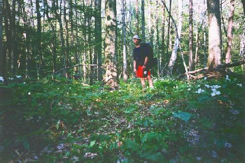
Almost immediately after leaving the main trail for a smaller side trail (to stay along the coast, I saw a raccoon, frolicking in a patch of trilliums, in full bloom. He was a little camera shy, and I was too slow with my camera case to get a good picture though. I immediately moved my camera to my hip, where it would be ready for next time.
I looked at the topo-map and decided to make my first destination a small pond labeled "John Maleski." Since it was located next to the "Paul Maleski Place," I figured they were probably related....
The pond looked more like a tide pool on a rocky ocean beach, except it was all fresh water. It was located at the north-eastern most point on the island. There were hundreds of seagulls, though they could barely be heard over the thousands of frogs/peepers, chirping loudly in the pond.
"What a strange mixture of ecosystems," I thought as I hiked the stone-covered isthmus separating the pond from the lake.
I looked back toward the trail, up on the ridge above me, and saw the two guys, trudging slowly up the hill to the next ridge. I wanted to see which way they were going, as the trail forked ahead. I figured I'd go the opposite way, because I didn't want to be hiking up on them. By the time I reached the top of the ridge, they were standing there, resting. One of them was looking at a map. I asked which way they were going.
One direction followed the whole north ridge (according to the topo), but faded off the smaller trail maps they were using.
The other direction headed back toward the main trail. They said they were gonna take a minute to decide, so I bid them a good day and headed for the north ridge trail. I think they just wanted to see where I was headed, so they could go the other way. Funny how that works out.
I won't say that I regret taking the north ridge. I will say that I won't be doing it again. And I don't recommend it to anyone else during the "leafy season".
The trail quickly dissipated into a deer run (there are many deer on the island), and then into nothing. This was almost the slowest I travelled all weekend. I zigzagged through heavy brush with a full pack, on a ridge 80 meters above the beach. This was not fun, but I'm sure the deer were thankful that I cleared their path for them. Ironically, the only pin I have attached to my pack reads "Don't be a meadow stomper -- stay on the trails!" Ugh.
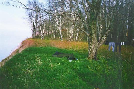
Eventually, I burst into a small clearing of grass with a minor trail leading through it. It was completely surrounded by heavy brush on three sides, and a dune-cliff on the other side. It would have been difficult to get down the dune to the water with my pack. It would have been almost impossible to get back up.
No matter. I didn't even WANT to go down, since I had plenty of water for that night.
It was obvious that someone had planned this. There was plenty of shade, being almost exactly in the center of the north ridge.
There was even a burn scar in the ground where a campfire once burned. The rangers had cleaned it well, though, as it looked like it hadn't been used in years, and I couldn't find any solid coals in the hole. A small tree had even sprouted near the center of the fire ring.
The park service has owned and operated the island since 1970, but they didn't really start "running" the island until a few years later.
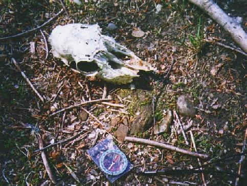
Hunters probably used the site. There is a special deer season for N. Manitou. The island was stocked with deer long ago, and they had begun to overrun the island. I didn't see any on the island, but I saw many, many tracks and plenty of deer scat. Unfortunately, the only live deer I saw was on the side of the highway on the way home.
The time was 5:30. Looking at the topo, I decided to camp here. I couldn't tell if I was 300 ft from the shoreline, (another rule) but I figured if you counted the elevation change, I was far enough away.
I had hoped to make the Northwest edge of the island before camping, but from the looks of it, there weren't many clear areas to camp between here and there.
The NW corner of the isle is called "The Pot Holes" for the three enormous breaks in the ridgeline at that point. I was about a mile short of there, but about two or three miles to the nearest known camp.
Plus, from here, I could head straight down the trail to the main trail in the morning, if I decided to skip the Pot Holes today. I had enough of this bush-wacking. I figured I had about 2 to 2 1/2 hours until dark, and I didn't expect to be able to see the sunset, being on the north ridge of an island which is above the 45th parallel.
I setup my bivy sack and strung my bearbag line to hang my dew-soaked socks and pants. I cranked up the heaviest item I was carrying, my newly acquired Coleman single burner stove. Man, was that thing heavy. What I didn't realize when my dad gave it to me (this was my first in-the-field test) was that it really cranks out heat! It took some tweaking at first, but once it got going, I had two cups of water boiling in about 2.5 minutes! I hadn't even pulled the ramen out of the bag yet, and the water was boiling over. Hooooo waaaah!
Had I known this, I wouldn't have brought the extra fuel. The tank held more than enough. Oh well, I always overpack something. At least I planned my clothing well....
I sat and slurped my soup with my feet dangling over the ridge, watching the swallows do their thing in the trees above me. What do the bees have to do with this?
I heard a screech and looked up to see a bald eagle soaring over the bluffs. It made the sleek gulls look pitiful in comparison. Just before I finished eating, I heard a "whoosh," like the sound of a car passing you when you're standing on the side of the highway. I looked up and saw a duck, dive-bombing towards the shoreline. He had just missed the top of the tree I was sitting beneath. Just before he hit the water, he spread his wings and landed gently next to a few other ducks. I imagined he had just flown from Lake Manitou to Lake Michigan.
I rinsed the pot out and drank the water. I put everything away in my pack and covered it with a plastic bag. I never zip the pockets up at night. Even though all the food was hung up, if a raccoon really wants into my pack for some reason, he's welcome to chew through the garbage bag, not my new Jansport. I could just hear the Chipmunks crying out, "Hee hee! There's a million of us, and only one of you! You can run, but you can't hide your food!"
I sat in the last bit of sunshine (North ridge?) and read Daniel Defoe's Robinson Crusoe. Appropriate. I started it at Summer Camp last year, left it in my camping gear, and didn't find it until last weekend while preparing for S. Manitou. Luckily, my bookmark was right at the part where Crusoe reviews his daily log thus far -- like a recap of everything that's happened since being marooned.
If you are interested in hearing about what an idiot I am, read on, otherwise, skip to the next section.
*********************************************************************
begin Scott's Brainfart #1:
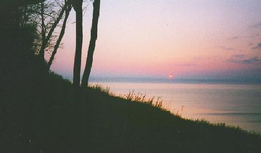
Just before 9:00 pm, I realized that I was watching the sunset. This boggled me. (My flask of Jack Daniels may have helped with this task as well.)
I have been orienteering since I was a little scout. I could SEE most of the north ridge of the island, and it was shaped exactly as the maps showed. I got out all three of my island maps, and found my location on each. I knew EXACTLY where I was. Dead center of the north ridge of the island, due north of the Stormer Camp, on a secondary trail which ran right thru my camp. I was 110% sure of my location. But at this point, My view should have been directly north, or maybe slightly to the east of north. The Pot Holes, to my west, were actually the northern-most point on the island. At this latitude, even though it was nearly June, the sun should have been in the SOUTHWEST, right?
I felt like a moron. I still do. I thought about everything I knew about global cartography, astronomy, and atmospheric refraction. Christ, I have a degree in physics and in engineering, and I work with Geographic Information Systems every day! I should be able to figure this out.
I took another bearing on the sunset. 307 -- every time. I checked it with the ridge line, and later the north star. The compass is right. 307. That's West-Northwest. That's impossible. I'm north of the equator, so the sun should be always to the south. Check it again. 307.
Now I know what some of you are thinking. Magnetic declination? Well, according to the topo, the error in magnetic north was only -3 degrees, 30 minutes. That's only 3.5 degrees to the west, which helps a little, but even 303.5 is way north of 270, due west, and well above west-southwest, where I expected the sunset to be hiding.
Even if it was magnetic declination, the maps couldn't ALL be wrong. There is NO WAY that I can be looking anywhere south of west because of the ridge. This was obvious even without a compass. The topographic map is TRUE north oriented. AND YES, I was on the north ridge.
"Use and Trust your compass." -Orienteers' Law
This reminds me of when one of my scouts was leading us by map and compass into the Waterloo Rec Area. It took us about 3 miles to figure out that his compass had been somehow REVERSED. Red arrow pointed DUE SOUTH. This is another story, though.
My other thought was that my elevation was throwing my view off. But I was only 80 meters above the lake, and I was watching the sun dive into THAT lake.
The only way I was able to put my mind to rest was to reason that it was a combination of
a) my ignorance for having NEVER thought to actually take a bearing on the sunset before.
b) elevation (80 meters above Lk. Michigan or about 250 meters above sea level)
c) atmospheric refraction of the sunlight. It is greatest at sunset/sunrise.
and maybe...
d) changes in the magnetic declination (very slightly)
It wasn't until I got home, drew a 3-D diagram of the earth's solar terminator, and consulted with a PhD friend (thanx, Ken!) that I realized that it was due to my latitude. At the Arctic Circle, in late June, the sun reaches it lowest point at due north, then begins to rise again.
This really makes me feel stupid because I was only about 12 miles north of the 45th parallel. I was RAISED (and taught orienteering) in Traverse City, about 15 miles south of the 45th parallel. I should have figured this out. I guess, living at the south end of Grand Traverse Bay, I never paid attention to either sunrise OR sunset that much.
End Scott's Brainfart #1
**********************************************************************
**********************************************************************
Begin Scott's Brainfart #2:
After reassuring myself that I was actually on earth, on North Manitou, on the North Ridge, I got out my (dad's) little transistor radio to try to tune in the Red Wings first game of the Stanley Cup playoffs. "yeah, right," I said out loud. I tried this from S. Manitou last weekend from the top of a tall dune, and just barely picked up a Cadillac station (I think) after sunset. And that was on the other side of the island. I am surely outta luck this time.
I was able to pick up the Milwaulkee Brewers game. Did you know Bob Uecker still does color for the Brewers? Anyway, I got the friggin' Brewers on two different stations -- clear as day.
No Wings. Oh well. Hopefully someone is taping it for me. I'll just tell everyone "Don't tell me who won!" and go watch the tape when I get home.
end Scott's Brainfart #2 (this will become clear later)
***********************************************************************
10:00pm. Time for bed. Looks like the fog is rolling in from the East. Better put the rainfly on the bivy.
Total distance friday: 3.6 miles
SATURDAY:
6:30 am.
Scott's Watch: "beep beep beep beep beep beep beep beep beep beep beep"
Scott: "Zzzzzzzzzzzzzzzzzzzzzzzz... Mmmmph. Huh? Time to get up."
I unzipped the rain fly to look around (from inside sleeping bag).
I couldn't see my backpack, only 8 feet away.
"Mmmmm. Foggy. Go, go gadget Solar-Fog-Eliminator!"
Zip fly back up.
"Zzzzzzzzzzzzzzzz."
9:30 am. "Ahhh. I'm refreshed!" The fog was much lower now, and everything was dry/drying in the sun.
I didn't want to waste valuable hiking time cooking/cleaning up oatmeal, so I decided to have a couple of granola bars for breakfast while I hiked.
Now I had to decide whether I would be seeing the whole island this weekend, or if I should just take my time and see whatever looked like it needed seeing. I chose the later, since it was already mid-morning.
But I really wanted to see The Pot Holes, and I was only a mile east of them. Looking back, I should have day-hiked to it, leaving my pack at the minor trail-head. Instead, I figured I could make it there, and then just head South and pick up the trail. Why would I want to back-track? I was headed for the West side trail anyway!
The Pot Holes were very unexciting, but I felt very rewarded for having seen them, because it was such a pain-in-the-butt getting there. "Mental note: Don't ever hike back to the Pot Holes." By the time I got down to the main trail, at Stormer Camp, it was 11 am.
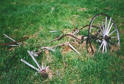
I took a picture of an old, busted-up carriage along the trail.
It was time to start the Monster Hike. I was trying to make Swenson's barn before lunch. It was about 4 miles away.
Somehow I completely missed Davenport Camp, where the actual trail up to the Pot Holes began. I missed the trail too, while hiking back from the Holes. I'm sure it was nearby, but I was really truckin'.
The main trail looked like a two-track, but since it was called "The Old RR Grade," I assumed it was an old railroad path. It was very beautiful, and easy to follow on the topo due to the great variance in elevation, and the winding trail.
I arrived at the big field by Swenson's barn around 12:30 and headed down to Lake Michigan to refill my water. The trail map said I was at the "Cresent Dock (ruins)" in the ex-village of Cresent, but the dock wasn't on the topo map, and I didn't see any ruins.
I took off my socks/boots and waded out into the lake with my water pouch and filter/pump.
"Woa. Instant numbness." It felt great on the feet, even though I was walking on little stones. I gorged myself on water, filled the bottles, and then sat down with my chunk of cheddar cheese and low-salt wheat thins (they were on sale), looking at the water. I miss living in Traverse. Southfield = Detroit. No, wait. At least down river has Lake St. Clair. Ugh.
Gordon Lightfoot nailed it when he sang the Edmund Fitzgerald. Lake Superior's storms, Lake Huron's shipping trade, and Lake Michigan's Recreation. Pretty much sums it up. I'm Lake Michigan, through and through.
One of the groups on S. Manitou last weekend was from Grand Haven (Southwestern Michigan shore). They commented on the difference between even the northern and southern parts of the lake.
"I can't believe we drove all this way and we're still on the same lake!"
"Yes, but it was well worth it."
Chicago = Nice Detroit. Ugh. Nice because it's on Lake Michigan....
The Dock ruins were also the only other place I encountered humans. There were a few tents set up in this area, presummably for the beautiful, private sunsets. "Silly people! Don't you know the sun sets in the NorthWest!?!"
Tee hee.
A group of four was further down the beach, cooking soup. Mmmm, bonding.
I finished up and started down the beach. Now, you would think at this point that I would have figured out that you can't just expect to find smaller paths. Anything that even RESEMBLES a path is clearly marked on the topo. But it was about a half mile east to get back to the trail, and I just wanted to go south, along the coast. There is a good chance that I may still see this whole island, though, if I get a move on!
So down the beach I went. I thought about cutting over to see little Lake Tamarack, but it looked about as big as John Maleski (the pond, not the man), so I skipped it. Probably Mosquito-ville.
Speaking of insects: I didn't even bring bug repellent. As soon as I got off the boat, I noticed how the midges swarmed up in the breeze and grabbed onto anything they could. It was like watching sea-horses in a current. They never bite, and they certainly aren't poison (to eat), so I got used to them real quick. At night, there were a few mosquitoes, but Avon Skin-so-Soft was enough to make me taste bad to them. (And it keeps my skin so silky-soft!) I had been saturating my diet with a vitamin B complex, too, which I have found to be effective in making your blood taste like mosquito dung to a mosquito. It makes your urine pretty bright too, so you need to look for other signs of dehydration.
These are all nice attempts at keeping the bugs away, and they may work well in early spring (June = spring on the island), but if I were there later in the summer I would probably recommend some good ole fashioned DEET.
Down the beach I went, full pack mounted. Say "Howdy!" to the nice people eating lunch. Sure enough, as soon as I rounded the next bend, I saw how hard this was going to be. This was the western edge of the isle. This is the side that catches all the nice Jet-stream-pushed storms head-on. There were hundreds of downed trees strewn along the face of the ridge, which was slowly getting taller and steeper, until it was over 100 ft straight up.
"Well, here goes nothing," I thought, and started climbing over, thru, and around the trunks that lay in my way along the beach. I could just imagine them being blown down over the cliff, crashing down onto the beach in a raging gale. Don't mess with Momma Nature, she'll rip you a new one.
Eventually, as you would expect, the beach became impassable. Luckily, there was a nice ridge path which ran a switchback path up the side of the ridge. I very carefully scampered up to the top of the ridge, only to find that I was back in the bush again.
"Don't be a Meadow Stomper..."
Grrrr.
The main trail was only about a half mile away, in ANY direction. Apparently it avoided this section of land because it was too overgrown with heavy, thorny brush, built to withstand the fury of a Great Lake's storm.
I finally trudged out onto the trail. It's funny how you can't see the trail until you're standing on it. At one point, I stopped to look at the ridgeline, comparing it to the topo map. I remember thinking "Jez, the trail should be right HERE!" I took about four paces and stepped out onto the primary trail, completely invisible from my previous location.
I made my second important MENTAL NOTE: Stay on primary/secondary trails only from now on. "Don't be a stomper," especially in short pants. THIS was the slowest I travelled.
At this point, I started to think about where I would be bedding down. It was only about 3:30, but I wanted to sleep relatively near the docks, since the boat leaves at 10:15 tomorrow. I wasn't terribly worried about this, because I knew I would sleep well (and early) tonight. Little did I know....
I cruised past the Johnson Place, the Fredrickson Place, Cat Hole, and Fat Annie's. I was nearing the south end of the island now, and I began to realize that there was still a chance of finishing my round trip of the island, and getting into the center to see the lake before dark.
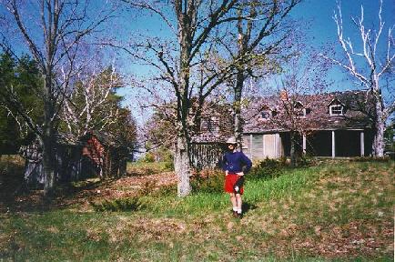
I might still see the whole thing! I decided not to hike down the mile-long driveway to see the Stormer Place. I didn't come here to see buildings which have been condemned since 1940.
I did come here to see those who built these homesteads, though, so I hurried to the cemetary to check out the names on the headstones. Sure enough. Anderson, Bournique, Feilen -- all names which were associated with homesteads, many of which were still standing (barely).
The southern end of the island seemed to be much more open. I figured that it had been cleared by early logging, since this end of the island was so much easier to access from the water. The main shipping line to Chicago was through Manitou Passage, to the south and east of the island.
Not many ships approached the west and north ends of the island. They would have had to climb the enormous ridges to get to the trees. It all made sense!
I decided to shoot for the South Cherry orchard, about 2 miles away. That was the nearest labeled location on the trail map that was within 2 miles of the docks. "If I get there early, I'll keep going." Or maybe I'll set camp and day hike down to the lake and back. Who cares? I'm on vacation! This was about 4:45 pm.
The southeastern tip of the island was one of two areas closed to humans. The area was designated as a Piping Plover nesting area. You think you're walking along a beach with medium-sized rocks laying in the sand, then SPLAT. A pair of rocks crack under your feet, and some mother Piping Plover is childless. Luckily, this never happened to me. I avoided that whole area, and was extra careful not to step on any medium-sized rocks while I was up by John Maleski, the pond, not the man.
Sidenote: I don't think you should be allowed to give ponds two names. Either "John Pond" or "Maleski Pond," not John Maleski pond. Or John Maleski Pool. Whatever. You know what I mean. People are too vain. If I ever buy a pond, I'm gonna name it "Frog pond" or something. I would consider naming it "Swan pond," but ONLY if there were swans in it. Who would ever write a poem about "Scott pond" or "Joe hill"?
Careful, Narcissus, if you get too close, you may fall in and drown.
The other closed area was near the southern end of Lake Manitou. The bald eagles were nesting in that area, so they shouldn't be disturbed. I thought they moved the bald eagle from "endangered" to "threatened"? The signs said 'Endangered Species Nesting Area -- Stay out.' I did.
I made the South Cherry orchard before 5:30, and still didn't feel that hungry. (Mmmm. Nacho cheeze pretzel Combos. And a free phone card in the bag!) So I took a water break and started NorthWest, towards the Carlson Place, and a shortcut to the Frank Farm and Apple Orchard. I thought it might be nice to camp in an apple orchard.
According to the topo, the orchard was actually still there, unlike the cherry orchard, which was just a large clearing.
I made it to the Frank farm and headed for the back of the orchard. I had to cross the entire farm (a cleared field) to get to the orchard, which was still there, but not in great shape.
From the back of the orchard there was an easy trail down to the main trail which leads back to the docks. I was unable to find a decent spot to pitch bivy, though, so I headed back down to the farm. There was a small grove of trees at the southwestern edge of the farm which looked like it had been used as a camp before, and it wasn't that far from the main trail.
After nearly 20 miles, I plopped down in the tree grove. First things first. Get outta these boots! Hang up my socks and air out my feet. Gimme them sandals!
It was almost 7:30 by the time I had camp set up, and I was really enjoying sitting, so I decided to save the lake for the morn and risk loosing it to another late morning. Besides, I wanted to get dinner before dark. HA! Nothing to worry about there! Fire up the Coleman Mega-Flame insta-boiler, after a little tweaking, of course.
I sucked down my ramen juice and prepped for bed. Nothing stopping me now. Whew, I was totally spent.
Around dusk, I climbed into the bivy with my headlamp, Robinson Crusoe, JD flask, and the transistor radio. Hmmm. I wonder what the weather is gonna be like. I clicked the radio on, and BOOM! There was Mickey Redmond, the Wings were on!!! Yesyesyesyesyesyes!
I was sooooo happy! I must of had the day of the game wrong. But I was sooooo tired. I started listening. It was 1-0 Wings in the first. Last thing I remember is 4-2 half way through the third.
Luckily, that was the final, because the next thing I remember is the big dipper staring at me and some lady complaining about being overly committed. 3:20 am. Kill the talk radio.
"Whoa. There's dew on my face. Zzzzzzzz."
Total distance saturday: 19.4 miles.
Total weekend distance so far: 23.0 miles.
SUNDAY:
6:30 am. beep beep beep beep beep beep beep beep beep beep beep beep beep
6:31 am. "Ooooooh. Gotta get up to go to the lake."
6:35 am. I got up!!!! (those of you who know me know how phenomenal this really is!)
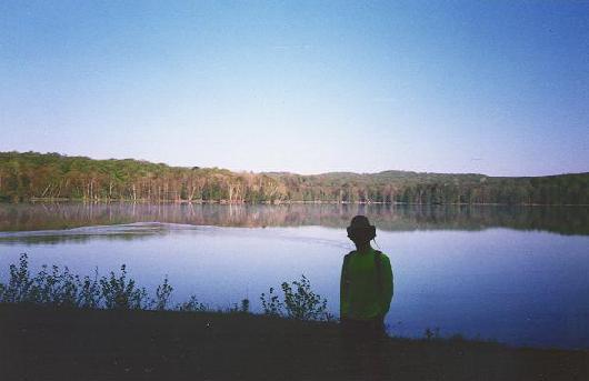
I skipped (temporarily) oatmeal for granola bars again. I only had about 2 cups of water left. I could either filter some from Lake Manitou, and do breakfast at the farm, or wait and do it by the docks.
I opted for the docks, just in case. If you miss the boat, you spend another day on the island. This would not have been that bad, but I had to get to Traverse for a Scott Carter's recital at 3 pm. This was the reason I came up north in the first place. Plus, I had to work on monday.
I flew down to the lake sans pack, took a picture, looked for eagles, and flew back up to camp. It looked like every other little inland lake I've ever seen. Think of any stupid horror film that's set at Summer Camp. Incredibly majestic and gorgeous, but a dime a dozen in Northern Michigan. :)
Unique, though, being a sizable lake, on an island, in a lake.
Besides, I was hungry. I got back to camp, finished my water off, packed up, thanked the late Mr. and Mrs. Frank for the use of their farm, and headed down the final trail, due east, towards the dock.
A mile later, I was sitting under a tree next to the ranger station, digging the stove out of my pack.
The 5th graders were there. They could see the boat coming so they were all geeked. They started hauling their packs down to the docks.
I looked. The boat was barely half way here. By the time it gets here and unloads, it'll be another 45 minutes. Do I have time to boil some water for oatmeal and cocoa? Oh yeah! I fired up the Coleman/Boeing 727 engine and had two cups boiling before the last kid got his pack to the dock.
Mmmmm. Good stuff. "Somethin' warm in yer tummy." Screw cleanup, I'll be at the dishwasher by dusk.
There was a lady down by the dock selling her book and posters/maps of the island. The book was called "North Manitou -- Sunrise to Sunset". I think her name is Rusco. She was the longest running postmaster on the island before the park service acquired it. The book is all about the history of the island. I didn't have any money, or I may have gotten it. I listened to her talk until the boat rolled up to the dock.
total distance Sunday: 3.4 miles
total weekend distance: 26.4 miles (is that a marathon?)
I was back at the Jeep by noon.
I wanted to mention a little safety tip about soloing. Hypothermia is very deadly if it goes untreated.
One of the first signs of hypothermia is shivering and mental slowness. It is often difficult to catch yourself becoming hypothermic, and once it has set in, you probably won't know you have it. It is vital that you change the clothes nearest your skin before and after bed, or don't wear anything to bed. (or don't wear anything during the day) If you wear the same thing day and night, your sweat will build up in your clothes -- even with polypro/thermoline. I always take two sets of polypro, so I can change into dry ones often, while the other ones dry. If you play your cards right, you'll be drying quicker than you're sweating.
This will help keep your body heat IN. But you have to make sure there is heat to BE KEPT IN. Increased physical activity is good to "kick start" your heaters, but usually this results in sweating too, so be wise.
You MUST eat and drink a lot. Hot stuff is great, but make sure you got your fats and sugars, too.
I was careful with each step. A log that I would normally have no trouble hopping over was carefully negotiated, because a sprained ankle can be a big problem when you are alone on a wilderness island.
But I could have dealt with it. This weekend, I was really only afraid of one thing, hypothermia, because I have been trained to look for it in my Boy Scouts and in my ODR participants. I know how hard it is to notice it, and how easy it can be to treat.
Just my half a nickel. Keep the change.
----------------------------
Scott J. Swan
Tell me what you thought!
----------------------------