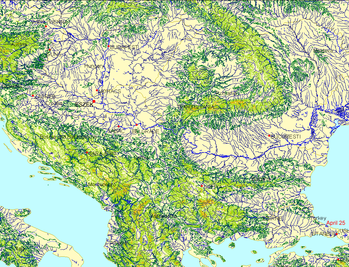
- Suleyman and his
entourage leave Istanbul at the end
of April in 1532, apparently mounting another attack against
Vienna.
They proceed to Guns,
south of Vienna, along a route different from that in previous
campaigns, through "Transdanubia"
using the military road from Belgrade to Eszek, rather than through the
valley of the Danube River (with its marshy west bank). Clot
notes that addtional troops and supplies joined the campaign at
Belgrade, at Eszek, and at other points. Following the
capitulation of Guns on August 9, the campaign does not go forward once
again to Vienna but returns to Istanbul, via a circuitous route to Graz
and other towns (captured by the Ottomans) and arrives back in Istanbul
November 18.
- As Suleyman campaigns
proceeded throughout the Danube Basin and in parts east, Barbarossa and
Andrea Doria were fighting for the Mediterranean. Barbarossa
often was the dominant force with much of North Africa capitulating
(but with some back and forth control between the opponents).
- The animated map above was
made from reading material in Andre Clot, Suleyman the Magnificent, Saqi
Books, London, 2005 and from material on the website listed in the next
link. To learn more about this Conquest and the events that
took place around it, follow the many links below. The link
provided here offers
a starting point to this complex topic.
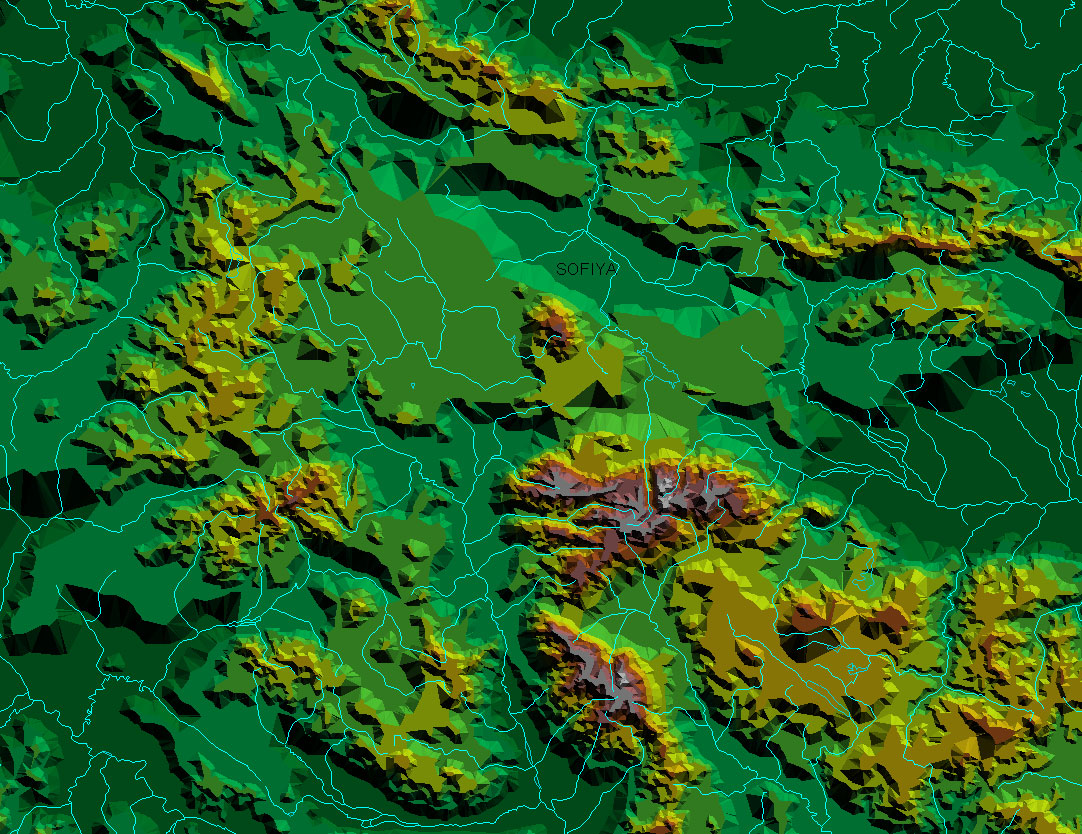
- The topography from
Istanbul to just southeast of Sofia is relatively flat. Take a
closer look at the
topography surrounding Sofia:
- Sofia, a Triangulated Irregular Network (TIN)
- Sofia, a plausible journey path, in red dots,
following topography through the TIN.
- Sofia, a screen capture of a 3D image
- Sofia, virtual reality
(install Cosmo Player or Cortona in your browser...free downloads from
the web). The sun was set in the southwest at a height of 50
degrees above the horizon. The vertical exaggeration was
calculated by the software (ArcView 3.2, ESRI) and seems a bit on the
steep side, but that is satisfactory for purposes of understanding
navigational difficulties in rugged terrain. The contour
interval is 1000 feet. Take the journey yourself! (If the
model does not fully load, the memory or the connection speed on the
machine you are using is not sufficient to the task; try on a different
machine.)
- It is easy to see
where to go when in a floodplain. Navigate yourself using the
Cosmo controls.
- Try navigating
through the mountains, right along the surface. The logic of
following the streams will be evident as a good course of action.
Nonetheless, it is very easy to get lost when navigating through rugged
terrain, at the level of the terrain (much easier with an overhead
view...which Suleyman did not have).
- Try using the
"viewpoints" to navigate through rough areas...they are the substitute
here for an experience guide. See how important that experience
can be!
- Where next?
Maps can offer guidance that the research should take. The
Virtual Reality model makes it easy to speculate on rational routes, in
terms of topography. But, were these the routes actually
used? Research in primary sources becomes critical and the maps
suggest where to look in them.
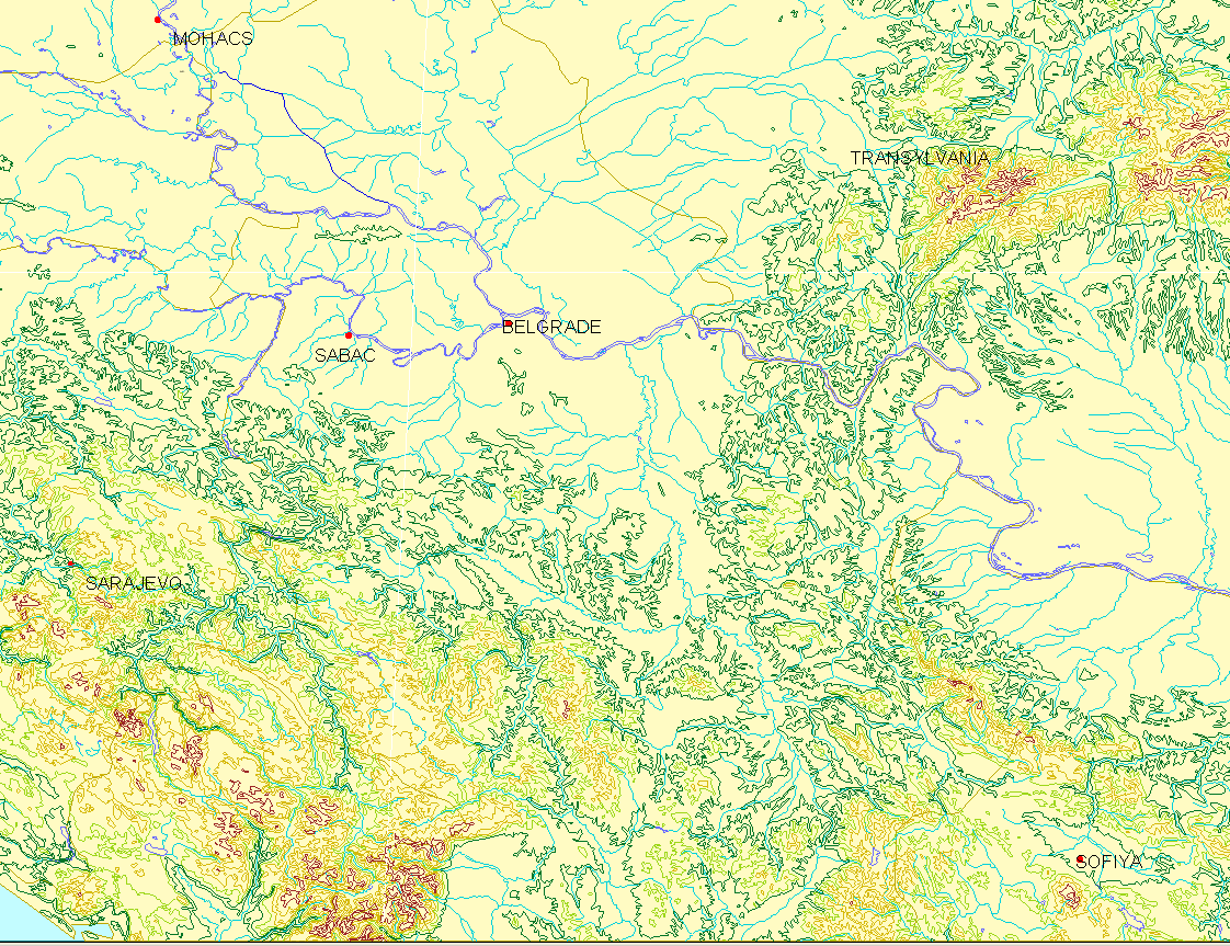
- This link shows the
topography in two dimensions from Sofia to Mohacs, including Belgrade.
- Links to sites describing
the action, references, and bibliographic material:
- TheOttomans.org,
look at all the links of this interesting site: http://www.theottomans.org/english/chronology/index.asp
- Perjes, Geza.
Translated by Maria D. Fenyo with a Foreword by Janos M. Bak. The
Fall of the Medieval Kingdom of Hungary: Mohacs 1526 - Buda 1541
Social Science Monographs, Boulder, Colorado, Atlantic Research and
Publications, Highland Lakes, New Jersey, distributed by Columbia
University Press 1989.
- The Ataturk Institute
for Modern Turkish History
- References on Suleyman:
- Environmental Programme
for the Danube River Basin and United Nations Development Programme, http://www.rec.org/DanubePCU/index.html
- Sibiweb: maps and other
materials
- Goings on elsewhere
during
this year of 1532...links to sites with timelines:
- Related links:
- Goffman, Daniel. The Ottoman
Empire and Early Modern Europe. Cambridge University Press.
Link to Frontmatter.
- The Ottoman Empire and
Modern Turkey, 1453-1950, Thomas Kuhn course syllabus and notes,
Simon Fraser University http://www.lib.sfu.ca/researchhelp/subjectguides/hist/classes/hist043350.htm
- GLOBALHISTORIE: NOEN
(FORHOLDSVIS NYE) TITLER, MED SÆRLIG VEKT PÅ PERIODEN
1400-1900; http://rorg.no/rorg/Tema/historie/litt.htm
- Agoston, Gabor. Guns
for the Sultan: Military Power and the Weapons Industry in the
Ottoman Empire. Cambridge University Press. http://assets.cambridge.org/052184/3138/excerpt/0521843138_excerpt.pdf
- Ghazzal, Zouhair, Modern
Middle East, History 313, Loyola University Chicago, http://www.luc.edu/depts/history/ghazzal/hist313.htm
- History On-Line,
UK: http://www.history.ac.uk/ihr/Resources/Theses/tpasia.html
|
