 Main Phase One Phase Three Phase Four
Phase Two:
GeoCoding Metro Area CERCLIS sites
I obtained a dataset from the Environmental Protection Agency which list all sites regulated under the
CERCLIS program. This is also an extensive list. For the purposes of this project, I look at sites within
the Baltimore-Washington Metropolitan Statistical Area.

Using ARCView, I create a pointfile of CERCLIS by geocoding. This process is pretty slow. Stay tuned....
Problem 1:
Some of the 270 sites listed within the EPA dataset that I obtained are in rural areas and don't have
street address. For example, the Doyle Wood Treatment Site located in Martinsville, Virginia has a
street address that reads "Routes 58 and 684" - this is not an exact location for geocoding. Ugh!

-----Option 1: I cango back to EPA to see if there is a shapefile of CERCLIS sites. However, the
September 11th tragedies have made obtaining information like this more difficult. Now, I have to
file a formal Freedom of Information Act (FOIA) request to get data (if, in fact the Agency has what
I'm looking for). FOIAs take time, which I can't afford to give. Ugh!
-----------Option 2: The sites in my dataset all have zip codes. Zip codes are arguably more crude
measures than latitude and longitude coordinates. What precison I lose by utilizing zip codes, I hope
to gain by overlaying zip code polygons containing the sites of interest over census block groups for
the Metro DC region. My buffers will be based on the average size of my zip codes, versus the more
refined 2.5, 5, and 10 mile buffers used by Hamilton and Viscusi in the demographic analysis of NPL (1999).
Solution:
_______I did both, in a manner of speaking. I created geocode point map (it took hours) from a smaller
geographic area that was closer to the center city. Thus, I avoided the rural areas altogether.
The area that I chose was a 45-mile area around the boundaries of the District of Columbia:
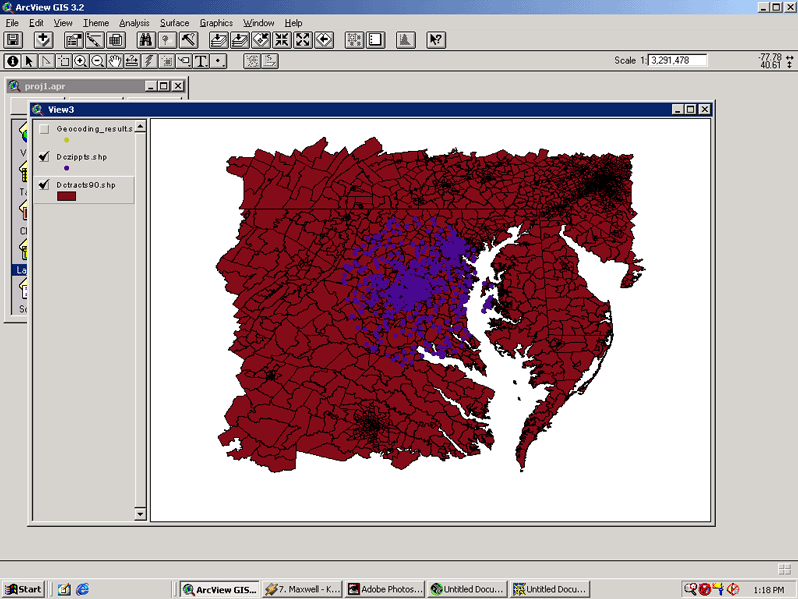 The purple represents the cetroids of the zip codes within the District of Columbia, proper.
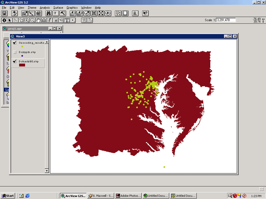
Here is the result after adding the geocoded points. Notice that there is a point that is an outlier.
The purple represents the cetroids of the zip codes within the District of Columbia, proper.
Here is the result after adding the geocoded points. Notice that there is a point that is an outlier.
 Also (with tremendous help from Dr. Arlinghaus!) The zip codes from the original CERCLIS dataset were transformed into polygons
and matched with the centroids of the tracts from the Anderton dataset. ARCview was used to capture areas where the centroid
of the tract fell within a zip code which featured a CERCLIS site.
Also (with tremendous help from Dr. Arlinghaus!) The zip codes from the original CERCLIS dataset were transformed into polygons
and matched with the centroids of the tracts from the Anderton dataset. ARCview was used to capture areas where the centroid
of the tract fell within a zip code which featured a CERCLIS site.