Method Two is a refined application in the use of census tracts as the unit of analysis. To reduce aggregation error, a combination of census tract information, coupled with zip code information was used and merged to create more precise areas of interest. To do this, data sources were used. For the census tract information, I used the data from Method One, which categorized each of the over 60,000 census tracts in the United States based on whether the tract hosted a CERCLIS site. In addition, I obtained a listed of archived and current CERCLIS sites within the US from the Environmental Protection Agency. Street addressing matching from this EPA list was virtually impossible, given the time constraints. Our remedy was to use the zip codes of these sites as the geographic link.
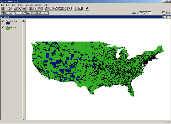
Here's how we came up with an impacted area: the point representing the centroid of the census tract had to fall within the area of the host zip code polygon. The map below presents the impacted areas (blue) in comparison to tracts that do not host CERCLIS sites (green).
CERCLIS and White Americans
The map below illustrates national view of the distribution of white Americans within impacted areas derived from a combination of centroid of census tract and zip codes. It is very difficult to detect patterns at the national level. The next map is a zoom into the eastern part of the United States. Note that there are pockets in impacted areas where there are not many white Americans. Further investigation of other racial/ethnic groups may give me a clue at whether or not there is disproportionate impact by race.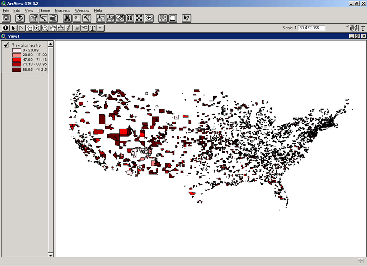
Whites in the eastern United States:
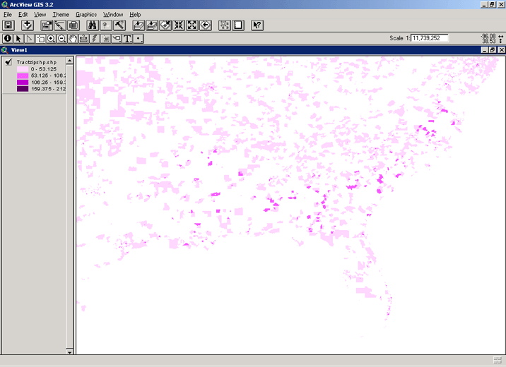
CERCLIS and African-Americans
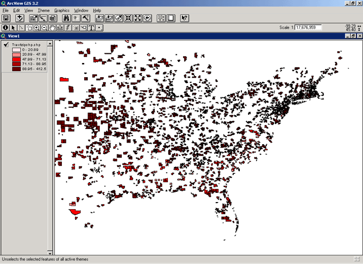
The map below is represented in graduated color of African-American who live in in census tracts whose centroid lies within a zip code that hosts CERCLIS site. The map that follows is a closer look at the southeastern United States where there are the highest concentrations of Blacks. These map detect that there are census tracts with significant population of African-Americans that host CERCLIS sites within their zip codes. Thus, the map hint that environmental racism may be operating. Given that African-Americans constitute only 12% of the population, one would not expect to see CERCLIS site host zip codes within tracts that have high concentrations of Blacks.
A Closer Look at southeastern United States and African-American Population Distribution Among Zip Codes/Tracts that host CERCLIS sites:
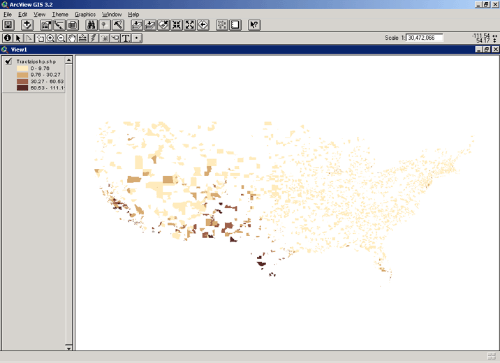
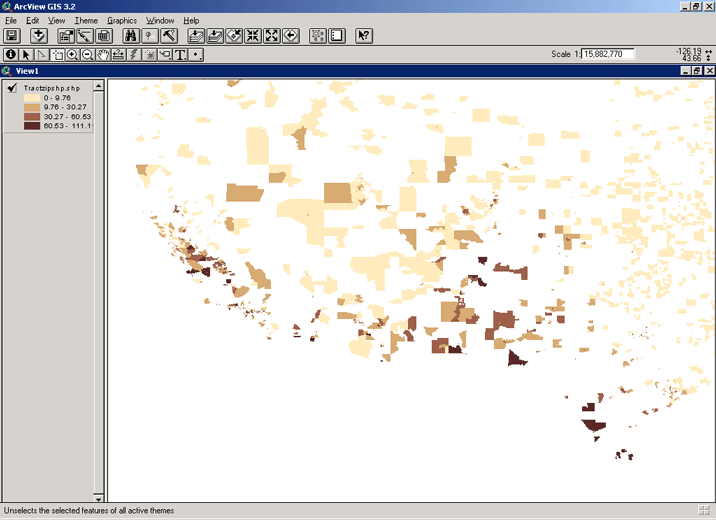
CERCLIS and Latinos/as
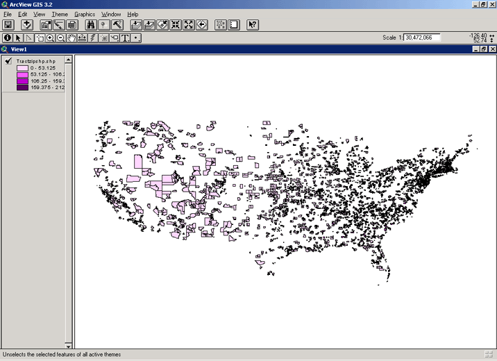
The map below presents a national map of Hispanic population distribution in impacted CERCLIS areas, as well as a "zoom" within the southwestern United States which hosts the highest concentration in Latino communities. Also, note that there are high concentration of Latinos within CERCLIS host impact area, which may lend evidence to disproportionate impact. Similar to Africans-Americans, Latinos constitute a small percentage of the total US population and evidence of ethnic population concentrations on a national scale suggest possible disproportionate impact.
Using a more refined area, rather than the broad census tracts regions to determine disproportionate impact is a novel approach. I haven't seen this form in any of the environmental justice literature. It allows researchers to go beyond the political boundaries of census tracts. However, if demographic information is derived from census tracts in the end, I recommend some form of interpolation. One of the strengths of this approach is that is that while it is more precise than the geographic unit from method one, it also generalizable. It is harder to create this shapefile and requires a series of merges. One drawback shared by both method one and two is that it ignores multiple hazards. What happens if there is more than one CERCLIS site within the census tract or zip code polygon? Currently there is no way to address this problem with these two methodologies. The next, and final method presented here can address multiple hazards, because it relies on each hazard as a unit of analysis, rather than a broad geographic area.