Main................ UP507 project Intro...............Method Two ...................Method Three ...........Conclusion
Method One:
Census Tracts as Unit of Analysis
One of the first national studies of environmental hazards and their relationship with race and income came from the United Church of Christ, Commission for Racial Justice in 1987. They used demographic data derived from zip codes that contained uncontrolled hazardous waste sites. Their research indicated that there was a positive relationship between the race and the presence of an uncontrolled hazardous waste site.
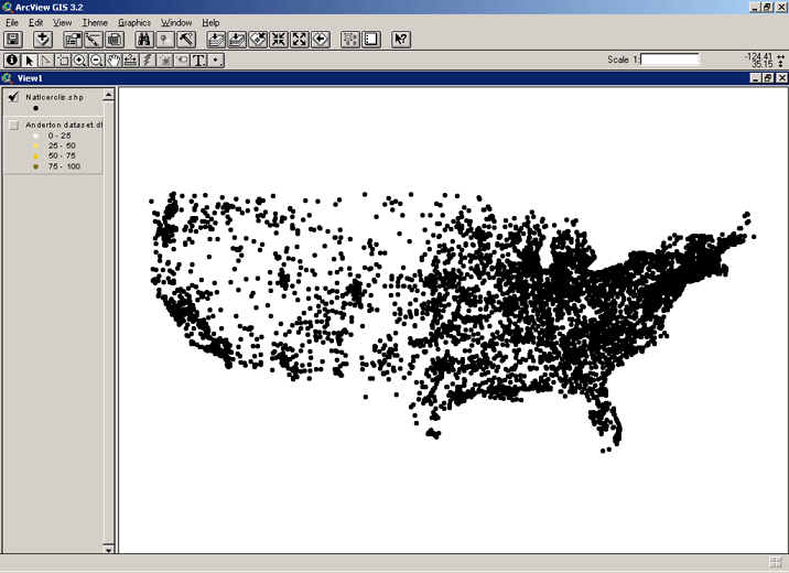
In 1994, researchers at the University of Massachusetts-Amherst conducted another national study of hazardous waste and race. Instead, they used census tracts. Their results indicated that there was not a statistically significant relationship between race and waste. I obtained the original dataset from these researchers for their study in 1997. The unit of analysis is census tracts (rather than zip code) and the environmental hazard under investigation was CERCLIS, or Superfund site. Each tract was given a CERCLIS dummy variable, (0) or (1), wherein (1) indicated that that tract hosted a Superfund site. Using ArcView, I created a shapefile out of those tracts hosting Superfund sites:
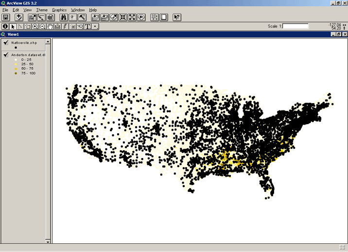
The map above presents the national distribution of CERCLIS sites by the centroid of the tract hosting the site. Note, that the eastern portion of the United States is more dense that the Pacific Northwest. This density reflects a density in persons, or census tracts, not necessarily density in CERCLIS sites. Next, I overlaid the CERCLIS shapefile with thematic maps representing the percentage White, Black, and Hispanic.
CERCLIS and White Americans
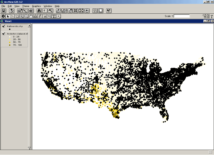
White Americans make up the numerical majority, in comparison to people of color in the United States (although researchers predict that this trend will end soon). As a result, the map below does not detect any pattern in racial-location, in comparison with racial and ethnic minorities. The darker shaded areas represent larger percentages of white Americans in both maps below. The second map below highlights the relationship between the presence of CERCLIS (by tract) and percentage White. The black dots represents CERCLIS sites:
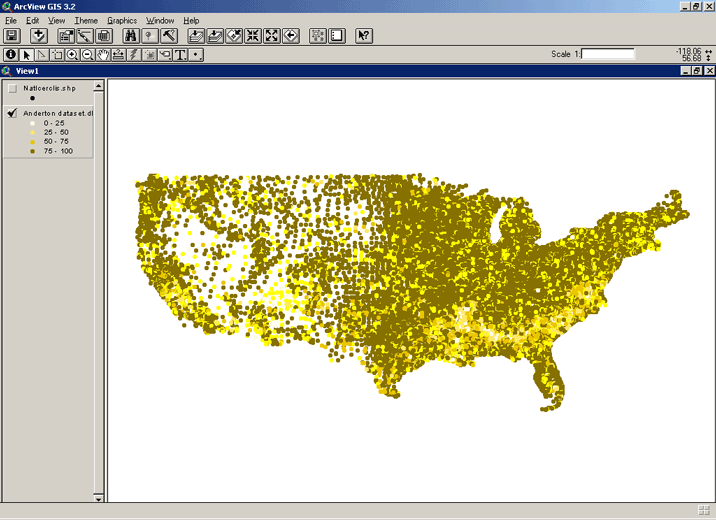
Again, it is difficult to detect a spatial pattern between White and CERCLIS sites, because White persons seems to be randomly located.
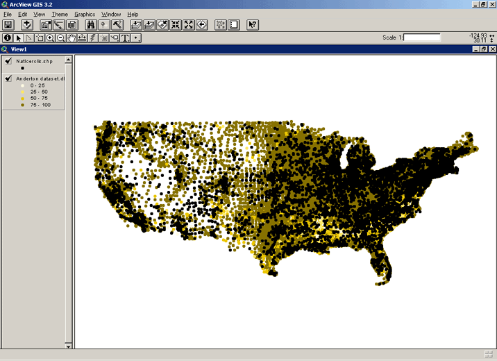
CERCLIS and African-Americans
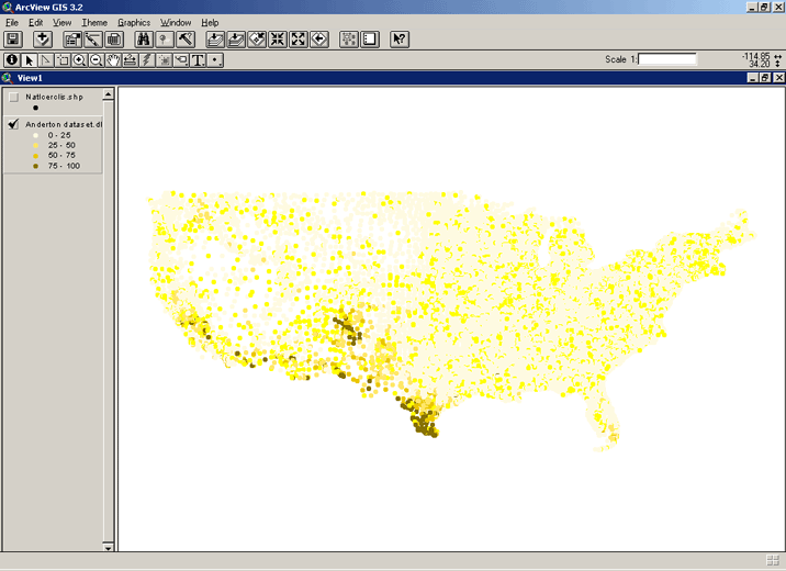
African-Americans represent approximately 12% of total population of the United States. The map below demonstrates that African-American population are primarily located in the Southeastern United States. The second map attempts to detect a spatial pattern between the percentage Black and the presence of CERCLIS sites. Once again, the darker shades of green represent higher percentages of African-Americans and the black dots in the second map represents census tracts with CERCLIS sites:
The map above does not easily detect a pattern between African-Americans and the presence of CERCLIS sites.
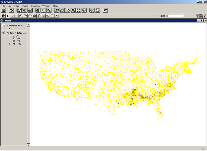
CERCLIS and Latinos/as
Latinos, or Hispanic-Americans constitute 9% of the total population, according to the 1990 census. This ethnic group represents one of the fastest growing in the nation, and their numbers are expected to double towards the end of the century. The map below illustrates the Hispanic Americans are concentrated in the Southwest, more specifically Texas and Southern California. The second map juxtaposes Hispanic American percentages with the presence of CERCLIS sites. Once again, it is difficult to draw conclusion from such a large geographic area.
Evaluating Method One
The use of census tracts to detect disproportionate impacts is one of the most utilized methods in environmental justice research. For one, it is very easy to obtain information on census tracts. The results are also generalizable. Likewise, it is not too difficult to perform this type of analysis on a national level. However, what does this information tell us? Not much. Without spatial or conventional forms of statistics, the disproportionate impact does not reveal itself very easily. Also, deriving the census information from the host tract may lead to aggregation error. What if the hazard under investigation is on the edge of the tract - the impacts of this hazards may be related to those in a nearby tracts rather than than the host. Method Two in my investigation is a more refined unit of analysis.