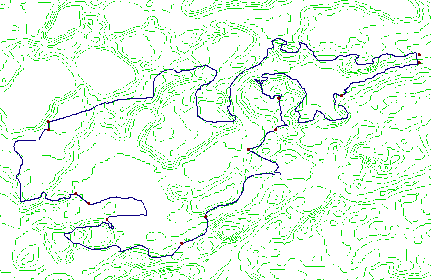
Above is a contour map of the trail at Island Lake in which each green contour line represents a different elevation from the adjacent ones. The closer the lines are together, the steeper a hill will be.
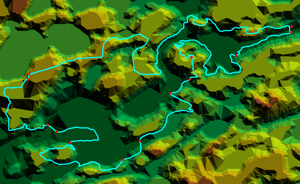
Above is a TIN map in which each elevation level is denoted by a different shade. The gradations are denoted in the legend. The darkest green color represents the Huron River and the surrounding flood plane. As you can see the trail parallels the river and crosses it twice making for a very scenic ride.
back