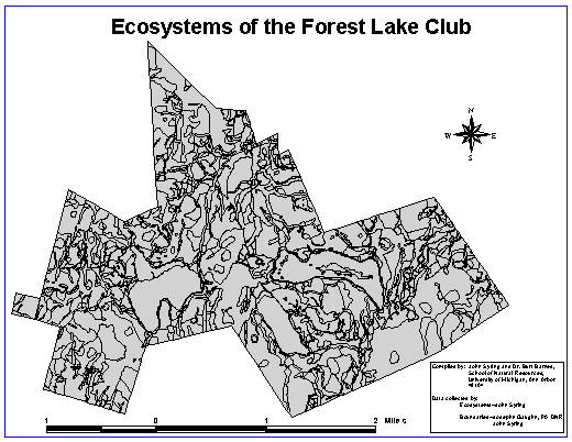
Ecosystem Map of the Forest Lake Club
As of yet this map is incomplete and attributes have not been assigned to the individual polygons (ecosystems). As the Ecosystem Classification reaches completion these attributes will be assigned, and the finished product will be put in place of this temporary map.
Landscape ecosystems are geograpic or terrain segments of Earth space--units that may be identified and separated out from the landscape continua in which they occur. They are the structural-functional units of nature. Local ecosystem types of Club property are nested within a hierarchy of landscape ecosystems starting from the largest ecosystem that we can work with--the Ecosphere. The local ecosystems are nested into landforms; larger ecosystems at a broader scale, of which there are three on Club property. These landforms are then nested into larger ecosystems (sections and then physiographic provinces as defined by Penn State University).
This map is meant to be used in conjuncture with the ecosystem classification. The classification contains full descriptions of each of the individual ecosystems, including information on physiography, soil, biota, microclimate, similar ecosystems, and natural history notes. This map, along with the Landform Map, Cover Type Map and Cover Type Classification form the basis for a landscape management plan. The potential uses of this information are almost endless, because it sets up a consistent framework from which to work with in any further study done by the Club.

Click here to return to main page.