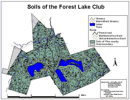
Soils Map of the Forest Lake Club
This is a map of the Soils of the Forest Lake Club along with the streams, lakes, roads, and trails. The soil layer is an individual layer that can be used by itself. It was collected off the PA Department of Natural Resources Soil Conservation web page. Data is currently only available for Pike County, and you can see the gray area on the map represents that portion of the Club that lies in Wayne county. I am currently searching for an online directory of the soil descriptions, but if this can not be found we do hold in our possession a hard-copy of the soil decriptions for Pike county. It should be kept in mind that these soil maps are done at a very broad range and are not always extremely accurate. Data collected in the field from our plots is a much more accurate reflection of the soils on Club property.
Click here to return to main page.