Aerial Photograph Analysis:

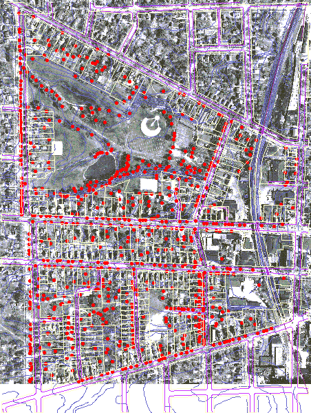
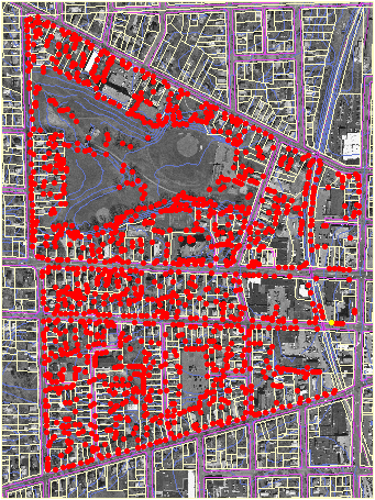
Below is an analysis of tree locations within the project site. Tree locations are marked by red dots throughout the project site for both 1947 and 1997 images. The time of year that each of these aerial photographs was taken probably influenced the margin of error present in locating trees, as it is often easier to identify trees using late fall aerial images. Additionally, small trees were likely not visible quite often; therefore, to say that this analysis is a highly accurate representation of actual number of trees during these years, would not be truthful. Taking this into consideration, an effort was made to be as careful as possible in locating trees.
1947
1997
The ArcView script program called "ptinpoly.ave" was utilized to count the number of trees per parcel within the project site. There were more than twice the number of trees within the project site in 1997 in comparison to 1947. 1,097 trees were identified in the 1997 aerial image while only 426 trees were identified during 1947. West Park increased from 125 trees in 1947 to 199 trees in 1997. While these figures cannot be taken literally since there is a margin of error in locating the trees using the aerial photographs, it is safe to say that there are more trees present within the project site now than there were in 1947. The tabular results from running the script program using the ArcView polygon parcel layer with the point data of the trees follows by clicking below.

NEXT, Table Results

Go Back to Home Page