GPS FIELD IDENTIFICATION
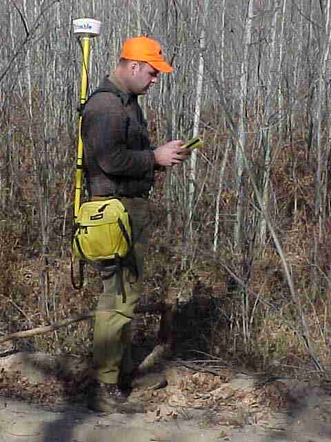 A Trimble ProXR Global Positioning System (GPS) was
used to identify locations of various aspen stands around the northern portion of lower
Michigan. Identification of these locations will allow for the remote sensing
software to be trained, that is, the software will be programmed to identify the
certain portions of the imagery that match the values found at these GPS'd locations.
Since these locations are indicative of aspen stands, the software will be able to
identify all other areas within the images that represent aspens. The image below
shows the locations of the various aspen stands that were located. Clicking on any
of the eastern locations will link to the photographs of the aspens that were being
identified at that spot.
A Trimble ProXR Global Positioning System (GPS) was
used to identify locations of various aspen stands around the northern portion of lower
Michigan. Identification of these locations will allow for the remote sensing
software to be trained, that is, the software will be programmed to identify the
certain portions of the imagery that match the values found at these GPS'd locations.
Since these locations are indicative of aspen stands, the software will be able to
identify all other areas within the images that represent aspens. The image below
shows the locations of the various aspen stands that were located. Clicking on any
of the eastern locations will link to the photographs of the aspens that were being
identified at that spot.
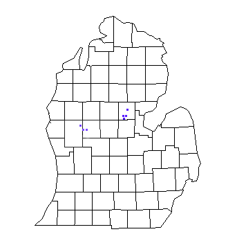
Expanded view above contains links to several pictures of aspen stands located with the
GPS.