 ESGR
Soils
ESGR
Soils
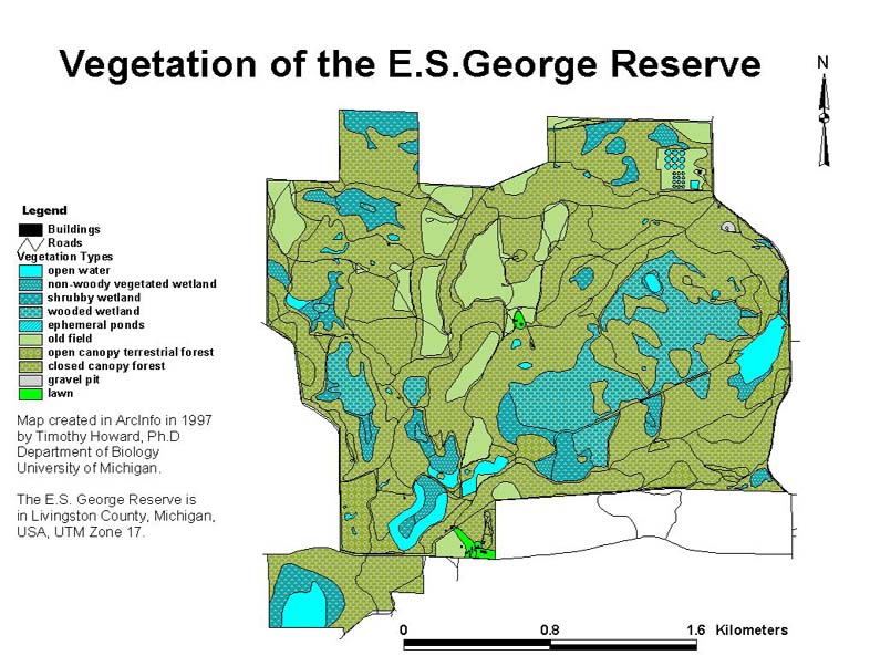
This map shows the vegetation types of the ESGR, with the roads and buildings overlay. Tim Howard created this map in 1997 using ArcInfo. He classified the vegetation from digitized aerial photos and then he ground truthed his classifications. Comparing this vegetation map to the soils map, you can see that a number of soil types lie under each vegetation type.
Another difference between the soils maps and this vegetation map is the shape of the Reserve. The soils maps only cover the land that was part of the Reserve at the time of the original survey (1953), while the vegetation map covers all ESGR property.
This image was created by importing Tim's files into ArcView GIS 3.1.
Go to: