
Background information
It is commonly observed that fishes of a particular body shape live in very predictable habitats. Trout, for example, are a relatively slender bodied family of fishes that characteristically live in swiftly flowing rivers and streams. Sunfishes are a relatively deep bodied family that are commonly found in lakes, ponds and slow flowing rivers and streams. This relationship is seen all over the world and is hypothesized to be a result of bioenergetics.
A slender body shape is more hydrodynamic than a deep body shape and allows more energy to be allocated to food acquisition, reproduction and station keeping is fast moving waters. Slender bodied fishes have definite competitive advantages in these environments and are usually the only resident species. Exceptions exist, of course, for families like sculpins and suckers that live on the river bottom and therefore do not routinely face the full force of a current.
Deep fish bodies are better suited to rapid maneuvering
in slow flowing water and weedy environments. As a result, some of
the world's largest freshwater fishes are deep bodied and live in some
of the world's largest floodplain rivers, namely the Amazon and Mekong.
Whereas deep bodied fishes are not usually found in the same habitats as
slender bodied fishes, the opposite situation actually does occur.
Large, slow moving rivers are very species rich and represent a large variety
of body shapes. Fast moving waters are usually limited in species
richness and body shapes.


The project
Current velocity can be inferred by measuring the gradient,
or slope, of any river. A gradient is the number of feet per mile
(or meters per kilometer) that a river drops. High gradient rivers
are usually found in high elevations and vice versa. For the reasons
just described, it is believed that slender bodied fishes will predominate
in high gradient rivers and low gradient rivers will have a large variety
of species and body shapes. By examining the complete records of
the University of Michigan's Museum of Zoology (UMMZ), Fish Division, it
may be possible to quantify this relationship. Such a relationship
would prove very useful in predicting paleoenvironments based on fossil
fish specimens.
Study site
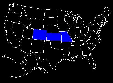
The states of Missouri, Kansas and Colorado (east of the
Rocky Mountains) were selected as the study site for several reasons.
Because this transect lies more or less at the same latitude, many variables
can be eliminated from statistical analysis. Additionally, all rivers
in this region are part of the Mississippi River drainage and all species
in the site (excluding introduced species) have co-evolved. Most
important, however, is that this site represents a wide variety of elevations
and river gradients and will provide satisfactory sampling. See image
below:
Methods
Field sites were located on 1:250,000 USGS topographic
maps based on UMMZ records. Dividers were used to measure distances
between contour lines that transected each field site. The quotient
of the elevation difference between contours (in feet) and the measured
distance (in miles) was used as the gradient for each location.
For the purposes of this project, field sites were plotted on individual
maps based on the presence of any members of a family. Maps
were constructed according to family and not species because of time considerations
and because all members of a particular family share morphological characteristics.
Due to the limits on plotting exact locations on these maps, field sites
are accurate only to the county level. Points on the maps, representing
individual field sites, are color coded according to the site's measured
river gradient. It is hoped that a relationship between body shape
and gradient will appear by examining these maps. Maps were created
using Atlas GIS 4.0 and Digital Chart of theWorld.
Show
me the maps!
Colorado,
Kansas, Missouri
