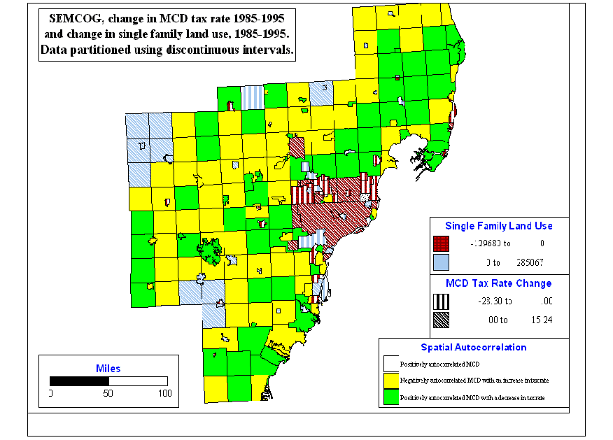
Spatial Autocorrelation Using MCD Tax Rate as An
Example:
A negative autocorrelation is found. Referring the
land use change maps on the website, it is likely that the areas faced
with the greatest increase in low-density residential land use are the
same ones (yellow areas) that are negatively correlated with an increase
in MCD tax rate. The negative autocorrelation is possibly due to the fact
that the development of sewer zones is a spatially continuous process,
which somehow dictates the occurrence of new larger patches of low-density
residential land use. It is possible that the green areas are those developed
before 1985 while the yellow areas are those developed between 1985 and
1995 and overlaid with a new sewer zone planed or built between 1985 and
1995.