The
area analyzed has overlapping aerial photography coverage in 1946 and 1982.
The
study area is 69.2 km2
It
encorporates a portion of the river that is 9 km long.
Resulting maps:
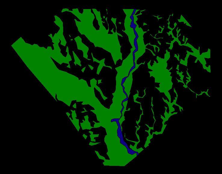
Study
Area in 1946:
| FOREST AREA |
| RIVER AREA |
Study
site in 1982:
| FOREST AREA |
| RIVER AREA |
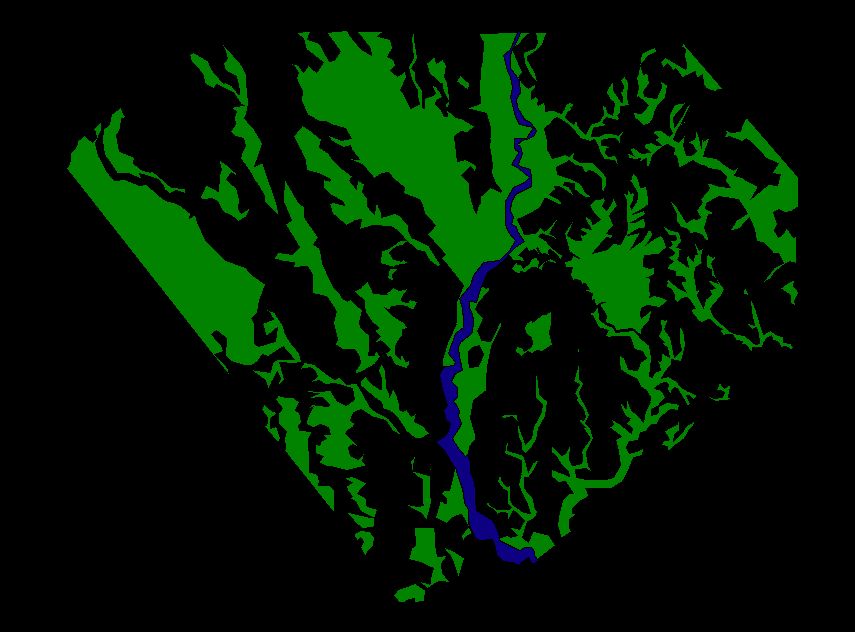
The areas of river and forest have
changed!
| 1946 | 1982 | |
| forest area | 31.6 sq.km | 26.1 sq.km |
| river area | 1.3 sq km | 1.4 sq.km |