All maps are made in ArcView 3.1 (as indicated from the screen-capture) from base maps and information provided by the City of Ann Arbor. Many of these maps, as well as others showing contours, land use, and so forth, are available in the labs in the Dana Building. The maps of the Allen Creek Flood Way and Flood Plain, along with maps such as these, form a basis from which to consider the spatial foundation of the creekshed.
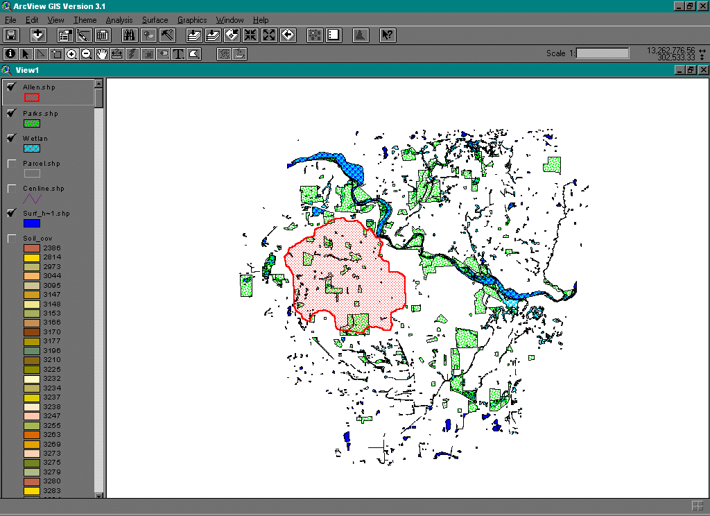
Parkland acquisition might be one use for the Flood Way and Flood Plain
that would offer a low -environmental cost use. Directly below is
a map of existing parkland, gross surface hydrology, and the outline of
the Allen Creek watershed.
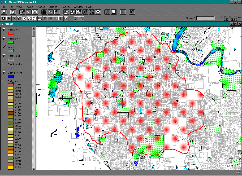
Where do people live and work? The map directly below shows a
magnified portion of the map above together with the parcel map of the
City of Ann Arbor.
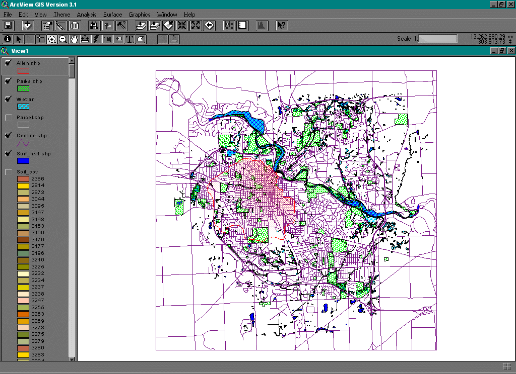
Impervious surface accelerates the flow of water into the creekshed. One source of impervious surface that has been mapped is the road network, shown in the map directly below. Others that should be mapped include rooftops, driveways, and sidewalks, all of which also contribute to impervious surface.
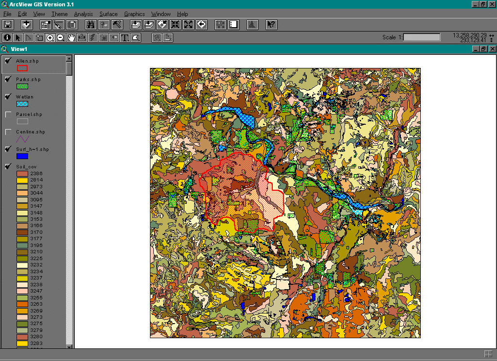
Accelerated run-off often can create accelerated erosion of banks and
destruction of fragile habitat along streams. Different types of
soil erode at different rates. The map directly below shows different
soil types in the Allen Creek shed; in some cases, the flood plain is suggested
by soil groupings.