GIS maps based on UNDP data sources.
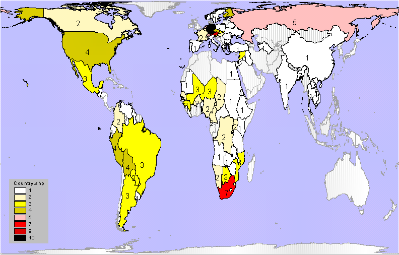
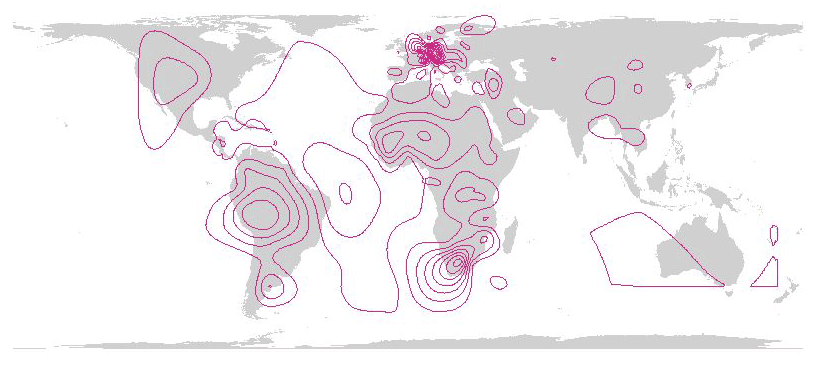
Map showing world base map shaded
according to number of commissions to which countries belong.
Map showing global distribution of lake and river basin commissions.
The shading shows the number of commissions to which each country belongs.
Thus, Germany belongs to 10 commissions; South Africa to 7 commissions.
Numerals also show the number of commissions to which countries belong.
European Union and RAMSAR affiliations not counted. Peters projection.
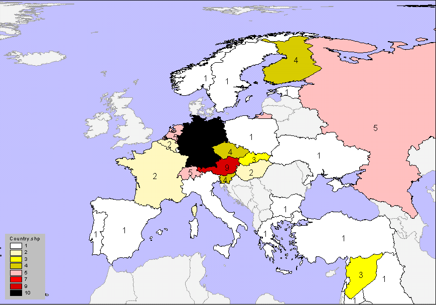
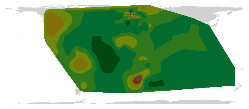
Maps showing continental
base maps shaded according to number of commissions to which countries
belong.
-
Map showing European distribution of lake and river basin commissions.
The shading shows the number of commissions to which each country belongs.
Thus, Germany belongs to 10 commissions; South Africa to 7 commissions.
Numerals also show the number of commissions to which countries belong.
European Union and RAMSAR affiliations not counted. Peters projection.
-
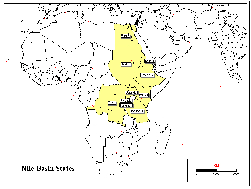
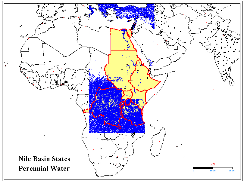
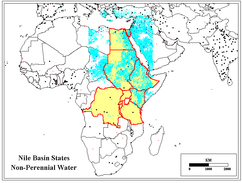
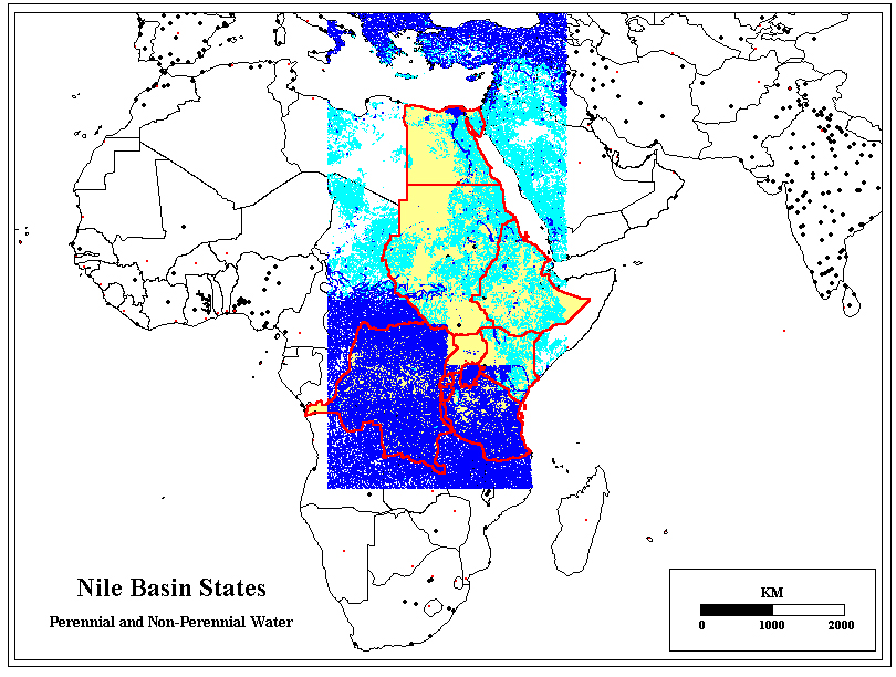
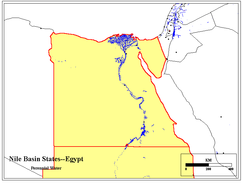
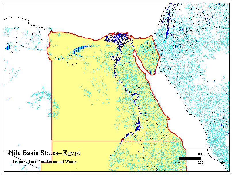
Nile Basin maps (source: Digital Chart of the World).
-
Egypt (source: Digital Chart of the World).
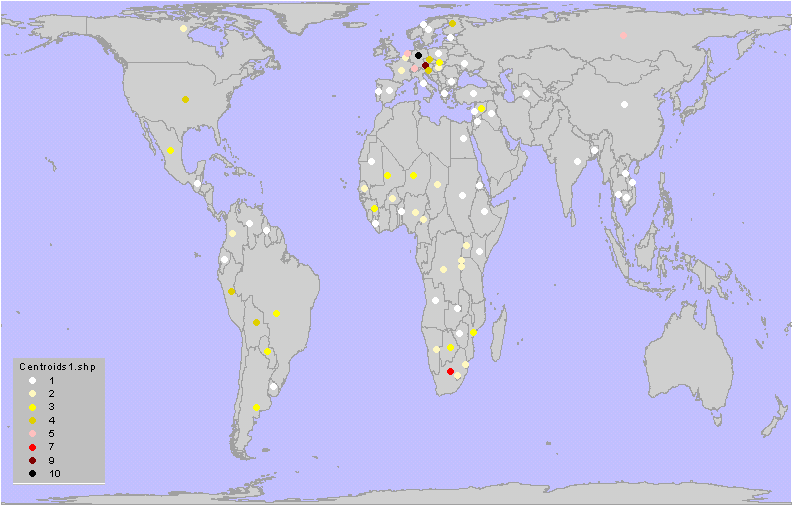
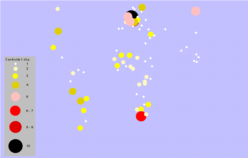
Abstract maps.
A sequence of more abstract maps, based on point-level abstraction,
line-level abstraction, and region-level abstraction, is presented below.
These maps may be useful for grasping global distribution pattern at a
glance.
-
The first map shows a more abstract map showing country centroids shaded
according to number of lake and river basin commissions to which each belongs.
The darker the color of the dot, the larger the number of commissions to
which the nation belongs (from 1 to 10).
-
The next map also uses centroids represented as circles of graduated size.