UM LOGODepartment of Earth and Environmental Sciences
            University of Michigan

  HOME     |     RESEARCH     |     PUBLICATIONS     |     ABOUT ME     |     CONTACT     |     WHAT'S NEW?     |    CASSANDRA!     |     فارسی      |      CHANNEL    |    OUTREACH    |    COURSES   |    CV


Earthquake Hazard in Iran

The question of earthquake hazard in Tehran, the capital of Iran, has long been debated in scientific, political, social and economic frameworks with almost  no conclusive results. This can be attributed to the fact that, as in many other cases in the world, this is a multidisciplinary question. But more importantly,  we do not have unlimited resources. We, as any policymaker will tell you, always have to decide where/how/when to spend our resources.

Located in the Alpine-Himalayan seismic belt, Iran hosts a large number of earthquakes and is one of the most seismic countries in the region, along with Greece, Turkey, Italy and the rest of the Adreatic countries as more than 96,000 earthquakes were recorded by the Iranian Seismological Center (IRSC) between 2006 and 2015. Obviously, this number is a victim to catalog completeness and the actual figure is arguably much larger as, for instance, the number of Iranian seismic stations has significantly increased over time.

          All EventsFault DensityEarthquakes (IRSC)
LEFT: Iranian earthquakes (2006-2015). MIDDLE: Number of fault points per square degree (Tehran is depicted with a blue star).
RIGHT: Earthquakes within a 5-km distance from known faults.


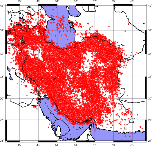
An average of 175 earthquakes with ML > 4 occur in Iran every year. About 99% of Iranian major cities, are 
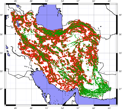
built at a distance less than or equal to 100 km from  Quaternary faults. About 60% of such cities are less than 10 km away from these faults which exposes them to some level of hazard.  It is very difficult to comment  on the extent of risk at these cities, but we can very roughly guesstimate. Such endeavors are usually based on general geological and seismotectonic features exhibited at a certain location (=seismotectonic province).

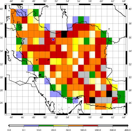
We should still wonder whether or not such assessments are in anyway useful. This is why many researchers use the accessible seismic data to analyze the hazard to which the cities are exposed. The results are usually expressed in the form of either iso-intensity (acceleration) contour maps or block zonings. The first type of maps gives the possible amount of shaking as result of a possible future earthquake, and the second type stops at specifying potential seismic sources and the respective possibly affected areas in their vicinity.

Here is a movie of the seismicity of the Iranian plateau between (2006-2017).