Amir Salaree
Research Fellow
Department of Earth and Environmental Sciences
University of Michigan
 |
 |
|
I am a seismologist who likes to play around with seismic, hydrodynamic, acoustic, and geomechanic problems. I have a keen interest in studying natural hazards and have worked on earthquakes, tsunamis, landslides, and storms (see my research page!). I did my PhD at Northwestern University (see here). |
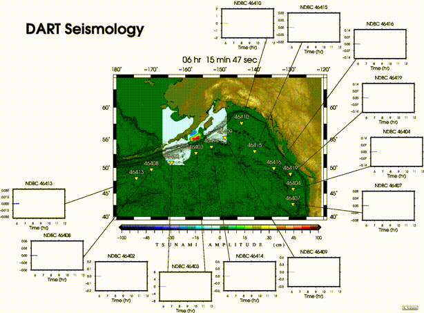
Tsunami simulation of the Mw=8.3 Alaska earthquake in July 2021. Small panels show seismic Rayleigh waves in DART (ocean-bottom pressure seonsors) data. DART are actually designed to record tsunamis (high-resolution movie here). |
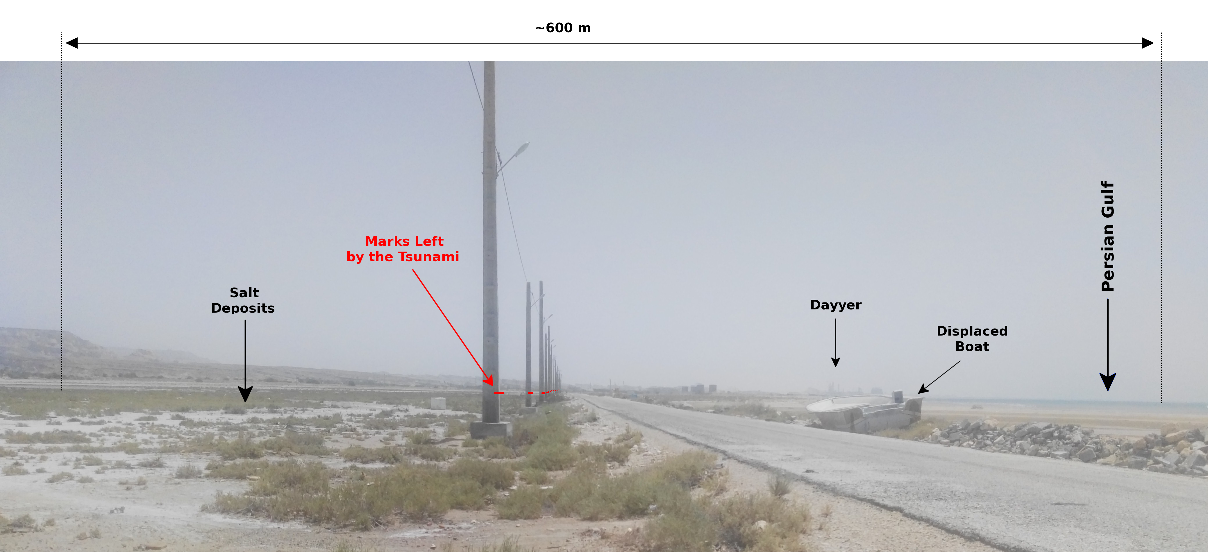
My Approach:Like most other geophysicists, I harvest various types of data in search of meaningful, scientific patterns. Usually, everything starts with an apparently out-of-place observation. The observation can be anything: things like unusual shaking of the gound, blips and noises in the audio track of a diver's recording, a boat capsized half a mile inland, large sea waves in a nice, sunny day, an aftershock making a tsunami twice as large as that made by the main earthquake, seismic waves showing up on tsunami records, ... (I sometimes brag that I deal with all four Greek elements of nature 😁). Also, sometimes the work begins from a light-bulb moment when reading the literature, working out the math, or discussing science with colleagues, students or the public. After that, it is usually about not letting go of the good idea. |
|
I use a wide variety of datasets from seismic, hydrodynamic, geodetic, geological, hydrological, and satellite imagery, to historical and anthropological evidence in further studying such phenomena. The tools I use can be computational (usually lots of coding is involved!), based on field surveys, or theoretical. While like many of my fellow geophysicists I follow the glued-to-my-computer stereotype, I enjoy the detective story aspect of field surveys! |
Diversity Commitment
You can find me here:


