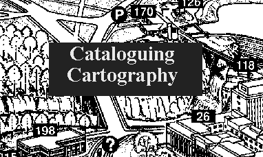
This document is directed at fellow novice cataloguers interested in performing some original cataloguing of maps and other more or less traditional cartographic materials in conformance with the descriptive standards established by AACR2r, such as might be done in a small library with a small collection of maps, plans, guides, etc. It is issued in the hope that it might be of some use, and in the greater hope that my own straying feet might be put back on the right path. Professional map librarians should probably avert their gaze. A progress report on this project is available.
This exercise has been designed to be taken in one of three ways, of which
the first, the tough direct climber's confrontation with the raw data, has suffered
some landslips and is not yet fit for passage. The hike and the stroll,
however, are available. You may proceed...
Either
by strolling through the components of the bibliographic description
in order, taking in the most important rules as they appear, and viewing
the results of the rules in portions extracted from catalogue records...
Or: by hiking through eight sample records, examining
the (linked) data on which they are based, and comparing (linked)
notes with the cataloguer.
To stroll, continue down this page or click on any strolling link.
To hike, click on any hiking link or choose instead one of the the following
examples that are included in this exercise. Note, however,
that the notes are cumulative and work best when the entries
are proceeded through in order.
EXAMPLES
This exercise is based strictly on AACR2r, with some help from the discussion in C.O. Frost, Media Access and Organization, chapter 2, much of it derived from the invaluable Cartographic Materials: A Manual of Interpretation for AACR2 prepared by the Anglo-American Cataloguing Committee for Cartographic Materials (1982) [CM]. These, together with the usual LC Rule Interpretations, should answer most of the basic questions arising from the application of AACR2r to ordinary cartographic materials.
The scope statement is quite careful, but there are inevitably fuzzy areas. Even my Item 3 could be called a chart, and one item excluded from the samples only at the last minute, a glossy card providing information about a section of the Pembrokeshire Coast Path, could also be reasonably be construed as such. The accompanying material attached to Item 8 threatens to tip the balance and become the primary item in itself. And computerized GISystems, thankfully excluded here for the present, really need to be treated under both chapter 3 and chapter 10.
When an item is catalogued as a map, even if it appears with a book attached, the map remains the chief source of information. Example 8 is one example with significant accompanying printed material, though one in which there are no differences between map and material in the all-important area of title and statement of responsibility (important since for them the chief source is the only permitted source). I have taken "cartographic item" (the words AACR2 uses to describe the chief source) in keeping with its use elsewhere in the chapter, that is, as denoting e.g. not only the map per se but the entire sheet on which the map appears.
Most maps occur in series, or on sheets with other maps. To what extent should the collections or series be catalogued as a unit? Item 6 is a typical series map that should probably be catalogued as a series.
 United Kingdom. Ordnance Survey.
     Thirlmere [map] / made and published by the Director
  General of the Ordnance Survey. -- Scale 1:25,000
  (W 3o 04' 50"--W 2o 53' 34"/N 54o 34' 18"--N54o 28' 54").
  -- Southampton, [England] : Ordnance Survey, c1952.
     1 map : col. ; 40 x 40 cm. on sheet 48 x 47 cm. folded
  to 24 x 12 cm. -- (1:25000 First series : provisional
  edition ; sheet NY 31).
(1:25000 First series : provisional
edition ; sheet NY 31).
Most items that include several maps can probably be dealt with under a common title, or treated as if one title subsumed the others, but there are certainly cases in which no collective title can be found, in which case the option is available of cataloging each part separately. Item 2 has been handled in this way.When separate items are physically attached, it results in a few distinctive features for the record:
United States. Army Map Service.
      Southeast China [map] / compiled for the U.S. Army Air
   Forces by the Army Map Service (LC, LN), U.S. Army. --
   Scale 1:2,000,000 ; Lambert conformal conic proj.,
   standard parallels 26o and 45o (E 112o--E 122o/
   N 22o--N 32o). -- Washington, D.C. : Army Map Service,
   1944.
     1 map in 2 segments on side 1 of 1 map : col., silk ;
   60 x 49 cm. -- (AAF cloth map : Asiatic series ; no. 34)
    With (on verso): Northeast China. -- (Asiatic series ;
   no. 35).
The question of responsibility is frequently a vexed one with maps, whether one is dealing with a main entry heading (in which case rule 21.1B2(f) provides a lot of leeway for introducing the corporate authorship of a mapmaking company or agency), or primary statements of responsibility (again corporate authorship must often be considered, but how can one distinguish a statement of responsibility from a publication statement?), or edition/revision responsibility. The permissible source for these three responsibilities differ, of course, and the primary statement of responsibility is restricted to the chief source. Even so, in a case like the NY Subway map, is the responsible party the MTA, the NYCTA, or no one? When a company name is given, with no statement of relationship, should it be taken as denoting authorship or distribution? Item 4 poses another challenge: what tasks qualify as authorial? Should surveying be considered, however technically or otherwise that term be intended:
Gemmell, Arthur
     Grassington and district [map] : footpaths & town
  maps & walks guide / Arthur Gemmell. -- 5th ed. / most
  of the paths...resurveyed for this edition by Reg and Joyce
  Smith and the author.
For most maps, this boils down to three items, scale, projection, and lat and long coordinates, the first of these essential if at all possible, the last an optional but desirable attempt to create an absolute means for the retrieval of geographic material.
The scale requirement in practice usually involves a few outs, then some hard slogging. In the most common cases:
MapEasy (company)
     MapEasy's Guidemap to Chicago [map]. -- Scales vary.
  -- Amagansett, N.Y. : Mapeasy, c1995.
     5 maps on 1 sheet : col., plasticized paper ; 58 x 88
  cm. or smaller on sheet 61 x 91 cm folded to 23 x 12 cm.
AZ Leeds and Bradford street atlas. --
Grassington and district [map] : footpaths & town maps & walks guide / Arthur Gemmell. -- 5th ed. / most of the paths...resurveyed for this edition by Reg and Joyce Smith and the author.
Projection is regarded as much less important and need only be given if given by the item, in the same words as given, but with all valid AACR2 abbreviations employed.
The only choice is whether to include additional projection information, especially meridians and so forth, should that happen to have been given by the item. Item 2 and Item 8 exemplify a positive response to this option.
Scale 1:1,000,000 ; minimum error conical proj.
Coordinates are particularly handy things to have, since they provide an absolute reference system independent of fashions in political boundaries. They are conceptually simple, requiring one simply to give the westernmost, easternmost, northernmost, and southernmost points in order (reflecting a bias toward the North and the West?). And they can be obtained from anywhere, even if the item does not provide the information directly. Item 6 kindly supplies the information directly and precisely (for "o" read a degree sign of course):
(W 3o 04' 50"--W 2o 53' 34"/N 54o 34' 18"--N54o 28' 54")Whereas in Item 4, I had to translate from the British National Grid references to their rough equivalents in latitude and longitude:
(W 2o 07'--W 1o 57'/N 54o 07'--N 54o 02').
Physical description, including the notorious 3.5D1, poses some of the nastiest nitpicking in AACR2 treatment of maps ("cartographic materials" but the American GMD controversially says "maps"), as might be expected. The first questions to ask are commonly:
1
AZ Leeds and Bradford street atlas. -- Scale 1:15,840. --
  Borough Green, Seven Oaks, Kent, [England] : Geographers'
  A-Z Map Co., c1993.
     1 atlas (202 p.) : 62 maps ; 20 cm.
Dimensions can be put off no longer, and they are a fitting place to end. Rule 3.5D1, applying to the dimensions of maps, plans, etc., is the densest rule in Chapter 3. The basic rule is simply to represent the height and width (h x w) of each map to the next nearest centimenter. If the map makes this practically difficult (specific reasons are given involving lack of borders, irregular shape, etc.,) resort to measuring the sheet instead. Item 8 fits this simplest profile:
1 map : col. ;
The next commonest or at least simplest situation arises when the map size is significantly different (half the size, linearly speaking, or less) from the sheet size and/or there is substantial additional material on the sheet (e.g. text). In that case, give both map size and sheet size. Item 1 perhaps fits that pattern:
1 view ; 46 x 82 cm. on sheet 65 x 86 cm.
Common road maps and similarly designed folding maps with or without an attached cover, so long as they are clearly designed so that one panel faces the public, require that the folded size be given, and often the sheet size as well. Several of the items fall into this category, eg. Item 6:
1 map : col. ; 40 x 40 cm. folded to 24 x 12 cm.and Item 4:
2 maps on 1 sheet : col. ; 16 x 12 cm. and 39 x 45 cm.
  on sheet 39 x 47 cm. folded to 20 x 12 cm.
Item 4 also illustrates the principle that up to two sets of dimensions for any class of thing may be given: 2 maps or 2 sheets. Beyond 2, and one has to resort to listing the largest dimensions (not necessarily paired in actuality) and follow them with "or smaller." Item 7 traverses that line:
5 maps on 1 sheet : col., plasticized paper ; 58 x 88
  cm. or smaller on sheet 61 x 91 cm folded to 23 x 12 cm.
Finally, if the various "maps" in an item would in fact be continuous if joined up, they are not maps but segments. Segments are not individually measured, but the complete map that would be formed by joining the segments is. Item 4 illustrates this too, since the large map listed as being 39 x 45 cm. is in fact two half maps, one on each side of the sheet. In arriving at the measure of the combined map, I omitted the short strip of border material that they share. When segment assembly becomes difficult, only then give just the sheet numbers. I have no examples of that.