
SOCIO-ECONOMIC DATA BEYOND CENSUS
Arab Community |
Business |
County Summaries |
Crime |
Employment |
Environment |
Government |
Health
Hispanic Community |
Income/Poverty |
Libraries |
Newspapers |
Quality of Life |
Politics |
Population Estimates
Religion |
Schools |
Social Services |
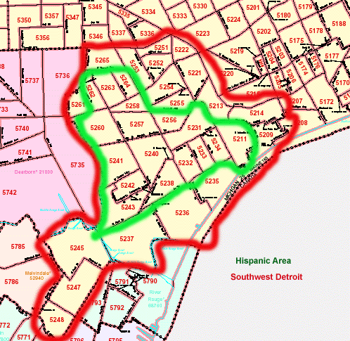
Southwest Detroit |
Transportation
REFERENCE TOOLS
Citations |
Excel |
Statistical Indexes
COMMUNITY TOOLBOX | SLIDE SHOW | CENSUS EXERCISES | EXCEL TEMPLATE
| Summary Files 1 and 2 (100% Data) | |
| Subjects | Geography |
|
Household relationship |
Summary File 1:
All levels to block Some details limited to tract
All levels to census tract Must have 100 of race in area |
| Summary Files 3 and 4 (Sample Data) | ||
| Subjects | Geography | |
|
Subjects in SF 1 in less detail Marital status Grandparents as caregivers School enrollment Educational attainment State or foreign country of birth Citizenship and year of immigration Language spoken at home Ancestry Place of residence 5 years ago Veteran status Disability Labor force status Place of work Journey to work Occupation Industry | Class of worker Work experience in 1999 Income and poverty in 1999 Housing units in structure Rooms in unit Value of home Rent paid Year structure built Year moved into residence Heating fuel Plumbing and kitchen facilities Number of bedrooms Farm residence Telephone Vehicles available Monthly shelter costs |
Summary File 3:
All levels to block group Total ancestry figures only to tract level
|

Definitions for the 2000 Census appear in the Appendix B to the Summary File 3 Technical Documentation
Chapter 7: Data Dictionary [http://www.lib.umich.edu/govdocs/census2/sf3td/sf3td7.pdf] - 1.6 M (all individual variables in all tables with codes).
Appendix G: CODE LISTS
- Ancestry [http://www.lib.umich.edu/govdocs/census2/sf3td/sf3tdg1.pdf] - 60K
- Group Quarters [http://www.lib.umich.edu/govdocs/census2/sf3td/sf3tdg2.pdf] - 56K
- Hispanic [http://www.lib.umich.edu/govdocs/census2/sf3td/sf3tdg3.pdf] - 26K
- Industry [http://www.lib.umich.edu/govdocs/census2/sf3td/sf3tdg4.pdf] - 59K
- Language [http://www.lib.umich.edu/govdocs/census2/sf3td/sf3tdg5.pdf] - 50K
- Occupation [http://www.lib.umich.edu/govdocs/census2/sf3td/sf3tdg6.pdf] - 92K
- Race [http://www.lib.umich.edu/govdocs/census2/sf3td/sf3tdg7.pdf] - 115K
- States and Foreign Countries [http://www.lib.umich.edu/govdocs/census2/sf3td/sf3tdg8.pdf] - 42K
- Multiple Races. The 2000 Census permitted people to choose multiple races. They are tabulated into six categories: white; black or African-American, American Indian or Alaska native; Asian; native Hawaiian or other Pacific Most tables also have a seventh category named Two or More Races. Approximately 2-3% of all people reported multiple races in the 2000 Census Many people believe the 2000 racial data is not comparable to 1990.
There were only five (rather than seven) standard tabulations in 1990. These include white, black, Asian or Pacific Islander (Asian Indian, Chinese, Filipino, Guamanian, Hawaiian, Japanese, Korean, Samoan, Vietnamese, other) American Indian (or Alaska Native) and other.
- Hispanic. Hispanic is not a race so is usually covered in a separate table. Some tables provide data for Mexican, Puerto Rican, Cuban, and other. The Hispanic question was asked after the racial question in 1990. The Hispanic question was asked before the racial question in 2000 so may be more accurate.
- Arab. The Arab population is considered white in the 100% data (Summary File 1). Summary File 3 (sample data) lists Arab as an ancestry.
- Labor Force. Labor force participation includes people who have jobs or want them. Reasons for not participating in the labor force include age, disability, family matters, retirement, school enrollment, etc.
- Unemployment. Unemployment is calculated by dividing the people who want jobs but don't have them by the labor force.
- Income. Income is calculated for households (families, people living alone, people living together but not related), families (related by blood or marriage), individuals, and per capita (including children).
- Median = half below level and half above level; Mean = average.
- Poverty. Poverty rates are calculated by the Census Bureau using the family income, the size of family, and poverty levels it establishes annually inflated from the original 1964 figures. Poverty rates are available for families and persons but not for households.
- Group Quarters. The category includes institutionalized people (nursing homes, mental institutions, prisons) and non-institutionalized people (college dorms and military quarters).
| State | ||||||
| Metro Area | ||||||
| County | ||||||
| Place | ||||||
| Census Tract | ||||||
| Block Group | ||||||
| Block |
- Use Mozilla for the best downloading.
- Main navigation section is on the lefthand side. It includes Data Sets and Address Search.
- Enter through ADDRESS SEARCH even if you don't know an address. Do a Name Search for a city or county if you don't know a geography number, such as tract or block group number.
- Zoom in for more detail. Boundaries, features, and years can be changed by using the legend and updating it.
- Enter through the Thematic Maps section of Data Sets/Summary File 3
- Choose the largest geographic level you need and use a pulldown box to change the display to a subgeography (e.g. tract, county, county subdivision).
- Use the legend to add features and boundaries.
- Right-click on the mouse to download in gif format; use the download button at the top to download in pdf format.
P6 and 7: Race and Hispanic Origin
P10: Household Living Arrangements (P146A-I by race)
P37: Educational Attainment of people 25+ (P148A-I by race)
P41: Basic Disability Data
P43: Employment Status
P50: Occupation
P53: Median Household Income (P152A-I by race)
P87: Poverty Status by Age Group (P159A-I by race
H6: Occupied v. Vacant Housing
H54: Median Contract Rent
H76: Median Housing Value
PCT 16: Ancestry
States: SRI Fiche C1200-2
Cities: SRI Fiche C1200-7
Zip Codes: SRI Fiche C1200-6
States: SRI Fiche C1200-2
Cities: SRI Fiche C1200-7
Zip Codes: SRI Fiche C1200-6
| Name | Address | Tract Number |
|---|---|---|
| New St. Paul Tabernacle | 15362
Southfield Detroit 48223 | 5422 |
| Bagley Elementary School | 8100 Curtis Detroit 48221 | 5386 |
| Latino Family Services | 3815 W. Fort
Street Detroit 48216 | 5235 |
| Delray Neighborhood House | 420 Leigh Detroit 48209 | 5237 |
| Delray United Action Council | 7914 W.
Jefferson Detroit 48209 | 5236 |
Grace York, Coordinator, Documents Center
The University of Michigan Library
govdocs@umich.edu