|
I. Home
III. Recent Publications
V. River Raisin Watershed Project |
|
THE RIVER RAISIN WATERSHED PROJECT
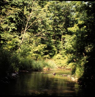
The River Raisin flows through a watershed that is
largely agriculutral, but much variation can be seen in land use, soils and geology, and human activities. Some tributaries have good habitat and native biodiversity, others are "trashed". Our project
seeks to understand how human activities, especially those associated with
changing land use, affect the stream ecosystem. Hopefully, better
management will result from improved knowledge.
Our project statement explains the broad goals of the River Raisin study, and the abstract of our current USDA grant provides more specific research activities. Numerous students have now completed their theses as part of this project and our list of publications is growing. GIS plays a central role in the Raisin project. A GIS (Geographic Information System) provides the capability to overlay, integrate, and analyze spatial data, often assembled from a wide variety of sources.
|
Last updated January 25, 1998
J.D. Allan, School of Natural
Resources & Environment
University of Michigan