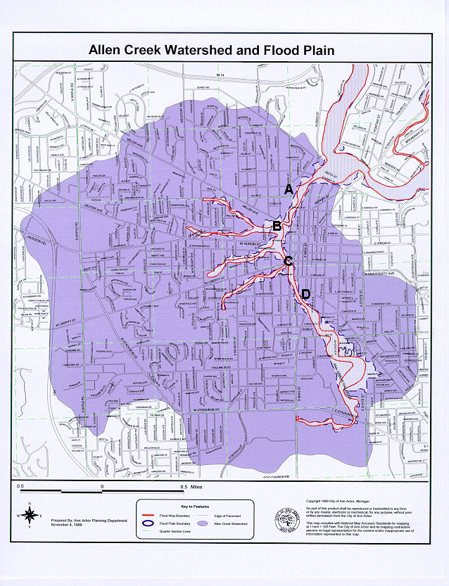
| On the map below, click on the letters A, B, C, and D to see an attached aerial view of Ann Arbor with the parcel map and Allen Creek Floodway and Floodplain superimposed on each aerial. |
 Hard copy of image and GIS work done by the City of Ann Arbor Planning Department (Karen Hart, Wendy Rampson, and Alexis Marcarello). |