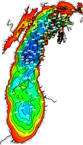
Figure 1. NOAA bathymetric map of Lake Michigan |
The boundary between art and science is often blurred. Insight and leaps forward might be "art"; the ability to repeat a process consistently might be "science." Transformations, often mathematical, can offer means to traverse this vague border. Thus, we propose the following research effort, linking fields of geography and music, using a bridge of mathematics realized in current technological environments.
A musical conductor often uses a score from which to lead an orchestra. Novices in the audience may see the conductor as useless; the musicians have their parts of the score so why is a conductor needed--as a traffic officer to keep violins from interfering with the flow of the horn section? Far more, however, the conductor is an artist who sees the whole, the parts, the whole as a sum of the parts, and the whole as greater than or less than the sum of the parts. Two different conductors using the same score will produce music that is identifiable but that sounds different as it reflects their personalities as artists. In that regard, the musical score is the scientific instrument: it is the score that is transferable and allows for repetition, at some level, of results. How then, might one characterize the performance of the artistic effort of the conductor? When the conductor simultaneously becomes a composer as he/she conducts, as is often the case with improvisational ensembles that respond musically to and with the conductor, that question becomes even more vexing.
A recent performance at The University of Michigan's Duderstadt Center, November 11, 2004, featured The University of Michigan Creative Arts Orchestra (an improvisional ensemble), conducted by Michael Nickens. Nickens donned a tight body suit covered with sensors and entered the immersion CAVE of the 3D Laboratory of The University of Michigan (Prof. Dr. Klaus-Peter Beier, Director). From within the CAVE, Nickens moved around as he wished and the ensemble, in another part of the building, responded with music appropriate to his actions. His actions were transmitted in real-time, as his body and its movements, captured as a discrete "point-cloud" by the sensors on the suit, was transmitted live, from the CAVE, directly to the room with the ensemble. Because the movements of the conductor were transmitted electronically, they are captured as a quantitative dataset that could be repeated. Thus, the immersion CAVE brings to the conductor-composer a method for quantifying the previously unquantifiable.
One step beyond the electrifying performance that Nickens gave, might be to introduce an environment into the CAVE to which the conductor might respond. Thus, we propose introducing geographic, or other environments into the CAVE. Then, have two (or more conductors) conduct the ensemble from the CAVE as they respond to being immersed in specific geographic environments. Because the movements of each conductor will be captured electronically, it will be possible to compare and contrast elements of style of musical conducting and composition, and create a learning tool for new conductors and a research tool for veterans.
Further, because all conductors are responding artistically to the same geographic environment, the professional geographer will also have an electronic atlas of human response to selected geographic scenes. One of the vexing problems of the geographer is that the real-world is his/her laboratory--one with few controls. Immersion CAVEs offer greater control over selected, but mathematically simulated, environments. Nonetheless, an atlas that captures human response in a systematic fashion has great implications for the geographer and spatial scientist.
To begin, we wish to consider an environment
that is compact (so that it will work in the CAVE), that is interesting,
that is not well-known (to reduce knowledge bias), and that might be chosen
for some "reason" rather than chosen at "random." Because Michigan
is the "Great Lakes State" we chose the Great Lakes. NOAA has made
interesting bathymetric maps of the Great Lakes (lake bottoms) that are
probably not well-known to most (Figure 1).
|
Figure 1. NOAA bathymetric map of Lake Michigan |
This year (2004) is the 100th anniversary
of a car ferry from Ludington, Michigan to Manitowoc, Wisconsin (Figure
2). The route of the ferry travels over the "Two Rivers Ridge."

Figure 2. NOAA bathymetric map showing Lake Michigan bottom from Ludington, Michigan to Manitowoc, Wisconsin, across the Two Rivers Ridge. |
The swath of lake surface linking these
ports, together with the bathymetry under it and a vertical profile of
that bathymetry, is a "compact" environment. To capture this environment
for the CAVE, we converted a digital map into a Triangulated Irregular
Network, as a three-dimensional bas-relief of the region (Figures 3, 4,
and 5).
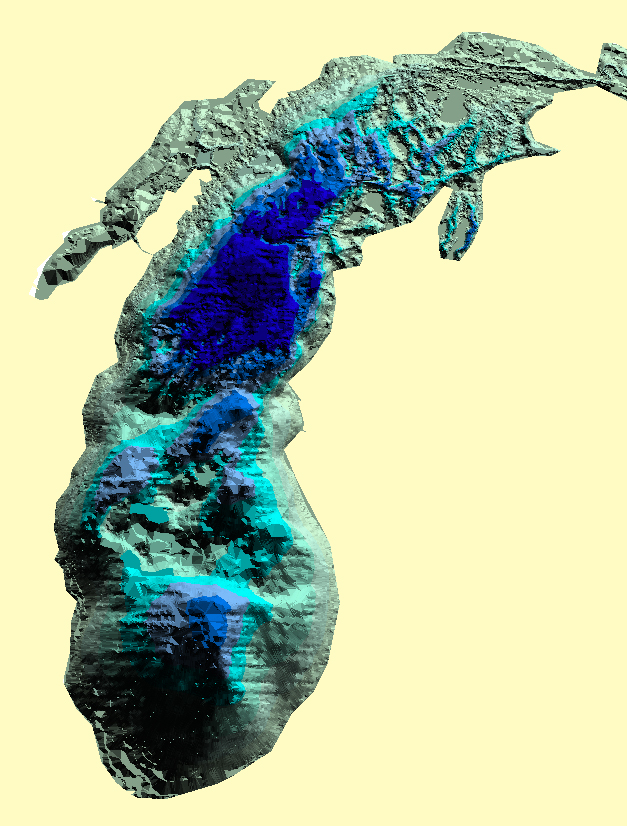
Figure 3. Lake Michigan captured as a Triangulated Irregular Network. |
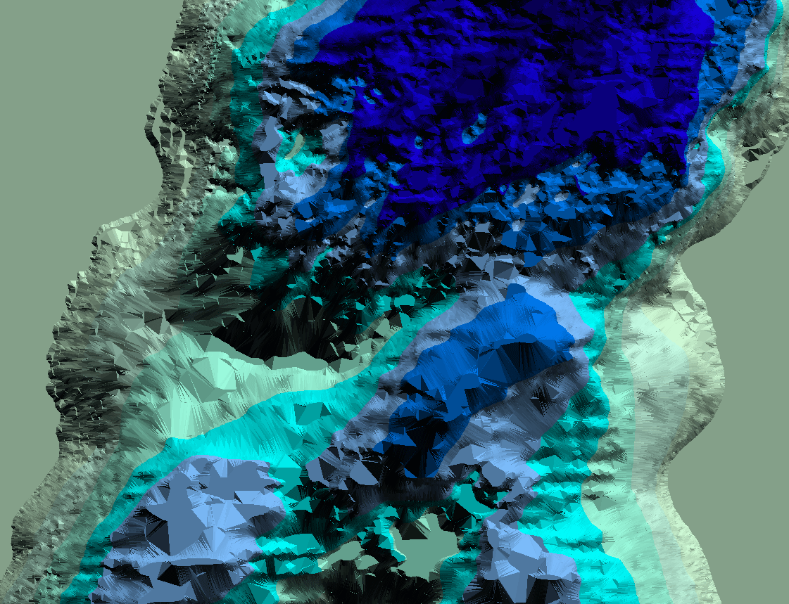
Figure 4. A Triangulated Irregular Network showing the Two Rivers Ridge; darker colors represent deeper parts of Lake Michigan. |
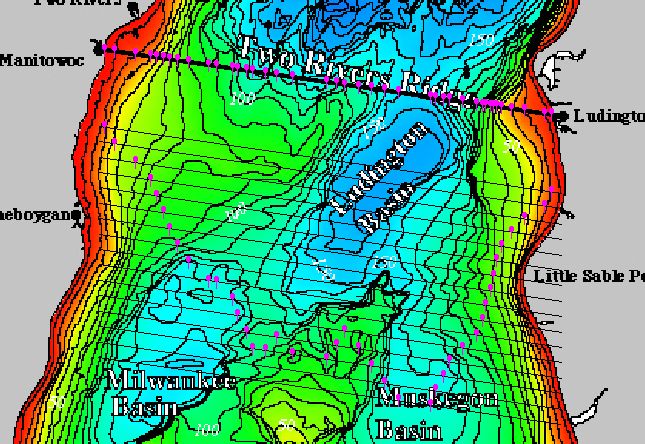
Figure 5. Vertical profile across the Two Rivers Ridge. |
When the 3D maps are converted to Virtual Reality Modeling Language, they can be used on the Internet as a virtual display of the region and an animation made from them to show, in a browser, what the region might look like (Figures 6 and 7).
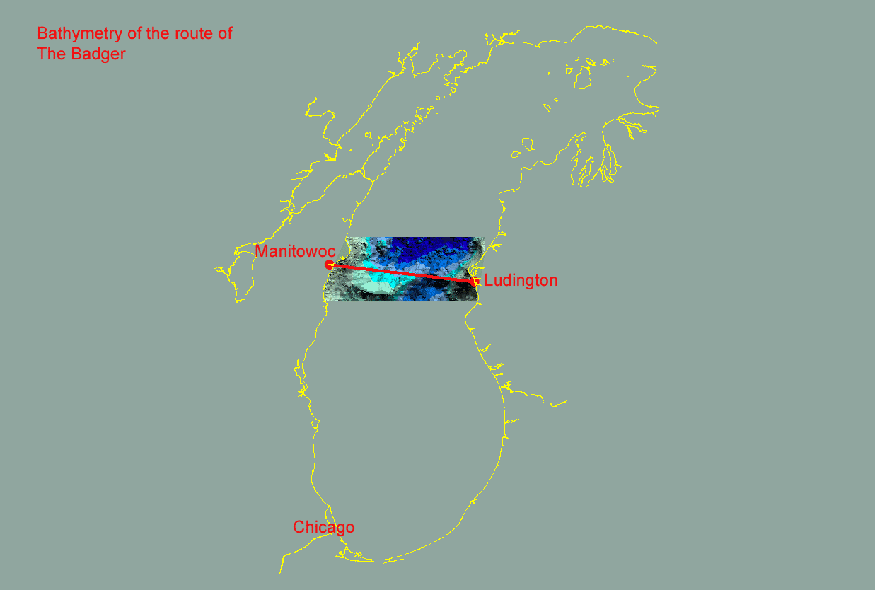
Figure 6. Animation shows transformation. |
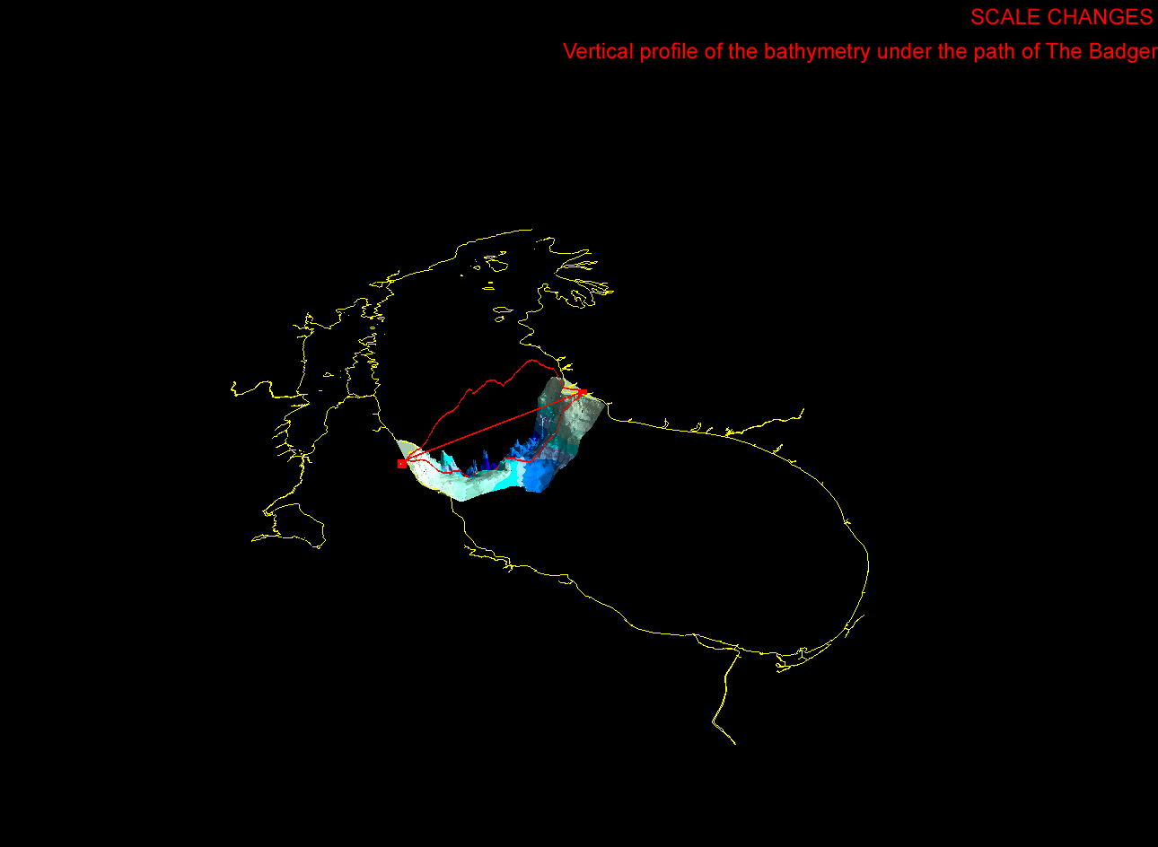
Figure 7. Animation shows scale change. |
The Virtual Reality (.vrml) model from
which Figure 7 was derived is linked here.
It is the sort of model that can play in the CAVE and might well serve
our initial purposes: one can traverse the bottom of Lake Michigan
on dry land. Thus, as a first step, we propose to make a model for
the CAVE of the Ludington/Manitowoc route and to introduce that to two
conductors, have each conductor react to that environment in the CAVE as
an improvisational ensemble reacts to the conductor in free form spatial
arrangements in a black-box theatrical environment separated from the CAVE.
Following the actual theatrical productions, analysis of data will show
common elements and differences in technique and viewpoint of conducting
style and resultant composition, and it will also show the same for reaction
to a specific geographic environment viewed in a CAVE. With feedback
from a pilot study in hand, we would then be in a position to assess prospects
for the future.