Sandra Lach Arlinghaus, Ph.D.
Adjunct Professor of Mathematical Geography
and Population-Environment Dynamics
School of Natural Resources and Environment
The University of Michigan
with input from**:
Klaus-Peter Beier, Matthew Naud, John
D. Nystuen
Taejung Kwon, Adrien Lazzaro, Paul Oppenheim,
Aaron Rosenbaum (Fall 2003)
Nikolai Nolan, Rasika Ramesh, Itzhak Shani
(Fall 2004)
The electronic
pages of this journal have, for the past few years, contained numerous
examples of virtual reality maps: from planning for extra residential
units in downtown Ann
Arbor to tracking rugged voyages of Lewis
and Clark. Many maps cover large areas of terrain; they are global
in scale. Virtual reality, however, often is best executed
in the small, at a local scale (Beier (lectures in Engineering
477, The University of Michigan), Crispen).
The virtual maps tend to become large in file size quickly, causing the
maps not to load properly. One problem is that software that easily
creates virtual maps may not also optimize file size. That persistent
problem of the virtual modeler can be partially addressed by importing
Virtual Reality Modeling Language (vrml) files exported from Geographic
Information System software (GIS software) into a software package that
executes polygon reduction of the vrml code. Beyond such reduction,
however, there remains the geographer's dilemma of scale transformation
and a need to map both globally and locally. A classical
way to execute such transformation is to arrange the spatial information
in layers of a nested hierarchy and use a well-defined transformation to
move from one level of that hierarchy to another. In the case of
virtual reality maps (VR-maps), one puts individual maps in separate layers,
separating maps before they become too heavy to run smoothly, or adequately,
on current computing equipment (the creator, of course, needs to decide
the target audience and the computing environment in which its members
are likely to function).
Earlier work
on creating a 3D Atlas of Ann Arbor has produced thousands of separate
virtual maps of the downtown (inventory
of previous work; click on the "Archive" button). Some are maps that
show the current stock of buildings. Others are maps that suggest
future buildout scenarios based on concepts provided by leading architectural
and construction experts. The images below show screen capture of
separate virtual reality models. The image on this offers a simple
solution to link the different hyperlinked images, using kiosks that transform
the user, via the internet, from one hierarchical level to another.
|
This linked
image shows a screen capture of an associated virtual
reality model of downtown Ann Arbor with buildings represented as simple
boxes extruded from digitized building footprints. Over several years,
such images, of both actual and projected cityscape, served as one set
of basic materials for planning efforts for city officials involved in
various aspects of municipal planning. Visualizing alternative outcomes
associated with different zoning types and land use patterns was helpful
in understanding how decisions might be reached. Maps and decisions
often go hand in hand.
These maps and
box-models were useful in a general way: for looking at patterns
of vacant land, possible infill sites, general skyline resulting from proposed
infill, relation of topography to the built environment, and as a general
inventory of the existing downtown scene by building height, zoning type,
and special designation (such as historic district or floodplain designation
or State-owned property, as are University of MIchigan buildings).
Many buildings, however, are not boxes, and all buildings have texture.
In the municipal arena of professional planning, supplementary architectural
drawings and models are therefore critical (until the day arrives that
virtual models are easy and inexpensive to make at all levels of detail).
Thus, one wishes for virtual maps that show more detail: not only
for planning purposes but for others as well. An important other
use centers on emergency
response: of firefighters
(using virtual training of firefighters in their downtime in the firehouse,
for example), of police
officers, of environmental
management personnel, and of a whole host of first
responders (link
to the 3D Laboratory, Duderstadt Center, The University of Michigan).
The introduction
of photographic textures on files causes rapid enlargement of file size.
The map in this linked image shows a screen
capture of one view of a virtual
reality file in which textures have been applied to a number of buildings
in the downtown area. The file is about at the limit of what a typical
desktop modern machine running 512 MB of RAM can run in a reasonable (not
optimal) time (anywhere from 1 to 5 minutes to load the model depending
on various local conditions such as amount of free hard drive space, fragmentation
of the hard drive, internet connection speed, age of machine, and so forth).
In this file, there are textures only on selected buildings. There
are no street or sidewalk textures and there is no street "furniture" nor
are there any other related accessories such as traffic lights, lane markers,
or cars.
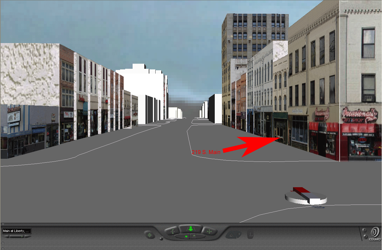
The extra detail
that comes at high cost in terms of file size is quite attractive for many
applications. Another way to introduce extra detail is to put links
on the virtual buildings. Thus, in the last linked
virtual reality model, one can click on selected buildings to look inside:
not at an image of the interior but to internet links to the interior via
a firm's own webpage and so forth. Try 219
S. Main Street: look at the bottom of Cosmo Player to see building
addresses as the mouse is moved across virtual buildings with active links
to html pages. The corresponding html page that comes up when the
building is clicked on in the virtual reality model is linked
here. The background color of the html page is significant.
All buildings in the same physical, four-sided, block have the same color
background. Buildings in adjacent blocks (with adjacency defined
as being "across the street from") have a different color.***
When environmental managers choose to insert, in the html pages, detail
about environmental hazards known to be in particular buildings (for private
municipal use only), then this model provides even more information valued
by these managers, and other first responders, in times of disaster.
One advantage to this approach using html files linked to virtual buildings
is the small file size of the linked web page; another is that no special
knowledge, beyond simple html, is required to maintain the model.
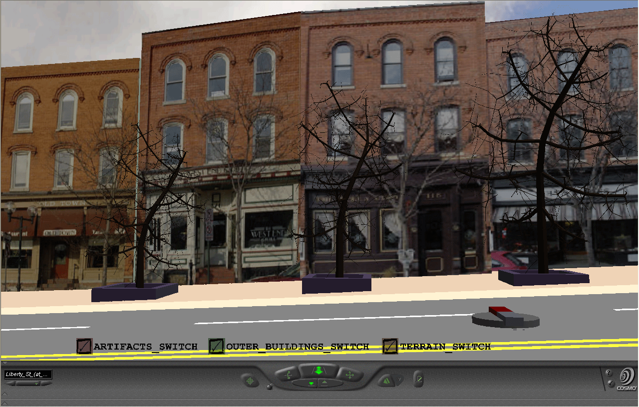
Finally, one
may wish to introduce even more detail with street textures, benches, trees,
and so forth. All of this detail quickly increases file size.
Over the course of two years, student groups worked for three months to
produce more detailed files. In the Fall of 2003, in Professor Klaus-Peter
Beier's Engineering 477 course (The University of Michigan), with Faculty
Advisors Arlinghaus, Naud, and Nystuen, students Kwon, Lazzaro, Oppenheim,
and Rosenblum produced a detailed model of the intersection of Main and
Liberty Streets that Beier edited substantially (look both at the screen
capture and at the virtual
reality model). In the Fall of 2004, again in Engineering 477,
students Nolan, Ramesh, and Shani, produced a detailed model of Main
and Huron Streets that Beier edited substantially (look both at the screen
capture and at the virtual
reality model). Both of these models were edited by the author
in terms of cleaning of photographic images (removing the foreground where
it remained), adjusting building shape and height to be correct and to
be compatible with materials from the City of Ann Arbor and The University
of Michigan, and adjusting building location so that the detailed models
would fit correctly and seamlessly with the City of Ann Arbor files and
with The University of Michigan files. These adjustments involved
the use of ArcView GIS software from ESRI, Adobe PhotoShop, Windows notepad
as a vrml editor, and 3D Studio Max from Discreet. The adjustments
were executed in the Usability Lab of the Duderstadt Center of The University
of Michigan using computing equipment configured with a double flat-screen
monitor for wide-angle viewing, and also on a home desktop with a large
single flat screen monitor.
While each model
has its own uses, an obvious desire is to be able to move from one to another
without returning to a page and links: to move directly from one
level of the hierarchy to another and stay within the virtual world.
One way to execute such movement is to insert markers, "kiosks,"
in files to link from one one level to another. Each virtual kiosk
has an internet link on it: the virtual kiosk serves as a center
of information based on the virtual matter of the internet much as its
real-world kiosk counterpart serves as a center of information based on
printed matter. Thus, the virtual kiosks, when loaded with correct
information regarding Uniform Resource Locators (URLs), serve as well-defined
transformations from one hierarchical level of virtual map to another.
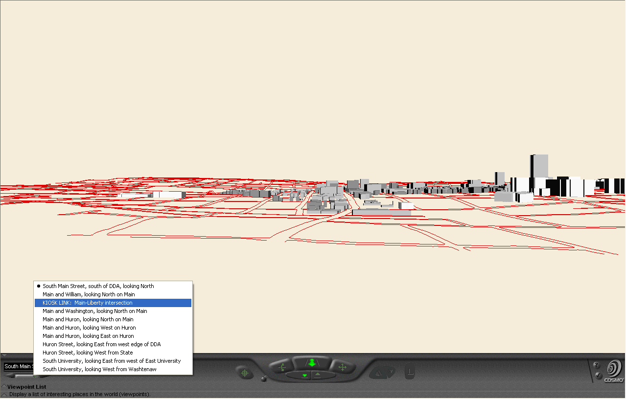
The table below shows how to use this single file. The rows represent
layers in a hierarchy: moving across the rows is a lateral move within
the same hierarchy or virtual image. The columns represent movement
from one virtual image to another; in this case, using kiosks loaded with
appropriate URLs to execute that movement.
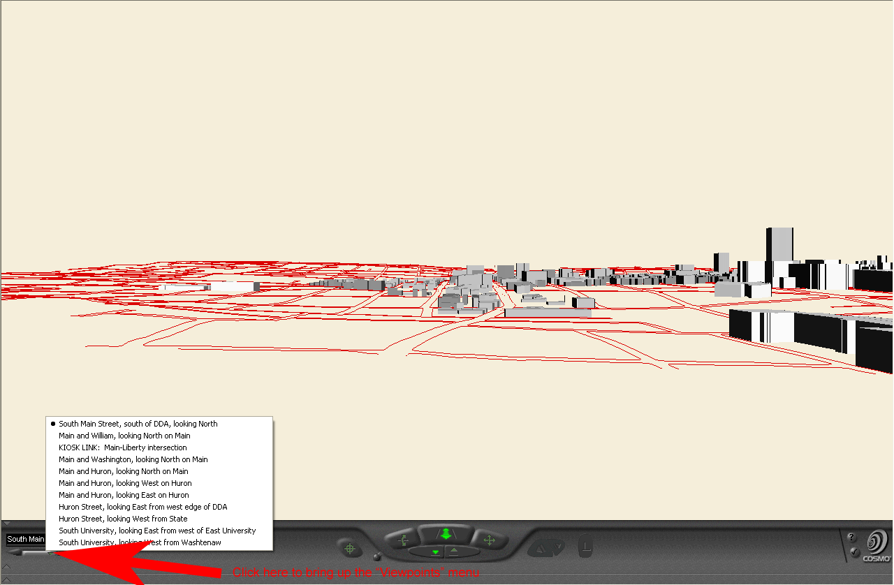
Entry
to file. The viewpoints menu suggests the lateral move (blue highlight).
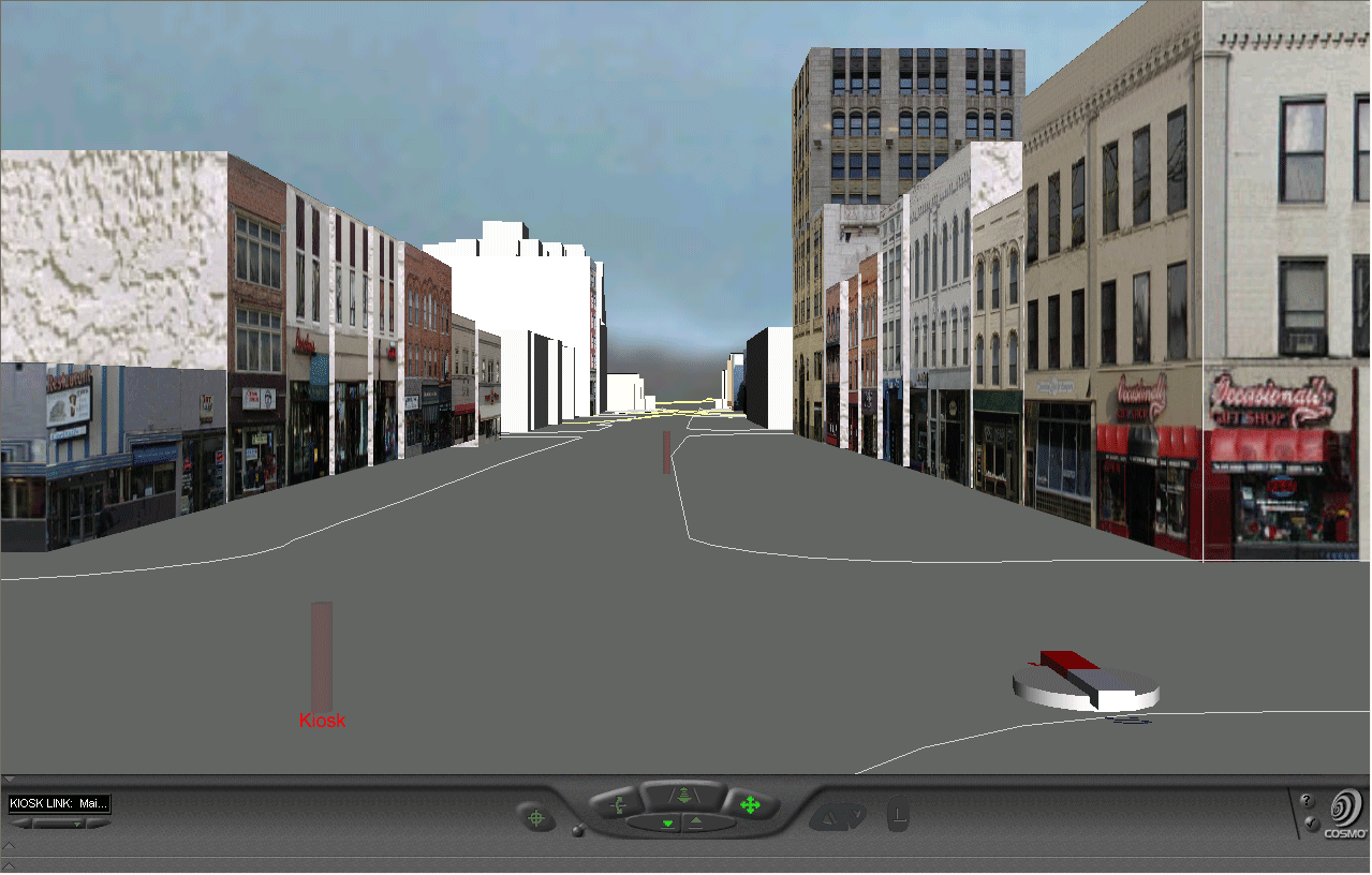
ImageThe direct link to this world is given in the table heading, above. |
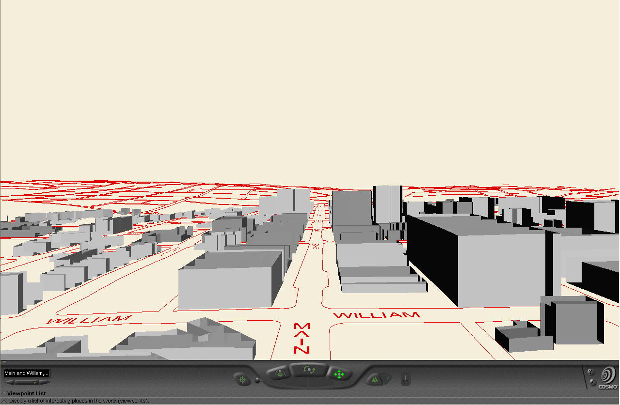
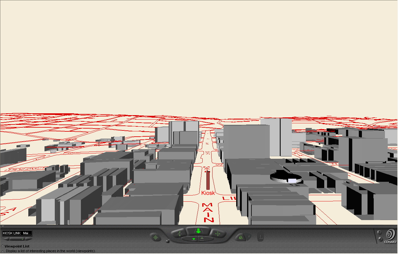
Lateral
move to kiosk, at Main and Liberty, to next level. Click on the kiosk,
in the virtual reality file, to go to next image, below.
Image |
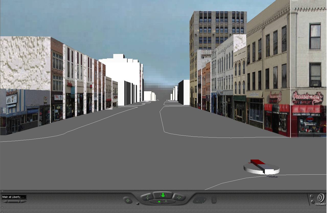
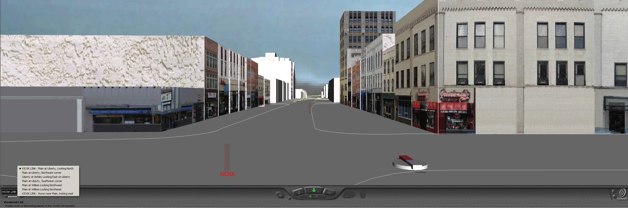
a | a |
| a | More detailed
view of scene at Main and Liberty. Note the kiosk in the street.
Click on it, in the virtual reality file, to go to the next image below,
showing even more detail of a region more local than that shown here.
Image |
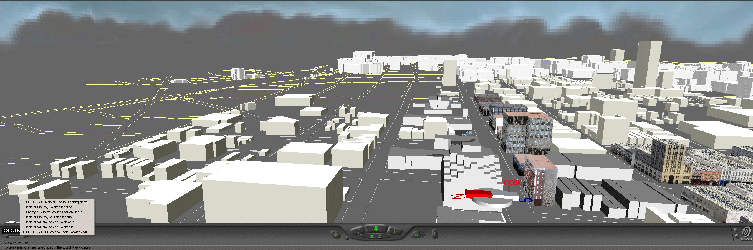
The
viewpoints menu suggests the lateral move (blue highlight).
ImageIn the various views at this hierarchical level, the streets outlined in white lie within the Downtown Development Authority (DDA); those outlined in yellow do not. |
More
detailed view of scene at Main and Huron. Note the kiosk in the street.
Click on it, in the virtual reality file, to go to the next image
below, showing even more detail of a region more local than that shown
here.
Image |
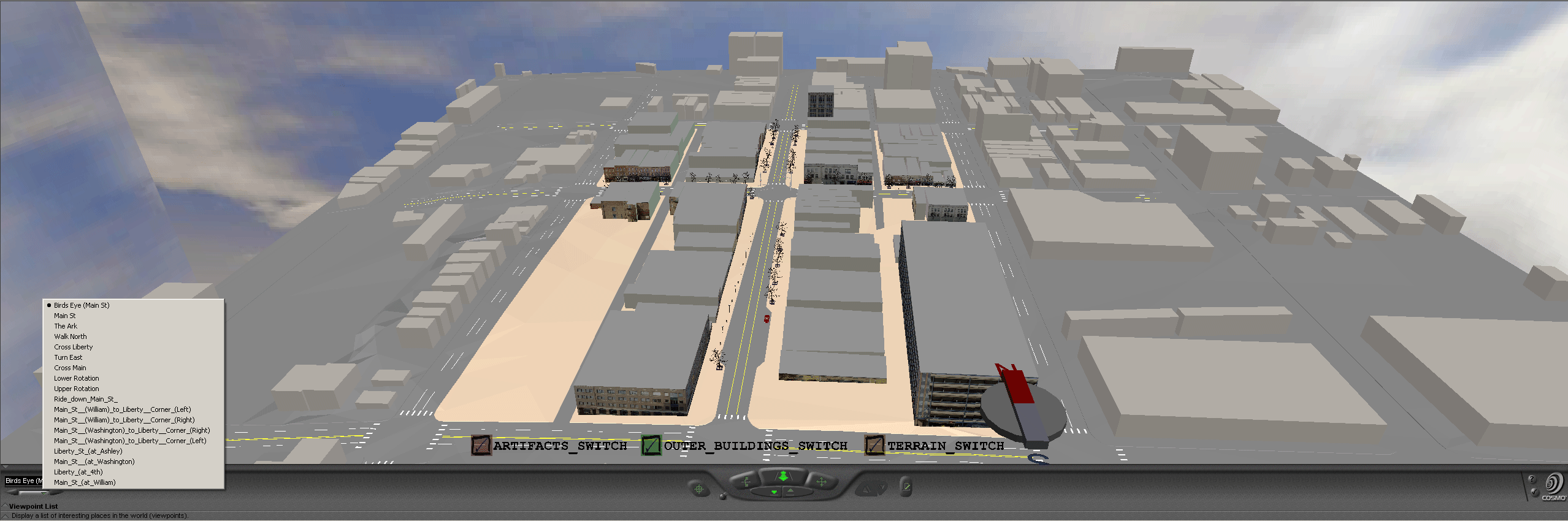
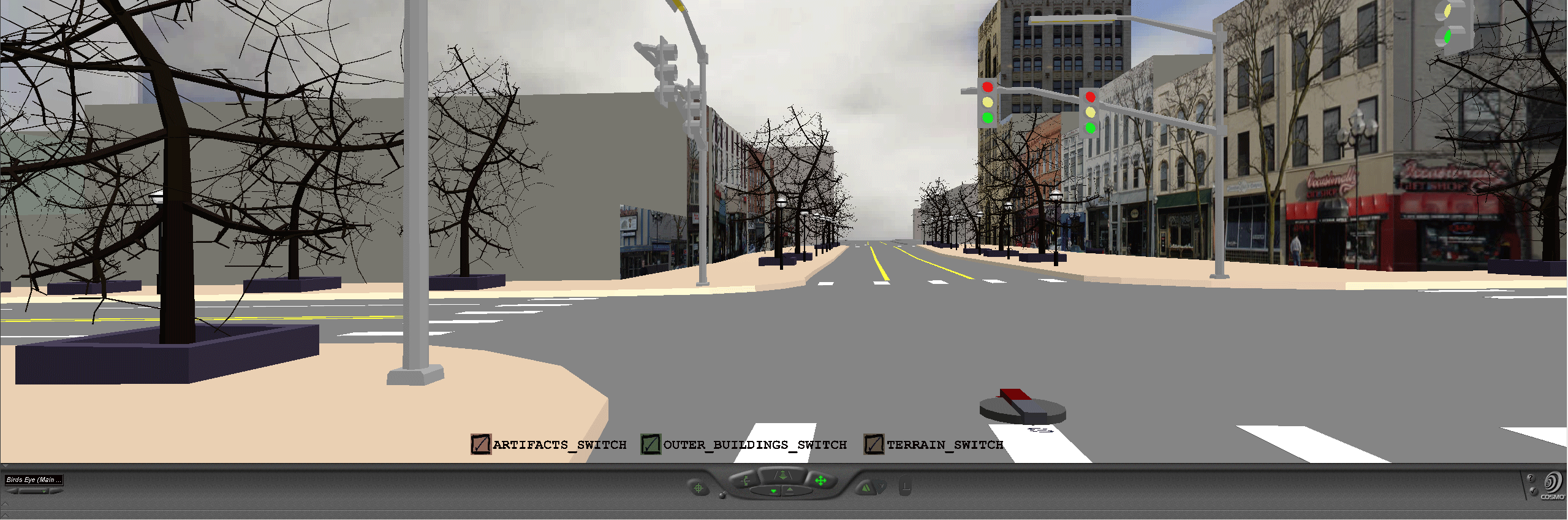
| a | Most detailed
view of Main and Liberty; note the variety of viewpoints available.
Try them. Click on the "artifacts" switch to see trees and other detail.
Image |
a | Most
detailed view of Main and Huron; note the variety of viewpoints available.
Try them.
Image |
Follow the path suggested in the table above to become familiar with navigation through the various layers of the model. Use viewpoints or drive freely within layers. One entry point to the virtual world offers access to a wide range of virtual files. An important aspect of such transformation is thus that one can have many files together in a single file no heavier to view than the single heaviest layer of the hierarchy. It would not have been possible, using merging techniques or some such equivalent strategy, to create the entire set as a single file. When kiosks (or some conceptually equivalent mechanism for jumping between hierarchical levels) are employed, it is easy to imagine emergency managers training first responders to fly through a small file of the entire city with chunky buildings in order to learn the general city layout. When each street corner or other strategic location in this general model is marked with a kiosk then with one click of the kiosk a detailed model pops up, while additional clicks on individual buildings in this detailed view reveal the interiors of buildings as html files. This sort of arrangement has been created for the City of Ann Arbor (and given to them). Creation of the model has taken several years and involved the use of a wide variety of resources, both human and digital. Maintenance, however, can be achieved using a simple text editor to alter the underlying code in either the html files or in the vrml files (part of the code for one building is attached). Thus, highly computer-literate City employees, armed with digital cameras and good computing resources can maintain the model and insert changes and additions to suit a variety of needs and interests: the process is in place. The arrangement of spatial information in a hierarchy is an efficient arrangement not only in the classical worlds of pen and paper but also in the contemporary world of digital models as well as in the practical implementation of such hierarchical arrangements in the real world.
Prof. Klaus-Peter Beier,
Ph.D., Director of the 3D Laboratory of the Duderstadt Center of The University
of Michigan has offered extraordinary insight and support on various phases
of this project. The author is indebted to his graciousness in sharing
computing as well as intellectual resources. She is also extremely
appreciative of the assistance and wise advice from staff members in the
3D Laboratory of the Duderstadt Center, Scott Hamm, Steffan Heise, Brett
Lyons, Eric Maslowski, and Lars Schumann, and also to Graduate Student
Instructors in Engineering 477, Thana Chirapiwat, Jamie Cope, and Bonnie
Congxi Bao.
The name "Kioskland" derives from a paper by that name by the author (1976, Department of Geography, The University of Michigan, unpublished).
** Matthew Naud, M.
S. and M. P. P., is Environmental Coordinator for the City of Ann
Arbor and a principal member of the Emergency Management team.
John D. Nystuen, Ph.D. is
Professor Emeritus of Geography and Urban Planning, The University of Michigan.
In the Fall of 2003, Taejung Kwon was a Ph.D. Candidate in the Taubman College of Architecture and Urban Planning, The University of Michigan, Adrien Lazzaro was a Master's degree Candidate in the School of Information, The University of Michigan, and Paul Oppenheim and Aaron Rosenbaum were undergraduates (Seniors) majoring in computer science.
In the Fall of 2004, Nikolai Nolan was an undergraduate majoring in General Studies, Rasika Ramesh was a beginning graduate student in the School of Information, and Itzhak Shani was an undergraduate (Senior) majoring in Engineering.
***The
Four Color Theorem is used in color assignment; thus, in a grid street
pattern, two colors are both necessary and sufficient to distinguish all
blocks (animated Four Color map link).
No more than four colors are ever required (viewing the block geometry
as part of a plane or a sphere). Thus, background color of the linked
html page also gives subtle information as to location.