Illustrative
3D scenes of the downtown core: Pictures Worth More than 1000 Words
The set of images that follows represents
a style of 3D model, built in virtual reality, examined by the Taskforce
to consider various scenarios. The colored buildings are added.
Yellow buildings are 8, 10, or 12 stories with a few extension bonuses
added in gold. Spacing of the towers in relation to each other is
such that there is at least 50 feet from an 8 story tower to another tower;
at least 75 feet from a 10 story tower to another tower; and, at least
100 feet from a 12 story tower to another. Setback conditions, coupled
with parcel size, serve to control possible height arrangements.
The yellow buildings are placed on vacant lots or surface parking lots.
Blue buildings are also in that height range; there are no bonuses on any
blue buildings. These buildings lie along Huron Street. Buildings
along Huron to the east of Division have 20 foot front setbacks; buildings
to the west of Division have no front setbacks at street level but have
upper story setbacks of 20 feet at the third story level. Some blue buildings
may be built on top of existing buildings (as, over time, new buildings
may replace old buildings). Red buildings lie elsewhere, along
selected corridors: along Liberty, up to a height of 8 stories built
on 3 story plinths with upper setbacks of 20 feet at the 3 story level;
along First and Ashley with three story plinths and 20 foot setbacks at
the three story level and rising to a height of 4 to 6 stories (about half
of each); along North Main in new river view apartment buildings; along
South Main, again with plinths and upper story setbacks; and, in the South
University Area. The figures shown here focus on the core of the
downtown. To see a full view of the DDA, from various vantage points,
the reader will need to use the web-based virtual reality models.
Generally, no building took place in any
parcel: that lay in the Allen Creek floodway, whose centroid lay in the
Allen Creek floodplain, that lay in an historic district, that lay on public
land, or that contained a place of worship. University of Michigan
buildings (files obtained from the University of Michigan) are shaded in
light gray; historic district buildings are shaded in dark gray.
All numerical estimates are just that: mere approximations.
Visualization of this sort was important in offering Taskforce members,
City Officials, and members of the public an overall 3D view of the downtown
from any vantage point desired in order to consider balance of the entire
scene and served as a backdrop for discussions of where general regulation,
via ordinance and other legal documents, might end and design guidelines,
of a more subjective nature, begin. (Please note that such visualization
is not designed for close viewing or for considering individual buildings
or small groups of buildings; other studies offer that opportunity).
These scenes are illustrative rather than definitive.
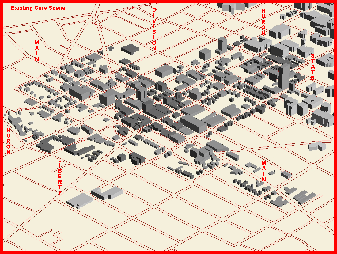
Figure 1. Existing Downtown Core, structural
3D model
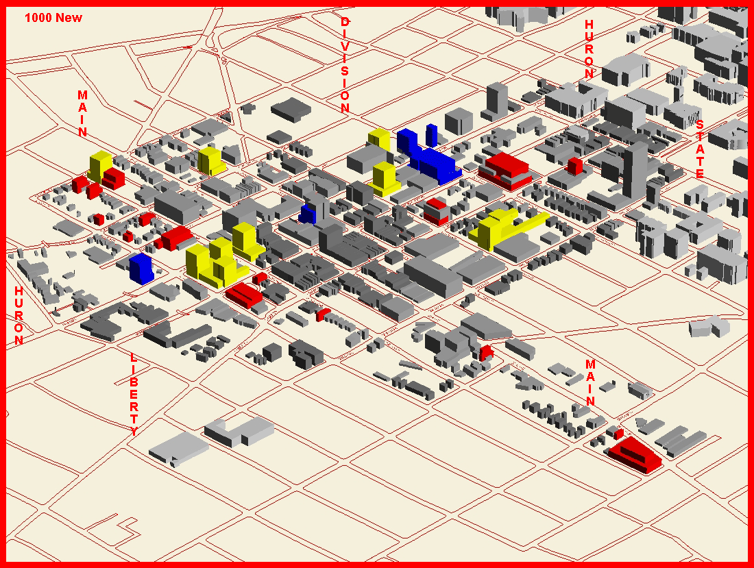
Figure 2. 1000 New Units; an illustrative
scene of a possible arrangement of structures.

Figure 3. 1000 New Units plus more in
extension bonuses on top of two 12 story buildings (bonus layers in gold).
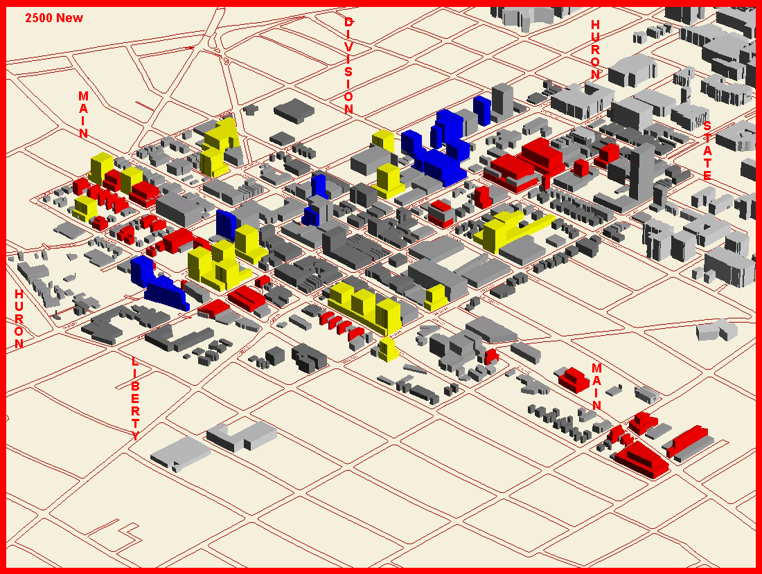
Figure 4. 2500 New Units; an illustrative
scene of a possible arrangement of structures.
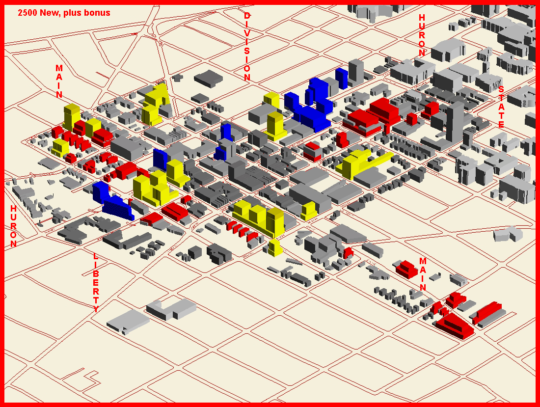 Figure 5. 2500 New Units plus more in
extension bonuses on top of three 12 story buildings (bonus layers in gold).
Figure 5. 2500 New Units plus more in
extension bonuses on top of three 12 story buildings (bonus layers in gold).
The Taskforce spent a considerable amount
of time on the height issue and examined numerous 3D, virtual reality,
and animated models. Appendix C explains some of the constraints
of the modeling technique. Readers wishing more information are referred
to the following website: http://www-personal.umich.edu/~copyrght/ddaheight/
Recent virtual reality links:
Figure
1
Figure
2
Figure
3
Figure
4
Figure
5
Links to Appendix for Final Report:
Appendix
Additional Topics
-
Use of a "point system" for awarding bonus
height. Suppose there are 9 factors for which a bonus might be given.
If a developer who offers a cluster of bonuses is to be given an extra
reward for thoughtful interaction of attributes, then a linear scale of
bonus points should not be used. One might consider squaring the
values: 1 factor gets 1 point; 2 factors get 4 points; 3 factors
get 9 points and so on according to the parabola y = x2 .
Then again, one might wish to dampen the reward after a certain point and
use an S-shaped curve (logistic style of curve) often employed in describing
population growth. These become asymptotic (to an horizontal asymptote)
to some value; halfway up to the asymptote, there's an inflection point--to
the left of the inflection point the curve is concave up (steep reward)
and to its right the curve is concave down (tapering reward).
-
Lack of parallelism of almost parallel streets.
When maps are made using a sphere as a base, all rectangles, with top and
bottom along parallels, are in fact not rectangles but are isosceles trapezoids
with top and bottom parallel and sides gently sloping along projected arcs
of great circles (meridians) converging at the geographic poles.
Thus, north-south streets are not truly perpendicular to east-west streets.
However, other maps may be made using a plane as the base. In that
case, true orthogonality results. When both types of north-south
streets are displayed in a single map, the result may be that most north-south
streets are parallel to each other with an occasional stray that is not
(because it is a projected segment of meridian). Kelbaugh notes that
that offset in parallelism appears to be the case in the DDA: that
Division Street is not truly parallel to the other north-south streets.
Solstice: An Electronic Journal of Geography and Mathematics,
Institute of Mathematical Geography, Ann Arbor, Michigan.
Volume XV, Number 1.
http://www.InstituteOfMathematicalGeography.org/