-
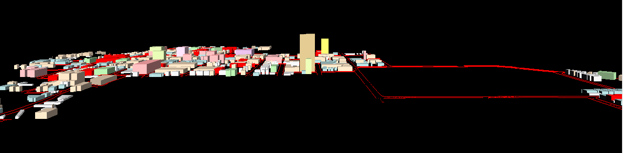
The following set of Virtual Reality files,
with the sun in the south in a "high" position and with terrain underlying
the street pattern based on City contour files, was created based on assigning
-
VR1:
300% to all parcels in red, lot line to lot line (back and forth; side
to side)
-
VR2:
FAR to all parcels in red by zoning category, lot line to lot line (back
and forth; side to side)
-
VR3:
FAR premiums as "by-right" values to all parcels in red by zoning category,
lot line to lot line (back and forth; side to side)
-
VR4:
600% to all parcels in red, lot line to lot line (back and forth; side
to side).
The set of VR files is organized roughly according
to amount of height, from least to most. The first two files are
quite similar to each other; the second one has two buildouts that are
one story shorter than in the first one (in C1A); it has more than that
that are one story taller than in the first one (in C2A). The last
two files (third and fourth) are even more similar to each other.
They are identical everywhere except that there are two buildouts, in the
S. University area, that are 400% on the third one, and 600% on the fourth
one.
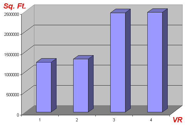
The amount of square footage in the red
(assuming multiplying the parcel footprint area times the number of stories)
is as in the following table--square footage includes only parcel area...not
streets:
VR1. 1238694.372
VR2. 1318163.76
VR3. 2465865.642
VR4. 2477388.744
Screen captures of the "closer view" of
each VR are shown as an animation below--to experience being able to walk
around, the user must go to the actual VR, though.