The View from the Top:
Visualizing Dowtown Ann Arbor in Three Dimensions
Sandra Arlinghaus, Frederick
Beal, Douglas Kelbaugh *
Under Construction until
at least June 7, 2004
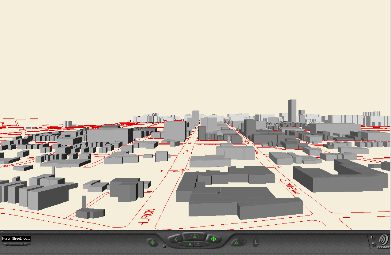
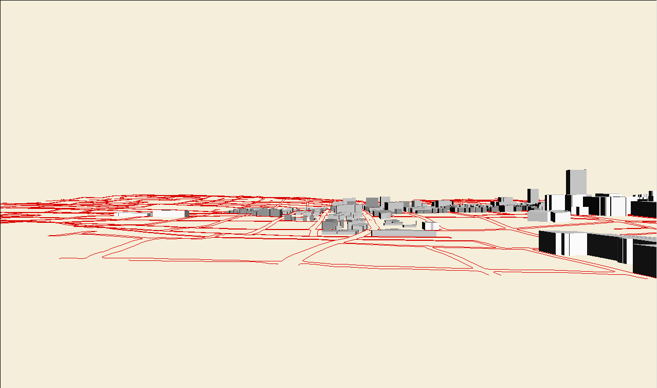
In previous issues
of Solstice, a variety of 3D models of parts
of the city of Ann Arbor have been presented as visual tools used in preliminary
form by policy makers (in the Ordinance Revisions Committee of City of
Ann Arbor Planning Commission) and as draft tools to which policy makers
might respond. This article chronicles the actual use of 3D models
by the City of Ann Arbor Taskforce to Increase Residential in the Downtown.
The Taskforce was charged with "...whatever is appropriate here...creating
x number of new units of residential in the downtown." The creation
of the models was an interactive process between modeller (first author)
and Taskforce, principally Kelbaugh (architect) and Beal (real estate development
expert). Other members of the Taskforce participated in various aspects
of process and are listed at the end of this article.
The focus in this
paper is to display the models that were developed as a result of a six
week interactive process between modeller and Taskforce. The
process began February 2, 2004. On April 27, 2004, the models as
they were at that stage were presented in a public hearing at City Hall.
Readers wishing to examine the developmental process of the models may
find all materials attached to the following link;
readers wishing to hear the public hearing may do so by listening to material
attached to the following link (the audio file
is quite large; over 126 mb). We recommend, however, that readers
wishing to follow either of these links do so after reading this more general
article: return to these links so that they are viewed in an appropriate
developmental context. Subsequent to an overview reading, the materials
in this article serve as an historical archive: primary source audio
and video materials are captured in the context in which they were presented.
The internet offers a unique opportunity for such preservation in an environmentally
sensitive manner. (Unlike film, the user may choose to focus exclusively
on audio or video, or coordinate them.)
DDA: 2500 residential units /
25 years
April 27, 2004
 |
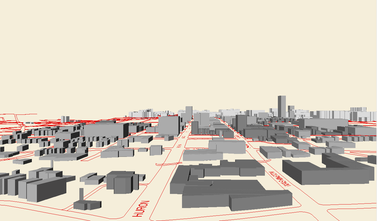
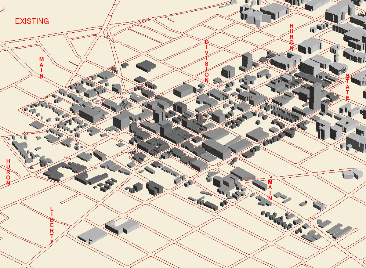
Existing:
aaaaaaaaaaaaaaaaaaaaaaaaaaaaaaaaaaaaaaaaaaaaaaaaaaaaaaaaaaaaaaaaaaaaaaa
-
Includes
all building footprints extruded according to heights currently available
from the City of Ann Arbor Planning Department.
-
If heights
are not available, a height of 3 stories was assigned arbitrarily, rather
than leaving the height at 0 stories.
-
Building
heights are converted to feet assuming a value of 12.5 feet per story (conversion
to work appropriately with the software). Eventually, more precise
measurements of height in feet will be needed.
-
There
are buildings within the floodway in the existing pattern.
-
Historic
districts are noted in a shade of gray darker than the rest of the core
University
of Michigan buildings are noted in a shade of gray lighter than the rest
of the core.
-
Standards
involving map accuracy and measurement issues are in progress.
|
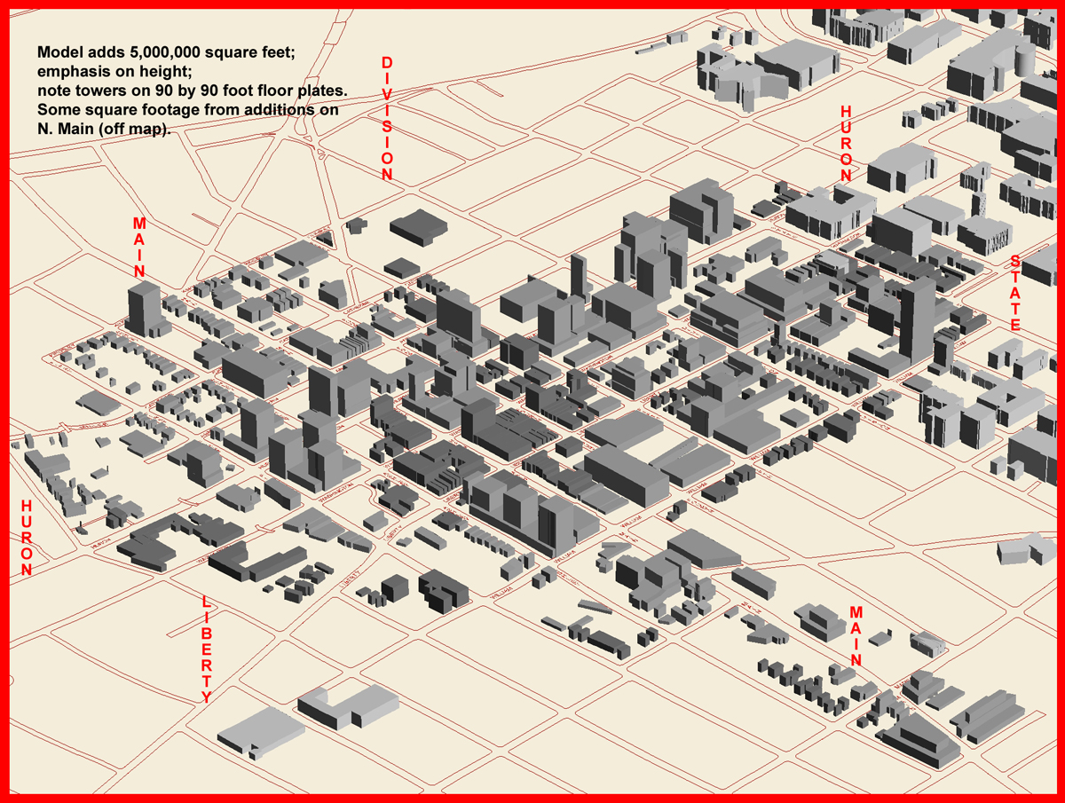
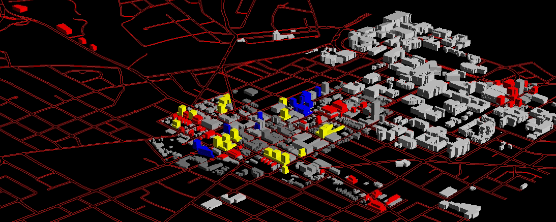
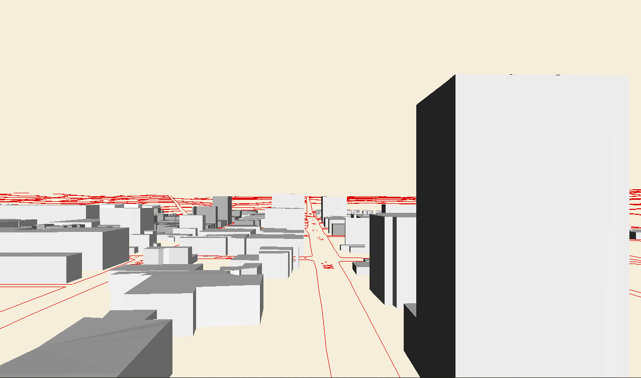
The animation below emphasizes
ONE new view:
YELLOW BUILDINGS ARE ON
VACANT OR SURFACE PARKING LOTS;
BLUE BUILDINGS ARE ON HURON
STREET (BUILT OVER EXISTING BUILDINGS, PERHAPS)
RED ARE INFILL ON LIBERTY,
ASHLEY, FIRST, SOUTH MAIN (AND NORTH MAIN, OFF MAP)--BUILT OVER EXISTING
BUILDINGS, PERHAPS
 |
Tall:
AAAAAAAAAAAAAAAAAAAAAAAAAAAAAAAAAAAAAAAAAAAAAAAAAAAAAAAAAAAAAAAAAAAAAAAAAAAAAAAAAAAAAAAAAAAAAAAAAAAAAAAAAAAA
-
excludes
from consideration all parcels
-
in a current
historic district
-
in the
floodway of Allen's Creek
-
whose
centroid lies in the floodplain of Allen's Creek
-
currently
containing a place of worship
-
designated
as public lands of the University of Michigan, and most others, as well
-
containing
existing parking structures
-
general
model considerations:
-
each story
is assigned a height of 12.5 feet
-
City of
Ann Arbor contour files, with contour interval of 5 feet (spacing between
successive contours is 5 feet), were used to generate a Triangulated Irregular
Network to represent the topographic surface. The buildings, roads,
and so forth were then draped over this topographic surface.
-
Sun position:
was set in the south at a height of 42.28 degrees, simulating the position
of the sun in the sky at noon in equinox conditions at the latitude of
Ann Arbor. This setting creates lighting of the buildings; it does
not create shadows of the buildings on the ground (that is a separate process
for the future).
-
within
these constraints, 5,000,000 new square feet are added as follows:
-
yellow
point towers erected on lands categorized as "vacant or surface parking."
Each tower has a 90 foot by 90 foot floor plate.Where suitable, they are
erected on a three story platform. The tower heights are 9,
12, and 15 stories; distances between adjacent towers on the same parcel
are 50, 75, and 100 feet depending on height (9, 12, and 15 stories respectively).
Where possible (according to spacing requirements), taller towers are erected
at lower elevations.
-
blue buildings
are erected along Huron Street at heights of 9, 12, and 15 stories.
The position is arbitrary.
-
East of
Division Street (to the right on the models) the front setbacks are 20
feet; west of Division Street front setbacks are 0 feet. These selections
are in keeping with the present front setback pattern of buildings already
present on Huron. The goal is to keep a uniform, rather than a staggered,
appearance in front setbacks (consistent with a "Grand Boulevard" approach).
-
Rear setbacks
are 40 feet; side setbacks are 10 feet.
-
Upper
story setbacks beyond the third floor are 20 feet in structures west of
Division.
-
red buildings
-
setbacks
and lateral information:
-
have three
story platforms
-
have upper
story setbacks of 20 feet beyond the third story (except on a few small
parcels that have only three story buildings)
-
have 40
foot rear setbacks, 10 foot side setbacks, and 0 foot front setbacks.
-
height
and vertical information:
-
on Liberty
Street may rise to a total height of 8 stories (including the three story
platform) with the upper stories set back 20 feet from the three story
platform
-
on 1st
and Ashley Streets may rise to a total of 4 or 6 stories (50/50), with
upper story setbacks of 20 feet above the third floor, arbitrarily placed
-
on North
Main, out of the picture, rise to a height of 6 stories and have 20 foot
setbacks from the road. Building footprint is placed on the parcel
in accordance with the golden ratio.
In this
style of plan, zoning follows spatial pattern of buildout.
|
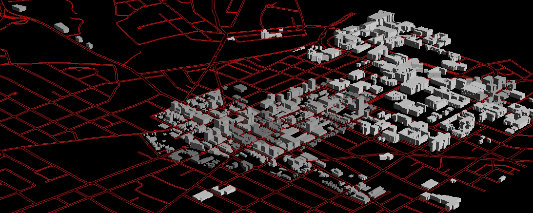
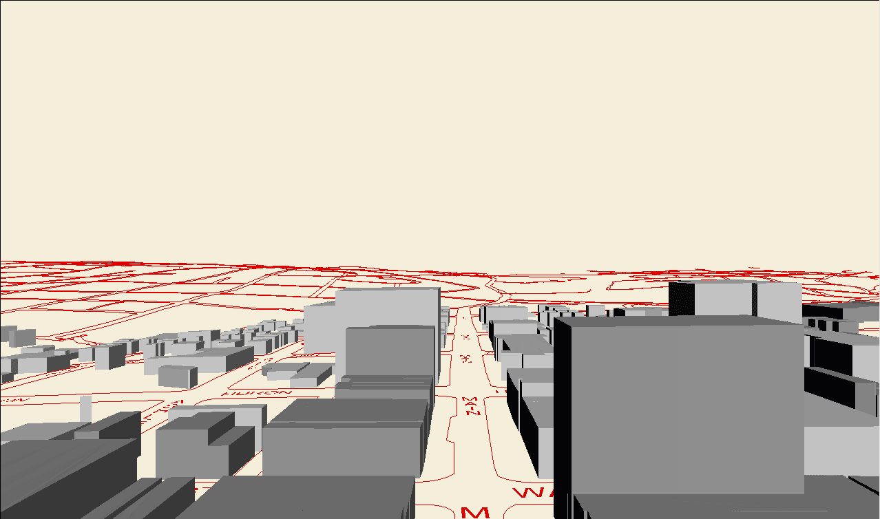
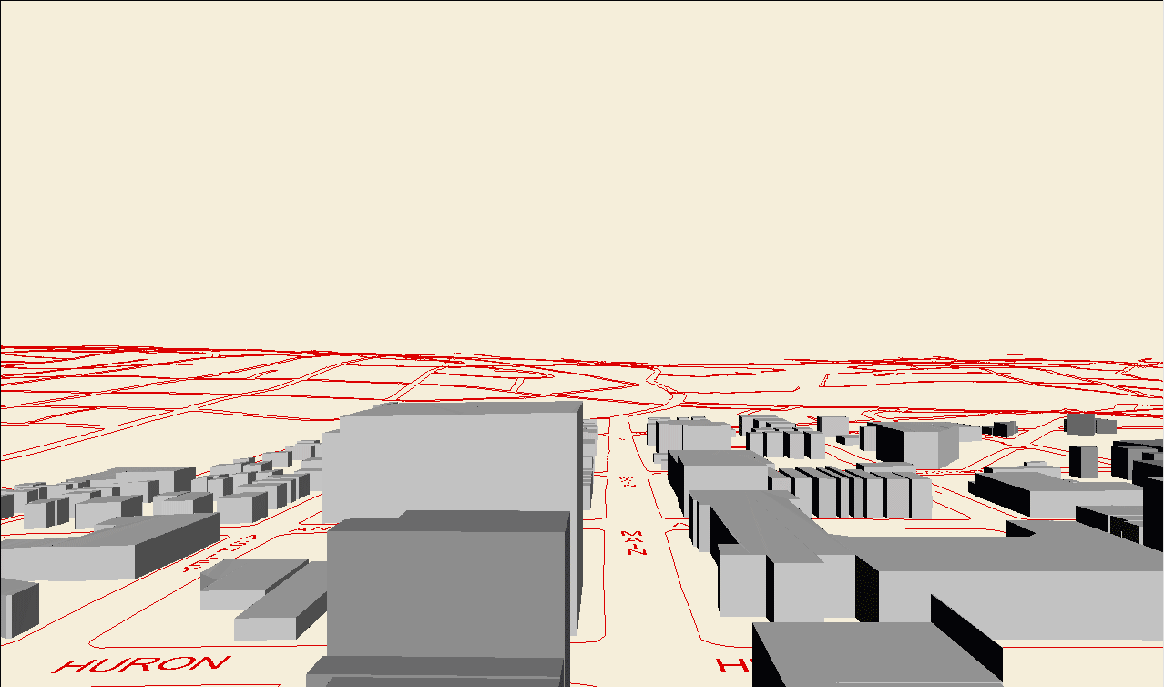
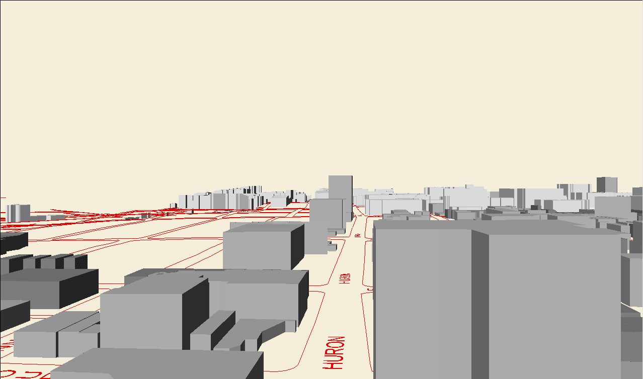
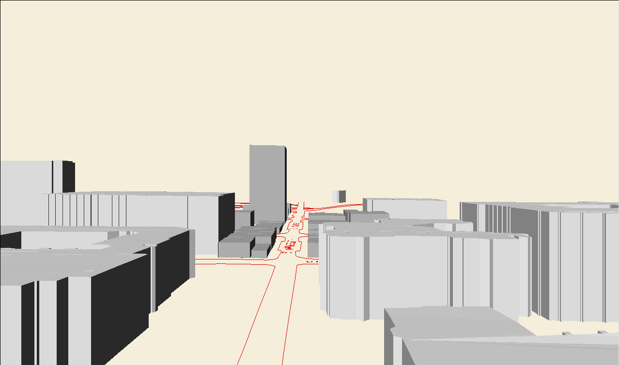
GRAYSCALE IMAGE, BELOW, EMPHASIZES
THE MASSING OF STRUCTURES
Virtual reality files with
navigational paths, lower left corner of Cosmo Player, were created to
show fly-throughs with navigational paths consistent from one model to
the next (download and install Cosmo Player in your browser): There
are a number navigational viewpoints predefined in Cosmo Player for ease
in navigation (or fly through at your own risk!). In addition, predefined
viewpoints enable comparison of identical views under different buildout
scenarios. The set of animations below corresponds to each of the
two scenes, existing, and tall, viewed in that order from each of the four
viewpoints. Transitional frames were inserted so that the viewer
might be able to see the new replacing the old.
Links to VR
Animations made from some VR
viewpoints.
Link to Audio File of Public Hearing of April 27, 2004.
DDA: Taskforce to increase residential in the downtown
May 10, 2004
Audio file of Public Hearing of April 27, 2004, delivered on CD, as
a .wav file, to DDA.
The 3D modeling of the entire DDA is done using ESRI software so that the
model works directly from existing city base map GIS files and associated
database files. The GIS is driven by the underlying database.
Hence, all information needed to do the mapping is available in the database
(.dbf) files (which can be opened in Excel). Here is some more information
from the various databases associated with the variety of files (over 2000)
generated in association with the various 3D models created in response
to Ordinance Revision Committee (Planning Department and Commission), Taskforce,
and other request (that has been ongoing over the past 2 or so years)
There are 739 buildings on 755 parcels in the DDA (some parcels have
more than one building); some parcels have less than one building (a building
overlaps more than one parcel), as with One North Main, Campus Inn, and
Sloan Plaza. Some of the new buildings, on vacant land or surface
parking lots, also overlap more than one parcel, as in the Brown block
or the Library block...and elsewhere in the yellow layer. There are
418 parcels in the set of target parcels (see below* for definition) and
405 buildings on target parcels (again, some overlapping parcels but more
frequently, there are multiple buildings on a single parcel).
Vacant or Surface Parking parcels
-
Square footage of vacant parcels in the DDA: 770,346 square feet.
-
Square footage of target vacant parcels in the DDA: 620,008 square
feet. Buildout to the 2/3 level, in 400,000 square feet, in 10 story
buildings (covering the parcels) would provide 4,000,000 square feet; in
12 story buildings, 4.8 million square feet.
Parcel inventory:
Square footage background of base layer:
-
DDA parcels, total: 8,269,459
-
Target* DDA parcels, total: 3,503,980
* a target parcel is a DDA parcel that is not:
public land, in an historic district, in the Allen Creek floodway, such
that its centroid lies in the Allen Creek floodplain, a church parcel.
Thus,
-
If half of each target parcel's footprint were covered, there would be
about 1.75 million square feet to work with.
-
If we need to generate 7.5 existing plus 5 million new, then that means
each parcel, on average would need to support a building of 12.5 / 1.75
or about 7 stories.
-
If we need to generate 7.5 existing plus 2 million new, then that means
each parcel, on average would need to support a building of 9.5 / 1.75
or about 5.5 stories.
-
If 1/3 of each parcel's footprint were covered, there would be about 2
million square feet to work with.
-
If we need to generate 12.5 million, then that means that on average each
building would be 6 stories.
-
If we need to generate 7.5 existing plus 2 million new, then that means
each parcel, on average would need to support a building of 9.5 / 2 or
about 4.75 stories.
-
If 1/4 of each parcel's footprint were covered, then there would be about
2.325 million square feet to work with:
-
If we need to generate 12.5 million, then that means that on average each
building would be 12.5/2.325 or 5.4 stories.
-
If we need to generate 7.5 existing plus 2 million new, then that means
each parcel, on average would need to support a building of 9.5 / 2.325
or about 4 stories.
Building inventory, smaller than parcel inventory
The following table answers the following questions:
How many square feet are there currently in
the built buildings? How many if all premiums were used? How
many if all buildings less than 6 stories were to grow to 6?
In the target population, using building footprints,
same questions as above--then, how many new square feet are brought in,
in the target parcels, by such vertical add-ons?
|
Current |
All Premiums Used |
Six by right |
| All Buildings |
7.5 million |
13.4 million |
15.6 million |
| Targets, only |
4.9 million |
8 million |
9.3 million |
| New for targets |
|
3.1 million |
4.4 million |
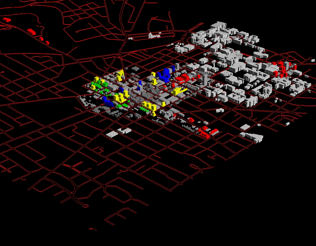
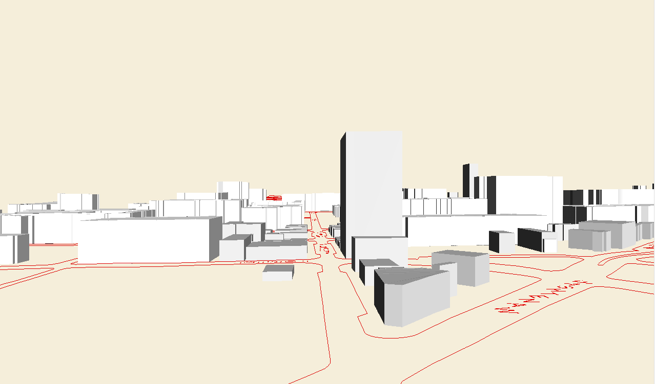
May 10:
Response to public hearing in relation to 3D model buildout:
-
Square footage of yellow layer, increased coverage coming from height reduction,
all on vacant or surface parking parcels, 8, 10, 12: 1,965,758 square
feet or about 1000 new apartments--SO, in the short run, 1000 new apartments
come from about a 2/3 buildout of existing vacant and surface parking
-
Square footage of blue layer along Huron Street, 8 (south side), 10, and
12: 996,767.4-258,847 = 737,920 square feet of new or about 370 new
apartments--height reduction, fine-tuning of historic district parcel base
map, sensitivity to building over Sloan Plaza and so forth on that block
of Huron Street. Also placed with an eye to optimizing amount of
new square footage and to reducing interaction with existing residential
(but needs fine-tuning in that regard).
-
Square footage of red layer,
-
remaining the same as before
-
Liberty--8 story buildings with a 3 story plinth: 462,626.76
-
First and Ashley--4-6 story buildings with a 3 story plinth, 50/50 mix--two
of the six story buildings are located on First; all others on Ashley:
385,128
-
S. Main: 323,628
-
altered:
-
N. Main--half the buildings removed: 635,812
-
S. University--new buildings added, at 8, 10, and 12 stories, consistent
with setbacks of existing buildings, placed to optimize (somewhat) amount
of new square footage.
923,546.68 - 83208.9017 = 840,337.7783
Total in this model, with expanded yellow layer reduced in height and the
addition of S. University along with a reduction in the blue layer and
in the N. Main layer: 5,351,209.778
Click here for virtual reality; download Cortona
or Cosmo Player, first, then view in your browser. There is the same
set of viewpoints as previously available plus two new ones along South
University.
Colored virtual reality model
Grayscale virtual reality model
An additional color (green) might be used to separate, visually, the
Ashley/First buildings from others. Added colors may offer certain
focused clarification of the model; however, they also fragment the visualization
power of the model, as a whole. There are merits and drawbacks; the
needs of individual cases will determine how many colors to use.
Animations of selected viewpoints from the Virtual Reality files; please
feel free to suggest other viewpoints to put into the VR files.
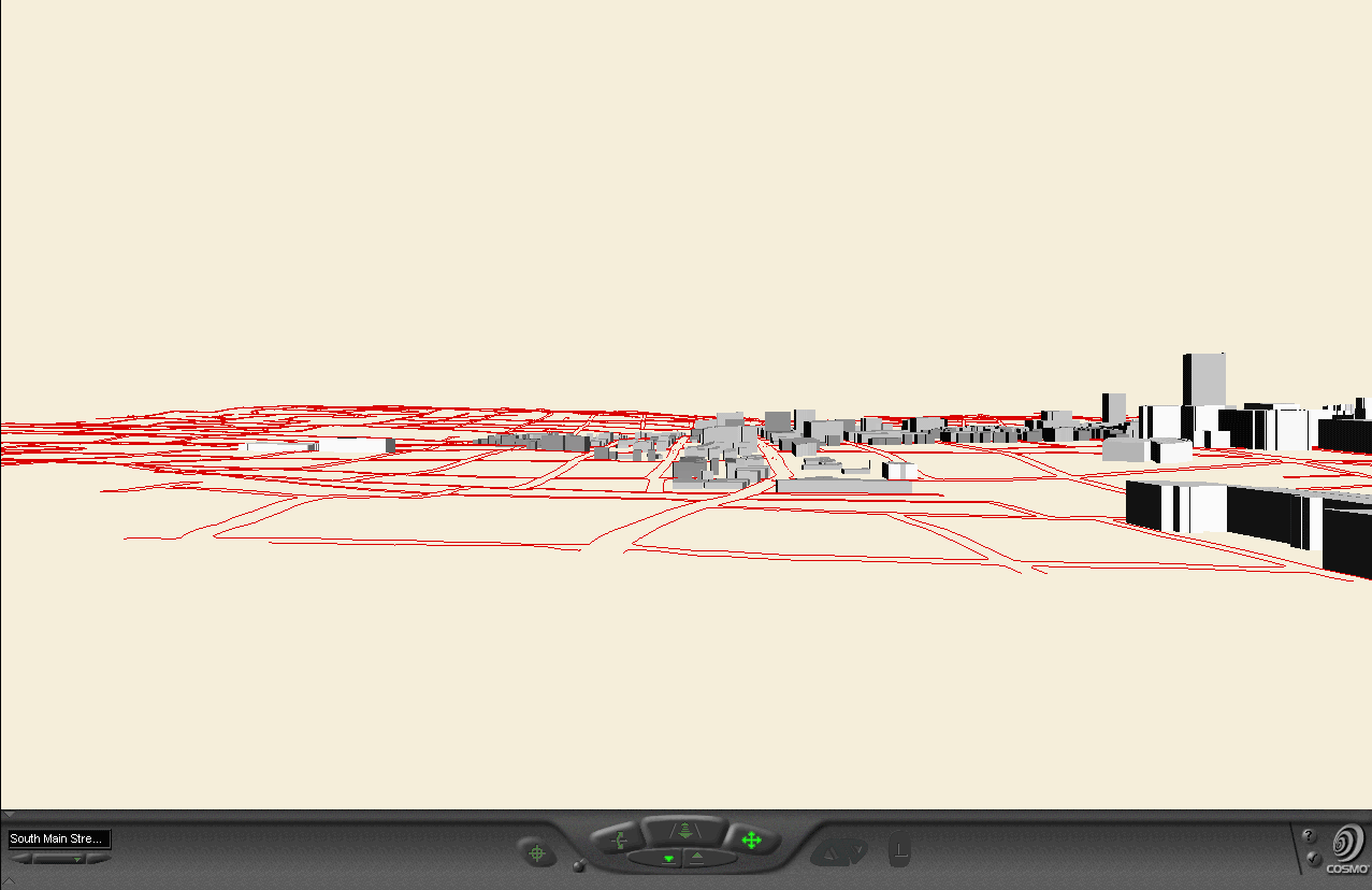
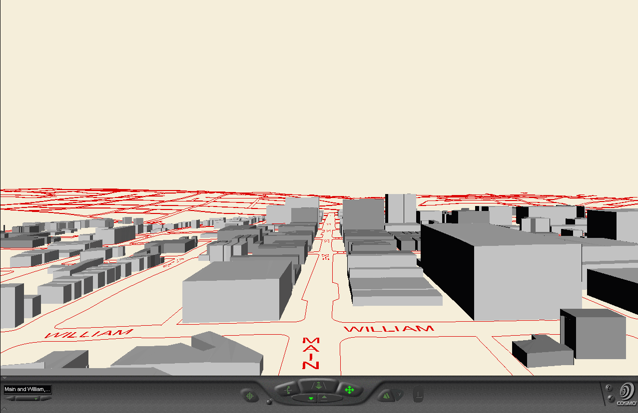
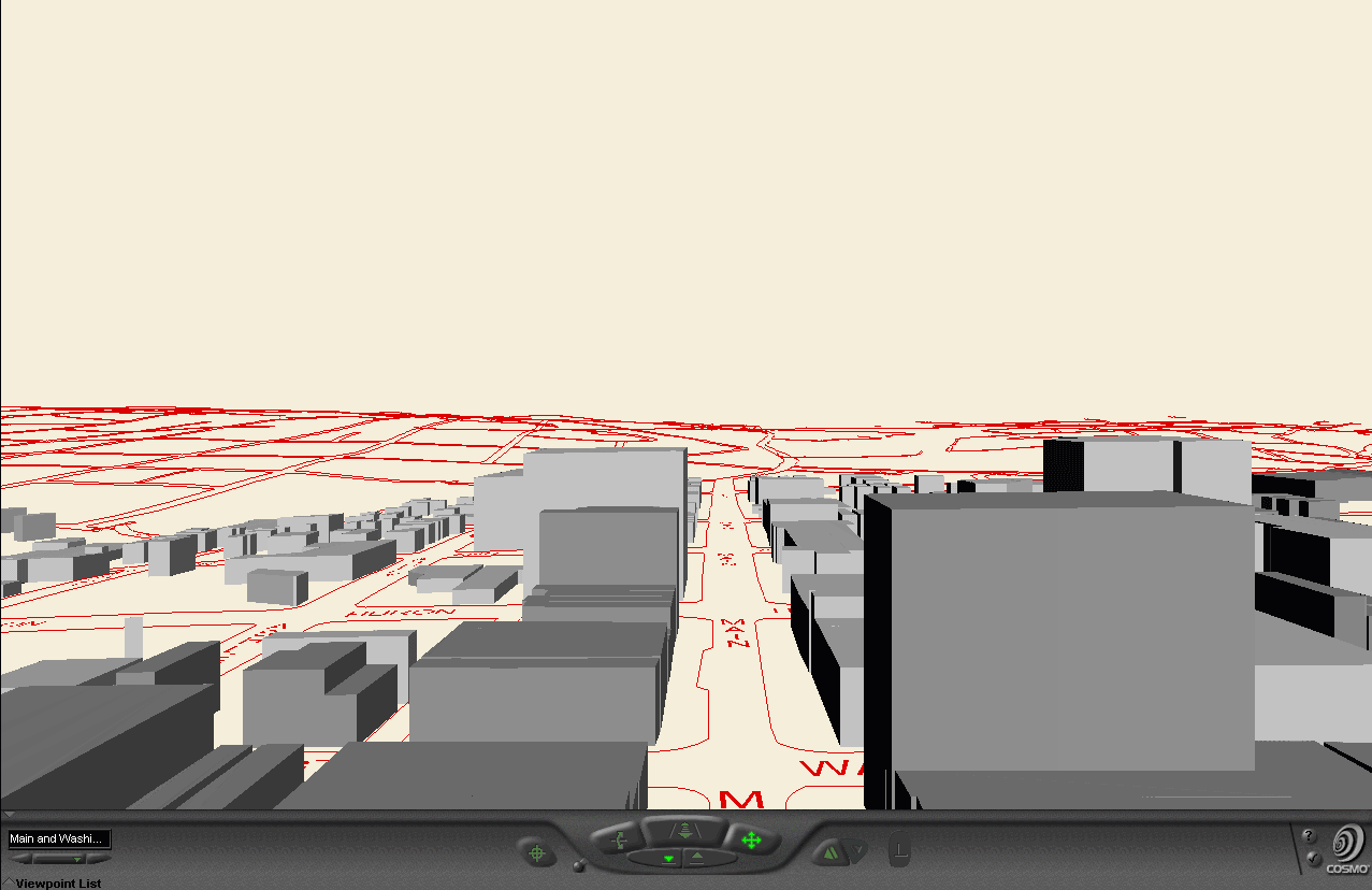
Sequence of animation frames: gray is existing followed by taller
scene of April 27 followed by shorter scene of May 10.
View from South Main
View from Main and William
View from Main and Washington
View from Main and Huron, looking North
View from Main and Huron, looking West
View from Main and Huron, looking East
View along Huron looking East from the west side
View along Huron looking West from State
View along S. University looking East from the Diag
View along S. University looking West from Washtenaw
Links to similar approaches:
http://depts.washington.edu/~uweek/archives/1998.08.AUG_06/_article2.html
Arlinghaus, Adjunct Professor,
The University of Michigan; Director Spatial Analysis, Community Systems
Foundation
Beal, President, Beal Construction
Kelbaugh, Dean, Taubman
College of Architecture and Urban Planning, The University of Michigan.
Modeling work donated by S.
Arlinghaus.