ATLAS
-
2D MAPS, STATIC AND ANIMATED
AS WELL AS SELECTED OTHER 2D VISUALS (first order subheadings arranged
in reversed chronological order)
-
FROM: Request from Brian Barrick, Pollack
Designs and from Fred Beal, to use a selected 3D
model as a base for creating a hand-drawn bird's eye view from the east,
northeast of the core; set of supplied images at different elevations,
May 29, 2004:
-
FROM: Follow-up
to meeting of May 26, 2004
-
FROM: Presentation
of May 10, 2004.
-
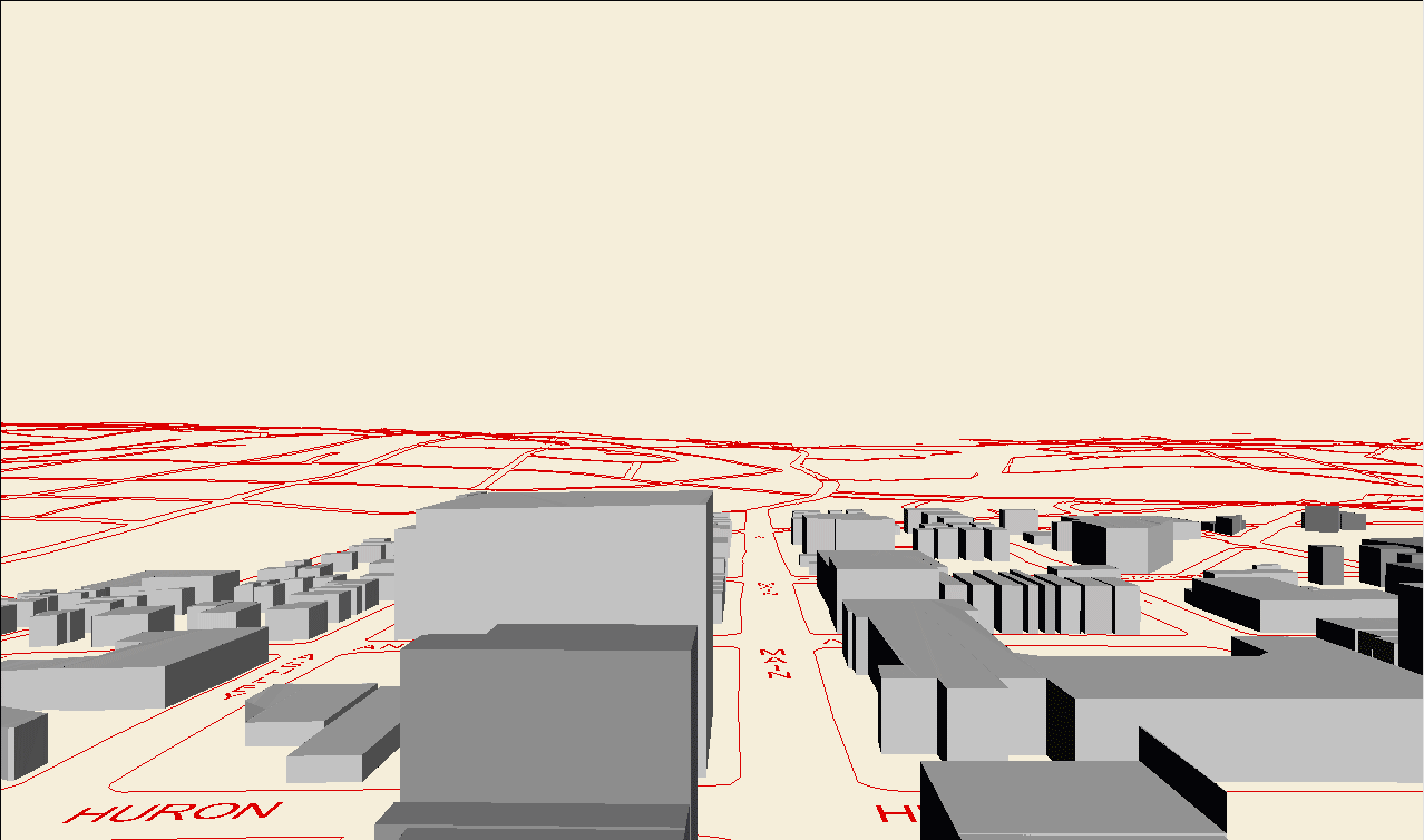
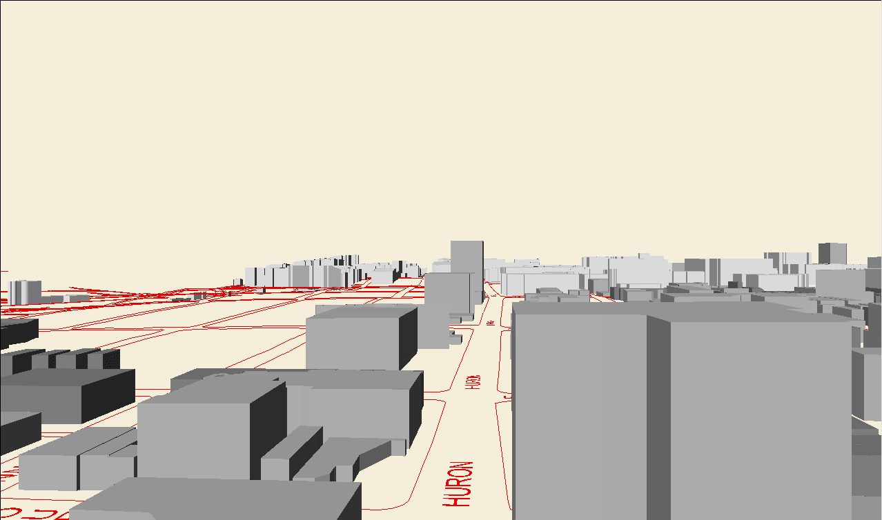
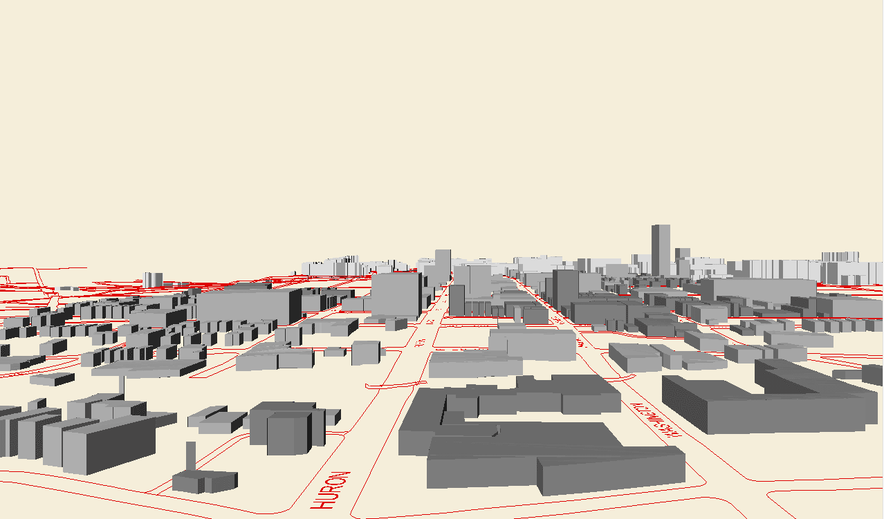
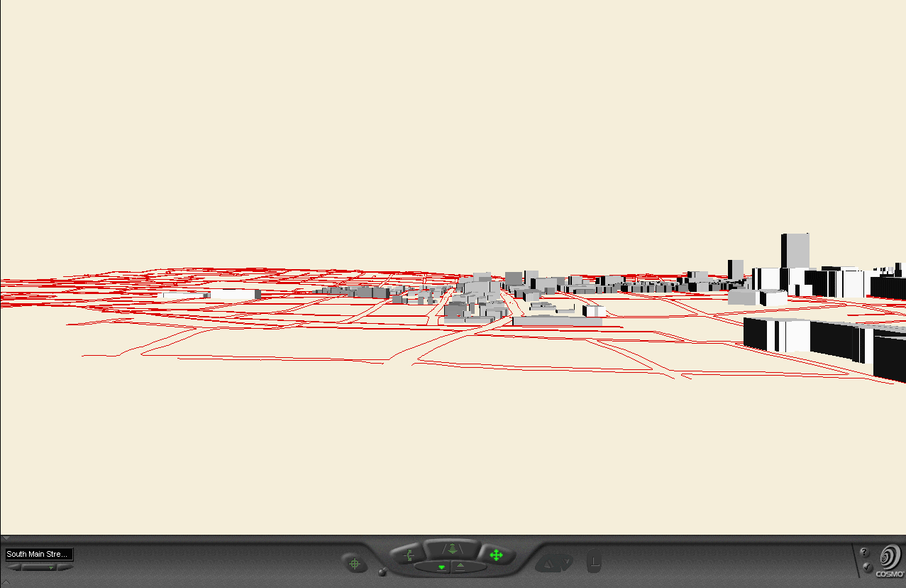
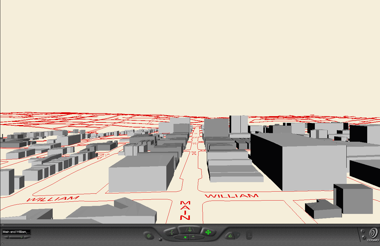
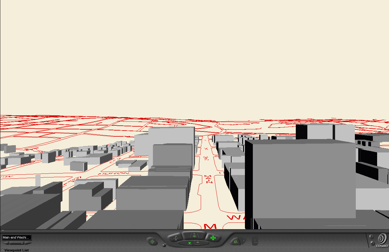
Snapshots from Virtual Reality models:
-
Animations mde from virtual reality viewpoints
-
FROM: 3D
Models, Animations, and Virtual Reality Files--Draft Visuals, DDA:
2500 residential units / 25 years,
-
FROM: Presentation
of April 26, 2004
-
Downtown Core:
-
Animations of Core
-
Animations of Core made from virtual reality
viewpoints
-
FROM: Presentation
of April 14
-
View
arranged in a matrix of three rows and five columns, each 800 pixels wide.
-
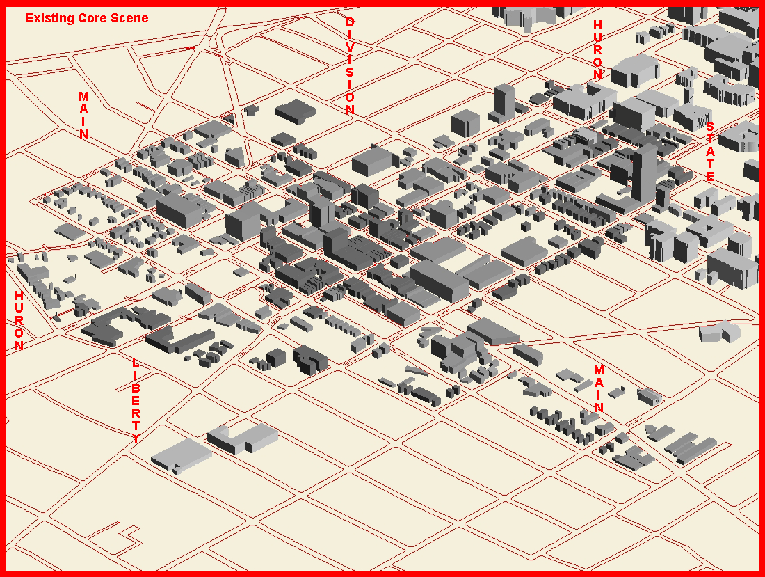
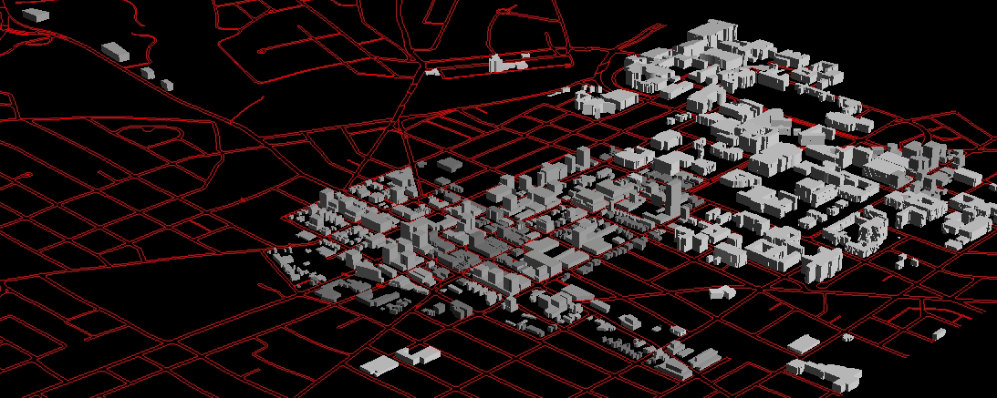
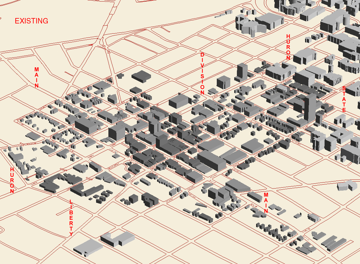
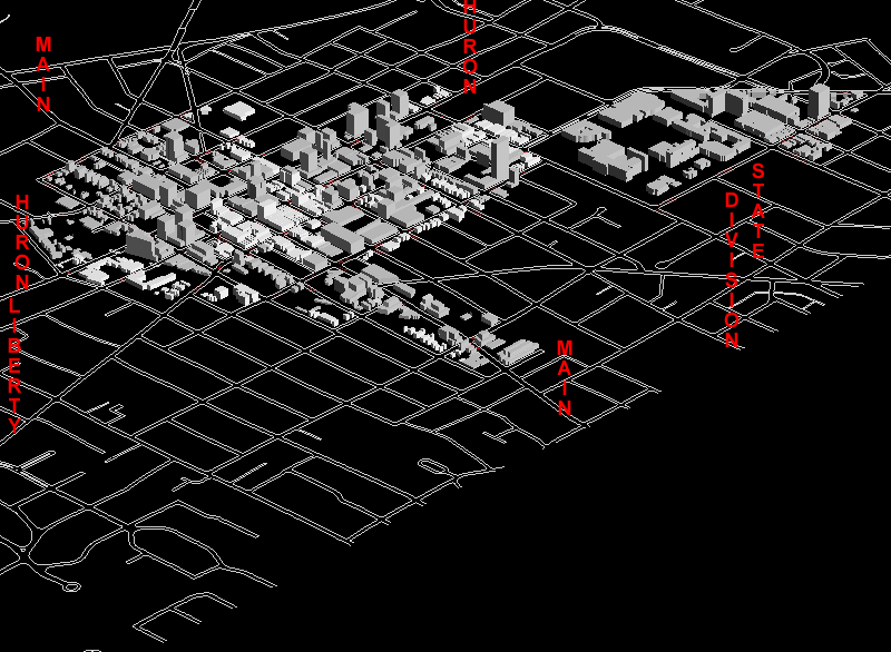
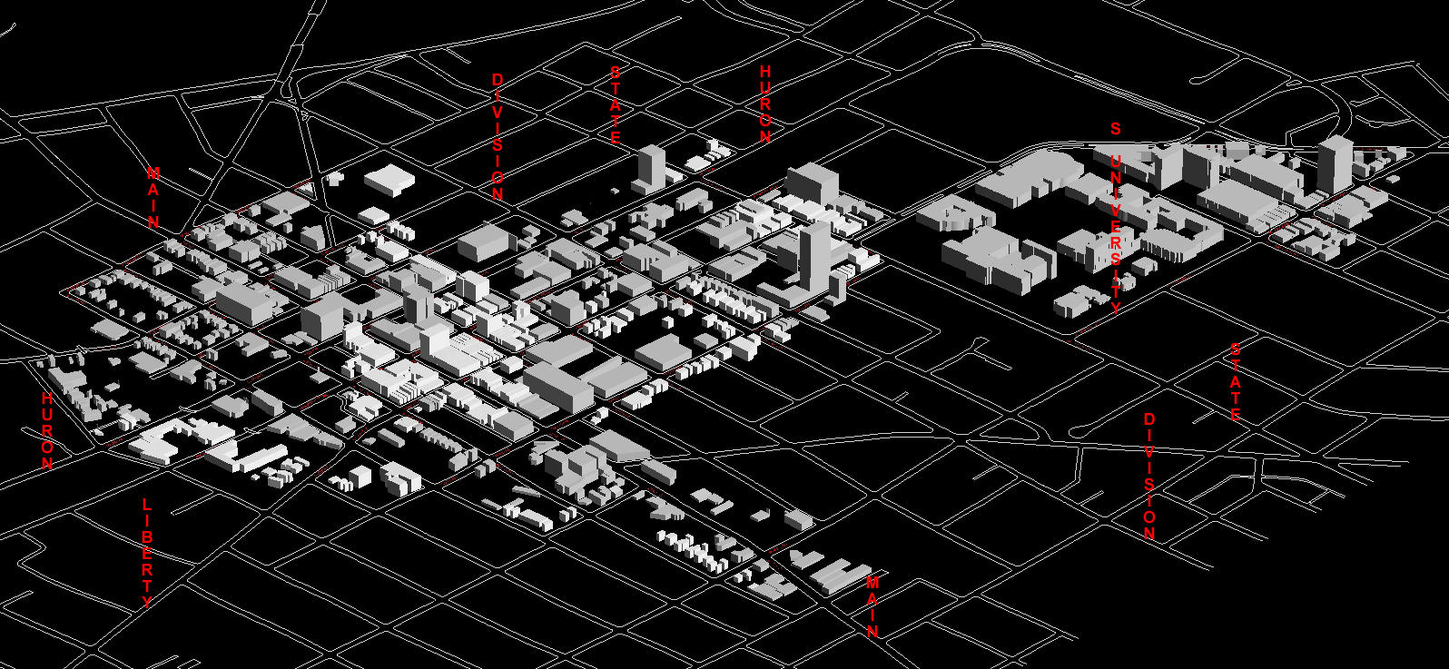
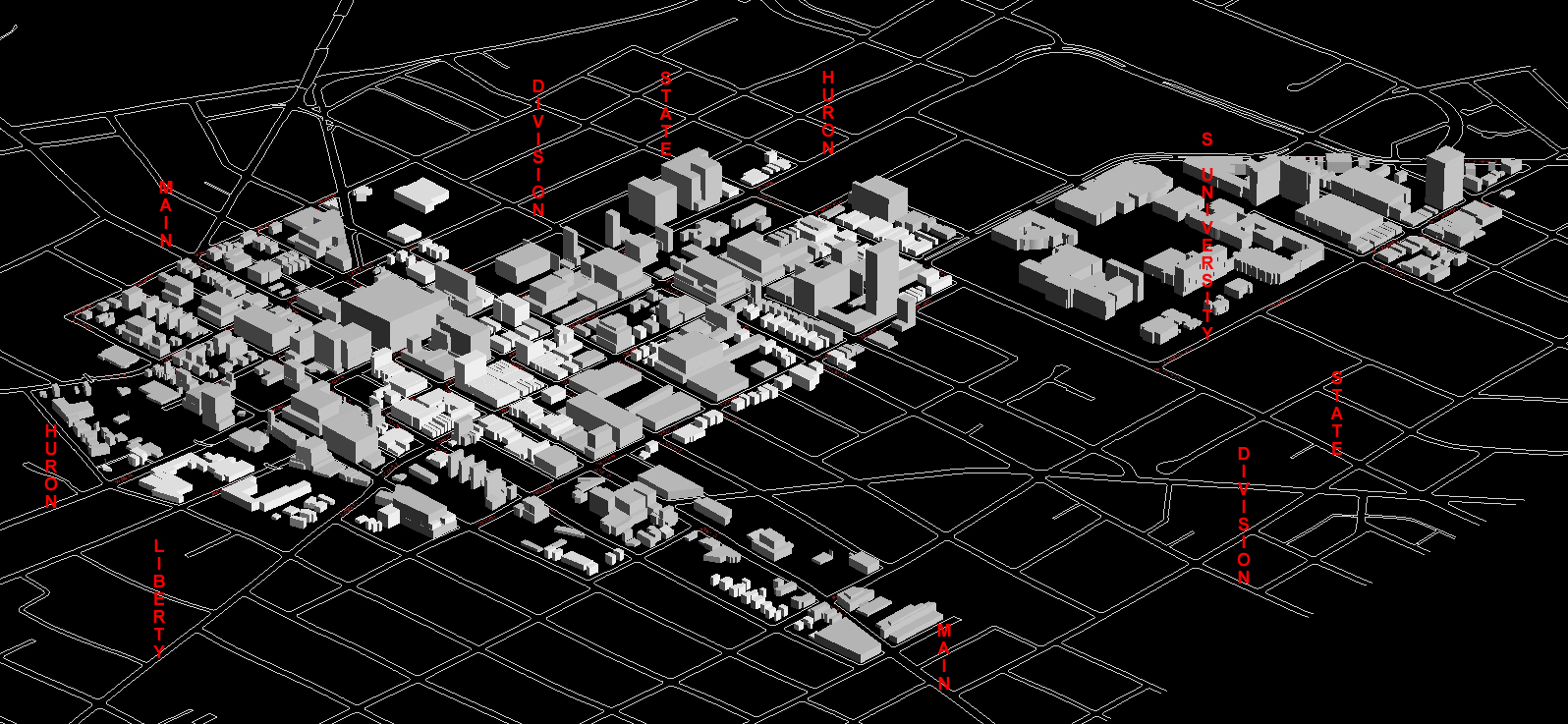
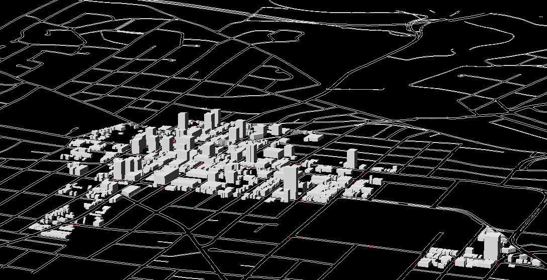
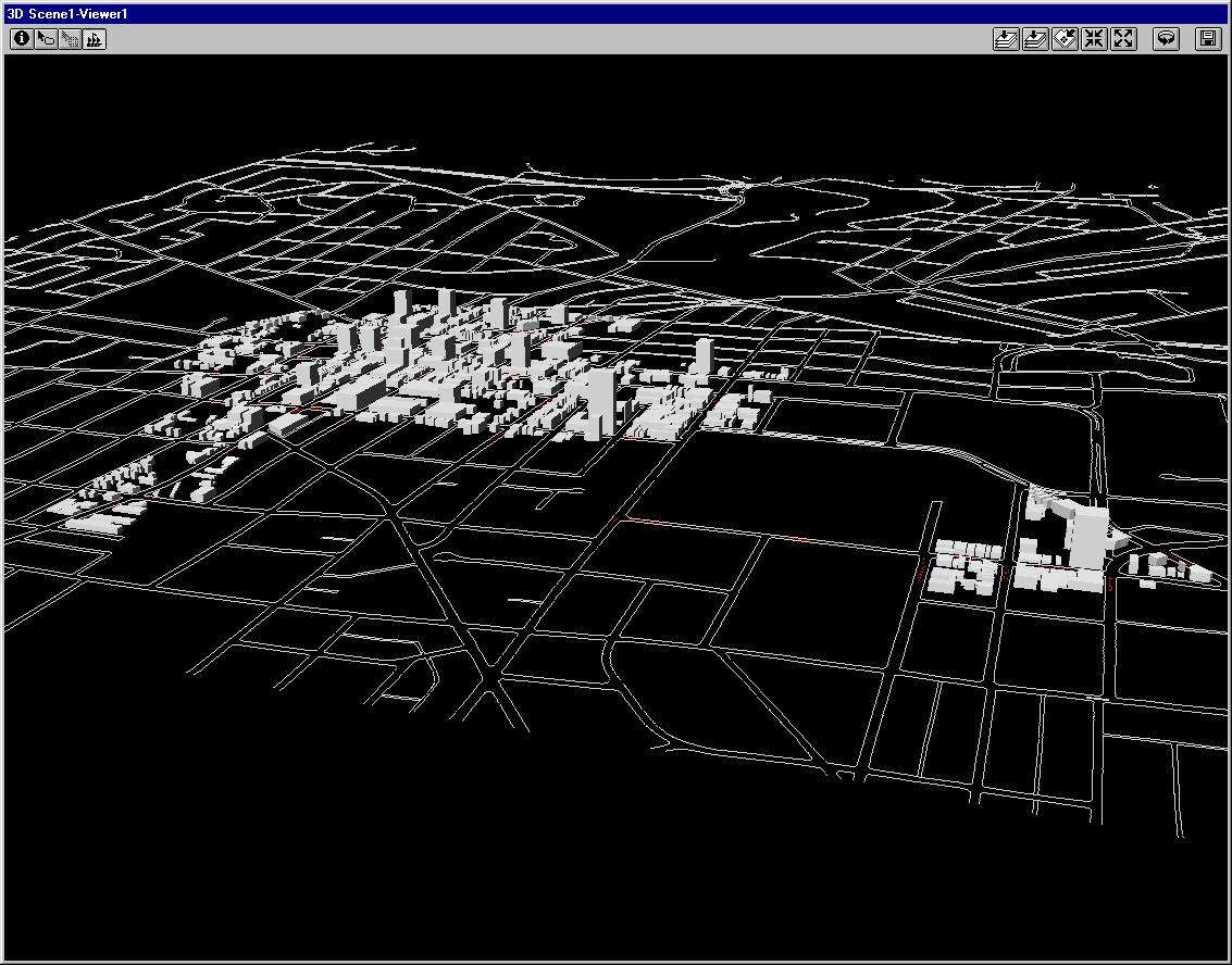
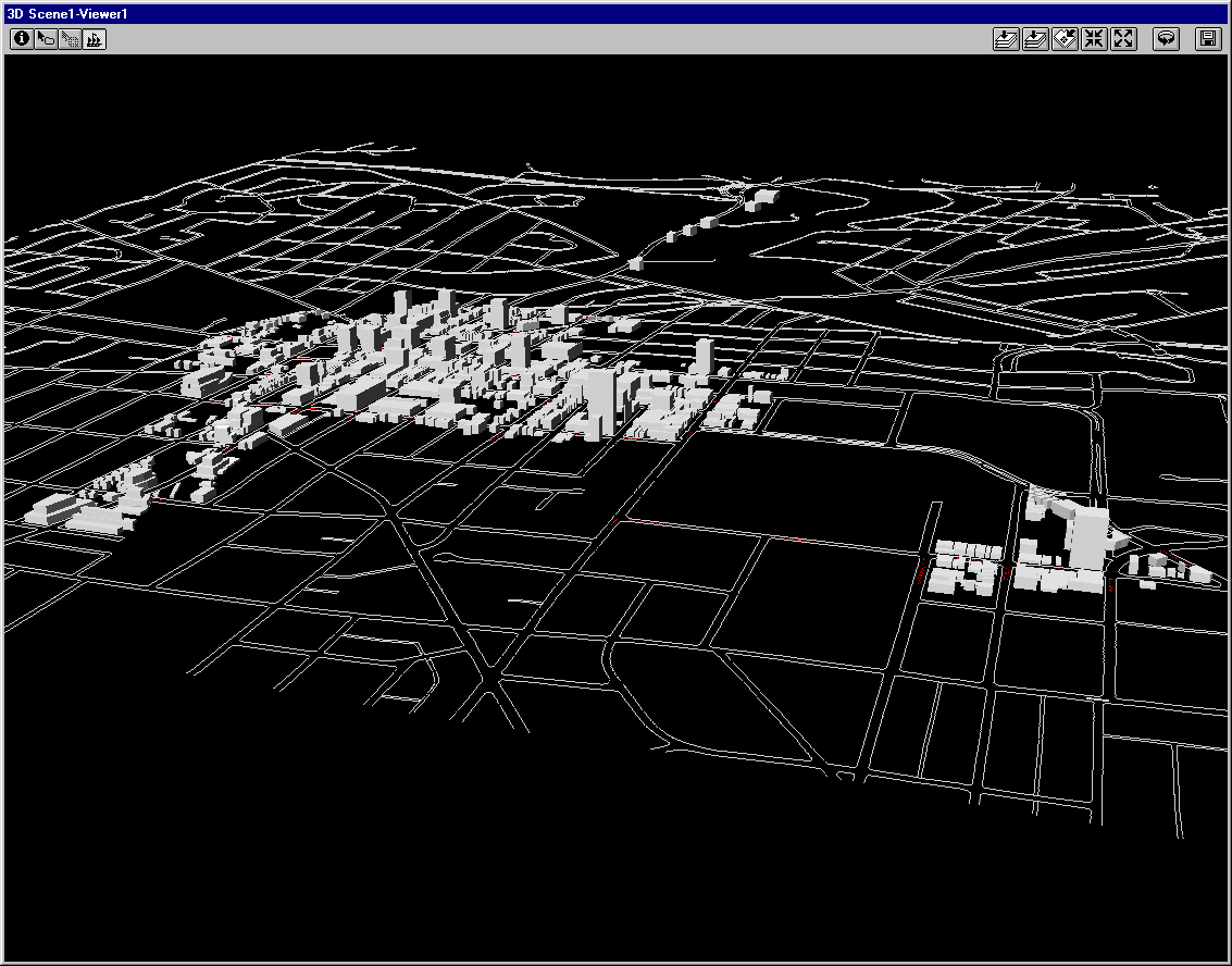
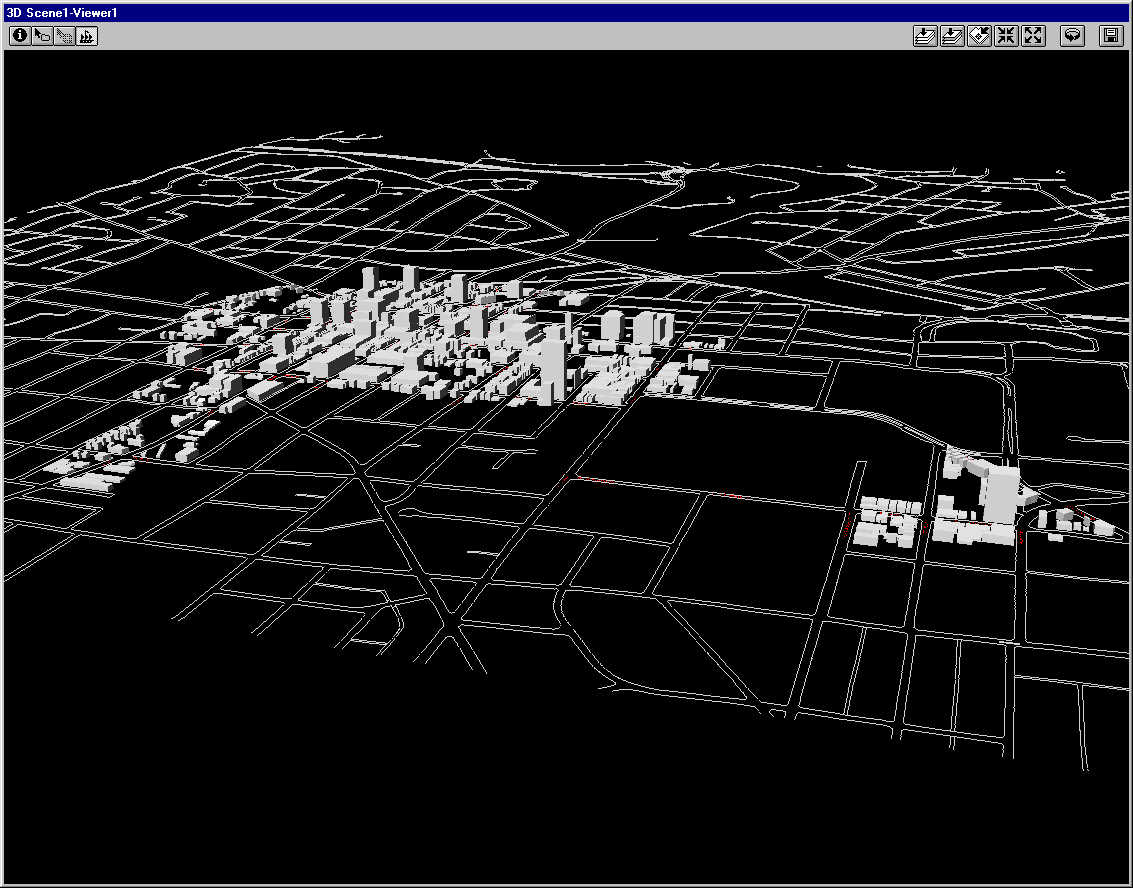
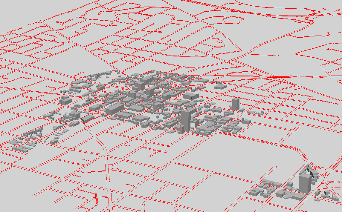
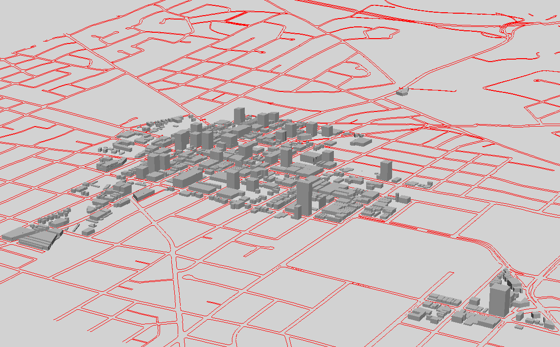
Total
estimated square footage within model of existing buildings:
7,469,852 square feet.
-
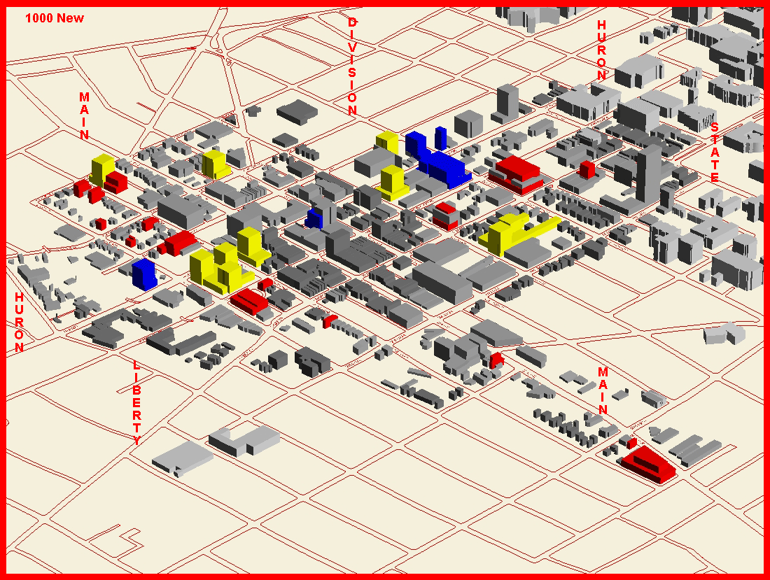
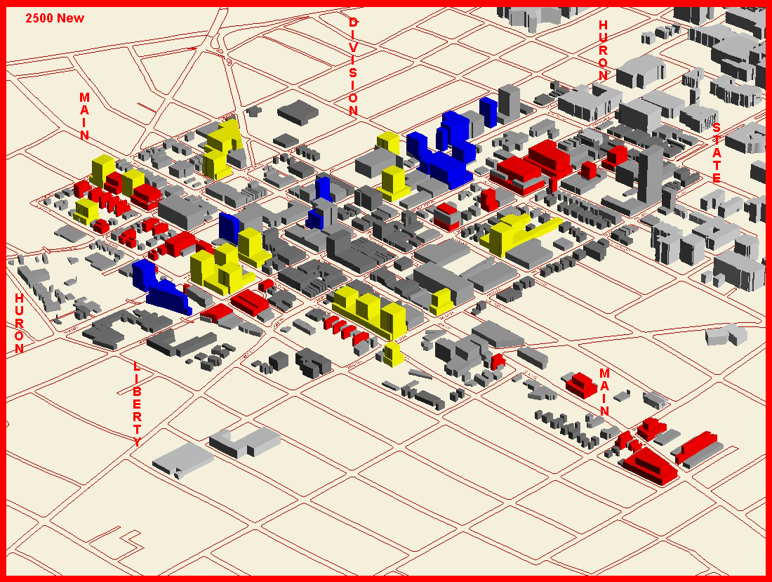
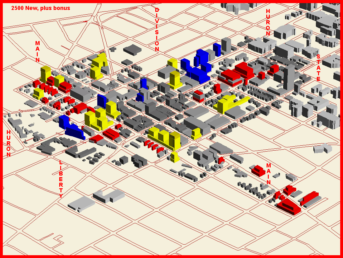
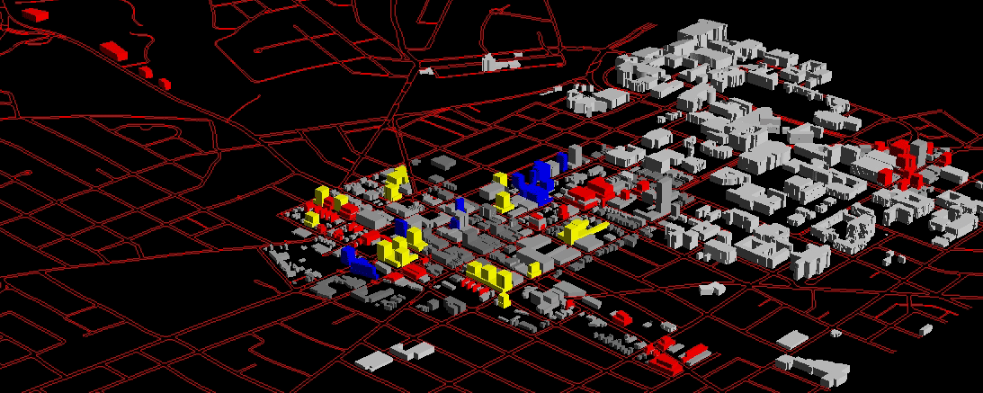
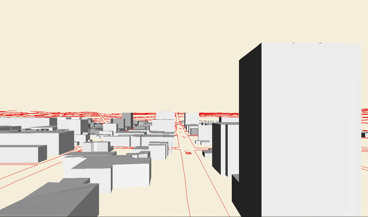
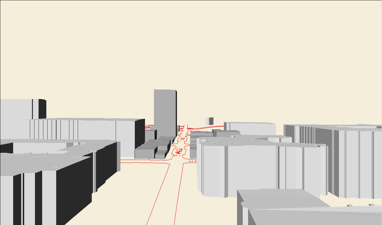
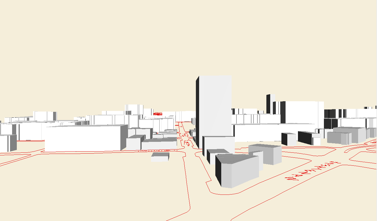
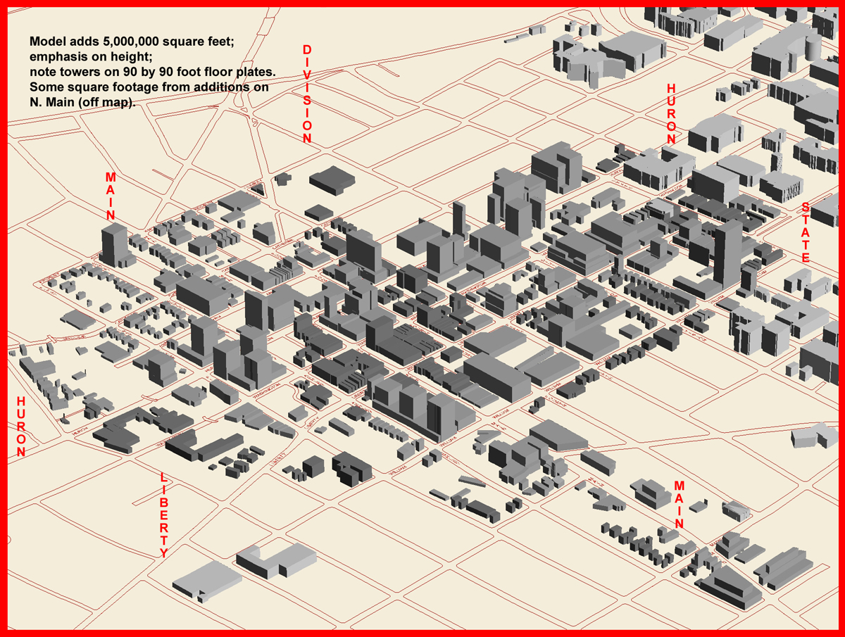
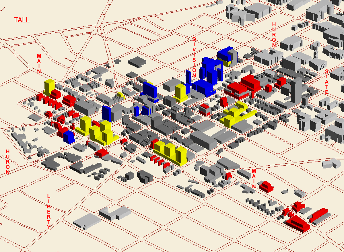
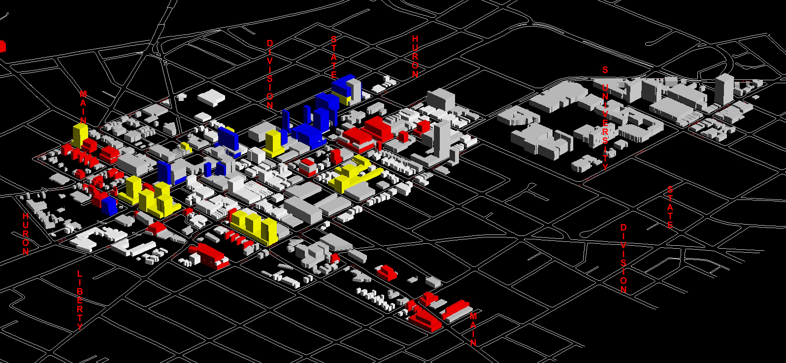
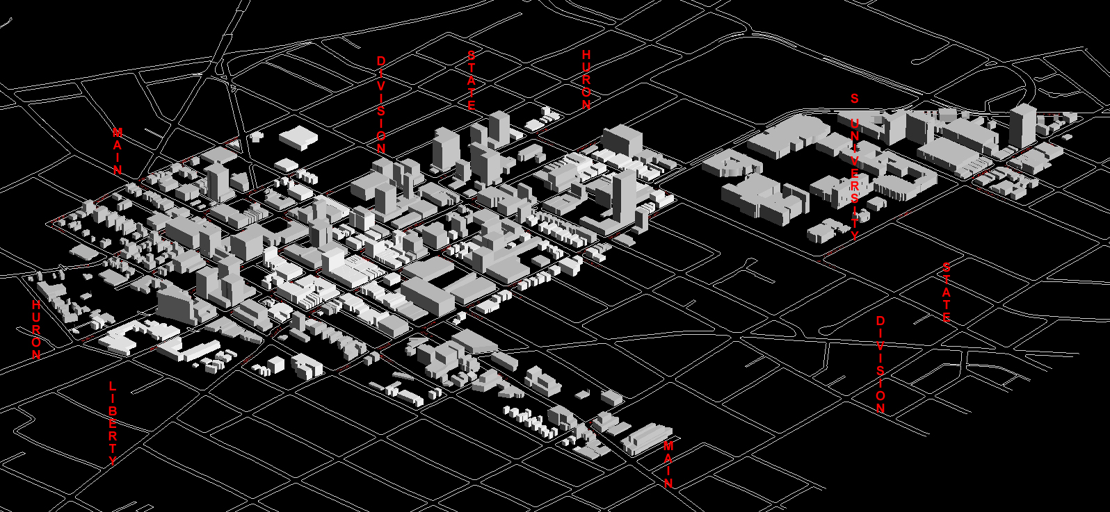
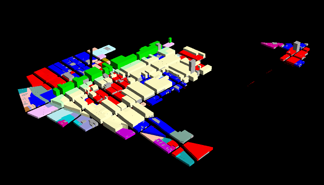
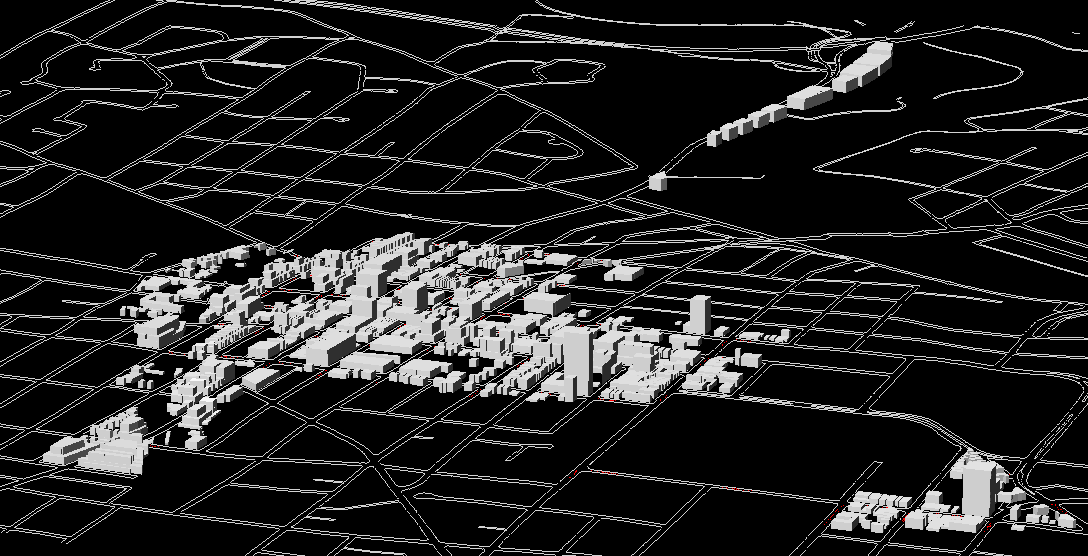
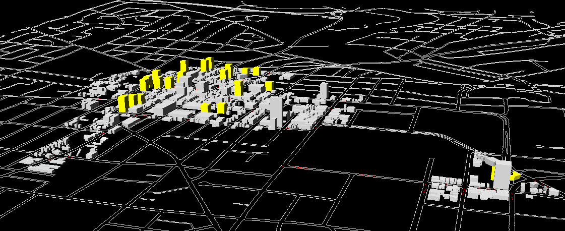
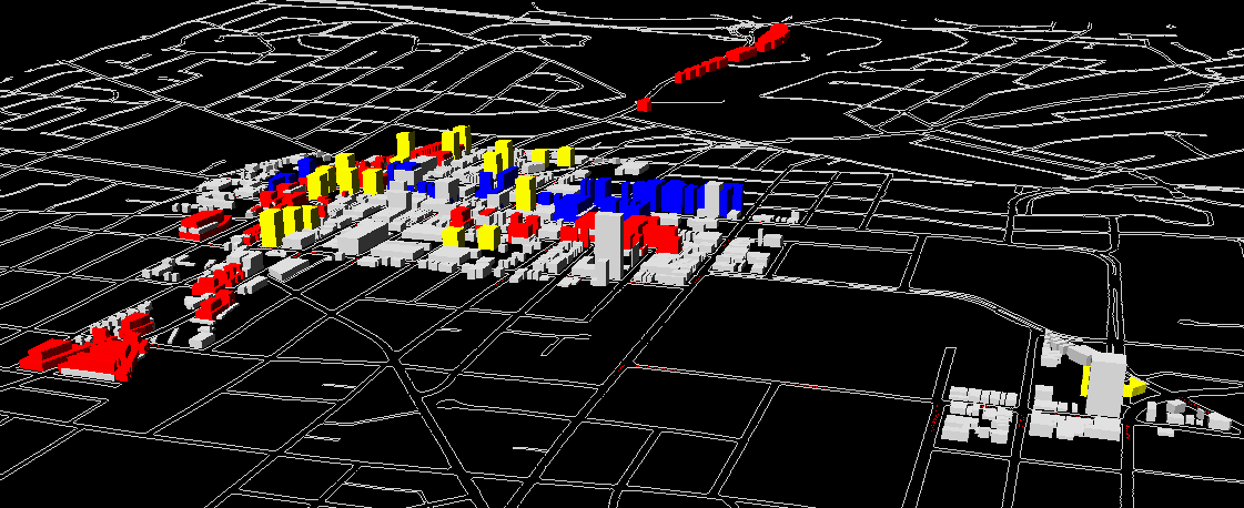
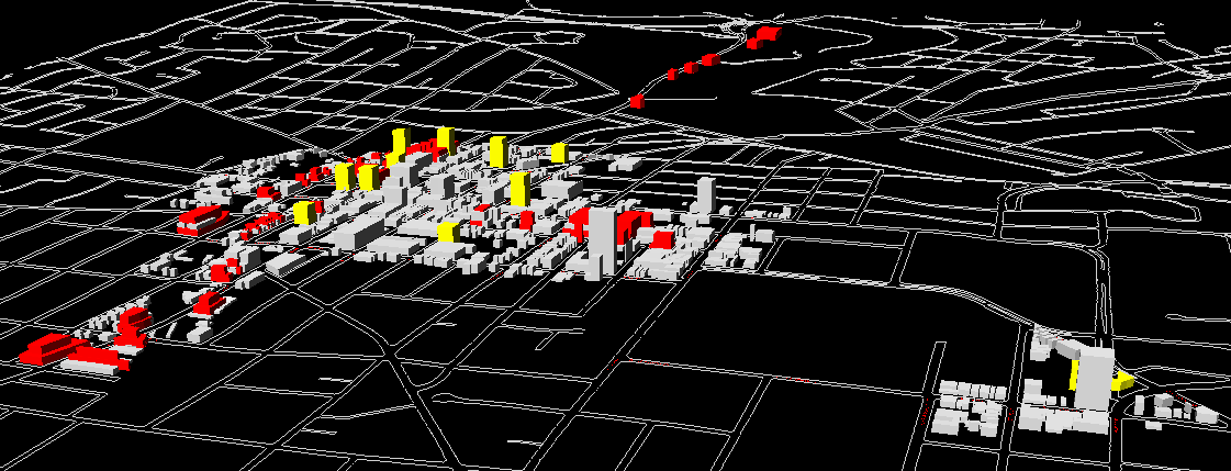
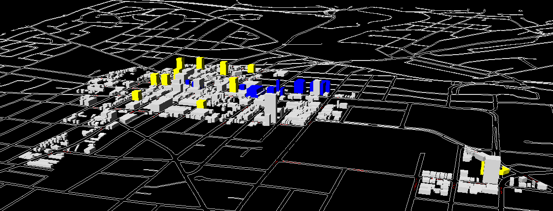
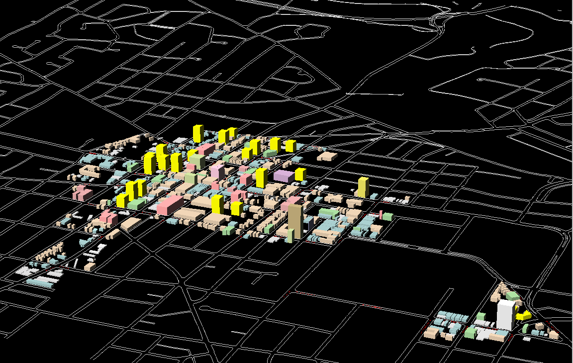
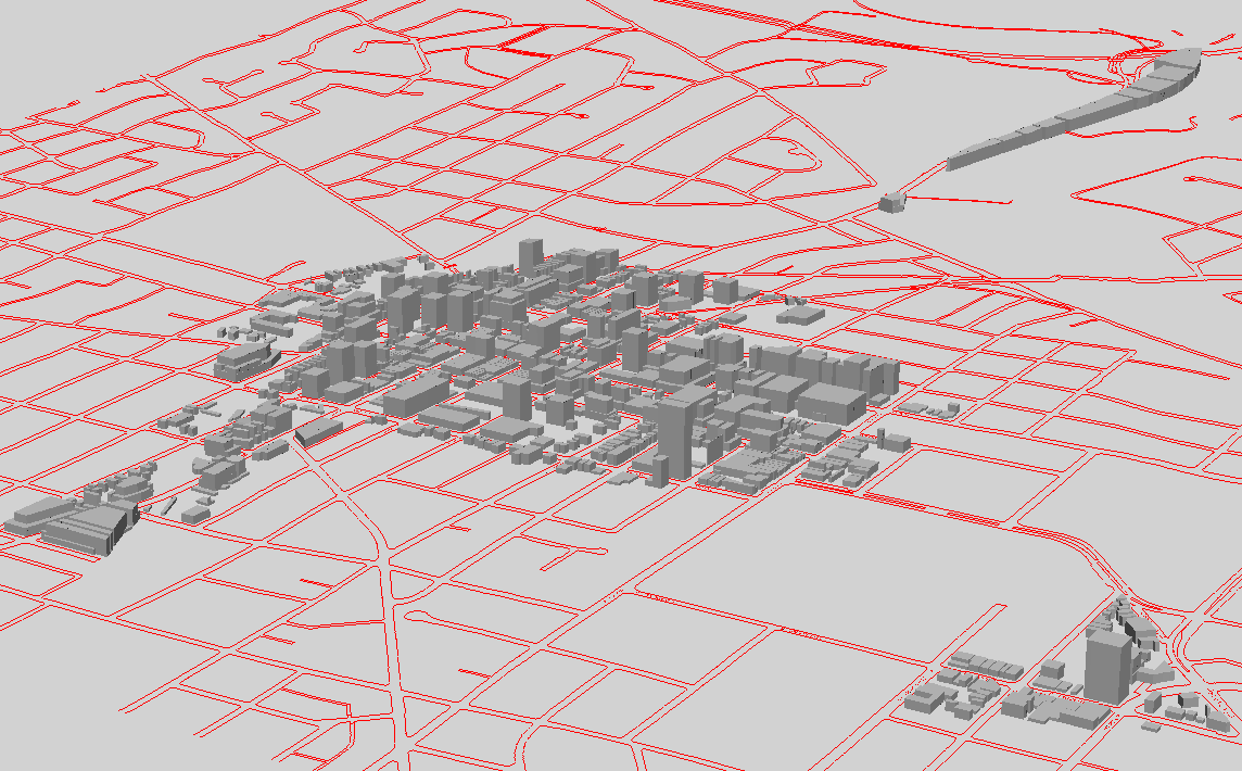
Tall
Alternative 1--color. Total estimated square footage within this
model is about 5 million square feet of new space with most coming from
the yellow buildings (about half of 3+ million in the yellow and about
half of 2- in the blue). Model uses widely-spaced tall buildings
to keep increases in height along First and Ashley quite modest.
About one half million new square feet come from North Main (out of this
picture). This model has the widest variety in height (most 3D texture)
and lowest height changes in existing residential sections of the DDA.
-
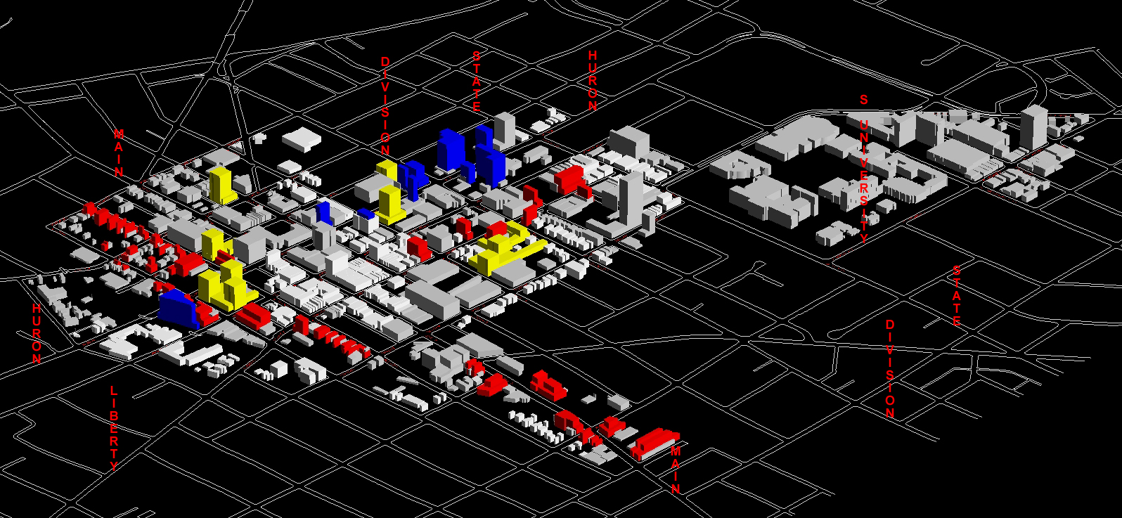
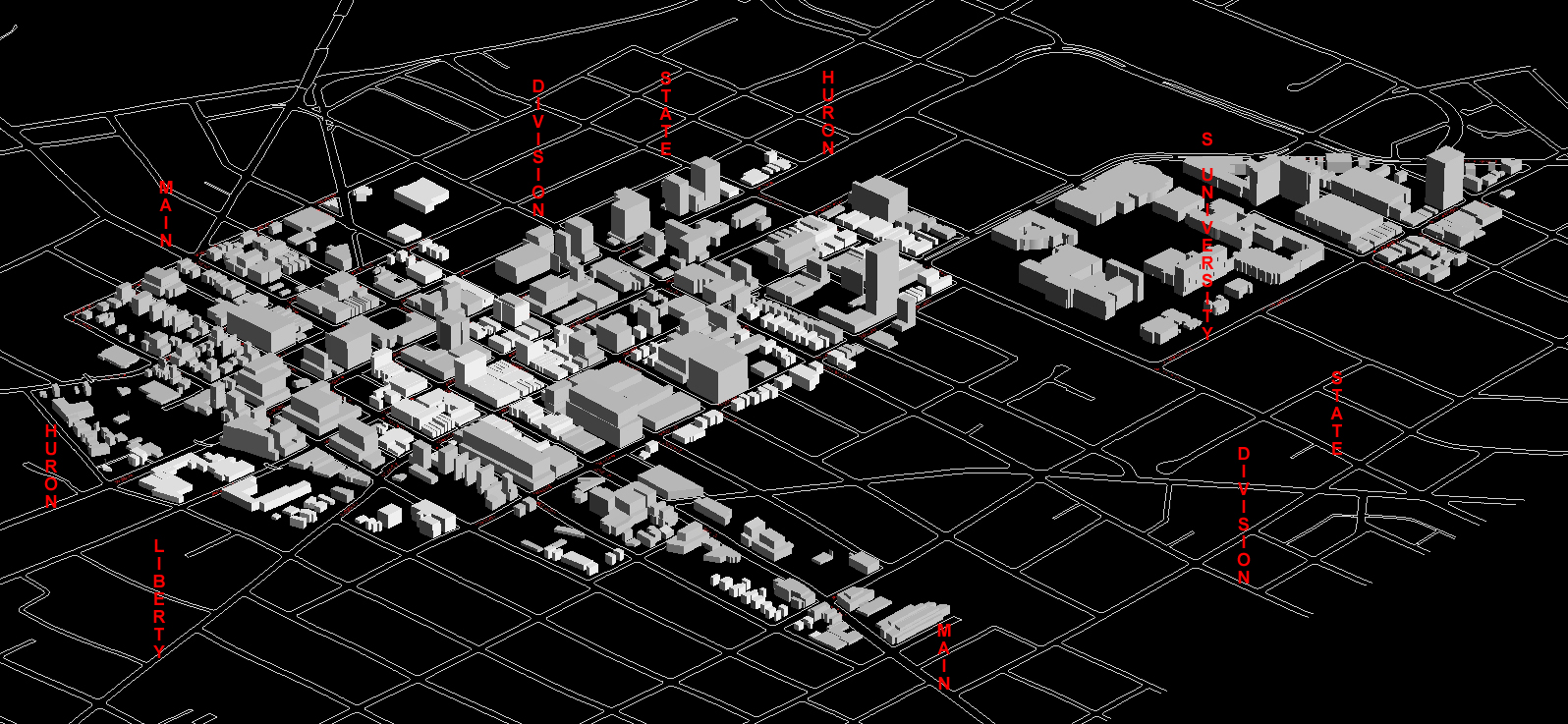
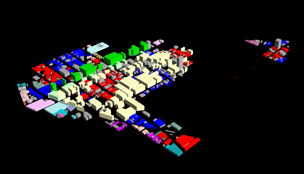
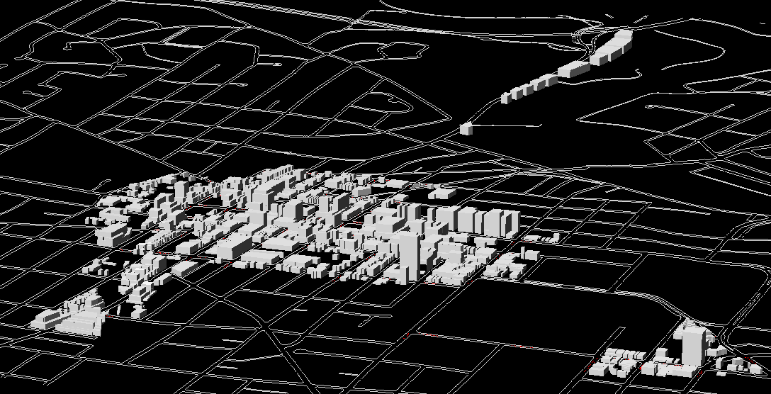
Tall
Alternative 2--color. Total estimated square footage within
this model is about 5 million square feet of new space with most coming
from the yellow buildings (about half of 3+ million in the yellow and about
half of 2- in the blue). Model uses widely-spaced tall buildings
to keep increases in height along First and Ashley quite modest.
About one half million new square feet come from North Main (out of this
picture). This model has the widest variety in height (most 3D texture)
and lowest height changes in existing residential sections of the DDA.
-
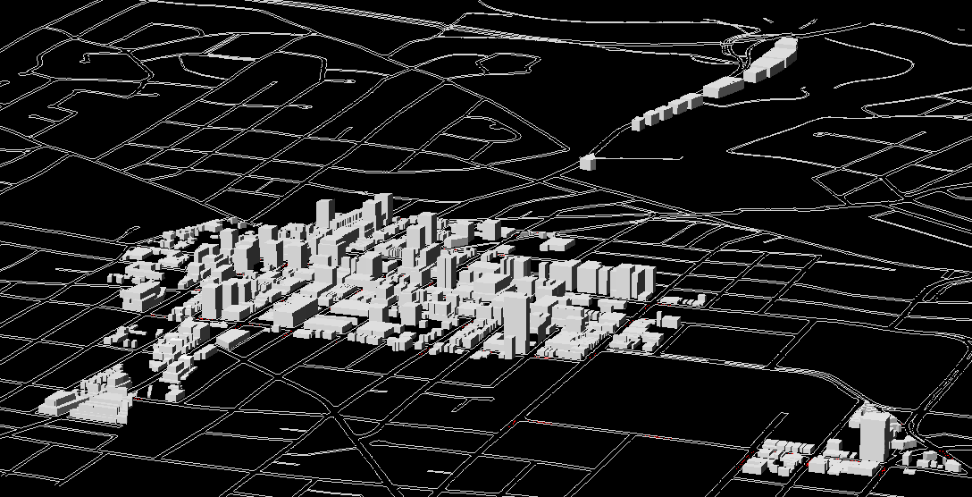
Tall
Alternative 1--gray. Model uses widely-spaced tall buildings
to keep increases in height along First and Ashley quite modest.
About one half million new square feet come from North Main (out of this
picture). This model has the widest variety in height (most 3D texture)
and lowest height changes in existing residential sections of the DDA.
-
Tall
Alternative 2--gray. Model uses widely-spaced tall buildings
to keep increases in height along First and Ashley quite modest.
About one half million new square feet come from North Main (out of this
picture). This model has the widest variety in height (most 3D texture)
and lowest height changes in existing residential sections of the DDA.
-
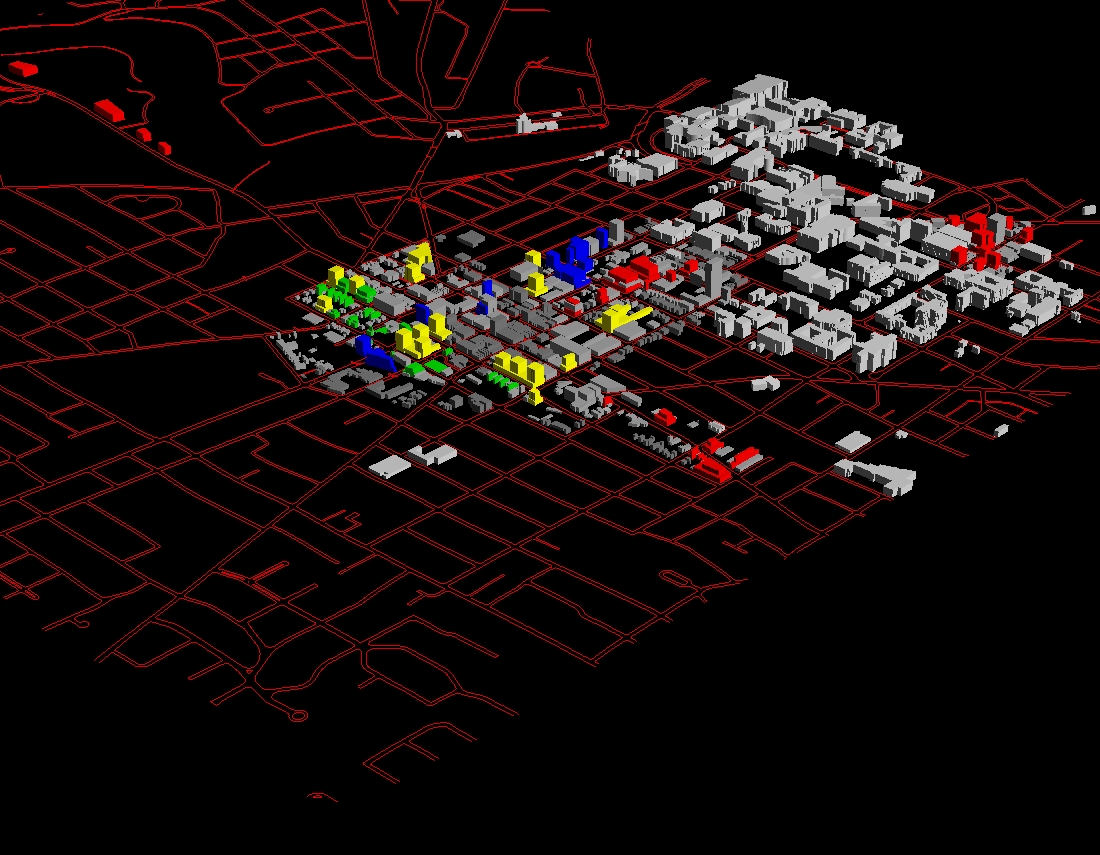
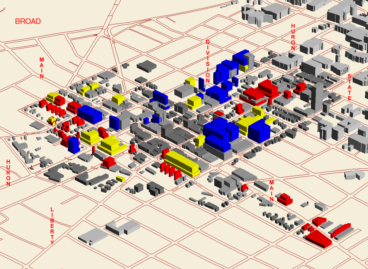
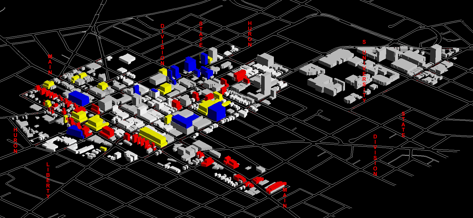
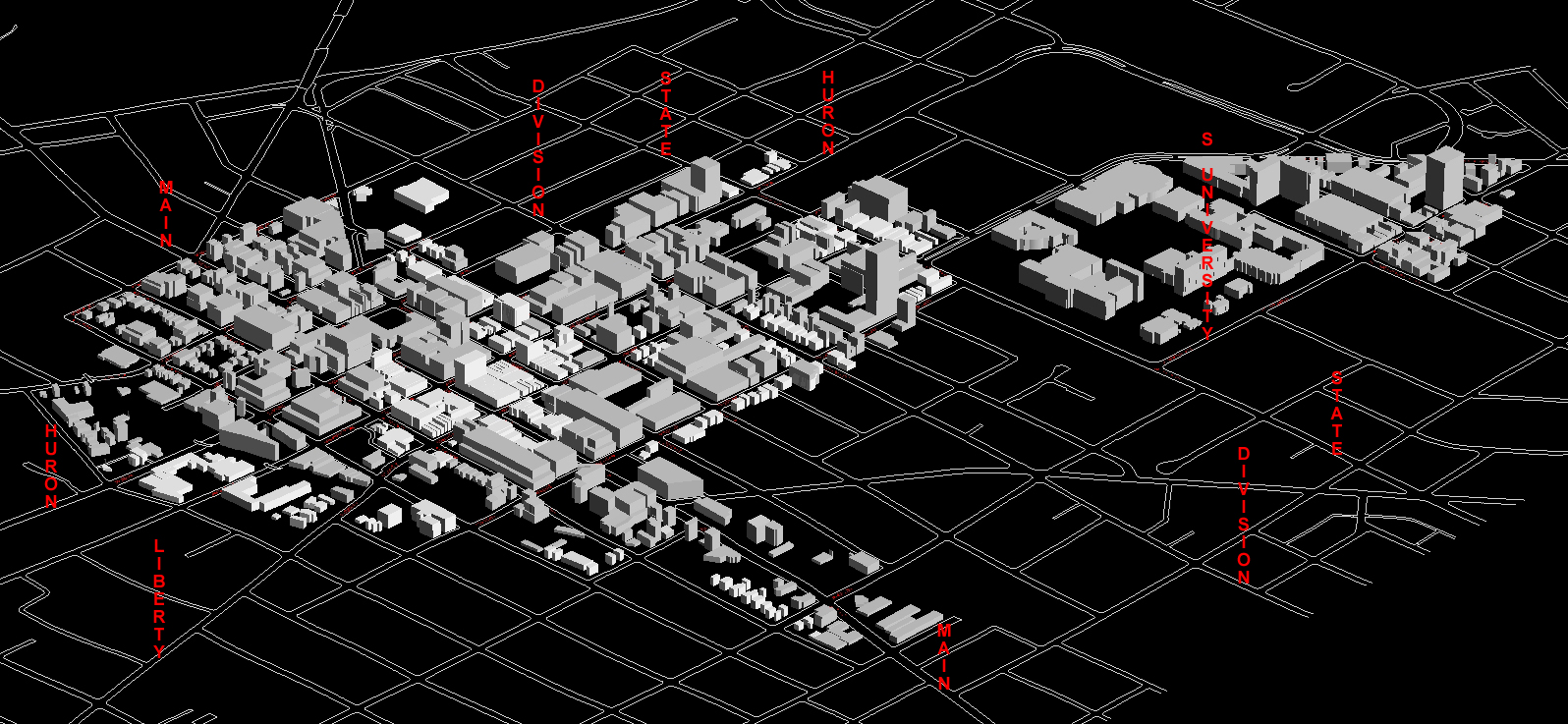
Broad
Alternative 1--color. Total estimated square footage within this
model is about 5 million square feet of new space with most coming from
the yellow buildings (about half of 3+ million in the yellow and about
half of 2- in the blue). Buildings containing large amounts of square
footage often are more massive, laterally, in appearance than are those
above (which gain mass through height rather than breadth).
-
Broad
Alternative 2--color. Total estimated square footage within this
model is about 5 million square feet of new space with most coming from
the yellow buildings (about half of 3+ million in the yellow and about
half of 2- in the blue). Buildings containing large amounts of square
footage often are more massive, laterally, in appearance than are those
above (which gain mass through height rather than breadth).
-
Broad
Alternative 1--gray. Total estimated square footage within this
model is about 5 million square feet of new space with most coming from
the yellow buildings (about half of 3+ million in the yellow and about
half of 2- in the blue). Buildings containing large amounts of square
footage often are more massive, laterally, in appearance than are those
above (which gain mass through height rather than breadth).
-
Broad
Alternative 2--gray. Total estimated square footage within this
model is about 5 million square feet of new space with most coming from
the yellow buildings (about half of 3+ million in the yellow and about
half of 2- in the blue). Buildings containing large amounts of square
footage often are more massive, laterally, in appearance than are those
above (which gain mass through height rather than breadth).
-
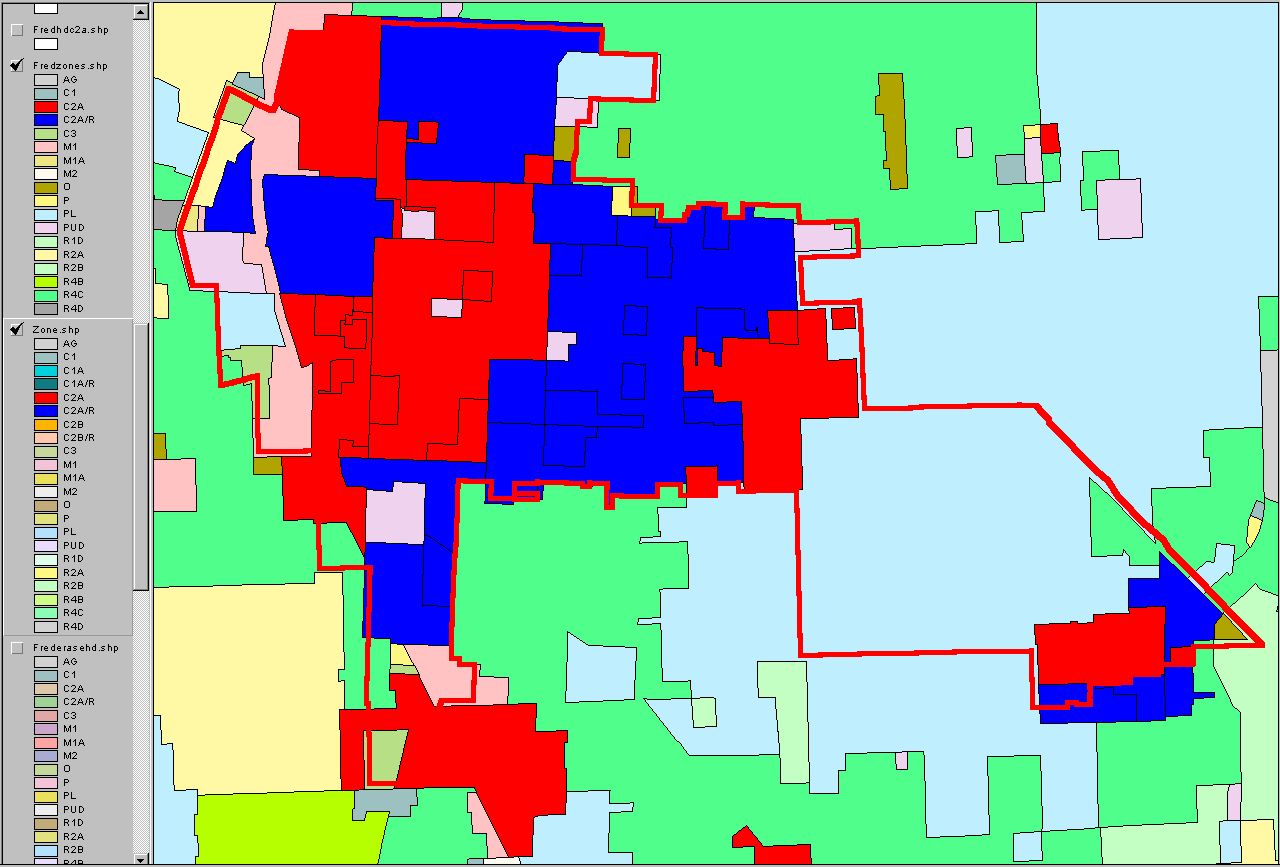
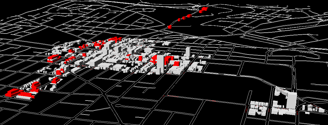
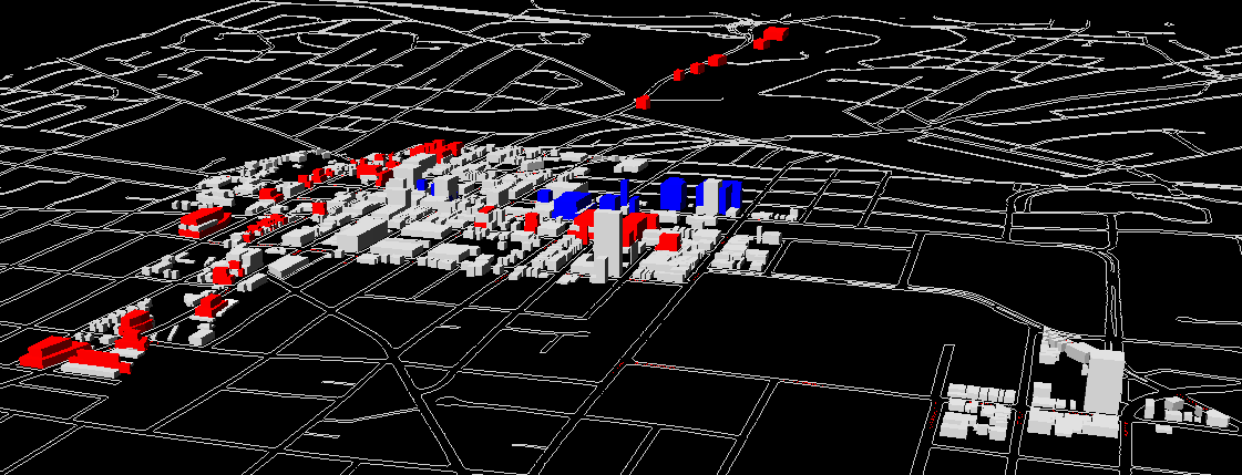
Current
Zoning Alternative 1--color
-
Current
Zoning Alternative 2--color
-
Current
Zoning Alternative 1--gray
-
Current
Zoning Alternative 2--gray
-
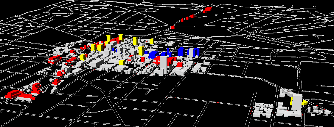
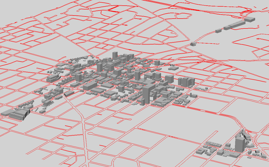
Files
scaled to show North Main buildings outside the DDA; these maps correspond
to the alternatives labelled "tall" above: Image
1, Image
2, Image
3, Image
4.
-
Panoramic
scenes arranged in a matrix of five rows and three columns, each 1600
pixels wide: Image
(1,1), (1,2), (1,3); Image
(2,1), Image
(2,2), Image
(2,3); Image
(3,1), Image
(3,2), Image
(3,3); Image
(4,1), Image
(4,2), Image
(4,3); Image
(5,1), Image
(5,2), Image
(5,3)
-
Panoramic
scenes showing DDA and North Main: Image
(6,1), Image
(6,2), Image
(6,3); Image
(6,4).
-
Comparative
views in a matrix arranged in 3 rows and 5 columns each 400 pixels wide
-
Extra
maps, showing various features
-
New
zoning map, reflecting e-mail from Beal since the last meeting on April
7, 2004.
-
FROM: Presentation of April 7; follow-up
to presentation of April 1
-
One hypothetical model at full
build out and at half
build out (half the buildings). The gray buildings are existing buildings;
the colored construction is height according to FAR within zoning type,
with no setbacks (to come). Also to come are plinths and 3+3 and
3+5 in the light yellow district. See below for various related scenes.
-
Another hypothetical model at full
build out and at half
build out (half the buildings). The gray buildings are existing
buildings; the colored construction is new buildings with setbacks
as given elsewhere.
-
At the meeting of April 1, Fred Beal presented
an alternative zoning scenario. This
animation shows Beal's changes; there are five seconds between successive
animation frames. The entire animation will repeat three times, after
which it will stop to show the entire zoning pattern. To reload the
animation, simply refresh the browser window. The zoning here simplifies
the existing zoning pattern; that is, spatial fragmentation is not as prevalent
in non historic districts.
-
Maps showing historic district retained zoning
pattern (part of Beal's prescription).
-
This
map shows only the historic districts and their zoning inherited from
present day zoning.
-
This
map shows the content of the map on the left against Beal's zoning
pattern.
-
Maps showing existing
DDA zoning and Beal's
zoning
-
Samples of Beal's plan.
-
The first image shows the base
plan to be extruded.
-
The following set shows the base plan extruded,
The extrusion is of parcels, according to FAR by Fred's zoning type and
by historic district zoning type. Setbacks do not yet enter the model.
-
FROM: Presentation of April 1. Follow-up
to presentation of March 18, 2004.
-
Gray scale maps with total buildout, shown
in various permutations, along Huron Street, Liberty, Ashley, First, North
Main, and South Main, and with point towers:
-
DDA as it is now (link)
-
DDA base with point
towers, only, added (link)
-
DDA base with Huron
Street buildout, only, added (link)
-
DDA base with Liberty,
First, Ashley, and Main buildout, only, added (link)
-
DDA base with Liberty-First-Ashley-Main
and Huron Street buildout (link)
-
DDA base with point
towers and Liberty-First-Ashley-Main buildout (link)
-
DDA base with point
towers and Huron Street buildout (link)
-
DDA base with point
towers, Huron Street, and North Main buildout (link)
-
DDA base with full buildout:
point towers, Huron Street, Liberty-First-Ashley-Main, buildout (link)
-
Gray scale maps with partial buildout, shown
in various permutations, along Huron Street, Liberty, Ashley, First, North
Main, and South Main, and with point towers:
-
DDA as it is now (link)
-
DDA base with point
towers, only, added (link)
-
DDA base with Huron
Street buildout, only, added (link)
-
DDA base with Liberty,
First, Ashley, and Main buildout, only, added (link)
-
DDA base with Liberty-First-Ashley-Main
and Huron Street buildout (link)
-
DDA base with point
towers and Liberty-First-Ashley-Main buildout (link)
-
DDA base with point
towers and Huron Street buildout (link)
-
DDA base with point
towers, Huron Street, and North Main buildout (link)
-
DDA base with partial
buildout: point towers, Huron Street, Liberty-First-Ashley-Main,
buildout (link)
-
Maps with gray scale
base and new buildings in color, with total buildout, shown in various
permutations, along Huron Street, Liberty, Ashley, First, North Main, and
South Main, and with point towers:
-
DDA as it is now (link)
-
DDA base with point
towers, only, added (link)
-
DDA base with Huron
Street buildout, only, added (link)
-
DDA base with Liberty,
First, Ashley, and Main buildout, only, added (link)
-
DDA base with Liberty-First-Ashley-Main
and Huron Street buildout (link)
-
DDA base with point
towers and Liberty-First-Ashley-Main buildout (link)
-
DDA base with point
towers and Huron Street buildout (link)
-
DDA base with point
towers, Huron Street, and North Main buildout (link)
-
DDA base with full buildout:
point towers, Huron Street, Liberty-First-Ashley-Main, buildout (link)
-
Maps with gray scale
base and new buildings in color, with partial buildout, shown in various
permutations, along Huron Street, Liberty, Ashley, First, North Main, and
South Main, and with point towers:
-
DDA as it is now (link)
-
DDA base with point
towers, only, added (link)
-
DDA base with Huron
Street buildout, only, added (link)
-
DDA base with Liberty,
First, Ashley, and Main buildout, only, added (link)
-
DDA base with Liberty-First-Ashley-Main
and Huron Street buildout (link)
-
DDA base with point
towers and Liberty-First-Ashley-Main buildout (link)
-
DDA base with point
towers and Huron Street buildout (link)
-
DDA base with point
towers, Huron Street, and North Main buildout (link)
-
DDA base with partial
buildout: point towers, Huron Street, Liberty-First-Ashley-Main,
buildout (link)
-
FROM: Presentation
to Taskforce, March 18, 2004 at DDA
-
FROM: Presentation
to Taskforce, March 12, 2004 at DDA
-
FROM: More
follow-up from meeting of February 2, 2004.
-
Animation
showing targets of opportunity partitioned according to distance from an
historic district:
-
Animation
of 1/4 mile buffer and target parcels within that buffer:
-
FROM: February 7, 2004. Follow
up from meeting at DDA of February 2, 2004.
-
Animated
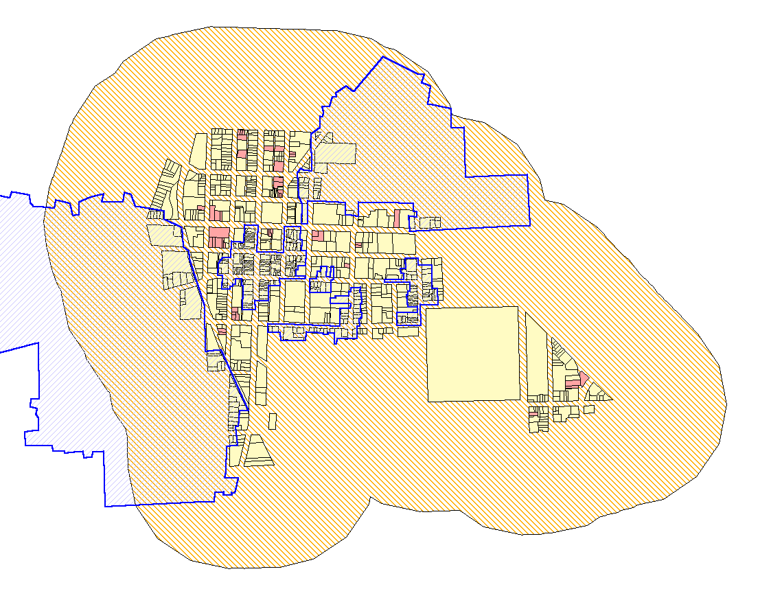
map shows the building footprint file, in shades of pastels reflecting
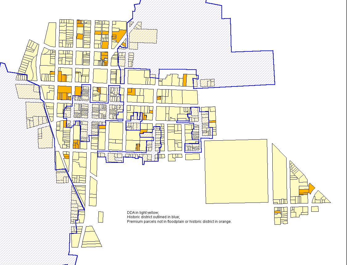
building height in stories. The file of red parcels that comes in
represents the set of all vacant/parking parcels in the five premium categories
within the DDA--only those that do not lie also in an historic district
or in the floodplain.
-
Animated
map shows buildout of vacant and surface parking parcels at 300 and
600 percent (in red) sandwiched in among existing buildings; target parcels
do not lie in the floodplain and do not lie in historic districts.
-
FROM: Ann
Arbor, Michigan: Virtual Downtown Experiments, Part II, Solstice:
An Electronic Journal of Geography and Mathematics, December, 2003
-
Static
panorama of existing skyline colored by building height
-
Animation
of DDA Building Height
-
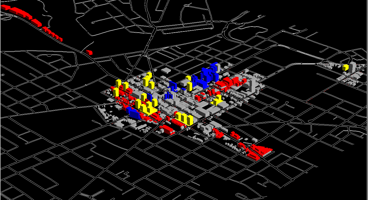
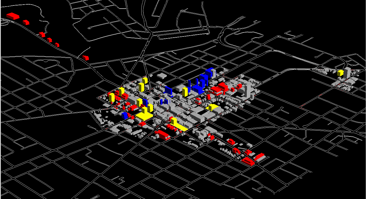
GRAPH: FAR as a rectangular hyperbola
-
Static
aerial with added information; tall buildings cast visible shadows
and suggest where new tall buildings might cast shadows:
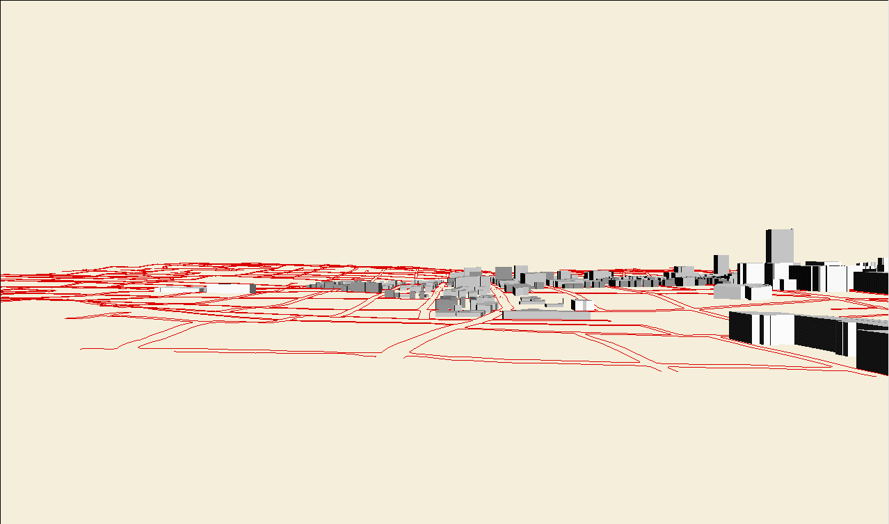
-
Interactive
aerial
-
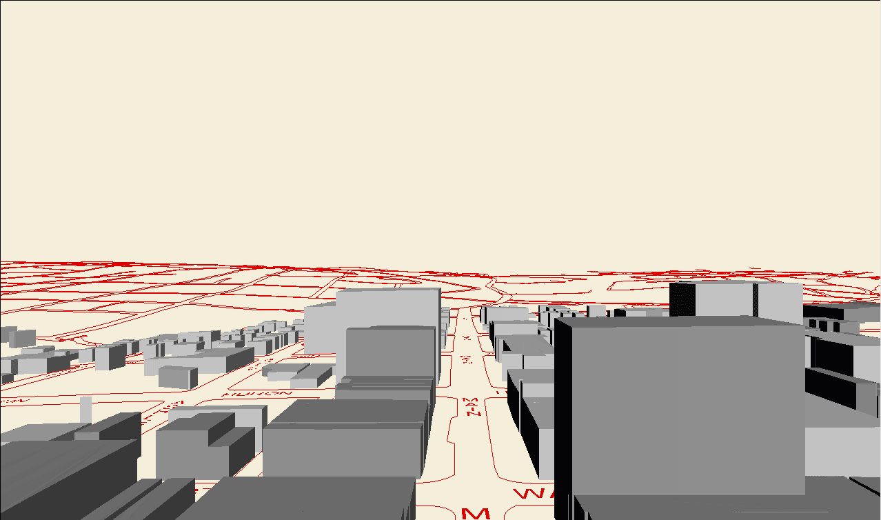
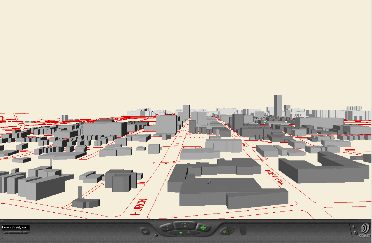
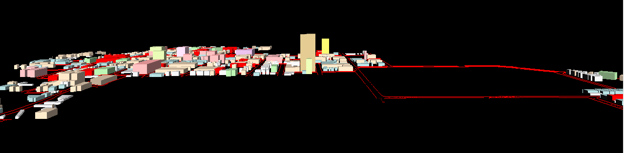
Growing Building at Fifth and Huron, animated
sequence taken from vrml files: Figures below show animated sequences
of screen shots from the virtual reality files.
-
FROM GeoWall
Display, Downtown Ann Arbor Virtual Reality, 9:00a.m., Media Union
3D Lab, November 11, 2003
-
Handout
given to participants:
-
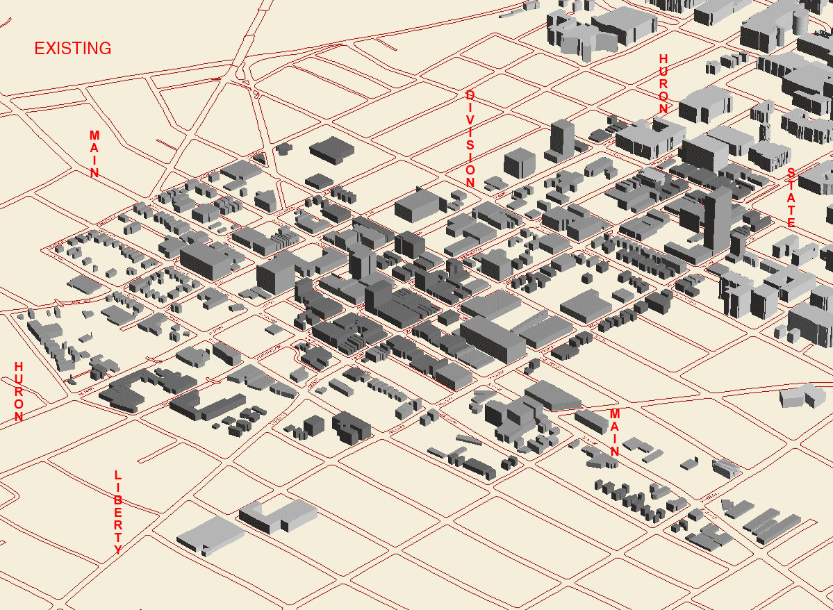
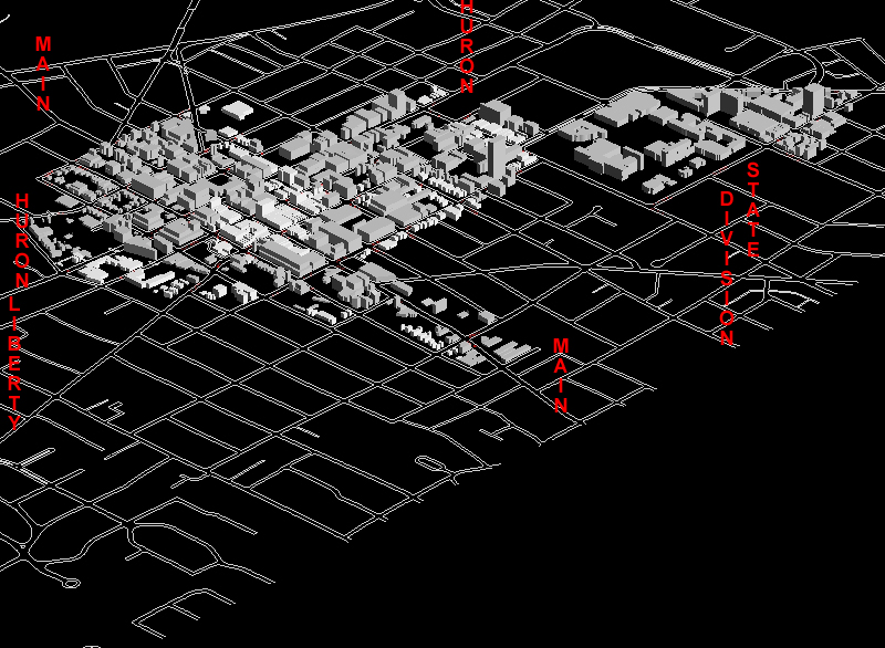
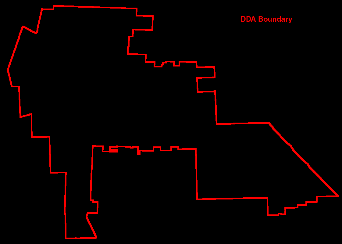
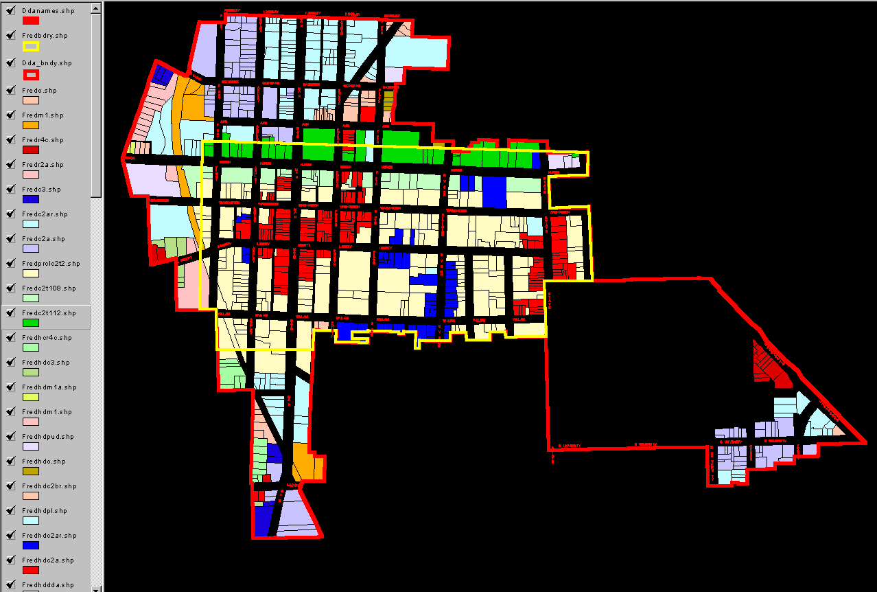
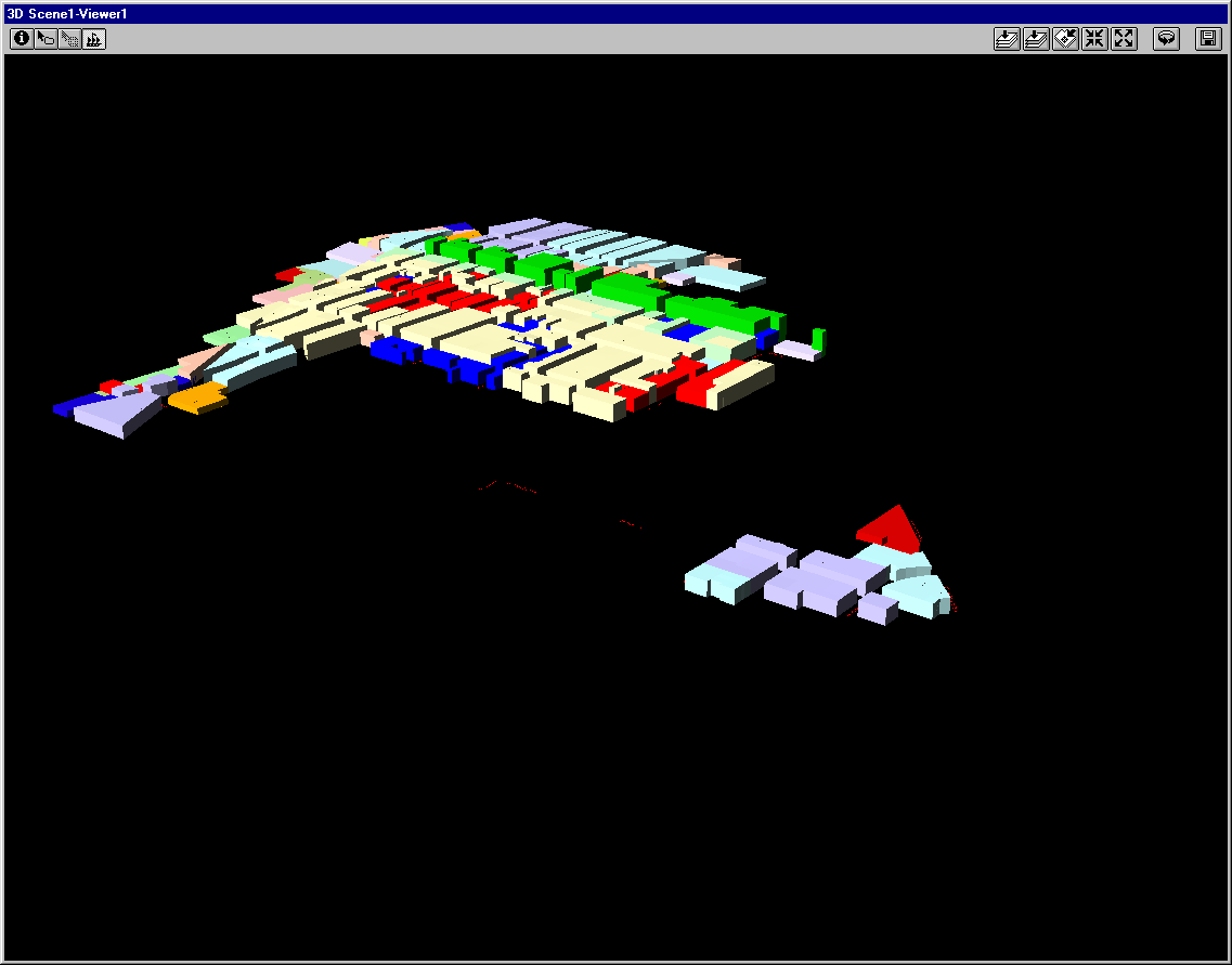
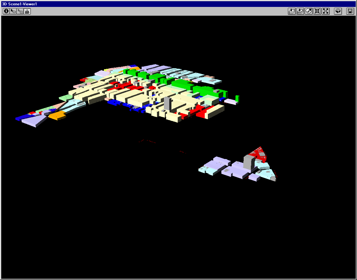
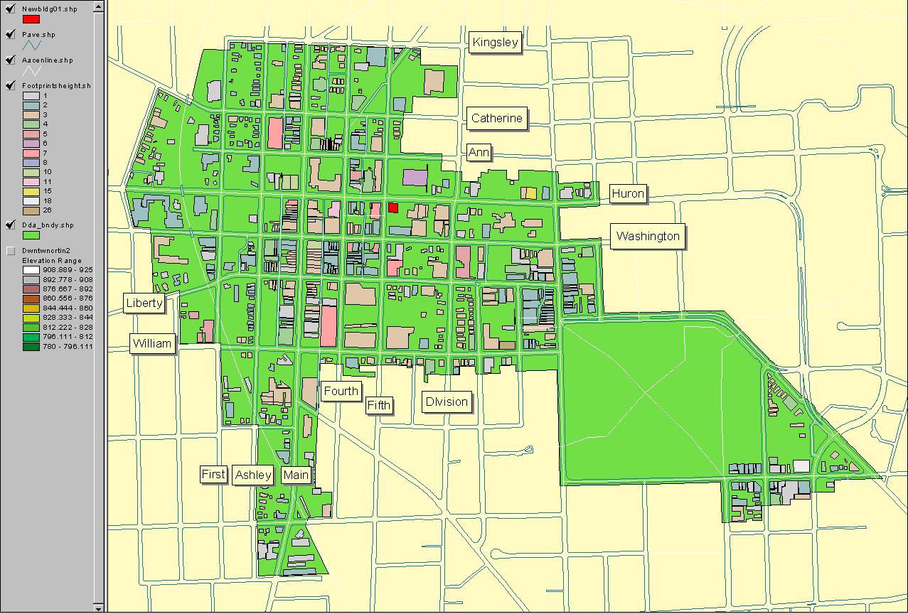
Map
of dda and building footprints
-
FROM Ann
Arbor, Michigan: Virtual Downtown Experiments, Solstice: An
Electronic Journal of Geography and Mathematics, June, 2003.
-
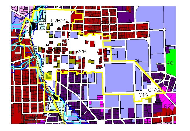
Zoning
animation of 22 zoning categories: AG, C1, C1A, C1AR, C2A, C2AR,
C2B, C2BR, C3, M1, M1A, M2, O, P, PL, PUD, R1D, R2A, R2B, R4B, R4C, R4D.
Zones enter the animation in alphabetical succession. Attached labels
are added in the final frame.
-
Shading is removed from C1A, C1AR, C2A, C2AR,
C2BR zoning categories--the downtown core--to visually group these regions
as those containing parcels that are targets
of opportunity for height in excess of that permitted by the FAR.
-
The historic
district designation (historic districts in red) further limits the
targets of opportunity.
-
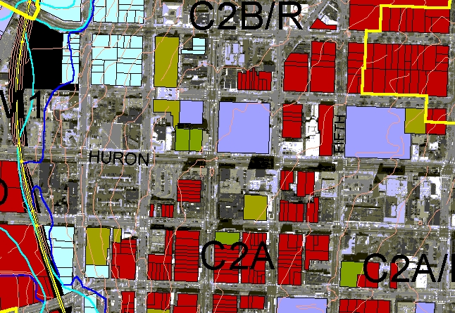
Zoom
in--use the street hierarchy to suggest locales--notice the shadows
leaning out into Huron Street as well as the content of the core area along
Huron Street, from tall buildings to parking lots.
-
INTERACTIVE,
CLICKABLE MAPS OR PHOTOGRAPHS
-
Interactive, clickable map series: Ann
Arbor Downtown Building Footprints and Height,
-
Map
showing building footprints and height (on mouse-over) as well as building
address and street names (on mouse-over). Parcel boundaries are shown
on the underlying aerial and on the green Downtown Development Authority
(DDA) area. The Allen Creek floodway (underground) and flood plain
are shown, shaded, respectively in blue and turquoise. Click on a
building or a street to see associated entries in the underlying database.
-
Aerial
showing parcel boundaries, zoning, building height (on mouse-over), and
street name. DDA outline, only, is shown in light yellow so the user
may zoom in to get a closer view of the aerial within the DDA (up to 800%
enlargement--can see cars clearly). The Allen Creek floodway (underground)
and flood plain are shown, outlined, respectively in blue and light blue;
again, because the shading is removed, the viewer may look at the content
of the floodway/floodplain in greater detail than above. Click on a building
or a street to see associated entries in the underlying database.
-
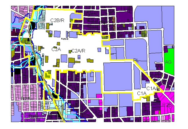
Aerial
showing zoning boundaries in the downtown, zoning type (on mouse-over),
building height (in the "zoneht" record of the database), and street name.
Click on a building or a street to see associated entries in the underlying
database.
-
3D SCENES (first order
subheadings arranged in reversed chronological order)
-
FROM: Follow-up
to meeting of May 26, 2004
-
FROM: Presentation
of May 10, 2004.
-
FROM: 3D
Models, Animations, and Virtual Reality Files--Draft Visuals, DDA:
2500 residential units / 25 years,
April 27, 2004, Council Chambers, Guy
C. Larcom City Hall, 100 N. Fifth Ave. 7:00p.m.
-
FROM: Presentation
of April 26:
-
FROM: Presentation
of April 14
-
Total estimated
square footage within model of existing buildings: 7,469,852
square feet.
-
Tall Alternative
1--color. Total estimated square footage within this model is
about 5 million square feet of new space with most coming from the yellow
buildings (about half of 3+ million in the yellow and about half of 2-
in the blue). Model uses widely-spaced tall buildings to keep increases
in height along First and Ashley quite modest. About one half million
new square feet come from North Main (out of this picture). This
model has the widest variety in height (most 3D texture) and lowest
height changes in existing residential sections of the DDA.
-
Tall Alternative
2--color. Total estimated square footage within this model
is about 5 million square feet of new space with most coming from the yellow
buildings (about half of 3+ million in the yellow and about half of 2-
in the blue). Model uses widely-spaced tall buildings to keep increases
in height along First and Ashley quite modest. About one half million
new square feet come from North Main (out of this picture). This
model has the widest variety in height (most 3D texture) and lowest height
changes in existing residential sections of the DDA.
-
Tall Alternative
1--gray. Model uses widely-spaced tall buildings to keep increases
in height along First and Ashley quite modest. About one half million
new square feet come from North Main (out of this picture). This
model has the widest variety in height (most 3D texture) and lowest height
changes in existing residential sections of the DDA.
-
Tall Alternative
2--gray. Model uses widely-spaced tall buildings to keep increases
in height along First and Ashley quite modest. About one half million
new square feet come from North Main (out of this picture). This
model has the widest variety in height (most 3D texture) and lowest height
changes in existing residential sections of the DDA.
-
Broad Alternative
1--color. Total estimated square footage within this model is
about 5 million square feet of new space with most coming from the yellow
buildings (about half of 3+ million in the yellow and about half of 2-
in the blue). Buildings containing large amounts of square footage
often are more massive, laterally, in appearance than are those above (which
gain mass through height rather than breadth).
-
Broad Alternative
2--color. Total estimated square footage within this model is
about 5 million square feet of new space with most coming from the yellow
buildings (about half of 3+ million in the yellow and about half of 2-
in the blue). Buildings containing large amounts of square footage
often are more massive, laterally, in appearance than are those above (which
gain mass through height rather than breadth).
-
Broad Alternative
1--gray. Total estimated square footage within this model is
about 5 million square feet of new space with most coming from the yellow
buildings (about half of 3+ million in the yellow and about half of 2-
in the blue). Buildings containing large amounts of square footage
often are more massive, laterally, in appearance than are those above (which
gain mass through height rather than breadth).
-
Broad Alternative
2--gray. Total estimated square footage within this model is
about 5 million square feet of new space with most coming from the yellow
buildings (about half of 3+ million in the yellow and about half of 2-
in the blue). Buildings containing large amounts of square footage
often are more massive, laterally, in appearance than are those above (which
gain mass through height rather than breadth).
-
Current Zoning
Alternative 1--color
-
Current Zoning
Alternative 2--color
-
Current Zoning
Alternative 1--gray
-
Current Zoning
Alternative 2--gray
-
FROM: Presentation of April 7; follow-up
to presentation of April 1
-
One hypothetical model at full
build out and at half build out (half
the buildings). The gray buildings are existing buildings; the colored
construction is height according to FAR within zoning type, with no setbacks
(to come). Also to come are plinths and 3+3 and 3+5 in the light
yellow district. See below for various related scenes.
-
Another hypothetical model at full
build out and at half build out (half the
buildings). The gray buildings are existing buildings; the colored
construction is new
buildings with setbacks as given elsewhere.
-
Sample VR files of Beal's plan:
-
Link to
virtual reality above, with no premiums and no existing building hull.
-
Link to virtual
reality above, with premiums and no existing building hull.
-
Link to virtual
reality above, with no premiums and existing building hull.
-
Link to virtual
reality above, with premiums and existing building hull.
-
FROM: Presentation of April 1. Follow-up
to presentation of March 18, 2004.
-
Gray scale maps with total buildout, shown
in various permutations, along Huron Street, Liberty, Ashley, First, North
Main, and South Main, and with point towers:
-
DDA as it is now (link
to associated VR file)
-
DDA base with point
towers, only, added (link to associated
VR file)
-
DDA base with Huron
Street buildout, only, added (link
to associated VR file)
-
DDA base with Liberty,
First, Ashley, and Main buildout, only, added (link
to associated VR file)
-
DDA base with Liberty-First-Ashley-Main
and Huron Street buildout (link to
associated VR file)
-
DDA base with point
towers and Liberty-First-Ashley-Main buildout (link
to associated VR file)
-
DDA base with point
towers and Huron Street buildout (link
to associated VR file)
-
DDA base with point
towers, Huron Street, and North Main buildout (link
to associated VR file)
-
DDA base with full buildout:
point towers, Huron Street, Liberty-First-Ashley-Main, buildout (link
to associated VR file)
-
Gray scale maps with partial buildout, shown
in various permutations, along Huron Street, Liberty, Ashley, First, North
Main, and South Main, and with point towers:
-
DDA as it is now (link
to associated VR file)
-
DDA base with point
towers, only, added (link to
associated VR file)
-
DDA base with Huron
Street buildout, only, added (link
to associated VR file)
-
DDA base with Liberty,
First, Ashley, and Main buildout, only, added (link
to associated VR file)
-
DDA base with Liberty-First-Ashley-Main
and Huron Street buildout (link
to associated VR file)
-
DDA base with point
towers and Liberty-First-Ashley-Main buildout (link
to associated VR file)
-
DDA base with point
towers and Huron Street buildout (link
to associated VR file)
-
DDA base with point
towers, Huron Street, and North Main buildout (link
to associated VR file)
-
DDA base with partial
buildout: point towers, Huron Street, Liberty-First-Ashley-Main,
buildout (link to associated VR file)
-
Maps with gray scale
base and new buildings in color, with total buildout, shown in various
permutations, along Huron Street, Liberty, Ashley, First, North Main, and
South Main, and with point towers:
-
DDA as it is now (link
to associated VR file)
-
DDA base with point
towers, only, added (link to associated
VR file)
-
DDA base with Huron
Street buildout, only, added (link to
associated VR file)
-
DDA base with Liberty,
First, Ashley, and Main buildout, only, added (link
to associated VR file)
-
DDA base with Liberty-First-Ashley-Main
and Huron Street buildout (link to associated
VR file)
-
DDA base with point
towers and Liberty-First-Ashley-Main buildout (link
to associated VR file)
-
DDA base with point
towers and Huron Street buildout (link
to associated VR file)
-
DDA base with point
towers, Huron Street, and North Main buildout (link
to associated VR file)
-
DDA base with full buildout:
point towers, Huron Street, Liberty-First-Ashley-Main, buildout (link
to associated VR file)
-
Maps with gray scale
base and new buildings in color, with partial buildout, shown in various
permutations, along Huron Street, Liberty, Ashley, First, North Main, and
South Main, and with point towers:
-
DDA as it is now (link
to associated VR file)
-
DDA base with point
towers, only, added (link to associated
VR file)
-
DDA base with Huron
Street buildout, only, added (link
to associated VR file)
-
DDA base with Liberty,
First, Ashley, and Main buildout, only, added (link
to associated VR file)
-
DDA base with Liberty-First-Ashley-Main
and Huron Street buildout (link to associated
VR file)
-
DDA base with point
towers and Liberty-First-Ashley-Main buildout (link
to associated VR file)
-
DDA base with point
towers and Huron Street buildout (link
to associated VR file)
-
DDA base with point
towers, Huron Street, and North Main buildout (link
to associated VR file)
-
DDA base with partial
buildout: point towers, Huron Street, Liberty-First-Ashley-Main,
buildout (link to associated VR file)
-
FROM: Presentation
to Taskforce, March 18, 2004 at DDA
-
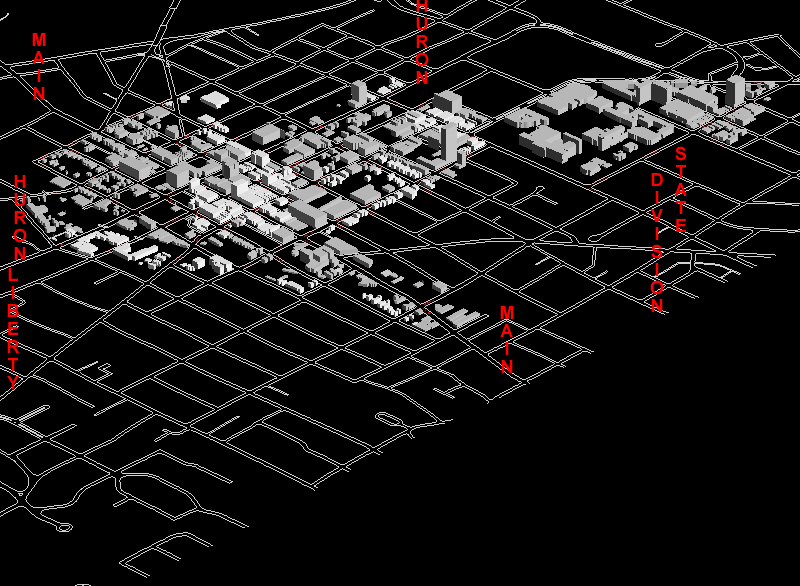
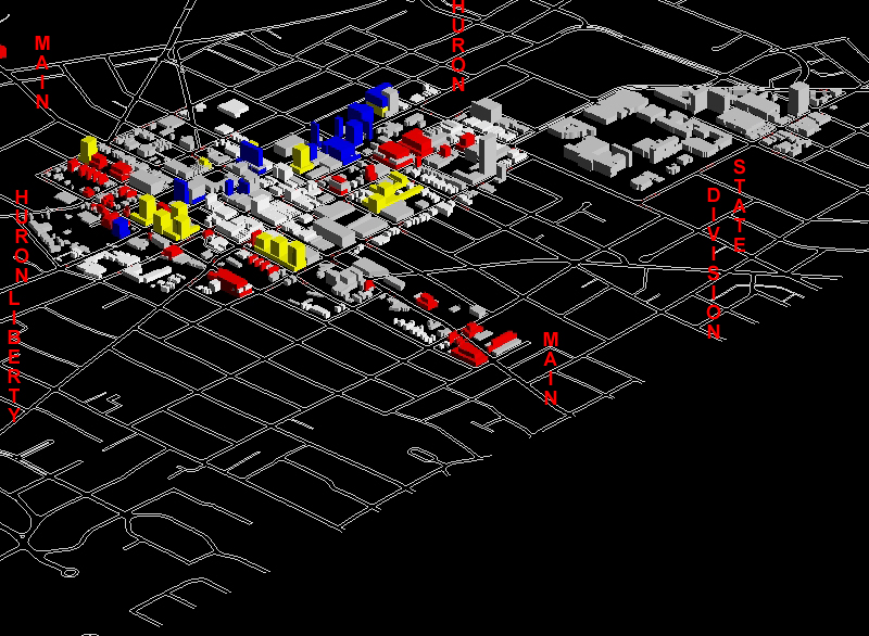
A general view of
the DDA, as it is, 2004
-
A general view of the DDA as it would be,
totally built out according to the parameters in the presentation link
above. Link to VR
-
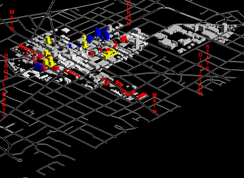
A general view of the DDA as it would be partially
built out. The partial build out was created by turning off odd number
IDs of buildings that were red, yellow, and blue. The three story
bases in pink and yellow were left on. Link
to VR
-
A view of the DDA showing all point blocks
together with existing buildings (no linear--red or blue--development).
The point buildings are built on vacant lots; the red and blue may or may
not be... This image also includes a new yellow building at Washtenaw
and Observatory. Link to VR
-
Gray scale renderings of similar images:
-
Downtown as it is now (link
to associated VR)
-
Full buildout according to above parameters
(link to associated VR)
-
Partial buildout as above (link
to associated VR)
-
Point blocks and layer of three story bases
added to current scene (link to associated
VR)
-
FROM: Presentation
to Taskforce, March 12, 2004 at DDA
-
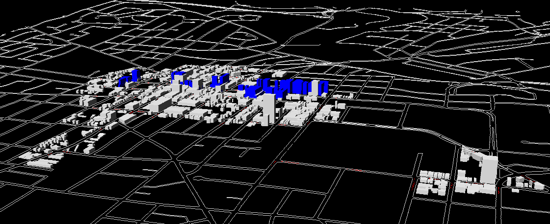
VR1:
Existing buildings with only yellow point blocks added (built on parcels
that are currently vacant).
-
VR2:
Existing buildings with only pink, 3 story buildings added as bases for
possible further upper story building. Many of these are on parcels
that already contain buildings.
-
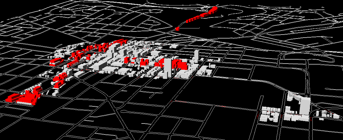
VR3: Existing
buildings with pink and red buildings added.
-
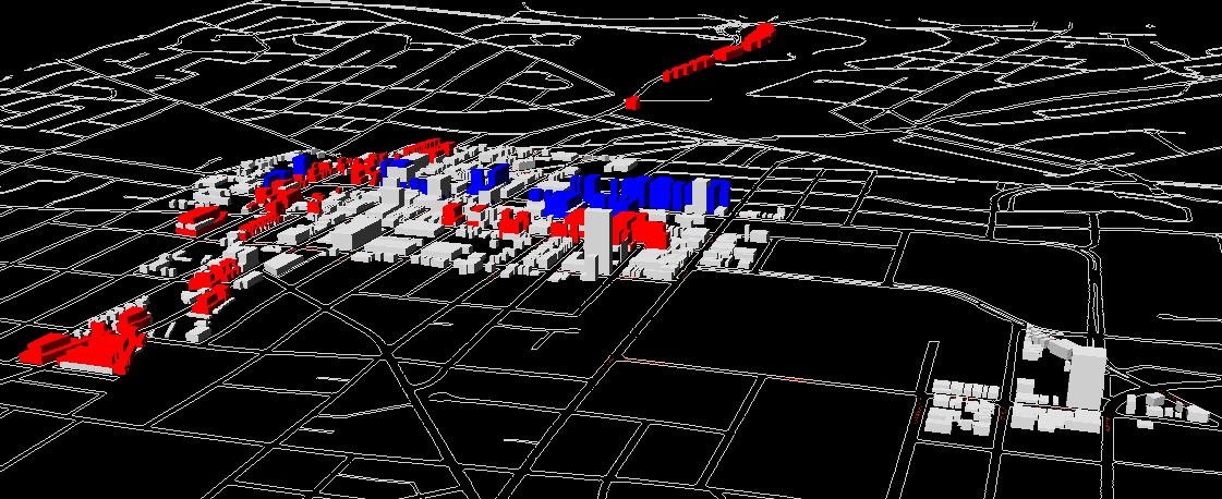
VR4:
Existing buildings with pink and blue buildings added.
-
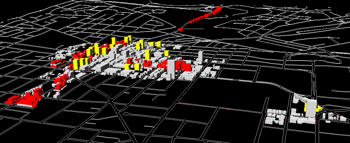
VR5:
Existing buildings with pink, blue, and yellow buildings added.
-
VR6:
Existing buildings with pink, red, and yellow buildings added.
-
VR7:
Existing buildings with pink and yellow buildings added.
-
VR8:
Existing buildings with pink and red buildings added.
-
VR9: Existing
buildings with pink, red, blue, and yellow buildings added.
-
FROM: More follow-up
from meeting of February 2, 2004. File
showing buildings extruded to a height of six stories in the buffer
-
February 7, 2004. Follow
up from meeting at DDA of February 2, 2004. The following set of Virtual
Reality files, with the sun in the south in a "high" position and with
terrain underlying the street pattern based on City contour files, was
created based on assigning
-
VR1: 300% to
all parcels in red, lot line to lot line (back and forth; side to side)
-
VR2: FAR to all
parcels in red by zoning category, lot line to lot line (back and forth;
side to side)
-
VR3: FAR premiums
as "by-right" values to all parcels in red by zoning category, lot line
to lot line (back and forth; side to side)
-
VR4: 600% to all
parcels in red, lot line to lot line (back and forth; side to side).
The set of VR files is organized roughly according
to amount of height, from least to most. The first two files are
quite similar to each other; the second one has two buildouts that are
one story shorter than in the first one (in C1A); it has more than that
that are one story taller than in the first one (in C2A). The last
two files (third and fourth) are even more similar to each other.
They are identical everywhere except that there are two buildouts, in the
S. University area, that are 400% on the third one, and 600% on the fourth
one.
-
Ann
Arbor, Michigan: Virtual Downtown Experiments, Part III, Solstice:
An Electronic Journal of Geography and Mathematics, Winter, 2003.
Kwon, Lazzaro, Oppenheim, and Rosenblum.
-
FROM:
Ann Arbor, Michigan: Virtual Downtown Experiments, Part II, Solstice:
An Electronic Journal of Geography and Mathematics, Winter, 2003.
Contours, with a contour interval of 5
feet, were used to create a triangulated irregular network as a topographic
base level from which to measure building height (rather than from a flat
geometric base level).
-
Actual height Virtual Reality: digitized
building footprints are superimposed on parcels in the downtown core zones.
These VR experiments depict the downtown using actual building heights,
where known that are extruded from a topographic base. This base is a Triangulated
Irregular Network (TIN) made from a City of Ann Arbor contour map with
a contour interval of 5 feet. There are three sets of files for June
21:
-
VR
5: sun in the southeast (morning)
-
VR
6: in the south (noon)
-
VR
7: and in the southwest (afternoon)
This was done in order to suggest variation
in lighting conditions with season and with time of day. The lighting scheme
is designed for hill shading and is therefore really only useful for suggesting
shadow location as it does not account for light reflected from impervious
surface.
-
Model
with three different viewpoints entered
-
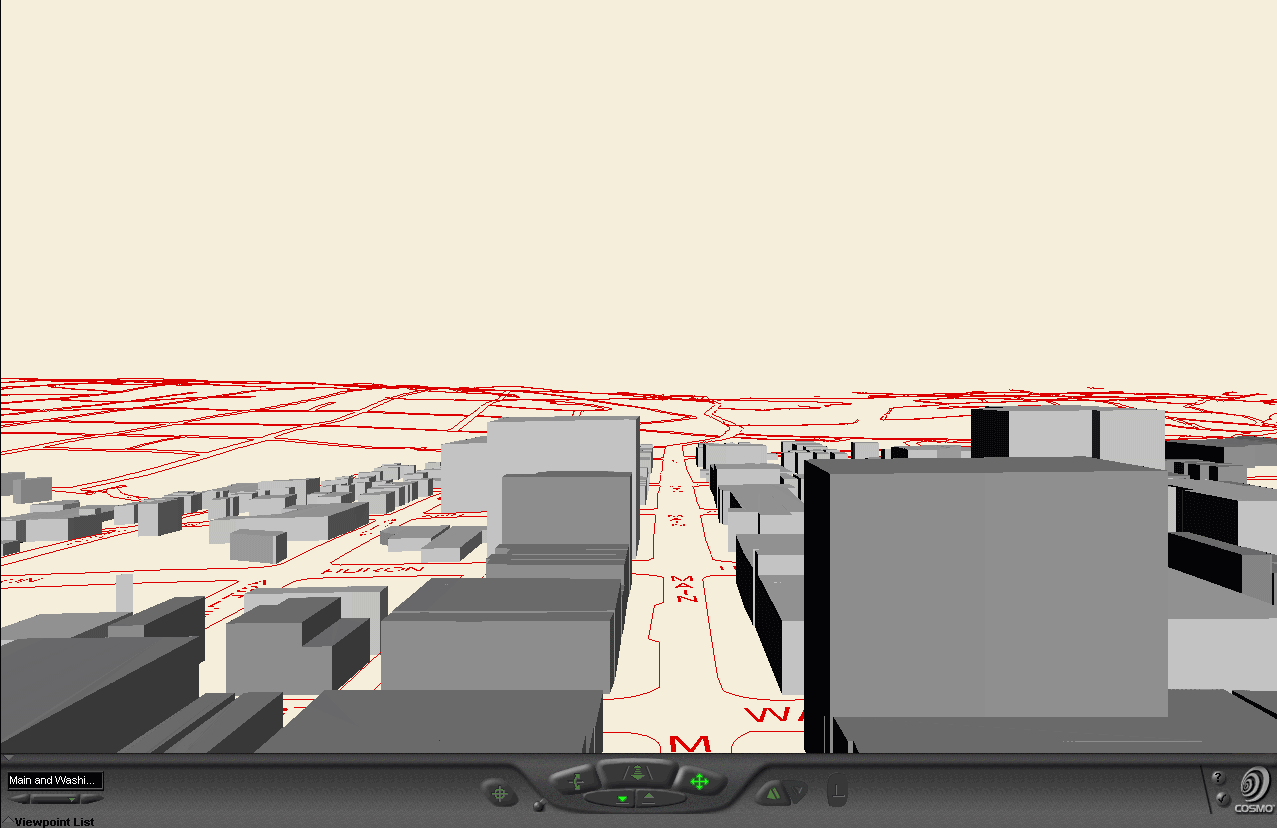
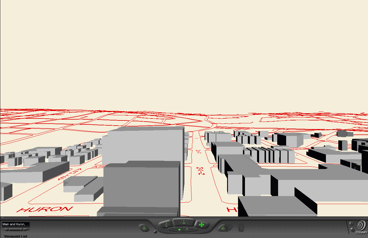
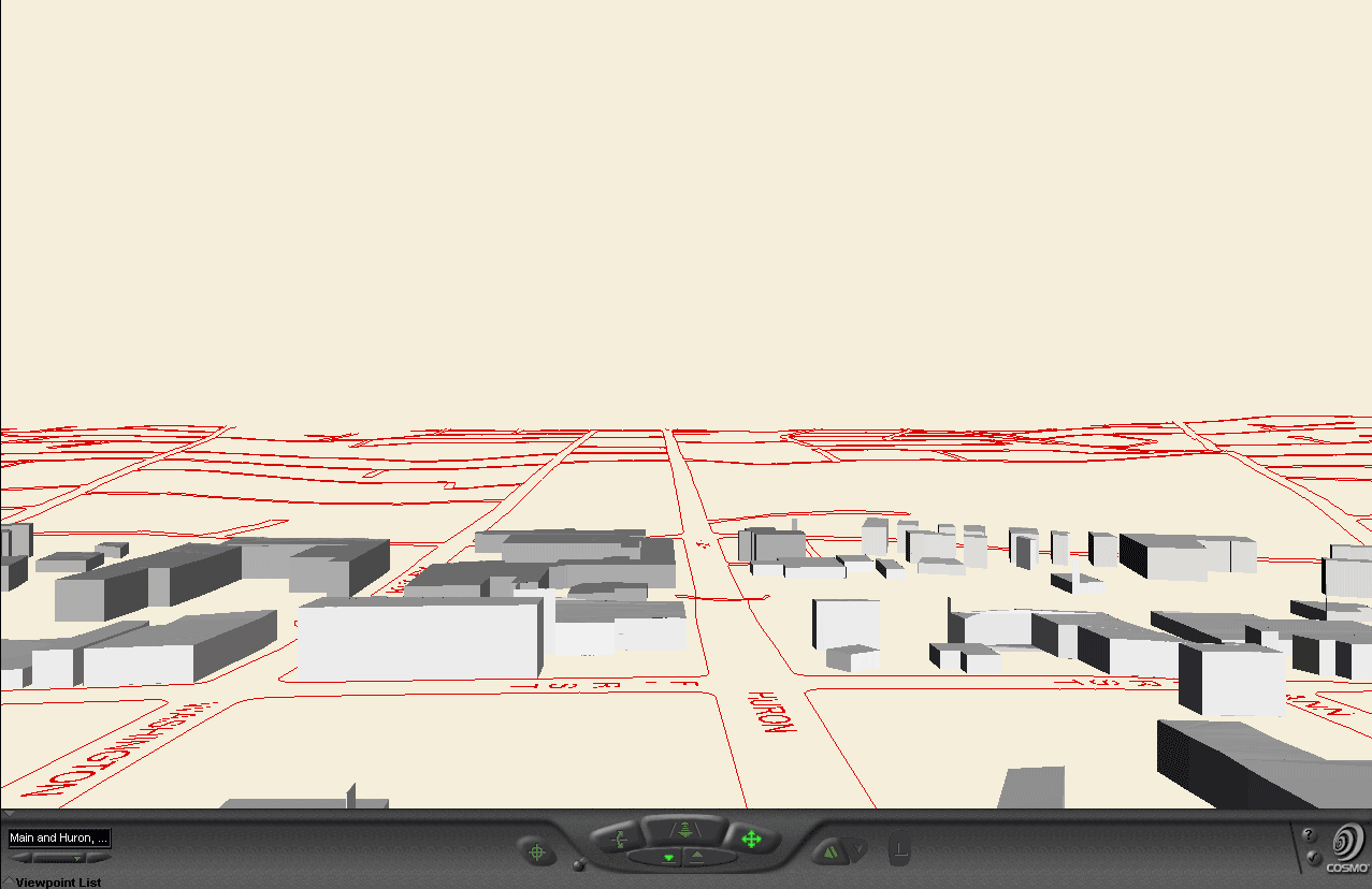
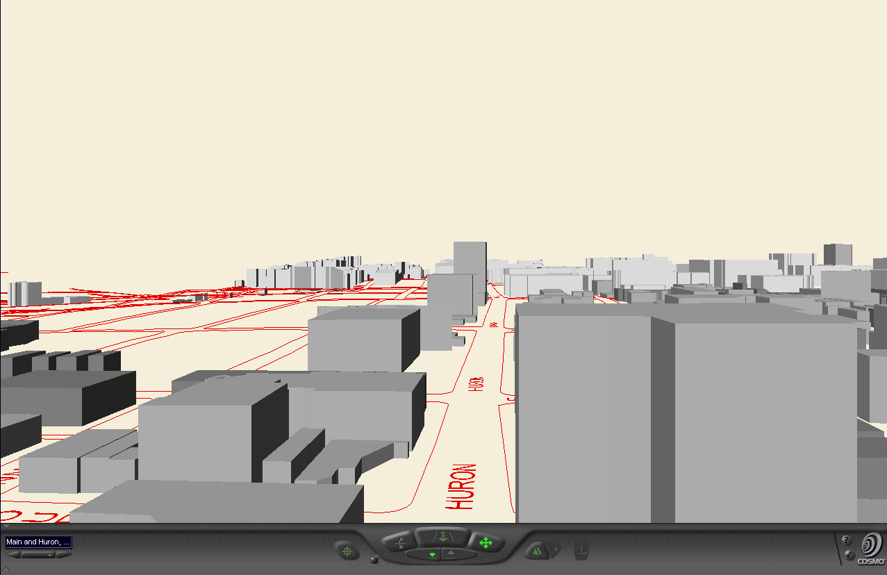
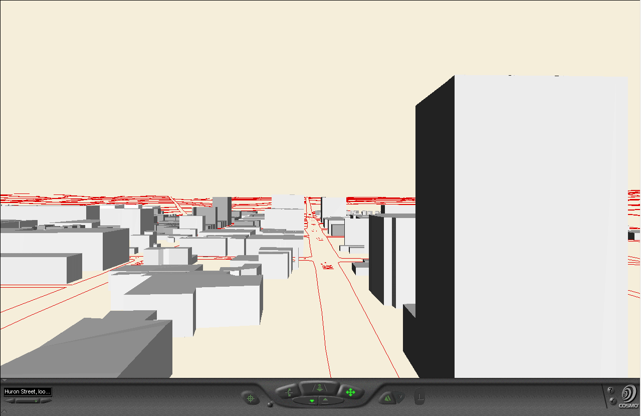
This set of files shows a sequence of views,
all with the same two camera angles--the first is a view of the entire
downtown and the second is a view looking west along Huron Street, from
a vantage point to the east of State Street. Use the navigation system
in the lower left-hand corner to see the views from these preset camera
positions; they offer a standard source for comparison as one switches
from model to model that the free-roaming form of navigation does not.
The red building in each model is a virtual building built on the southeast
corner of Huron and Fifth, across from City Hall.
-
FROM GeoWall
Display, Downtown Ann Arbor Virtual Reality, 9:00a.m., Media Union
3D Lab, November 11, 2003
-
FROM Ann
Arbor, Michigan: Virtual Downtown Experiments, Solstice: An
Electronic Journal of Geography and Mathematics, June, 2003.
-
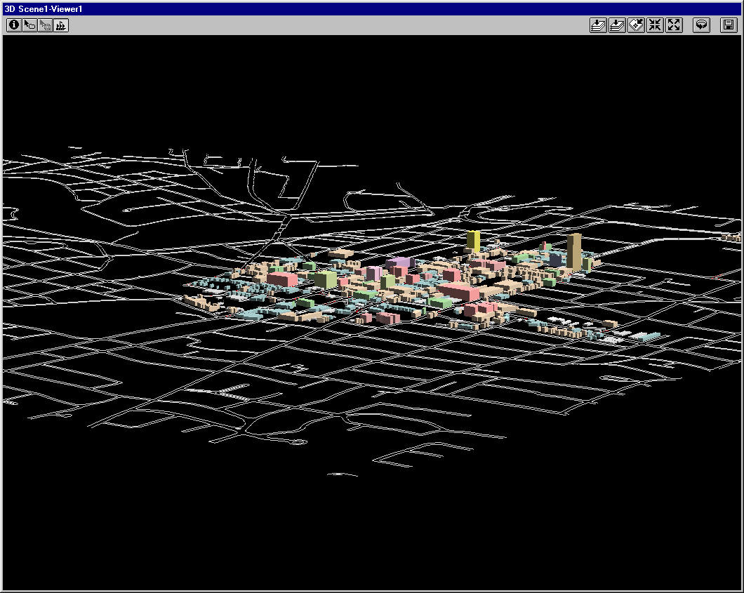
Translucent
buildings are superimposed, lot line to lot line on parcels in the
downtown core zones. This VR experiment depicts the downtown with
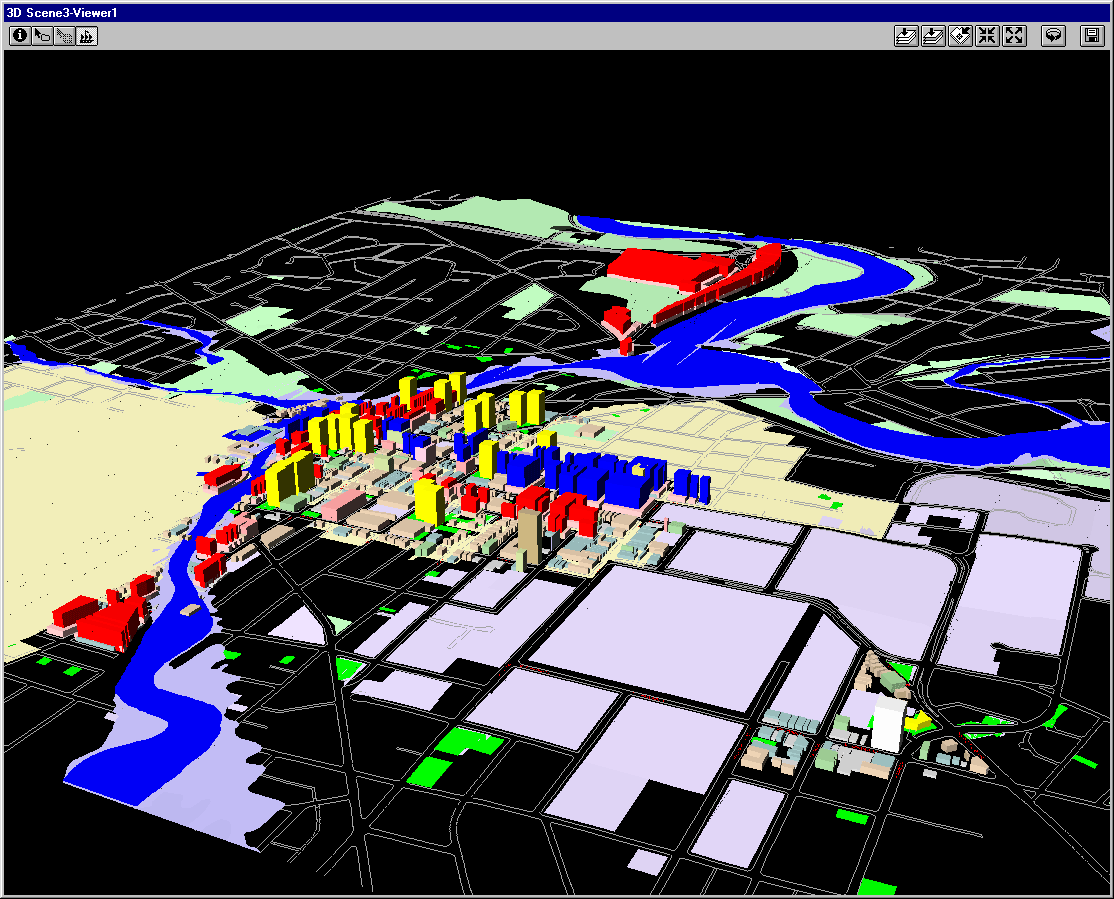
the simplest use of the FAR. [The DDA region is shown in black; the
Allen Creek floodplain in blue.]
-
Buildings
are superimposed, lot line to lot line, on parcels in the downtown core
zones. This VR experiment depicts the downtown using actual building
heights, where known. [The DDA region is shown in gray; the Allen
Creek floodplain and floodway in shades of blue; building color is according
to height category.]
Solstice: An Electronic Journal of Geography and Mathematics,
Institute of Mathematical Geography, Ann Arbor, Michigan.
Volume XV, Number 1.
http://www.InstituteOfMathematicalGeography.org/