 |
Tall:
AAAAAAAAAAAAAAAAAAAAAAAAAAAAAAAAAAAAAAAAAAAAAAAAAAAAAAAAAAAAAAAAAAAAAAAAAAAAAAAAAAAAAAAAAAAAAAAAAAAAAAAAAAAA
-
excludes
from consideration all parcels
-
in a current
historic district
-
in the
floodway of Allen's Creek
-
whose
centroid lies in the floodplain of Allen's Creek
-
currently
containing a place of worship
-
designated
as public lands of the University of Michigan, and most others, as well
-
containing
existing parking structures
-
general
model considerations:
-
each story
is assigned a height of 12.5 feet
-
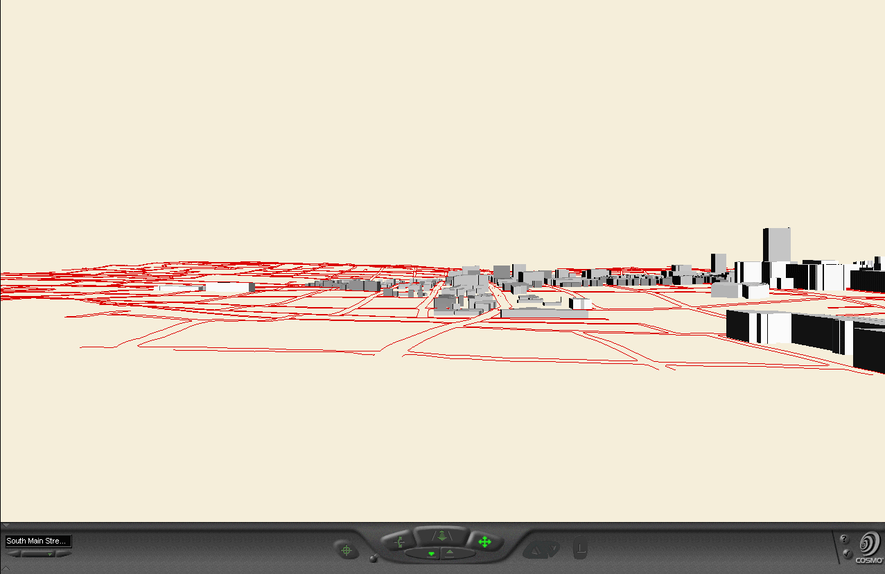
City of
Ann Arbor contour files, with contour interval of 5 feet (spacing between
successive contours is 5 feet), were used to generate a Triangulated Irregular
Network to represent the topographic surface. The buildings, roads,
and so forth were then draped over this topographic surface.
-
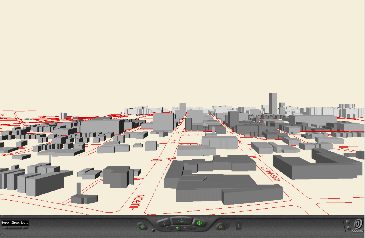
Sun position:
was set in the south at a height of 42.28 degrees, simulating the position
of the sun in the sky at noon in equinox conditions at the latitude of
Ann Arbor. This setting creates lighting of the buildings; it does
not create shadows of the buildings on the ground (that is a separate process
for the future).
-
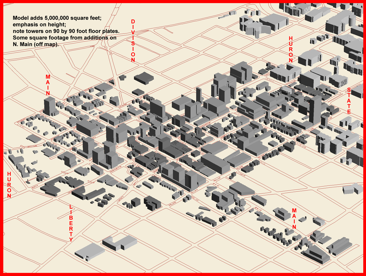
within
these constraints, 5,000,000 new square feet are added as follows:
-
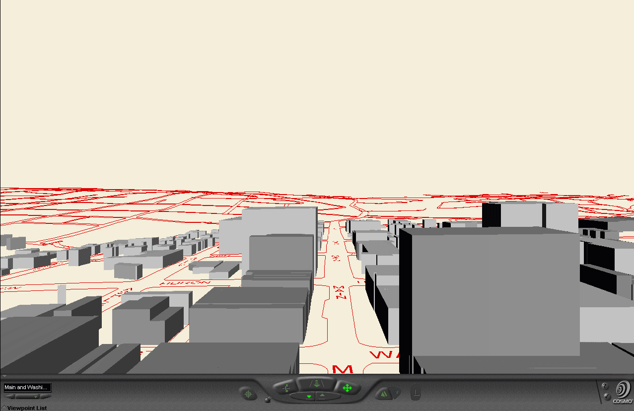
yellow
point towers erected on lands categorized as "vacant or surface parking."
Each tower has a 90 foot by 90 foot floor plate.Where suitable, they are
erected on a three story platform. The tower heights are 9,
12, and 15 stories; distances between adjacent towers on the same parcel
are 50, 75, and 100 feet depending on height (9, 12, and 15 stories respectively).
Where possible (according to spacing requirements), taller towers are erected
at lower elevations.
-
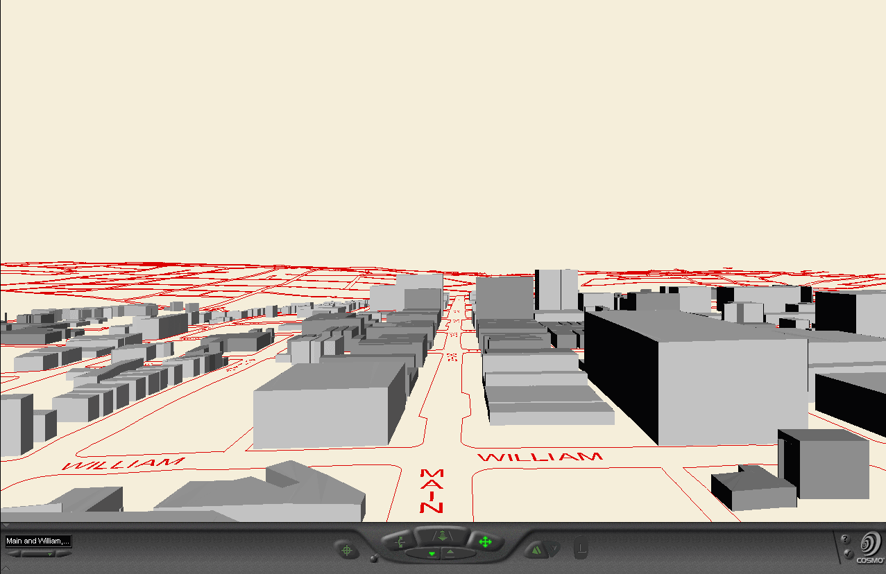
blue buildings
are erected along Huron Street at heights of 9, 12, and 15 stories.
The position is arbitrary.
-
East of
Division Street (to the right on the models) the front setbacks are 20
feet; west of Division Street front setbacks are 0 feet. These selections
are in keeping with the present front setback pattern of buildings already
present on Huron. The goal is to keep a uniform, rather than a staggered,
appearance in front setbacks (consistent with a "Grand Boulevard" approach).
-
Rear setbacks
are 40 feet; side setbacks are 10 feet.
-
Upper
story setbacks beyond the third floor are 20 feet in structures west of
Division.
-
red buildings
-
setbacks
and lateral information:
-
have three
story platforms
-
have upper
story setbacks of 20 feet beyond the third story (except on a few small
parcels that have only three story buildings)
-
have 40
foot rear setbacks, 10 foot side setbacks, and 0 foot front setbacks.
-
height
and vertical information:
-
on Liberty
Street may rise to a total height of 8 stories (including the three story
platform) with the upper stories set back 20 feet from the three story
platform
-
on 1st
and Ashley Streets may rise to a total of 4 or 6 stories (50/50), with
upper story setbacks of 20 feet above the third floor, arbitrarily placed
-
on North
Main, out of the picture, rise to a height of 6 stories and have 20 foot
setbacks from the road. Building footprint is placed on the parcel
in accordance with the golden ratio.
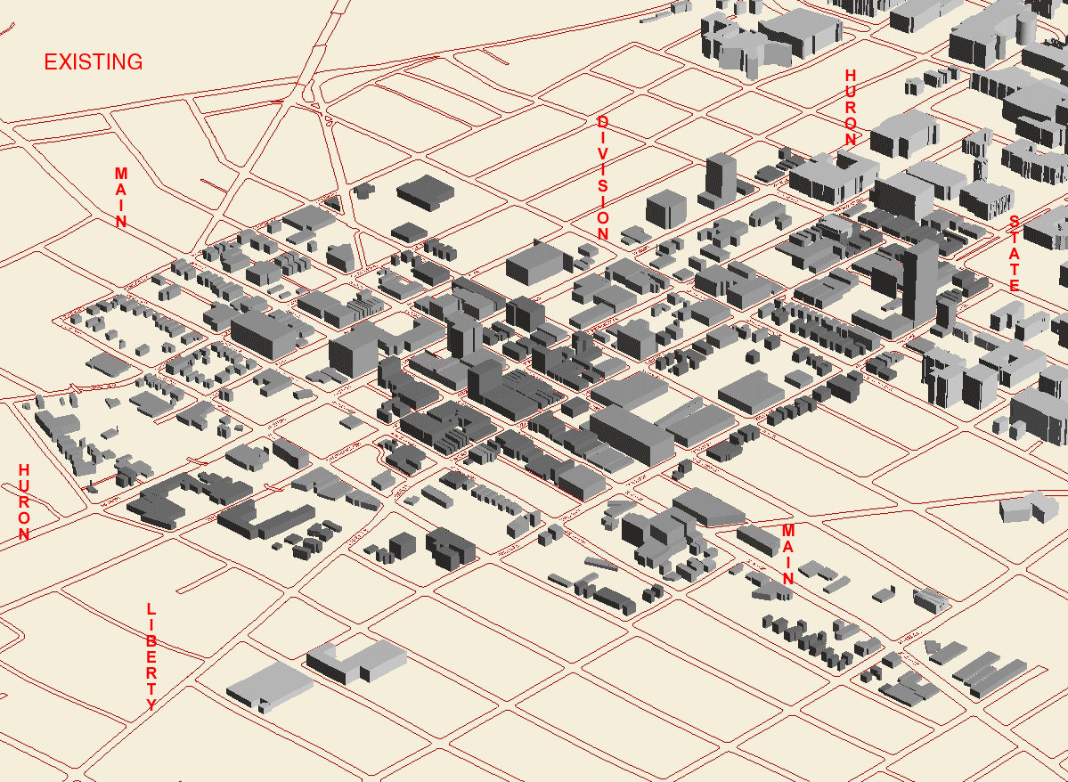
In this
style of plan, zoning follows spatial pattern of buildout.
|