Presentation
of March 18, 2004 at DDA
Following input from the Downtown Residential
Task Force subcommittee, Doug Kelbaugh, Frances Todoro, Jean Carlberg,
Steve Thorp, and Karen Hart, the following sequence of maps and virtual
reality scenes were made so that alternative scenarios of future downtowns
might be envisioned.
Pastel colors show existing buildings with
color varying according to height. All buildings of x stories are
assigned the same color.
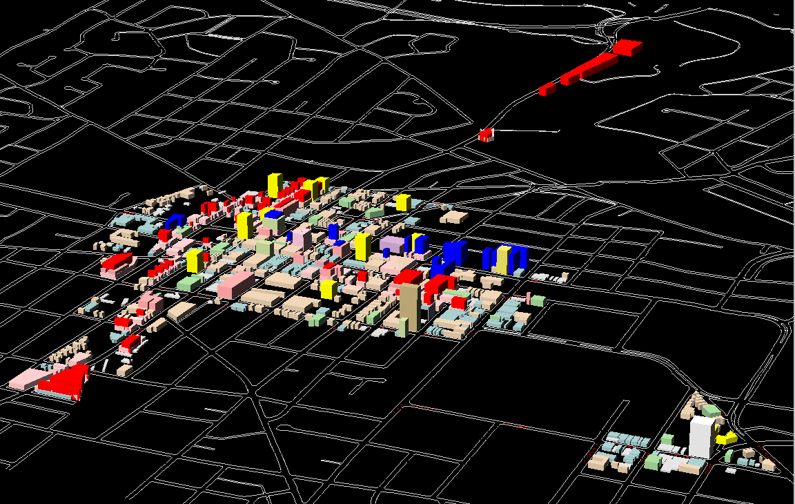
Bright colors show new buildings, in contrast
to the pastels; groups of new buildings are all the same color. Point
blocks are one color; Huron Street buildings, another.
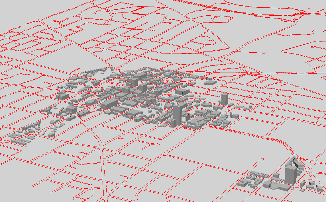
Gray scale renderings show massing of
buildings (as Kelbaugh suggests); here, the sun is in the southeast in
equinox position.
New parameters:
-
Blue, along Huron Street Corridor
-
E of Division,
-
8 stories on the south side of Huron
-
12 stories on the north side of Huron, with
the height differential designed to increase sunlight
-
front set back of 20 feet with no upper story
setback; side yards still 10' and backyard 20' (reduced from 40' to compensate
for the 20' front setback).
-
West of Division
-
3+5 stories on south side
-
3+9 stories on north side
-
zero front setbacks
-
Yellow, point blocks
-
90' by 90' floor plates
-
at least 50' between towers placed on the
same lot
-
one third of buildings at 3+6; one third at
3+9; one third at 3+12
-
Red
-
Liberty, Ashley, and First: one half
at 3+3; one half at 3+5
-
North Main, east side only, 6 story with 20'
front setback
-
South Main, 3+3
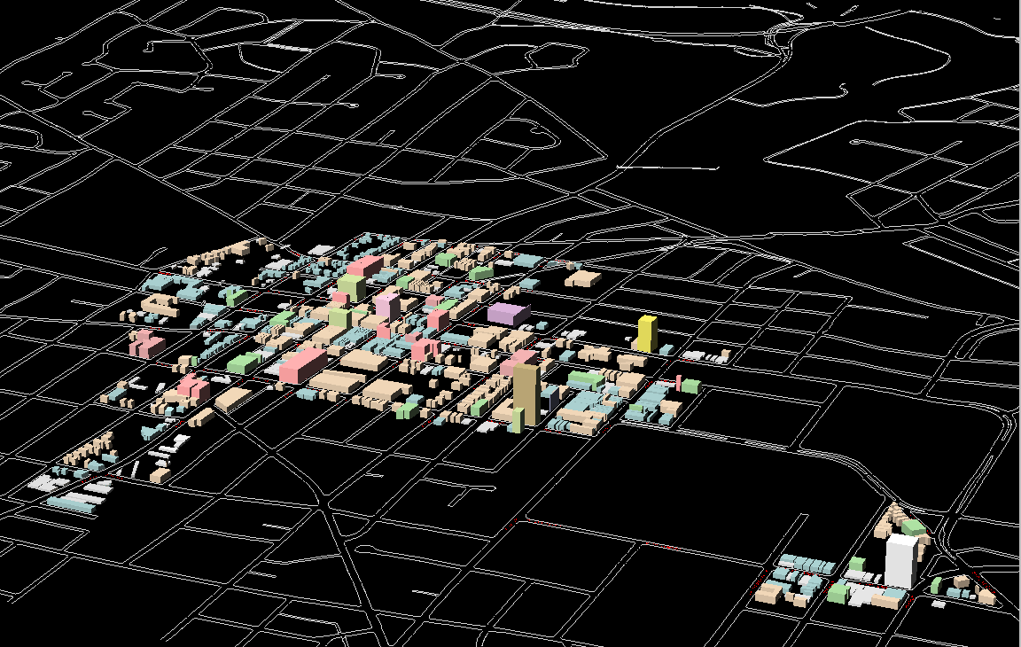
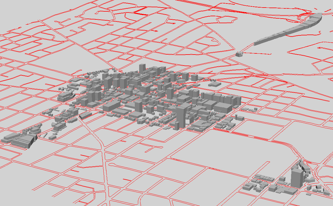
A general view of the DDA, as it is, 2004.
Link to
VR from which this static image was taken.
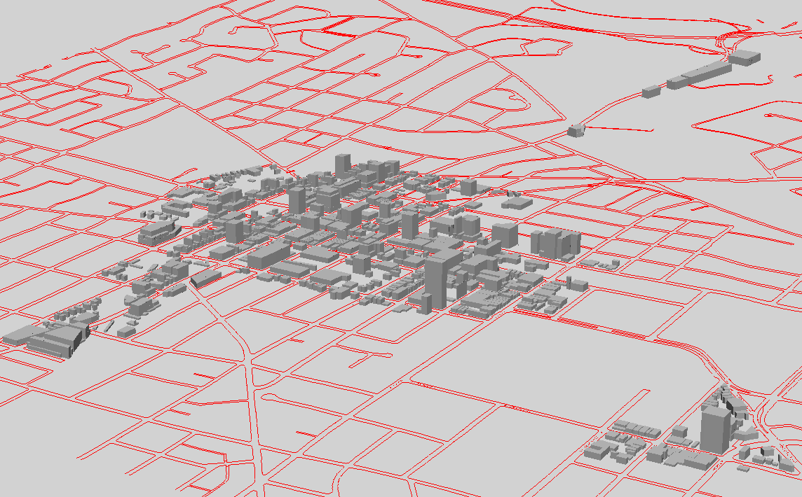
A general view of the DDA as it would be, totally built out according
to the parameters above. Link
to VR from which this static image was taken.
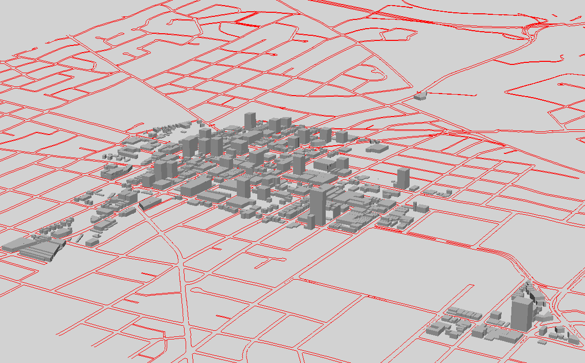
A general view of the DDA as it would be partially
built out. The partial build out was created by turning off odd number
IDs of buildings that were red, yellow, and blue. The three story
bases in pink and yellow were left on. Link
to VR from which this static image was taken.
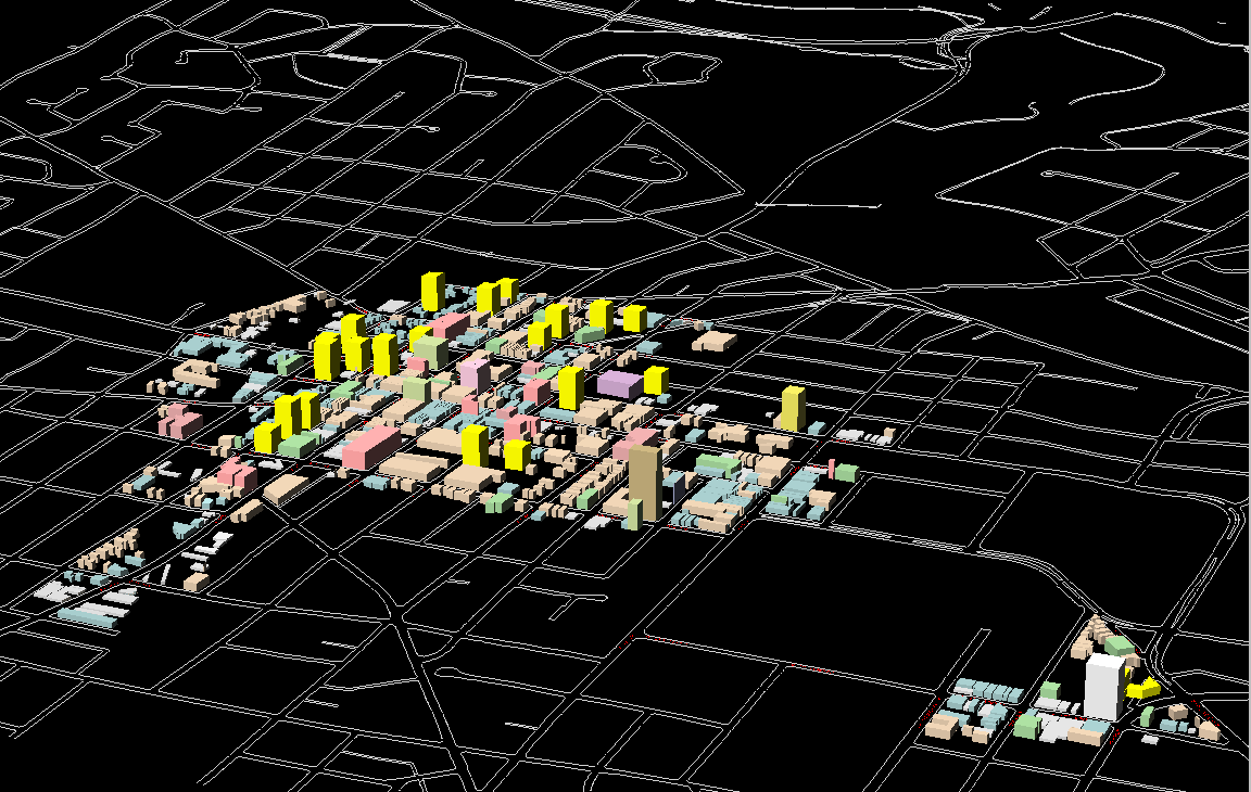
A view of the DDA showing all point blocks
together with existing buildings (no linear--red or blue--development).
The point buildings are built on vacant lots; the red and blue may or may
not be... This image also includes a new yellow building at Washtenaw
and Observatory. Link
to VR from which this static image was taken.
Gray scale renderings of similar images:
Downtown as it is now (link
to associated VR):
Full buildout according to above parameters
(link
to associated VR):
Partial buildout as above (link
to associated VR):
Point blocks and layer of three story bases
added to current scene (link
to associated VR):
Sandra L. Arlinghaus
Solstice: An Electronic Journal of Geography and Mathematics,
Institute of Mathematical Geography, Ann Arbor, Michigan.
Volume XV, Number 1.
http://www.InstituteOfMathematicalGeography.org/