Presentation
of April 7; follow-up to presentation of April 1
-
Four different views, as requested by Doug
Kelbaugh. The views are arranged in a matrix. Each view has
a link on the image to a corresponding virtual reality file, requiring
Cosmo Player.
-
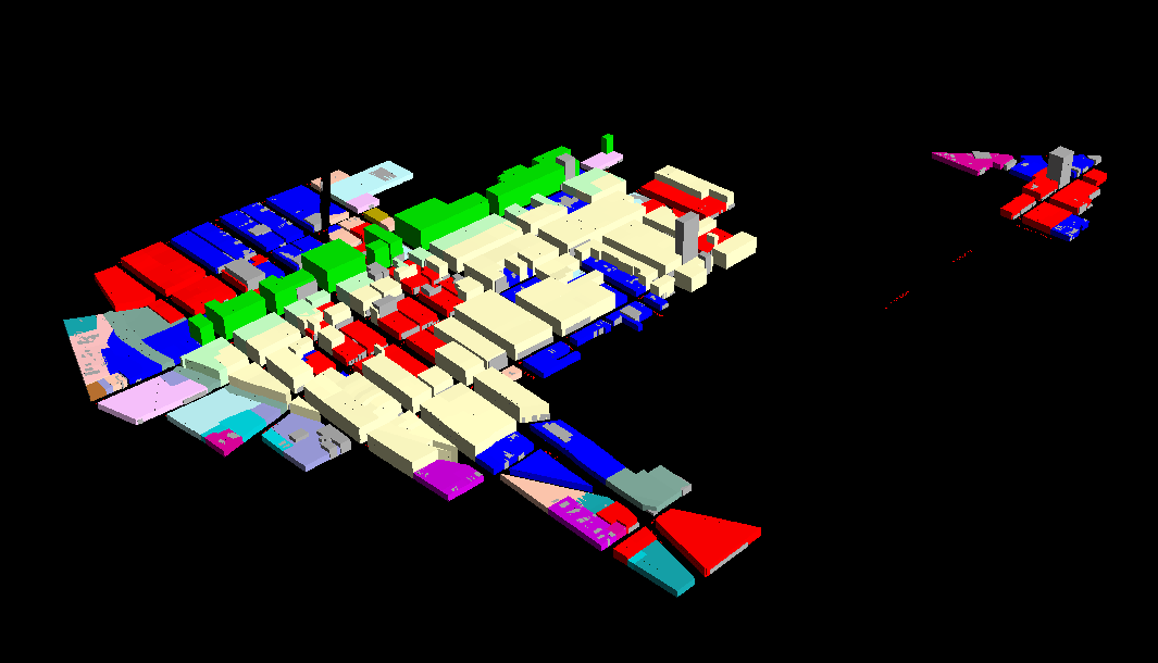
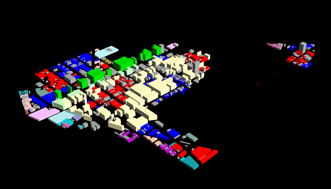
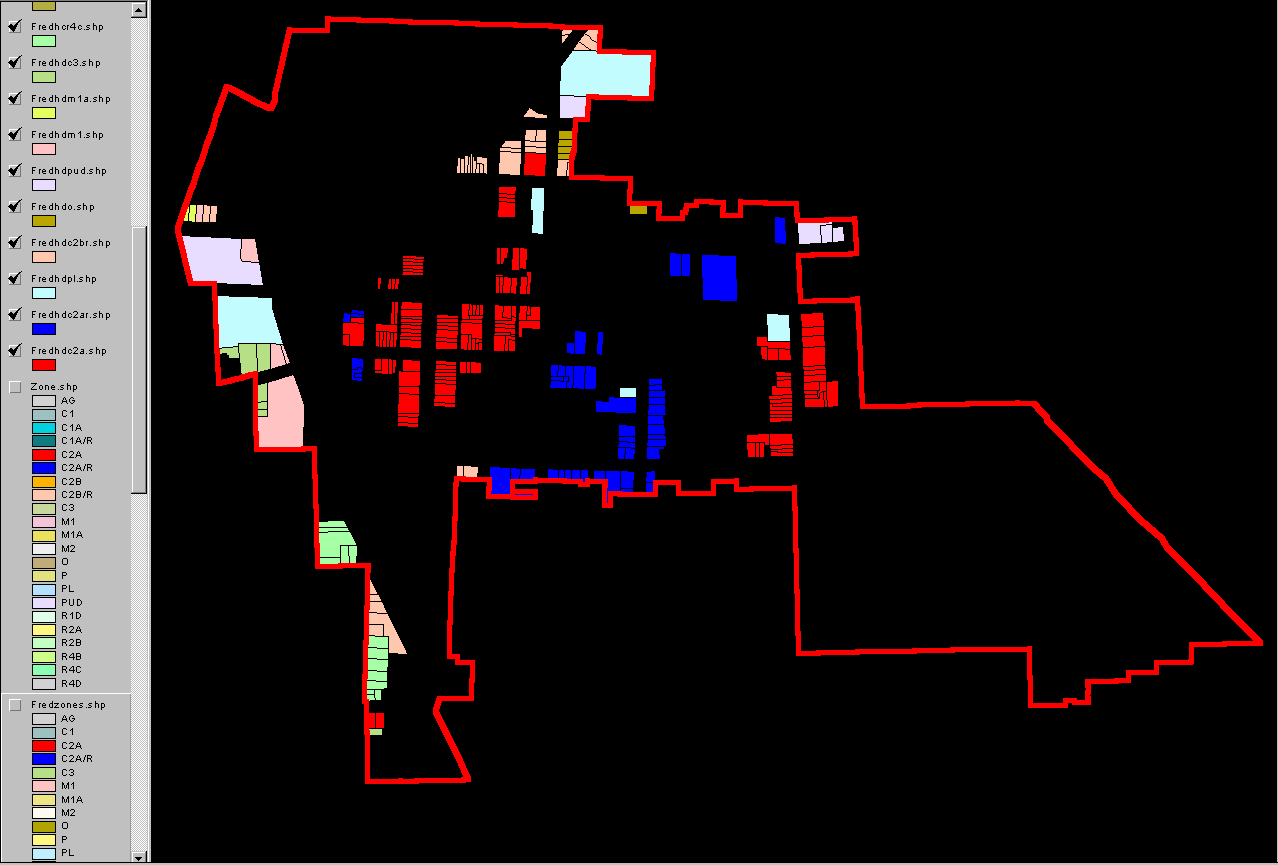
The top row contains views of Fred Beal's
model at full build out and at half build out (half the buildings).
The gray buildings are existing buildings; the colored construction is
height according to FAR within zoning type, with no setbacks (to come).
Also to come are plinths and 3+3 and 3+5 in the light yellow district.
See below for various related scenes.
-
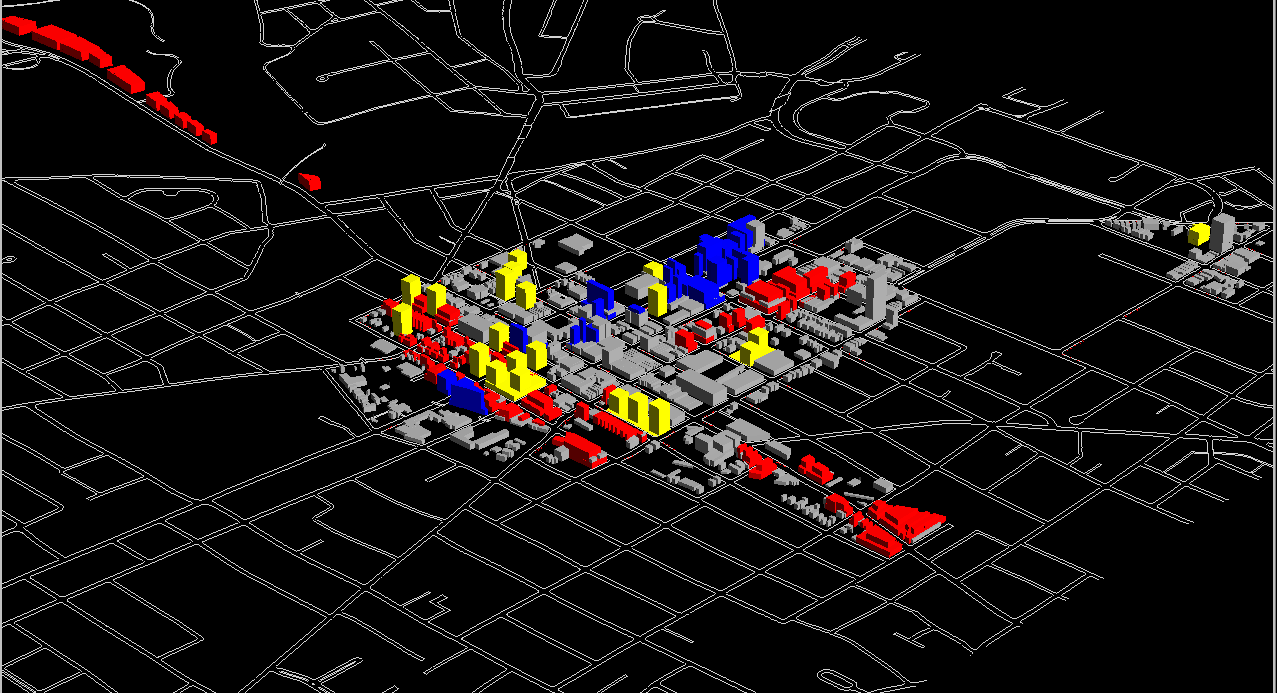
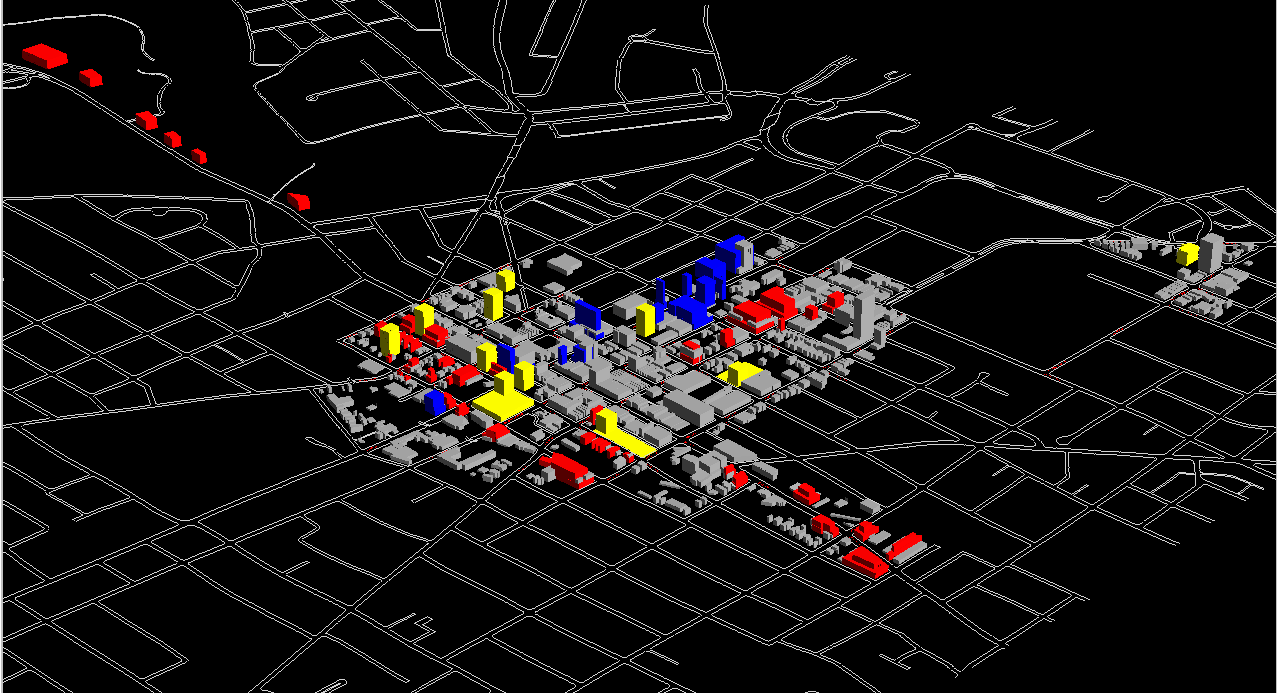
The second row contains views of Kelbaugh's
model at full build out and at half build out (half the buildings).
The gray buildings are existing buildings; the colored construction are
new buildings with setbacks as given elsewhere. More detailed work will
come. These models do not include, at this point, buildout possibilities
associated with many of the parcels housing gray structures. An earlier
link on the home page leads to an FAR based buildout for the five zones
supporting premiums.
-
A third row might be helpful, showing build
out and half build out. That work is to come, too. The goal,
in the final analysis, is to have comparable models showing alternative
scenarios.
-
At the meeting of April 1, Fred Beal presented
an alternative zoning scenario.
-
The animation below shows Beal's changes;
there are five seconds between successive animation frames. The entire
animation will repeat three times, after which it will stop to show the
entire zoning pattern. To reload the animation, simply refresh the
browser window. The zoning here simplifies the existing zoning pattern;
that is, spatial fragmentation is not as prevalent in non historic districts.
-
This link connects
to the document that Beal sent, concerning Zoning Barriers, that led to
that animation. This link leads to
a revised form of the previous one.
.
-
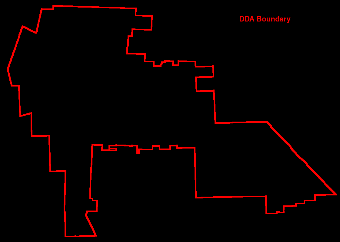
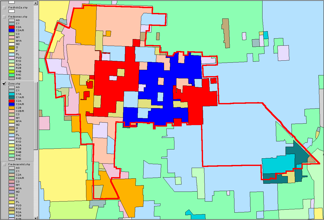
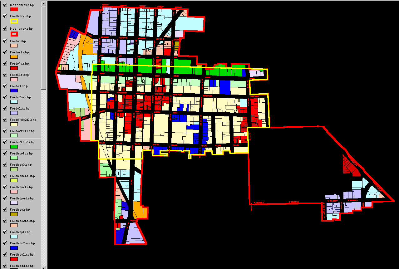
Maps showing historic district retained zoning
pattern (part of Beal's prescription). The map on the left shows
only the historic districts and their zoning inherited from present day
zoning. The map on the right shows the content of the map on the
left against Beal's zoning pattern.
-
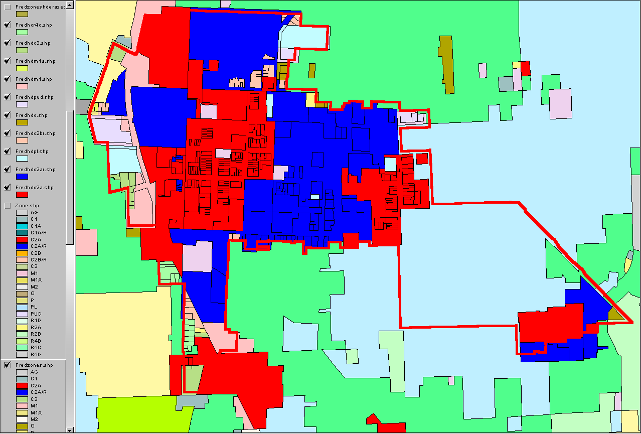
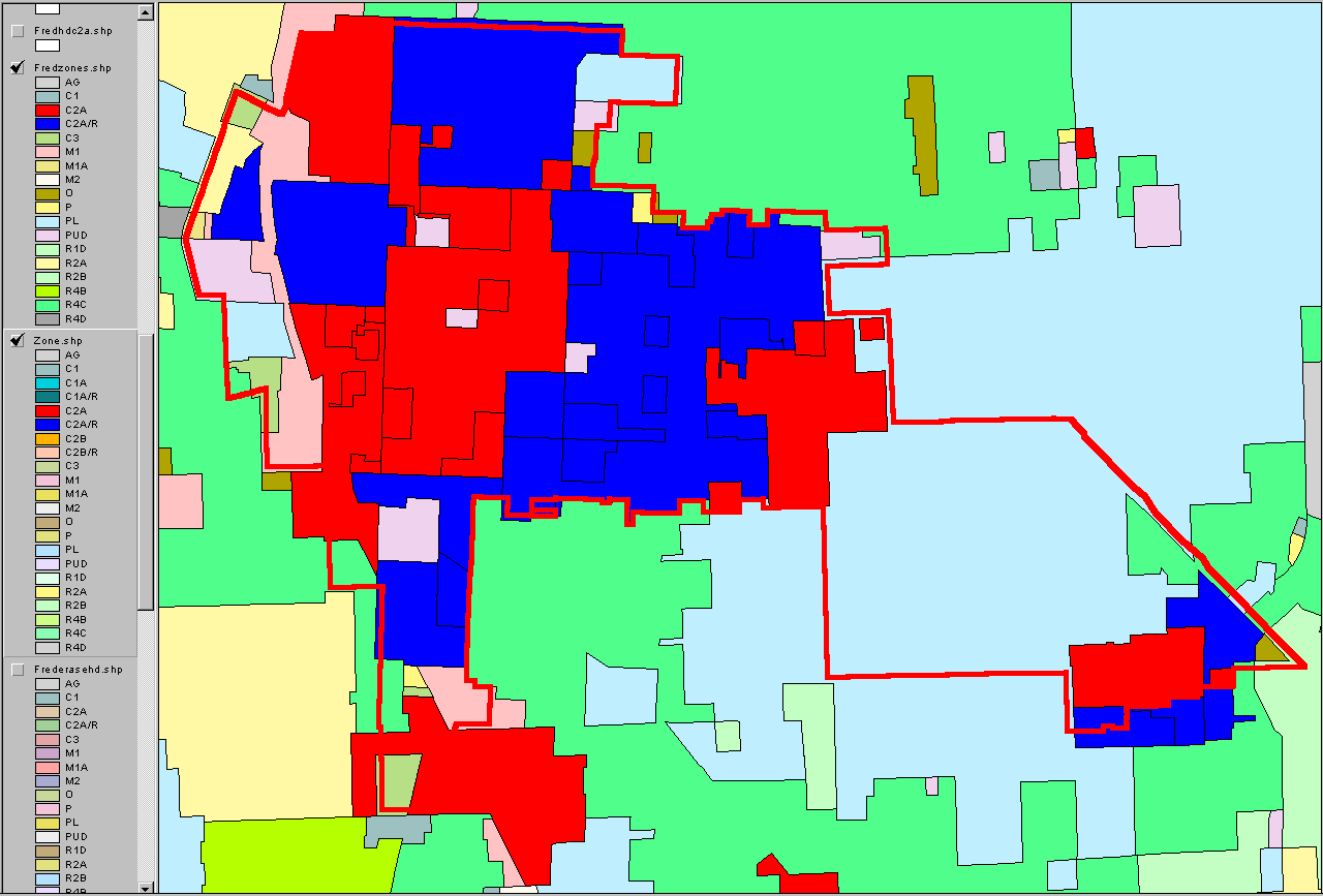
Maps showing existing DDA zoning and Beal's
zoning, side by side, and without regard to historic districts and without
regard to the new T districts proposed and displayed in the animation above.
The existing map is on the left. Beal's is on the right. The
point of this display is to demonstrate the simplicity of Beal's approach.
Compare and contrast C2A (red) and C2A/R in the two approaches. There
is no C2B nor C2B/R. There is no P and no PL (outside UM).
Unification of categories on the left is evident in the map on the right--scroll
across!
-
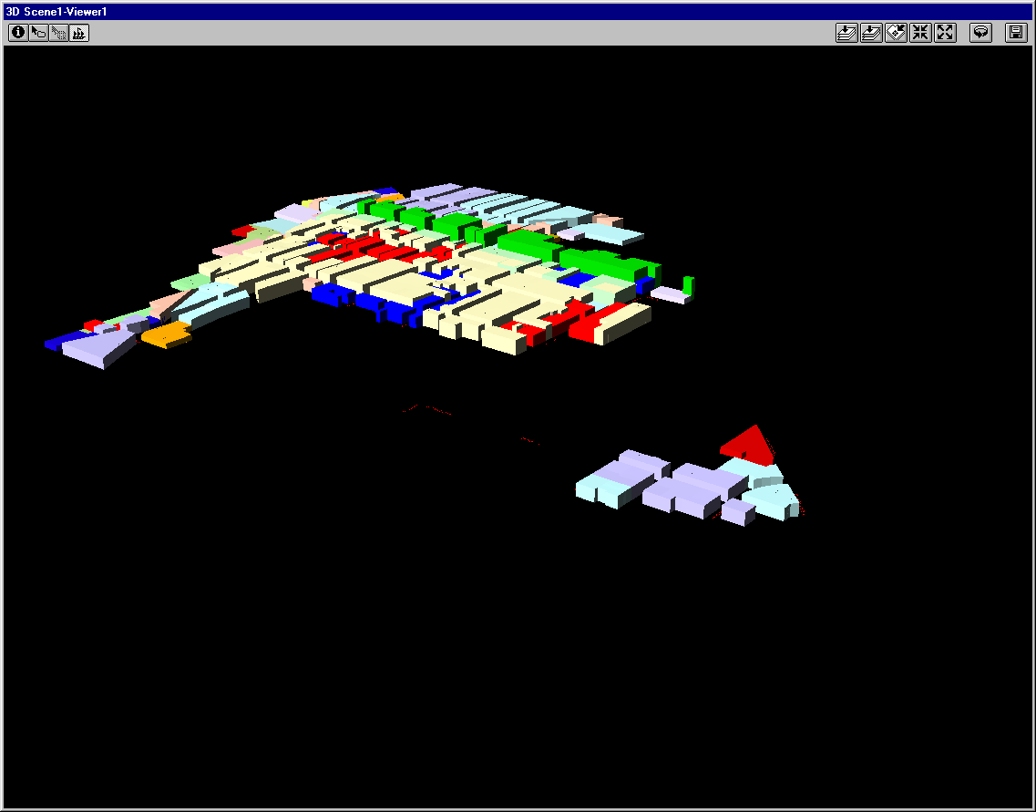
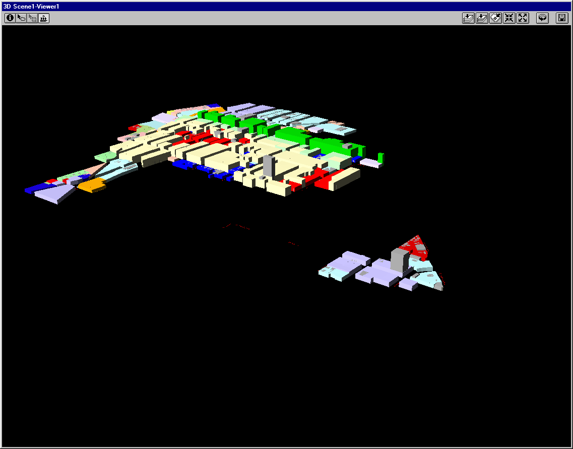
Sample 3D models of Beal's plan. The
first image shows the base plan to be extruded. The following 2 by
2 matrix shows the base plan extruded, from left to right without premiums
and with premiums and from top to bottom without the existing building
hull and with the existing building hull (buildings poke through, on occasion).
The extrusion is of parcels, according to FAR by Beal's zoning type and
by historic district zoning type. Setbacks do not yet enter the model.
-
Sample Virtual Reality links
-
Link
to virtual reality above, with no premiums and no existing building hull.
-
Link
to virtual reality above, with premiums and no existing building hull.
-
Link
to virtual reality above, with no premiums and existing building hull.
-
Link
to virtual reality above, with premiums and existing building hull.
-
Excel spreadsheets: contact first author.
-
Excel spreadsheets: Summary
data for Beal's model.
-
At full buildout, Kelbaugh's model creates
about 7.5 million square feet more that what is already built, doubling
the gray model.
-
At full buildout, Beal's model creates about
22 million square feet more than what can theoretically be built, doubling
the premium, no setback figure of Planning.
All figures need to be brought into alignment;
what is most useful?
-
Fine tuning of Doug Kelbaugh's and Fred Beal's
consequent 3d models continues.
-
Combinations of Kelbaugh's and Beal's models.
Solstice: An Electronic Journal of Geography and Mathematics,
Institute of Mathematical Geography, Ann Arbor, Michigan.
Volume XV, Number 1.
http://www.InstituteOfMathematicalGeography.org/